Monday, October 4, 2021

Day 103: Connecting Route, Point Beach Segment (Part 1), Manitowoc County

Day 103: Monday, October 4th, 2021

Total Miles covered for the day: 6.3     

Location 1: The Connecting Route between the Point Beach Segment and the Mishicot Segment
5.3 miles of trail other-half-covered 

Today, while I woke up all snug and lonely in my bed at home, preparing to go to work, Theresa woke up before dawn in a tent, 135 miles away in the Point Beach Campground, preparing to go hiking. She discovered an interesting thing about the Point Beach Campground, which is located in Manitowoc County along the shore of Lake Michigan; there are creatures here. 

Not the typical raccoon/skunk/squirrel creatures, as is typical in all campgrounds, but the snarling, yipping canine variety that travels in packs. Not wolves, though that would also make for an interesting story, but coyotes. 

Last night she heard coyotes yipping very close to camp, so she was more than happy to have made her way into her tent before full dark. But she woke up at some point to one of them snarling literally inches away on the other side of the tent wall, which she understandably found somewhat unsettling. 

No shrinking violet, she, she rooted around in the tent and found the hammer we use to pound in tent stakes, then proceeded to yell menacingly and loudly, scolding them like ill-behaved dogs, making as much noise as possible, intent on scaring the creatures away. Then she put the hammer back down close to her cot, and went back to sleep. She may have gone down in a fight, but she was taking one or two of them with her before it was all over with. 

When she did wake up it was still dark, but there were no coyotes within earshot. Good, then. Time to start the day.

The plan was to meet up with some friends of ours, whom we know from one of our other hobbies, geocaching. Mindy Borchardt (a.k.a. Conejo Rojo) and her husband, Tim, and their faithful canine companion Mora. Theresa met them at the corner of County Road V and Lake Shore Road and drove with them to Wedge Road for the first leg of the walk. 

Mindy and Tim had never played leapfrog with their vehicles, or with their car and bicycles, so the concept was new to them. The time was a little after ten in the morning, and the weather was - not raining. 

Theresa made one major mistake before starting the day. She had purchased a new pair of orthopedic hiking boots and put them on for the first time at the beginning of the day, having never walked in them before. Needless to say, they did nothing to fix the problems in her feet, and instead contributed mightily to her pain and discomfort as the day wore on. 

When they reached their waiting vehicle, a couple of miles later, the four of them drove to town to the other end of the connecting route and started walking towards Wedge Road, some 3 miles distant. 

I asked her what memorable events occurred while walking the road, and she proceeded to tell me about a farmer who was riding around in his Mule UTV and had stopped to talk to them not once, but twice as they walked past. The farm was fully decorated for Halloween, except on one corner he had a snowman with a pumpkin, which the trio found amusing. 

"A little early for Christmas decorations", Theresa quipped.

"Wait", Mindy said, "I think it's a ghost". 

Mora didn't voice her opinion. 

That was even funnier, and the three of them were having a good belly laugh when the farmer showed up on his UTV. "If you put a Christmas Tree in front, that ghost could do double duty and you could leave it up all year."

"Oh no", he said. "I've got all kinds of Christmas decorations. You should come see it then!"

They parted ways, then as they were continuing down the road, the farmer came puttering back up on his mule to engage them in more conversation. During that discussion the trio learned that the farmer was also a pilot, and flew for missionary visits to some south of the equator country, doing what is certainly intended to be good works. Theresa in turn talked a lot about the Ice Age Trail, and confirmed that they were staying down at Point Beach Campground. Theresa was actually quite happy for the break, because she was developing a terrible blister on the ball of one foot, and she needed the time to rest. 

Finally, though, the three of them got going again. When they got to Tannery Road, Tim suggested they stop for lunch, because they had almost reached the car and hadn't taken a break yet. So they all plopped down on the side of the road and ate their lunch at 12:40 pm. 


As I sit and think about the distance walked, the fact that they took this photo at 12:40, and the fact that there was vehicle movement involved as well as farmer-chatting, I have come to the conclusion that the three of them were loping along at a distinctly un-snail-like pace. 

After lunch, they walked the short distance back to the van, and Theresa took Mindy, Tim and Mora into town where they could continue their hike by lopping off the in-town portion of the Mishicot segment. But because Theresa had already hiked the segment the previous day, and because her feet were literally torn up from the new shoes, she begged off and sat in the van getting some rest and chatting with our daughter on the phone, while there was still decent reception. 

She sat there so long that by the time she left, Mindy and Tim had already completed their walk and had driven back to the campsite to set up for the night. 

Location 2: The northernmost 1.0 miles of the Point Beach Segment between County Road V and Lake Shore Road 
1.0 miles of trail half-covered plus 0.9 miles extra biking

Theresa went back to camp to change her shoes and assess the damage to her feet, which was substantial. But after taking a two-hour break, she was determined to make a little more progress towards her Mammoth Hike Challenge. Targeting the north one mile of the Point Beach segment, she drove up and parked her vehicle on County Road V. Then she took her bicycle up to the trailhead on Lake Shore Road and walked back to the car. 

Theresa is not often moved to taking photos, but she was so amazed by the boardwalk that she took out her camera and took not less than ten photos as she made her way through the swamp. Here are a few.


She also took this photo of a marsh marigold in a rare October second bloom.


The boardwalk is 1419 feet long as measured in a straight line through the swamp. In reality, it is somewhat longer, due to the meandering path, rounding out at about three tenths of a mile. 

These are some of the folks we have to thank for our ability to walk across the swamp. 


At the very end of the hike, Theresa encountered a group of people who were having an archery class, but she was able to work her way around it and get to the car. On the one hand, she was happy to have gotten in one more mile for the Challenge, but on the other hand even with different shoes and a huge patch of moleskin, and even with walking that mile at a much slower pace than was used to cover the road earlier in the day, it still hurt to walk. 

Theresa then drove back to camp and realized that she had forgotten to give Mindy and Tim their SnOTT patches. While they were not the first people to earn the patch, they were the first recipients, and it was with genuine joy that they received the honor. 


Brock's Progress on the Mammoth Hike Challenge: 18.2 miles
Theresa's Progress on the Mammoth Hike Challenge: 10.8 miles

Running Total: 741.7 miles of trail covered, 9.4 miles half-covered; 99.7 miles 'extra' hiking/biking. End of Day 103.

Sunday, October 3, 2021

Day 102: Connecting Route (x3), East Twin River Segment, Mishicot Segment (Part 2), Manitowoc County

Day 102: Sunday, October 3rd, 2021

Total Miles covered for the day: 7.9     

Location 1: The Connecting Route between the Tisch Mills Segment to the north and the intersection of Holmes Road and Rabitz Road to the south
2.9 miles of trail half-covered plus 2.3 miles extra biking

Last night Theresa and I were van-camping in the town of Tisch Mills, at the dead end on Mill Lane. It was a reasonable place to sleep, but really only because we had spoken to the house owner immediately next to the dead end and let hew know we would be sleeping there and why. She was enormously grateful that we introduced ourselves long before dark and told her we would be there, so she wouldn't worry. 

Since we got to sleep somewhere between 7:00 and 7:30 last night, shortly after dark, I woke this morning well before dawn. And, because we were in the mode of both of us trying to get in as many miles as possible for the Mammoth Hike Challenge, I decided to get up and start hiking connecting route while Theresa stayed asleep. 

Unfortunately, the Tisch Mills Segment, at least in this one area, has a bit of a mold problem, and the air was completely filled with mold spores. As I was getting in and out of the vehicle to get ready to go, the mold, to which Theresa is allergic, created a significant problem for her. While I was able to go on my merry way, she remained behind and suffered the effects of a fairly severe allergic reaction. Unknown to me until much later, Theresa spent much of the next four hours coughing, sneezing, and blowing her nose. Not exactly the peaceful sleep I thought she would be enjoying while I put on miles for the Challenge. 

I knew Theresa would be hiking this area later in the week as she stayed to put on miles and I went home to work, so I immediately went to work on the connecting route south of the Tisch Mills Segment. I drove to the west trailhead, where there is somewhat feasible parking on the edge of the road, and started driving south. It was still pre-dawn, and I was evaluating which way I would walk, and which way I should ride my bike. 

Eventually, and it took longer than I would have liked, I decided that the best option I had was to park at the trailhead, ride my bike south to the river, then walk back up to the car. I started this exercise just before dawn and had a chilly bike ride down to the East Twin River bridge crossing on Holmes Road. 

I finally started walking at 7:16 am, temperature 62 degrees. The skies were overcast and threatening, and I had a rain poncho with me in case the predicted rain started before I would be able to finish.  

I had barely started walking before hearing from Theresa on the phone. It was here that I learned she was already up and moving, but I didn't learn the full explanation until after I had completed this section. 

As I was hiking, there were several interesting things to see. First was a moose in the woods.


A little later on County Road B I saw this throw-back vintage scene.


And shortly thereafter I walked past this barn that was definitely showing its age, but hadn't given up its proud, straight lines yet.


I reached the trailhead for the Tisch Mills Segment, and the car, at 8:07 am. It was 64 degrees, and hadn't started raining - yet.


Next, I drove down to Holmes Road and met Theresa at the intersection with Rabitz Road. After a brief discussion we decided that I should walk back down to the River to finish off that piece of roadway while she finished trying to recover from her allergic reaction, which took me from 8:19 until 8:30 am. It was 71 degrees, rain was imminent, and it was time for some planning and nutrition. 

We knew rain was coming, and it wouldn't be minor. All the dire predictions for Saturday, including thunderstorms and all-day rain, had shifted 24 hours and were now all but certain to be our conditions for Sunday. However, except for the lightning, we knew a little rain wasn't going to kill us, so we planned on hiking anyway. 

Where we would hike was a little uncertain. We planned at first to hike connecting route together while it rained, and take it from there, so we drove down to the north end of the East Twin River Segment and dropped a vehicle off at the parking area there (which we immediately recognized as being vastly superior to where we had spent the previous night), and started heading to Mishicot. The rain had started by this point, and after a mile or so we changed our minds and went back to get the car. Being flexible was the only good choice, so we drove both cars into town. 

In town we made our way to the Clubhouse Family Restaurant. By the time we got there it was absolutely pouring rain, so we had to make a dash from the cars to the restaurant, and my trail book got a little wet by the time we were inside. 

Little did we know that the restaurant was in the process of being sold, and that a week later the restaurant would be closed. As I understand it there are new owners buying the place, so maybe if you're going through town and need a hot meal it will be back in operation by the time you visit. We enjoyed a great breakfast while the weather went from pouring rain to thunderstorms and back again. 

While we ate breakfast, we cooked up a new plan. I would hike the rest of the connecting route between Mishicot and Tisch Mills and the East Twin River Segment along the way, while Theresa hiked the Mishicot Segment that I had hiked the day before. This would have the dual benefit of having Theresa cover the ground I had already hiked, while I would hike more trail that she would be covering later in the week. 

When we left the restaurant, it was briefly no longer raining, and we took the opportunity to go to Point Beach Campground and set up the tent for camping. Though I would be headed home at the end of the day, Theresa was planning on camping and staying around for a few more days to put on miles for the Challenge. The campground was basically empty when we got there on a rainy Sunday morning, but because Theresa was planning to stay through Friday night, the only site we could find was one of the least desirable, right next to a mosquito pond. The other problem we faced was being just a little too far from the electrical outlet. We needed to be close enough for her to plug in at night, but far enough away to not be in the puddle in the driveway, all while remaining as flat and level as possible. No spot was ideal, so we just made the best compromise possible and went ahead and got set up. We finished just about the time it started misting again, and we got back in the cars and headed for the trail.

We dropped my van off at the north end of the hike I would be taking, and Theresa hauled me down to where we would both begin, going in opposite directions. By 12:13 pm, with the temperature back down to 63 degrees, we finally got back in action. 


Location 2: The Connecting Route between the East Twin River Segment to the north and Mishicot Segment to the south. 
0.7 miles of trail half-covered

While Theresa hiked south east on the Mishicot Segment, I walked in the opposite direction on the short connecting route that led to the East Twin River Segment. There isn't much to say about this short bit of road, except that it was raining, and I was wearing a poncho. This kept the rain off my head, which was great, but it was an extremely hot garment to wear, and with the several layers I was wearing underneath, I could tell I was going to get wet with sweat eventually. That, and it didn't keep the rain off my shoes. 

To see what Theresa was up to, see Location 2b below.


Location 3: The East Twin River Segment
1.4 miles of trail half-covered

I reached the south end of the East Twin River Segment at 12:30. It was a gray, rainy day, and I was hiking alone while my other half was hiking in the opposite direction. This was not the most fun I had ever had on the trail. 


The East Twin River Segment is beautiful. There is a great parking area on the north end, as I mentioned before, but not much for parking on the south end. 

An IATCC geocache explains a lot about what you're seeing as you walk through this short, lovely path through the woods and along the river. The boardwalk below crosses an area known as a 'seep'. 

Slightly below the thin layer of soil is the extremely hard rock layer known as the Niagra Escarpment. This is the same rock layer that creates the ledge over which Niagra Falls plunges, and water cannot penetrate. As a result, any water that accumulates on a hillside in the ground above the rock must move sideways to escape. When there are flat spots, such as those formed by a river flood plain, an area called a seep develops where the ground is very wet year-round. The long-term result is often a peat bog, or in this case, a muck layer necessary for the formation of a sedge meadow. Hence, the need for the boardwalk. 


My thanks to the IATA and the Mobile Skills Crew who came though here in 2014 to put in this and the other boardwalks. I can't imaging how wet this would have been trying to walk through here without them. 

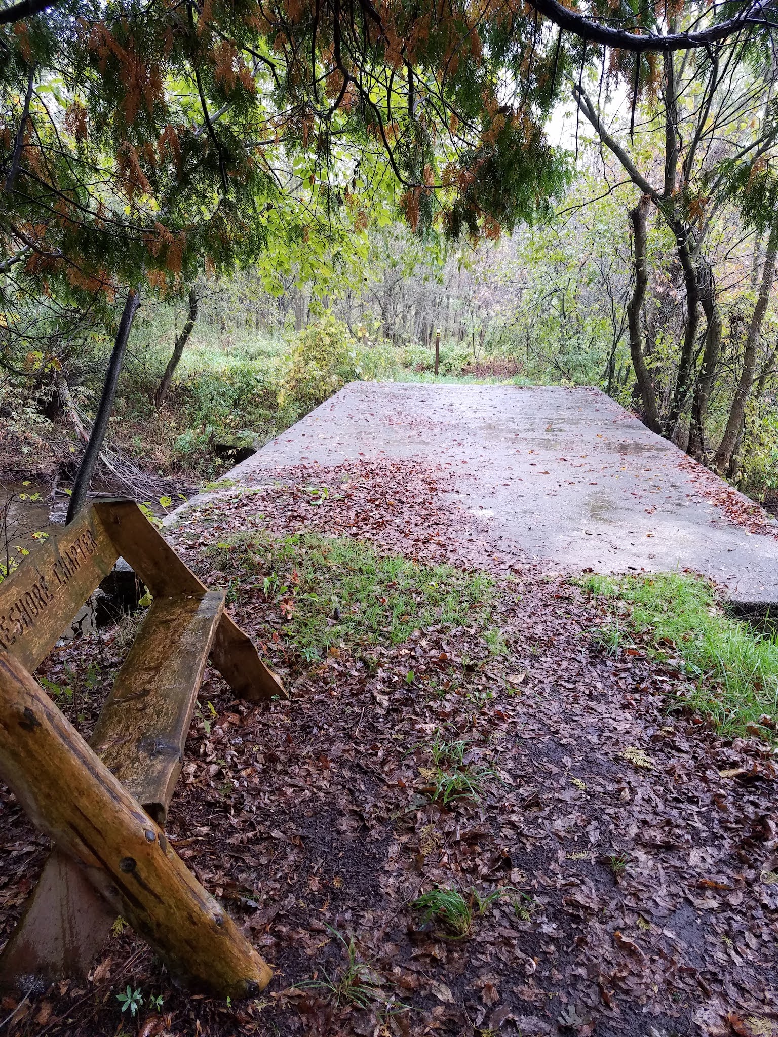
A little further north is the spot where the trail crosses the East Twin River on a permanent concrete slab, and here is where I encountered the only bench I remember on the Segment. 


The hiking along the East Twin River Segment is easy, almost totally level, and quite wet. However, once crossing to the other side of the river the woods changes temperament and the ground is less saturated. This makes for more solid footing, more mature trees, and no boardwalks. 

The trail remains fairly close to the river, and as far as I can tell, the proximity to the river is the one and only reason why the IATA chose to place their Distributed Campsite Area where they did. 


In hindsight, I can recall a hundred different and better places along this trail to set up a tent rather than the spot that is the official DCA, with better tree-cover, flatter ground, and just overall beauty. That made the official DCA disappointing at best, and well worth ignoring if you're planning to set up for the night in there in a small pup tent. 

A little further north I encountered this tree, the "Thompson Family Maple". I don't know the etymology of that name, other than the assumption that it was given in honor of the 'Thompson Family', but it is a magnificent tree. One source claims that this is the largest maple of it's kind in Manitowoc County, and perhaps the state. This claim is made more dubious by the fact that they call it a 'Silver Maple', which is clearly not correct (it's a Sugar Maple'). And while it is an attention-grabbing tree, it's hard to judge the largest tree of any kind without knowing on what parameter the claim is made. It could be the largest circumference, for instance, or it could be the tallest. No basis is given to go with the claim. Certainly, as far as overall height, this is not the record-holder for the state. And, I suppose, one could find another Sugar Maple with a similar girth, through that could take some seeking. But let's not take away from the awesome presence and beauty of the tree by questioning if it is the thickest, or the tallest, or the oldest. Let us take this tree for what it is - a magnificent, awe-inspiring beauty, that, but for the Ice Age Trail, I would never have had the chance to admire. There is a native dignity to any such forest elder, and the tree is worthy of respect no matter how it compares to other trees that may exist somewhere else in the world. 

The Thompson Family clearly thought so. 


Back on the walk, and a little further north, was an area populated with young maple trees that had all been allowed to grow together after a clear-cut of some kind. 

The near total absence of understory, coupled with the uniformity of these trees, made for a unique layered appearance that broke right at eye level, with green above, gray in the middle, and leafy brown below. It was almost like what one would see after a flood of some kind, where the high watermark was visible at a given height, and it went on for as far as the eye could see. 


Eventually, this short (1.4 mile) Segment was over with, but I felt like I had seen and learned quite a lot during that time. I reached the Hillview Road sign at 1:13 pm. 


Next up, more connecting route. And yes, it was still raining, though a little less hard at this point.

Location 4: The Connecting Route between the East Twin River Segment to the south and the intersection of Holmes Road and Rabitz Road to the north
2.9 miles of trail half-covered

Back on the Connecting Route, I needed to hike another 2.9 miles before reaching the waiting van. Unsurprisingly, though we had advertised our location to the world on Facebook, we had not met any IAT hikers who wanted to walk with us, or even cross paths with us, to get a SnOTT patch. 

Off I went down the road. My feet were squishy in my shoes, and I was wishing I had a dry pair of socks and other footwear to change into. The blisters that I felt developing earlier in the hike no longer hurt, which told me they had torn open. Good and bad, I thought. Sort of depends on what I find when I take the socks off in another 2.9 miles. 

And I was right about the poncho. I never got wet from the rain, and I was able to keep all my stuff dry, but beneath that impenetrable layer of plastic me and my undermost layers of clothing were soaking wet from sweat. If I hadn't kept moving, I would have gotten hypothermia. 

At 1:37 pm, I passed this colorful building at the intersection of Tapawingo Road and Jambo Creek Road. Whatever other mysteries remain about the owner, you can't miss their abundant religious fervor. 


Another 'blink and you'll miss it' moment was this mailbox. Hey - the county says you need to put numbers on your mailbox. Who ever said you can't use Roman Numerals? 


Finally, as I turned the corner on Rabitz Road and headed for home, I saw the namesake for the road in the form of a beautiful and proudly maintained farm, family owned an operated by the Rabitz family for over 160 years. 

Wow. 


At long last, and literally no more than ten minutes after the rain had stopped for the day, I reached the van. It was 2:14 pm. I have no idea what the temperature was. I was both hot and cold at the same time, being soaked with sweat but being kept warm only by constant movement. 


I spent a bit of time changing socks and bandaging up my feet. The damage wasn't too bad. A large and ragged blister on my heel that I patched up with a big bandage and a worn off bit on one little toe that would just have to get better on its own now that I had dry socks on. I called Theresa to find out how her progress was, and got in the van to go pick her up at the far end of her hike. 

Location 2b: The Mishicot Segment 
2.9 miles of trail other-half-covered 

While I was hiking north along the 0.7 mile connecting route between the Mishicot Segment and the East Twin River Segment, Theresa was hiking south. Her goal was the entire 2.9 miles of the Mishicot Segment, which I had hiked the day before. 

Theresa started at 12:20 pm. I told her how bad the footing was along the first mile or so where it sliced between farm fields and had suggested she might have better footing on the field itself, but with the rain the field had turned to mud. She had the choice between hiking the weedy, uneven, ankle-twisting trail and turning her shoes into ten-pound blocks. She chose the former. 

It was raining, as you already know, so her walk was not anything to write home about. I asked about her recollections, and the first thing she said was, "Do not drive on or park along Pit Road". She shared with me that while she was walking on this 'Private Road! Do Not Enter - Turn Around - This means you!' roadway, which is simultaneously the IAT and the absolute correct place to walk, a person in a truck sat and watched her walking, ostensibly to make sure she walked ONLY where she was allowed to walk and didn't stray to the side to - I don't know - explore the weed-choked side of the road or investigate the mosquitoes or something. In other words, she didn't feel welcomed, and felt that these were the kind of people who would definitely call the cops if anyone was on their road who didn't belong there. 

As she got into town, she stopped long enough to take this photo by the Mishicot Historical Museum. 


After that, she remembered the covered bridge, (who wouldn't?) and being suddenly uncertain which way to turn. There are blazes there, but in the rain I can see how they would be easy to miss. She did actually call me at this point, and I was able to steer her in the right direction. 

She was also surprised and fascinated at the large number of people fishing in that one small area just below the dam. As I shared on yesterday's post, they are all out there fishing salmon, and it's a perfectly ridiculous sight seeing all these men standing in the rain, casting lines into such a small area. It's more cartoonish than anything I ever saw on Saturday mornings on ABC, NBC and CBS as a kid. 

Thanks in part to my guiding her in advance she had less trouble determining that she needed to cross the bridge again after leaving the park to make her way to Washington Street. Before long she was at the corner of Randolph Street and Woodlawn Drive, but because there is an arrow pointing east at that corner, and she wasn't sure where the segment ended, she kept walking, and I didn't catch up to her until she had waked an extra four tenths of a mile along the connecting route. 

She was more than happy to see me, and to be told she had already reached the end. The time was a little past 2:30, and we were both wet, bedraggled, and ready to be done for the day. I faced a long drive home, and Theresa needed to get settled in back at camp and get some dinner. Morning was going to come very early, and she was planning on hiking with friends the next day. 

Brock's Progress on the Mammoth Hike Challenge: 18.2 miles
Theresa's Progress on the Mammoth Hike Challenge: 4.5 miles

Running Total: 736.4 miles of trail covered, 13.7 miles of trail half-covered; 98.8 miles 'extra' hiking/biking. End of Day 102.

Saturday, October 2, 2021

Day 101: Connecting Route (x2), Mishicot Segment, Manitowoc County

Day 101: Saturday, October 2nd, 2021

Total Miles covered for the day: 10.3     

Location 1: The Connecting Route between the Point Beach Segment and the Mishicot Segment
5.3 miles of trail half-covered plus 5.3 miles extra biking

Bring on... the Mammoth Hike Challenge.


41 miles in 31 days. Why 41? From what I understand, it's because the IATA has been around for 41 years. Next year, I imagine the challenge will be 42 miles. 

So what was great about this year's challenge was that we had a lot of miles left to cover, and in October there were five weekends in which to do it. This was the start of the first weekend in October, and the weather... was forecast for rain. 

At least it was last night. Ten days ago, the forecast was terrible. Then a few days ago it changed, for the eastern half of the state. Theresa hurried up and scheduled a SnOTT Walk for a connecting route out in Manitowoc County. People were excited, and best of all, our custom-made, fully embroidered SnOTT Patches were here!! We were super-excited to be able to give away patches to the people who showed up to hike with us. 

And then by Thursday, the forecast went to snail-slime. The forecast for Saturday, during the time we were supposed to be hiking, was thunderstorms followed by an all-day rain. Theresa went online and canceled all the event notices. 

But on Friday, it became apparent that not every one got the message. It was entirely possible that people would be showing up anyway. So on Saturday morning, I jumped in the van and drove all the way out to Manitowoc County to the very edge of Lake Michigan just in case anyone showed up looking for us. And when I got there - the weather was beautiful. 

All the way out as I was driving I kept expecting that the rain would start. And all the way out, the skies got less and less cloudy, until when I reached the starting point of the walk at 10:37 am the skies were mostly sunny and blue, with a few clouds. 

And there was no one there. 

This was not the first time that we ended up hiking separately. In fact the rest of the month will be riddled with I-hiked, she-hiked stories because we're trying to reach the 41-mile goal any way we can. But the previous time we did this out beyond Cornell I ended up recording everything on the day I covered the ground, and not fully recognizing Theresa and her hiking days, which wasn't fair at all. After all - it is our mutual Ice Age Adventure, and her story is every bit as important as mine. So from here on out, if we hike or bike something separately, I'll be blogging accordingly. 

So here I was at the beginning. It was 10:37 am, and the temperature was 68 degrees. I wasn't going to waste the day, so I grabbed my bicycle and started walking. 

The SnOTT Walk was on again! Long live the snail!


There are several ways one person with a bike and a car can cover five miles of roadway. One can, for example, drop a bike at one end, drive to the other end, hike to the bike, then bike to the car. Or, one can drop off the car, bike to the end, walk back to the car and drive back to the bike. Either one of these would have been preferable to what I did, which was to walk with my bike down the road, and after reaching the end, get on the bike and ride back to the car. 

The reason this last method doesn't work is that a person walking with a bicycle is a road hazard. Not because it's hard to stay off the road, but because so many people will stop to ask if you're in distress and need help. 

Picture this. You're driving down a country road, and you see a walker wearing a safety vest. You slow down a little, give them plenty of room, and maybe wave as you go by. Same with a bicyclist wearing a safety vest. Both of those make sense and are well within our scope of prior experience. Normal people doing normal things. 

Now - take the safety-vest wearing individual OFF the bike and walk down that same road and something is obviously wrong. No one does this. It's not normal. What do you do? If you're a kind individual you stop and ask if assistance is needed. "Do you need a ride?" "Do you need help? I have a bike rack on the back." "Is everything OK?"

I had four separate people actually stop and ask me if I needed a ride, and several others that I managed to encourage down the road without stopping by smiling, waving, or giving a thumbs up sign. Two of the would-be helpers actually passed me by, then turned around to come back to ask if I needed help. 

I will never walk down the road with a bicycle again. 

So besides all the helpful motorists I encountered on this sunny Saturday morning, I was able to play games, listen to nature, and make philosophical observations about the people who lived nearby. 

My favorite game to play on these walks is Road Kill Identification. The skill level needed for playing this game while driving down the road at 70 miles an hour is different than the skill level needed while walking. For example - what kind of snake is that? Or is it a lizard of some kind? Did that used to be a frog or a toad? If you spot bird paste, is it of the sparrow variety, or something more exotic? You get the point. Score the game any way you want. 

When there were no cars passing by (thankfully, I often spent minutes walking between vehicles) I was able to experience the Wisconsin farmlands by sight, and sound, and smell. Despite dire warnings, there were no fields taking on cow manure, so that wasn't an issue, but there were other smells, mostly quite pleasant. What I saw was beautiful, too, but what impressed me most was the grasshoppers. I never saw any, but I could hear them, and the crickets, by the millions. The air was full of their constant noise, which was only interrupted by the buzzing and crackling of the high power lines as I walked beneath them. I heard that sound for a quarter mile in each direction. 

As to philosophy, what I got was a sense of the pride and pure stubbornness of these people making their living off the land any way they could. From farming to firewood, home crafts to eggs, these people literally drew life from the earth as though they themselves grew from the soil. It's a way of life I only know in passing. It's easier to see up close if you pass more slowly. 

Finally as I headed down the last hill into town (where my fourth and final offer of a ride occurred) I passed by other signs of normal life in America. Trees covered in toilet paper. No doubt the high school had a special dance or important sporting event, and it was commemorated through the time-honored tradition of TP'ing those involved. Ah, youth. 


I reached the intersection of County V and Woodlawn Road at 12:07 pm, temperature 72 degrees. I had been making tracks, as they say, because I wanted to get as much done today as possible. I jumped on my bike, and headed back to the car, getting there at 12:35. 

Location 2: The Mishicot Segment
2.9 miles of trail half-covered plus 1.2 miles extra biking

The next segment to the west was the Mishicot Segment. I knew that Theresa was planning to possibly hike this Segment later in the week with some friends of ours, so I locked up my bicycle at the high school near the eastern end of the Segment, and drove to the excellent parking area on County Road B. 

My GPS told me to drive there via Pit Road, but when I reached the turn all I saw was a 'keep out, this means you' sign, so I turned around. 


Oddly enough, this is the very road that the IAT travels on, so...whatever. 

After parking on County Road B, I started hiking east at 1:07 pm, temperature up to 74 degrees. 


The hike starts by going through a very organic bit of forest land and around the end of a farmer's field. Then it hikes along and over a small drumlin. All during this part of the hike I was nothing more than a walking feast for the uncountable swarming mosquitoes. Lacking mosquito netting and repellent, it was a rapid and rueful sprint along what should otherwise have been a very pleasant walk. 

When I actually reached Pit Road, the signage for the trail became terrible. Up until then the blazes were good, but at Pit Road they dried up almost completely. Because I had studied the maps beforehand, I knew that I needed first to turn left onto Pit Road, then turn right at the T-intersection to stay on Pit Road, which was dry gravel. I was passed by only one vehicle, a kid on a 4-wheeler, but I passed several large homes as I walked. That explained the private road, anyway. 

I finally ditched the mosquitoes as I left Pit Road and walked into town past the first of many pumpkin gardens I would see. 


Now in town, the walking became mostly urban. I also got more in the mood for snapping photos, so I have more of them to share. 

Of course, the first feature most hikers will admire here is the lovely old covered bridge that crosses East Twin River. 


The signage through here was actually very good, and following the trail was easy. Turning left after going under the bridge, I encountered the dam, and saw more people fishing in one place than I have seen since - well - ever. 


Seriously - it was totally outside my experience. How could that many people be fishing one hole? Cripes, Charlie Berens would have a field day with this, eh?

To solve the mystery, I finally had to ask. "Salmon," was the one-word reply. 

Well, alrighty then. What would it take to make two dozen serious fishermen all fish in the same 30x40 foot hole? The prospect of catching a big, fat salmon, I guess. It reminded me of the indoor trout fishing pond they used to set up at the big trade shows inside the Coliseum in Madison when I was a kid. 

As I continued downstream, there were more fishermen sprinkled along the river, but not as many as were fishing that one, big hole below the dam. Still - what a sight to see. 

Once I left the park, I encountered the one location where the route seemed uncertain. 


And I didn't even bring my water shoes!

After consulting my map I determined that I did have to turn left and walk over the bridge on 147, although based on the sign I guess one option was to ignore the bridge and cross the river by wading. 

Then the trail arced along down Washington street, past the school where I picked up my bike, and finally back to Woodlawn and the end of the line at County V. I ended that walk at 
2:03 pm, and my knees were acting up on me, making each step fairly painful. I was more than happy at that point to take a little rest. 

So I biked up to the car, a distance of 1.2 miles, and had a little snack. I locked up my bike there and took a drive to the north/west trailhead, where I was able to pull off and park at the edge of the road. I started walking again at 2:34 pm, and it was now up to 76 degrees, with still no rain in sight. In fact, the day got more and more sunny as it passed. 

I was taking no chances. I wore the mosquito netting this time!!


The upper 0.9 miles of this Segment is a series of straight lines and right-angle turns, as it meanders along and between farm fields. The footing here was absolutely terrible, with the ground chewed up and rutted. It felt more like a cow path than a foot path, and after suffering through nearly a half-mile of this I decided to get six feet off the trail and walk in the field. 


What a huge difference it made walking on the hard-packed dirt rather than the overgrown and rutted trail. 

Just before I reached the finish, and my waiting bicycle, I received a surprise call from Theresa. It was 2:58 pm. 

"Where are you?"

I told her where I was, and she came and picked me up. I hadn't been expecting her for hours, if at all, but she surprised me by showing up with enough time left in the day to do some hiking. 

However, before we did, we decided it would make the most sense if we took the advice of another van-sleeping hiker and scope out a place to sleep before dark, which we did. 

We drove all over creation evaluating parking spots, and the one thing we determined was that there weren't any good ones. The parking areas at Shea Lake and Heidmann Lake were absolutely out, with overnight sleeping strictly forbidden. Each and every parking area along the Tisch Mills Segment was also terrible. 

As we were checking out the dead end on Mill Lane, which seemed to be the best option, we encountered an entire Scout Troop hiking the trail, some of whom were looking a little hot and bedraggled. In hindsight, we both believe this may have been the Scout Troop that was looking for us, and we wish we had stopped to give them the chance to identify us as 'The Snails'. We certainly had enough patches to have given each kid one, and I really wish we had. 

In the end, after checking out all the parking areas, this dead end seemed like the least of all evils, but Theresa correctly assessed that it would only be acceptable to park there if we introduced ourselves to the people who lived at the nearby house and ask for permission to stay there overnight. It turned out to be a widow who was quite pleased that we asked, so once again Theresa's instincts were spot-on. We would eventually come back here to spend the night. 

The one place we didn't check out was the one closest to where we started, and that would have been the hands-down winner. Had we evaluated the parking area at the north end of the East Twin River Segment, we surely would have stayed there overnight, and probably gotten a lot more hiking done. Theresa also mentioned that she wanted to check that spot out, but I somehow didn't ever get there. Definitely my mistake. 

Location 3: The Connecting Route between the north trailhead of the Tisch Mills segment and the intersection of Collegiate Road and County AB
1.6 miles of trail covered + 0.5 miles of trail half-covered. 

So after killing off the majority of the afternoon driving in circles fruitlessly looking for a place to sleep, we selected a bit of connecting route to walk. I was still in power-mode, trying to get as many miles in as possible, so we ended up walking in different directions. We placed our cars at opposite ends of Nuclear Road and crossed paths in the middle. That walk started at 5:00 pm, and it was still 75 degrees. 

As I reached the waiting car on the east end of that road, I spotted this lovely open-grown oak tree. 


As I drove back, Theresa had not yet reached the car, as expected. We determined that I should go an extra half-mile up the road and walk that distance while Theresa finished her hike. We both reached the car at exactly the same time, somewhere just past 6:00 pm. 

Brock's Progress on the Mammoth Hike Challenge: 10.3 miles
Theresa's Progress on the Mammoth Hike Challenge: 1.6 miles

Running Total: 733.5 miles of trail covered, 8.7 miles of trail half-covered; 96.1 miles 'extra' hiking/biking. End of Day 101.