Monday, March 29, 2021

Day 46: Harrison Hills Segment (Part 3), Connecting Route, Lincoln County

Day 46: Monday March 29th, 2021

Total Miles covered for the day: 4.7

Location 1: Harrison Hills Segment between Turtle Lake Rd. to the north and Alta Junction Segment to the south.  
3.5 miles of trail covered.

For many long seasons we've dreamed of the thrill
Of the day we completed the Harrison Hills
Three segments of walking, we took in three bites
On three different days, three very long hikes

I recall Lookout Mountain's spectacular view
And the cute little campsites, Herb Schotz' bench, too
And the ATVs ripping around through the woods
I remember the ugly, the bad and the good

I remember the sun and the wind in the trees
And seeing more hills, thinking 'Oh dear God, please!'
I remember that feeling of reaching the car
Fourteen long miles, though it felt twice that far

I have heard others' tales of the ups and the downs
Of the ponds and the muck and the short work-arounds
And the hills - Oh! the HILLS! - Yes, they all mentioned that
Which is why, I suppose, it's not 'Harrison Flats'

On this day we declared, Once more unto the breach!
And we took on the last of the hills and the creeks
And we saw the storm damage, beheld nature's wrath
And we followed the blazes that showed us the path

Until at the end, for the very last time
We saw 'Harrison Hills' on the Ice Age Trail sign
And we patted it fondly - 'Good-bye my old friend'
Knowing we and the sign would not cross paths again
. . . . . . . . . . . . . . . . . . . . . . . . . . . . . . . . . . . . . . . . . . . . . . . . . . . . . 
OK - now that I've had time to wax poetic, I should talk about the hiking. 


If you've been following along, you will have read that we always looked at the 14 miles of the Harrison Hills, with a 7-mile stretch including Lookout Mountain, to be fairly imposing. However, knowing that we knocked out the two longest pieces and survived, it seemed like the perfect time to finally put a 'done' checkmark next to the segment name in the book.

It was a beautiful early spring day, and we drove two vehicles up to County Rd J at the north end of the Alta Junction segment and dropped a vehicle, then went back up Turtle Lake Road and parked at the designated parking area at N 45 22.591, W 89 31.584. 

The time was 11:42 am, and the temperature was 46 degrees. The sun was shining, and the wind was blowing. It was cool, but pleasant. 

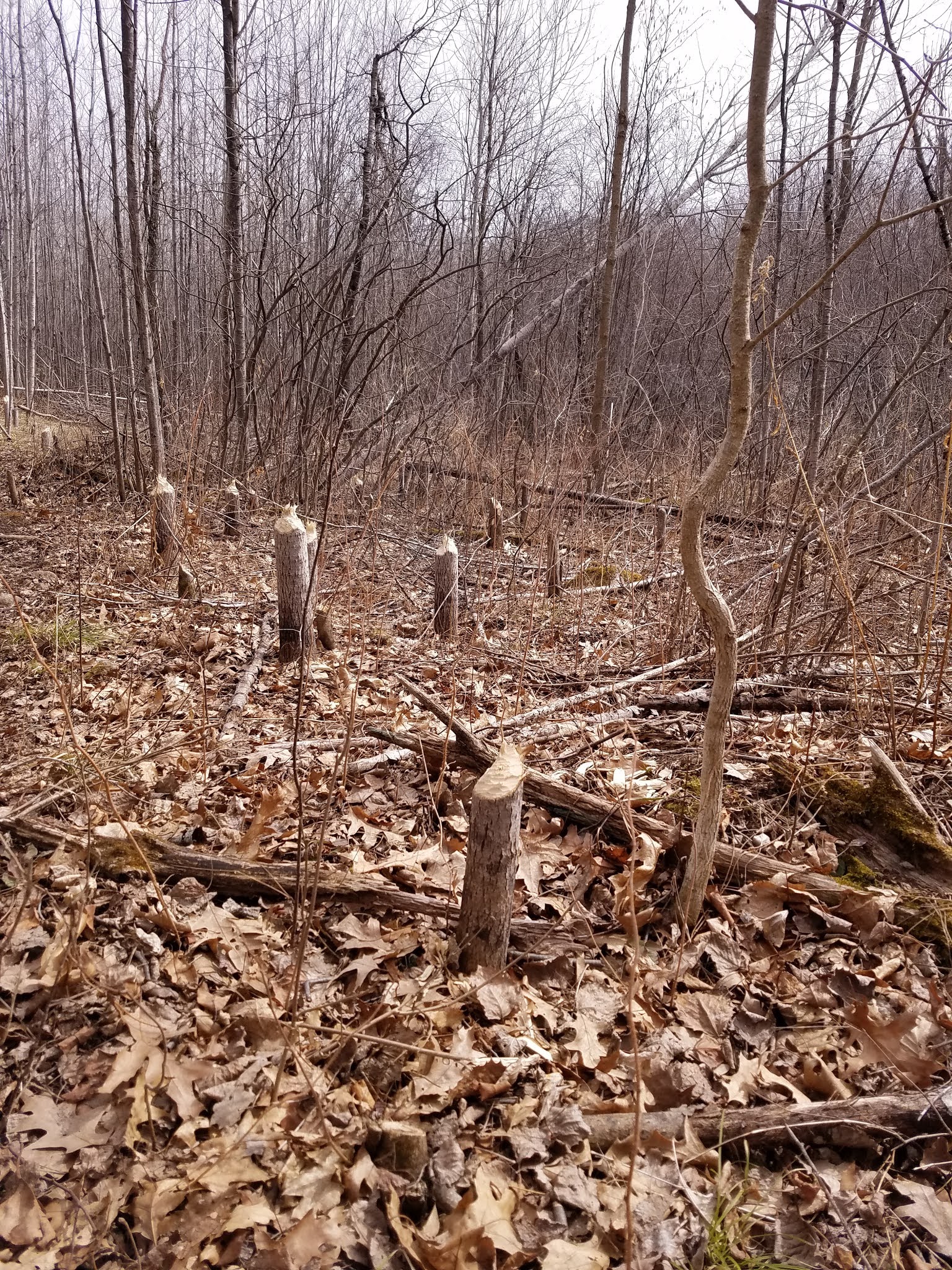
Let me start by saying that this lower third of the Harrison Hills segment was by far the easiest hiking. I can't say it was the most beautiful, because it was often scarred by storm damage and logging, but it had the least amount of elevation change, and the trail was mostly not very steep. 

The biggest hill you face, if you're hiking east to west, is right at the beginning. All the way up, then all the way back down to Beaver Trail Road, before heading off into the woods. 

The snow wasn't completely melted from the little bit we had a couple days ago, so as we were walking we noticed we were following a GIANT. I'm pretty sure Bigfoot doesn't wear hiking boots, so I'll assume we were following a person, but those had to be size 16 shoes, and the stride, even through the snow, looked to be at least 40 inches to the step. This is a person who can really eat up the trail. 


As we were hiking, we came to appreciate the times we were out of the wind, because it was howling away at 18-20 mph, and there was a definite chill to it. It's not too bad when you're moving along, but it's a little brisk when sitting to take a break. 

As we hiked along, we were never very far from the ATV trails, and crossed one at one point. There were some ATVs on the trail, but for the most part they were far away from us. 

I typically have a lot to say about each segment I hike. Not so on this one, mostly because it was six days ago, and we've covered a lot of ground since then. OK - here are some highlights:


* There are a number of places where we had to cross boggy areas
* There were a lot of downed trees (I already mentioned that), but they had been cleared from the trail.
* Whoever had to come through here with a chainsaw to clean up - thank you for keeping the trail open. Well done.
* There were plenty of yellow blazes.
* The footing is good, with not too many roots or rocks. Unless it's boggy, then it's hopscotch time.
* The part of the hike that goes all the way to North Branch Prairie River is worth it. Just ask Herb Schotz.
* The very, very last little bit that crosses the horseshoe road and through the alder bog, then out onto Cty J isn't worth it. It shouldn't even be there.

All in all I would call this a successful day, except we weren't quite done yet. We finished hiking this piece at 4:22 pm, with the temperature all the way up to 62 degrees. 

Finishing the Harrison Hills should have been more of a celebration. Instead, it felt like reaching the end of a movie where you knew the ending half-way through, and it was about 20 minutes too long. We were glad it was over with, but only because it brought us one more segment closer to our goal. 

Even better, it meant we were finally done with map 30. OK - now that's worth celebrating.

Since it was such a long drive to get here, we decided were would kill off the rest of the day by biking a bit of connecting route. 

Location 2: Connecting Route fragment along Horn Lake Rd between Horseshoe Lake Drive to the north and the East end of the Underdown Segment to the south.  
1.2 miles of trail covered.

This is a short piece of gravel road that seems to run uphill in both directions. We decided to park at the southern end, then go back to the northern end to bike the short, winding and oddly hilly road down to the start/end of the Underdown segment. We biked most of the way, but had to walk up a couple hills. Nothing eventful, except we were inching closer and closer to finishing Lincoln County. 

Running Total: 342.9 miles of trail covered; 33.1 miles ‘extra’ hiking/biking. End of Day 46.

Sunday, March 21, 2021

 Day 45: Turtle Rock Segment, Lincoln County

Day 45: Sunday March 21st, 2021

Total Miles covered for the day: 5.1

Location: Turtle Rock Segment between Averill-Kelly Creek Wilderness Segment to the West and Connecting Route to Grandfather Falls Segment to the East 
5.1 miles of trail covered, plus 2.4 miles extra biking.

One does not 'hike' the Turtle Rock Segment of the Ice Age Trail. One survives it. With planning. If you're worthy. Under the best of conditions, the journey is long and difficult, covered with ankle-twisting rocks, festooned with fallen aspens (thanks to the beavers), and just for the joy of it, right in the middle of this 5.1-mile bear-filled woods is a granite-boulder obstacle course, frequently and not always lovingly referred to as the 'Rock Garden'. This is the first time on the Ice Age Trail that I have been compelled to scale a small wall, and I wasn't entirely thrilled to see it.

Today, we felt, was about as good as conditions get on this segment. And I still have no desire to go back and do it again. Ever. The temperature was warm, and there was a breeze. The winter had been mild, and the snow was mostly melted. The water level was down in the creeks and the boggy areas. There were no bugs out, the bears were apparently still sleeping, there were no ticks - perfect hiking weather. Though we really weren't conditioned for a long-ish hike yet this year, we thought we would take a chance and hike this segment that we had been staring at for 8 years now, wondering when and how we would ever tackle the thing. This was the day. Today we would take down Turtle Rock or it would take us down. Turns out it was a near thing.

The Turtle Rock segment is theoretically 5.1 miles. I say theoretically, because my feet tell me it was longer. Maybe it was the rocks. Maybe it was the heaved soil that kept literally collapsing under our feet, breaking through a frozen crust to the muddy glop 2 inches below. Had it not been for the walking sticks to help us keep balance, I imagine I would have fallen at least two or three times. As it was, Theresa fell twice. That was the one thing about the conditions that was less than ideal. The footing was uncertain and treacherous. But that's enough grousing for now. Let me tell you about the hike.

We started out by dropping a bicycle off at the west end at the Burma Road parking area and drove to the East, or North end and parked at that lot. The plan was to hike the segment and then I would bike back to the car. 2.4 miles. Not too bad. 

The plan in place, we geared up and headed for the trailhead. We got exactly four steps before Theresa realized she had worn the wrong boots. The ones she had on were too small, and she didn't bring alternate footwear. A prudent decision would have been to just bag it for the day and go home, without hiking. But we REALLY wanted to get this segment over with. It was now or never. We chose now. As of this writing we're not really sure how many toenails Theresa will lose as a consequence of that decision. Maybe we'll update the blog later when we know. (Update - one.)

The time was 1:11 in the afternoon. It was 60 degrees. We hadn't been hiking in 322 days. This is frequently described as one of the most difficult segments on the whole trail, and Theresa's boots were too small. We touched the sign, and headed into the woods. 


The trail starts out innocently enough. A nice, broad Troad with a gentle slope and a little horse poop to avoid. They do that a lot on the IAT. 'Come hike this trail', they say. 'It will be fun' they say. Well, beauty is only skin deep, as they say. This little segment is a lot like an ogre. It has layers. The trail heads south for a little over 3/10th of a mile, where you encounter the beaver dam. 


The guidebook describes a rock-hop across the stream. There were rocks - and there was a stream, but I think the beavers have had something to say about where the trail goes, and the crossing is a little more harrowing than it used to be. I think a temporarily-permanent side-route has been created to avoid the dam, and the crossing can be managed dry with a little imagination. Just a tiny bit further and we headed east along the top of the bank overlooking the river. 

This really was a beautiful piece of trail, relatively flat, very well marked, and the scenery was beautiful. We stopped at the bench overlooking the creek and enjoyed our late lunch. It was so pretty we didn't want to leave, but we had a long road ahead of us, so off we went. 

The walking remained smooth and easy with a few hummocks, mostly dry, until we reached the banks of the Wisconsin River, where we coincidentally spotted a raccoon. Or - just the head of a raccoon. What eats raccoons? Taking a glance around for bears, we moseyed on down the trail. The trail south along the Wisconsin River reminded me of many, many water's edge trails in northern Wisconsin. A little hummocky, basic northern deciduous forest mix, sun dappling off the water - this could have been anywhere in the northern half of the state. 

We were a little over 4/10ths of a mile from the dam. Quite near the dam we encountered a couple that had canoed across the river with their very well-trained chocolate lab, who greeted us enthusiastically. The dog - not the couple. The couple was nice, too. We told them the trail went all the way across the state in both directions. They were interested, but I don't think they'll start hiking tomorrow. 


South of the dam is where the fun begins. Behold - the Rock Garden. From the north, it starts out fairly easy. A few boulders here, a steep step or two there. And then there are bigger boulders. Huge, cleaved boulders. Jumbles of boulders. The trail clung to the edge of the water like burdock on a sweater, because... well...  who wouldn't want to clamber in and among all those boulders?

Don't get me wrong. There is a trail. But this is where the Turtle Rock segment earns its reputation and well-earned 5-out-of-5 rating for terrain. I mean - the view is breathtaking. There was ice on the river, water crashing through and over the boulders littering the river bed, cascading headlong toward the falls further downstream. But still - it didn't have to be this way. 50 feet away from the shore it would have been possible to walk with significantly less difficulty. In many ways, I would have preferred it. 

Just south of the dam there is a turn on the trail that would be easy to miss. The whole point of this little away-from-the-river jaunt is to walk past the famous Turtle Rock, located at N 45 18.643 W 089 47.238 between the trail and the river. Going south, it's hard to miss. Going north, you could actually miss it. It's worth seeing. Cool rock. On we go.


A little further south you should stop at N 45 18.370 W 089 47.373 and look for the Geocache, GC1PYDK. It's just south of that place where you have to literally scale a small wall of pointy granite to get through. Only a couple feet, sure, but I'm not the Billy-goat I was 45 years ago, and neither is Theresa. Again - why? 


After what seemed like an interminable amount of hellish torture, we finally reached the southern tip of the trail along the water's edge, and headed inland, only to see that the trail rose rapidly uphill, and over - yes - more rocks. Not big ones, but by this time it started feeling like a cruel prank. And the closer we got to the top, the steeper it got, until we were digging our toes in the mud just to keep from sliding backwards. I feel a trail re-route coming to this spot someday. 

I have not revisited the agony of Theresa's too-tight boots yet. By the time we were only a half-mile in, we were seriously considering turning around. The solution, if you call it that, was to remove the inner soles of her boots. This gave more room for the toes, but also removed anything that you could call a comfort cushion on the soles of her feet. Knowing how my feet were feeling at this point, I can only imagine how hers were feeling, and write now in amazement that she made the journey at all. We stopped and rested briefly at the top of that steep incline, she almost in tears, not knowing how she could finish the trek at all, let alone before dark. Though the day remained balmy, actually warming up to the mid-sixties while we walked, we had burned much daylight and it was already 5:00. As much pain as she was in, I was rationing power bars in my mind for breakfast. 

Thankfully, within another 100 feet, we hit troad again, a long, sweeping level piece of trail that at least made the last leg of the hike seem possible before dark. The way was muddy at times, but at least we had left most of the boulders behind for a while. We still had more than two miles to go, but we had planned in advance to leave this section for the end, knowing that it was mostly level, and spent a lot of time on troads. 


We plodded along, we two, alone but for a few sparrows, our bear bells jangling away on our walking sticks. I think the bear bells were successful at keeping the bears away because we didn't see any. 

Into the woods again. Onto a troad. Into the woods again. If not for the abundance of blazes it would have been easy to take a wrong turn. The trail is narrow, and at times ducks through thick groves of trees with little by way of an obvious route. Only once did I stop in my tracks and scan forward, unable to spot the next yellow blaze. Then a few feet farther, and there was the next one. Well done, trail blazer! Well done!

I have little to say about the last leg of our trip, except that you get to see a small pond, some clearings, a few grouse, and if you keep your eyes open a whole lot of coyote scat on the trail. I'm saying it was coyote scat because it was full of hair, and I don't want to think it was wolf scat. At least now I know what ate that raccoon. 

The sun had sunk below the westernmost clouds by the time we got to the end, and may have actually set. I'm not certain. I believe we reached the trailhead at 7:11 pm, exactly six slow hours from when we started, and the temperature had dropped back to about 60 degrees. Oh yeah - no car. 


Back on the bike, I rode the 2.4 miles back to the car and went back to the trailhead to rescue my wife, just as deep dusk was setting in. We were well down the road by 7:40, and it was full-on dark by then. Another half-hour in the woods and we would have been hiking at night. 

Some things are like giving birth. You go through all the pain, but by the time you look back on the experience it was all worth it, and you hardly remember the pain at all. This was not one of those things. In fact, my wife tells me birth isn't like that, either. You never forget the pain. 

At least we got this one over with. Turtle Rock, we won't miss you.

Running Total: 338.2 miles of trail covered; 33.1 miles ‘extra’ hiking/biking. End of Day 45.