Monday, May 30, 2022

Day 181: Janesville Segment, Devil's Staircase Segment, Rock County

Day 181: Monday, May 30th, 2022

Total Miles hiked for the day: 5.9; Net Miles 0.1

Location 1The Janesville Segment, between Wright Road and Interstate Highway 39-90
3.1 Miles of trail covered

This being a holiday weekend, I took Friday off and Theresa and I dedicated ourselves to closing the gap in Manitowoc County, a 34.3 mile effort that we somehow managed to finish in a three-day period. That left us one more day - Labor Day Monday - to get a start on our next objective. There are 244.6 miles of trail that we had, in the past, chosen to traverse by bicycle. Actually, there was 274.3 miles of this when we first started but we've managed to hike off nearly 30 miles of it so far, so now it's under 250. 

That's still a lot. And we want to make sure we get it done by our final hike in September, on the 24th. That party is already in the planning, with an Event posted on Facebook. That means we've got some walking to do. 

So even though we had an absolute monster weekend so far, we drove down to Janesville this morning from Manitowoc so we could start working ourselves closer to home. This was a tactical decision, because when we took away all the biking miles and redefined our gaps, the farthest point from home was Janesville. Theresa went so far as to reprint our Wisconsin page on the Atlas so we could see what was left, and all the map pages, too, so we could mark them again when we hiked them. Our longest solid line now extends from map 75 all the way through map 104, and there is a disheartening number of pages we need to revisit in order to fill in the orange blocks. By starting with the maps furthest from home, we figured it would get easier and easier to clip off the miles. 

It was 12:08 when we finally found ourselves standing on Randolph Road, with our target vehicle parked to the north. It was a 0.8 mile section, but I actually thought I was at Mt. Zion, which would have made more sense. 

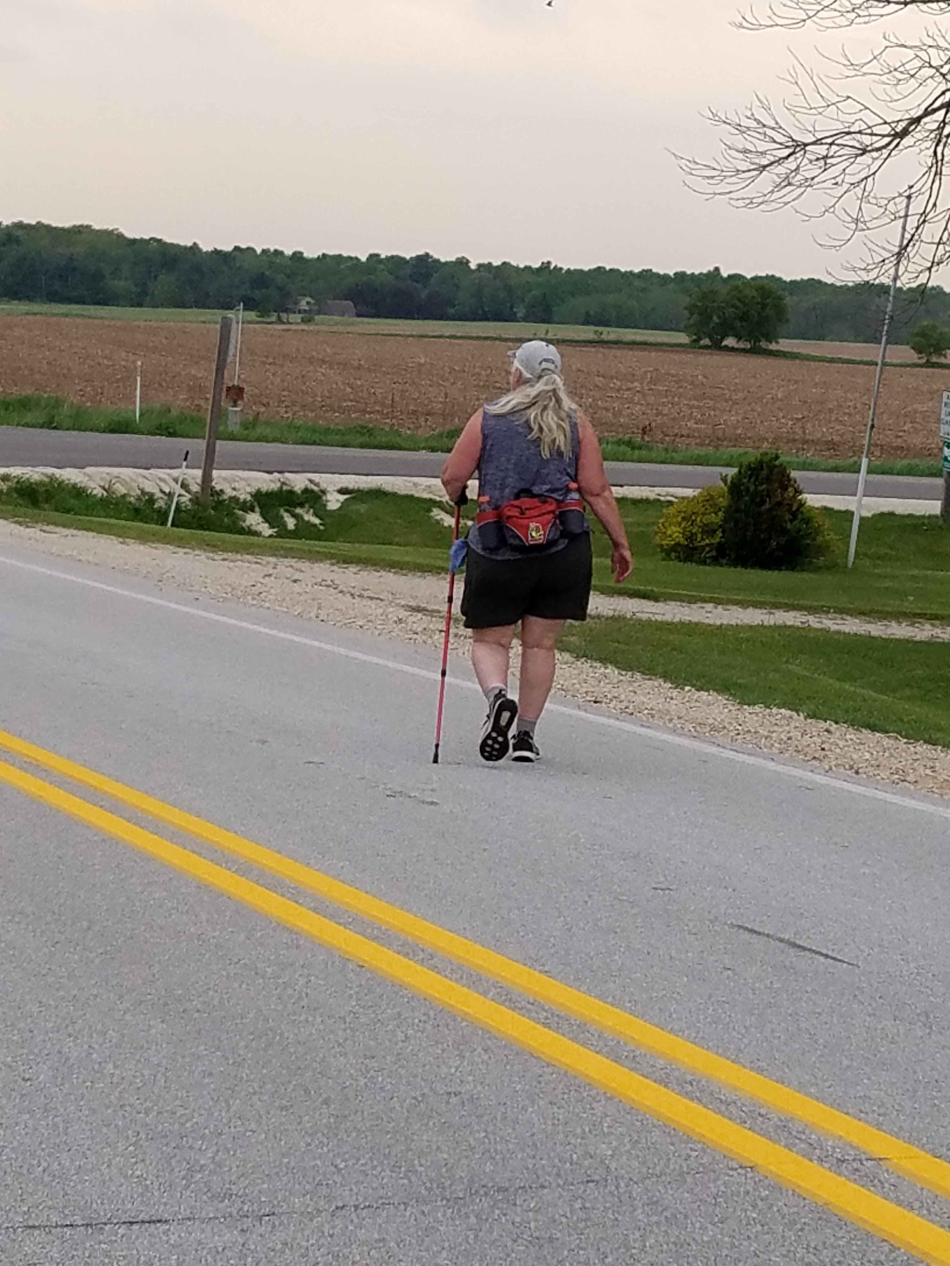
The temperature today reached a ridiculous 91 degrees, and when we started out at noon it was already 86. The sun was beating down mercilessly, and if not for the parasol, Theresa wouldn't have been able to do it. I used my umbrella, too, because I think I might have also wilted in the heat, and I was in no mood for the sunburn I would have gotten if I didn't use it. 


When I look at the photo above, this is what I see in my mind. Am I wrong?


We used every bit of shade we could find, and stopped often at the many benches we found along the way. 


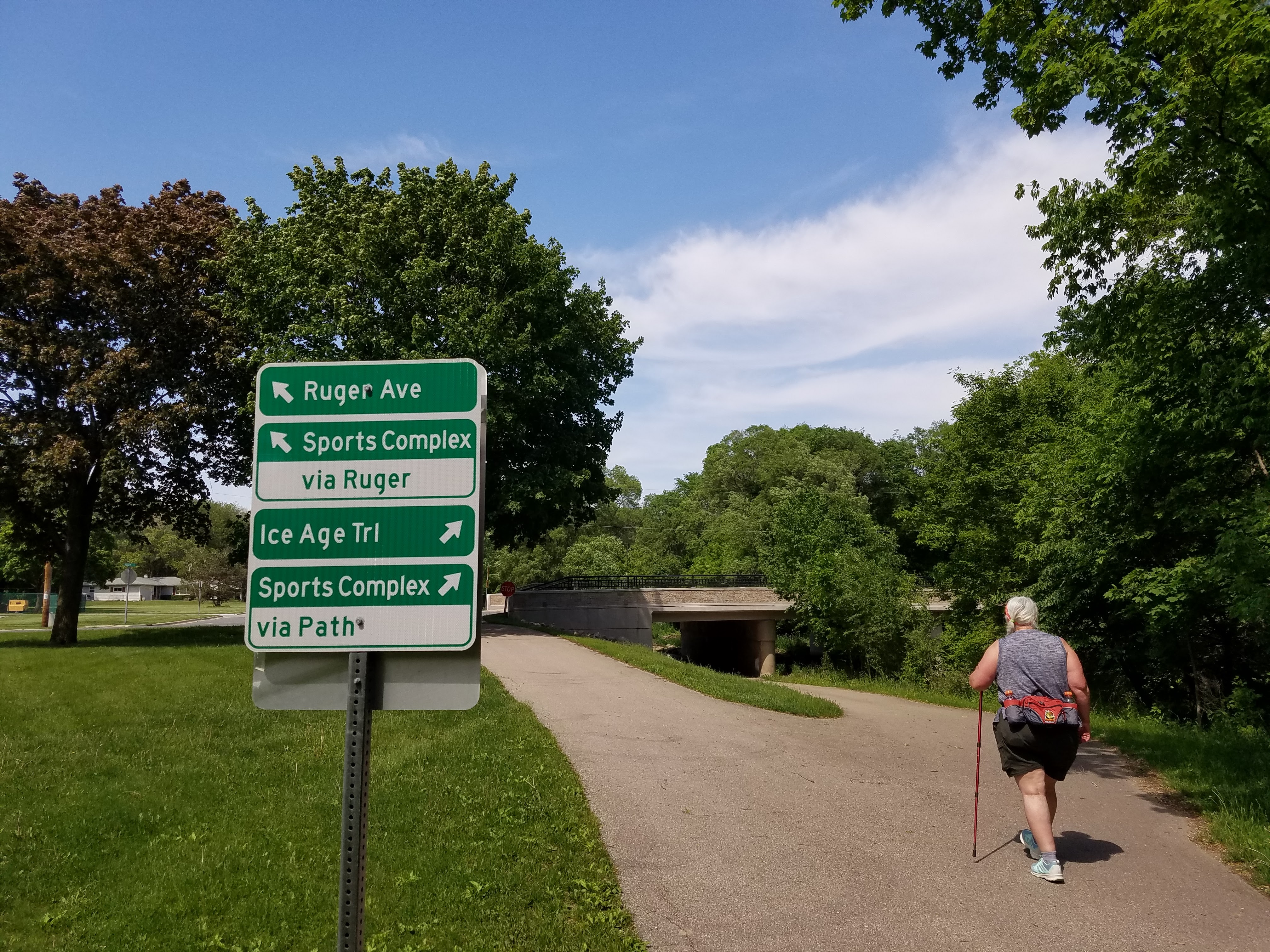
The Janesville Segment, as it winds through the city, is mostly on a bike path traveling through greenspace. I have described it before as low-rolling and very pleasant, but the sun took some pleasure out of the walk. 


Even so, we still enjoyed the beautiful sights and smells. 


And we weren't alone on the trail, either. This is Ping, who was out by herself doing an out-and-back on the whole segment. This, we thought, was a terrible idea, and we ended up giving her a ride to the other end to cut a few miles off of her walk. 


As noted above, when I parked the first time, I thought I was at Mt. Zion Ave. I still didn't know that at this point, so when I parked again on Sioux Court to hike the other 'half' of this gap, it actually turned out to be much farther than I anticipated, 2.3 miles instead of the expected 1.8. No wonder that first leg went so fast. 


We were very much taking our time, so when we spotted this very young fellow we stayed and watched for quite a while. I didn't get a good photo, but his nubbin horns were just coming into velvet. 


He seemed to be enjoying the phlox, which were just coming into full bloom today. 


The rest of the walk to Randolph Road seemed endless, but every step was pretty, and we loved traveling through the long, narrow park. Next, we made our way towards the Rock River, where we had another three miles to walk before finishing the day.  

Location 2The Devil's Staircase Segment, between Riverside Park and the eastern trailhead. 
1.3 Miles of trail covered

For whatever reason, we decided to finish up the last bit of hiking on the Devil's Staircase Segment first, so we dropped a vehicle at the end and went down to park at the end of the segment near the restrooms. This was a fairly short walk that started out near the edge of the river, though it wasn't easy to see that from anything resembling yellow blazes. I think I remember seeing one... or two. But not many. 


We walked along the edge of the river, where we think the trail was supposed to be. But eventually we just took to the road when the water's edge became a silly departure from the roadway a mere 20 feet away. 

The walk was easy, flat, and if not for the oppressive heat, quite enjoyable. I eventually found the sign that led up to the infamous Devil's Staircase, where there was an actual trailhead sign. To be frank, I can't figure out why they don't just have the Janesville Segment end there. 


Location 3The Janesville Segment, between the Canterbury Street tunnel bridge and the west end of the segment
1.6 Miles of trail covered

I have really fun memories of walking up and touching this wall in the middle of a February blizzard in 2014. The snow was blowing sideways and we couldn't see more than 50 feet in any one direction. We found just a trace of the old yellow blaze that was once painted here. 


Taking that as our starting point, we headed north under the tunnel (where the trail used to go) and made our way up and over the bike path to find a massive construction zone. We gingerly made our way around that only to discover that the trail, inexplicably, no longer went under the tunnel. We found the trail, where blazes went both left and right.

We reversed course and went back to the parking lot we started from only to take a closer look and see that the blazes led up this pathway that looked more like a volunteer trail to a homeless encampment. 


Look closer. I think we can be excused for missing this particular blaze. 


Up a little farther it looked even more like a path to a homeless shelter, albeit one with a yellow blotch of paint leading to it.  


I wonder how long it will be before the taggers decide to cover that little yellow splotch with something more entertaining. 


Then we came out riverside on the construction zone and back to the spot where we noticed we hadn't been on the trail after all. In short order we found ourselves on the bike path, which is a more recognizable trail to follow. Once again we were following an Eden-like paved pathway through a delightful wooded greenspace hidden along the Rock River through the middle of the City of Janesville. 


There is a railroad not too far from the bike path that sits atop an elevated bed, making it necessary to create water tunnels to let drainage get to the river. My inner geocacher wants to take time and explore these tunnels. 


Like the other side of the bike path, there were plenty of benches. 


There's also one or two places where road access is possible, if a little pinchy. 


I'm definitely not taking my car through that. 


While we were walking we chanced upon a young boy who was out walking with his mother. He wasn't having the greatest time of it. I'm thinking he was cranky because he was hot. But after some carefully applied snail therapy and a cool patch, he seemed to brighten up a bit. I chose to take no pictures except this one. 


We also once more ran into Ping, who had caught up to us from behind, having completed the entire Segment while we were marching off a few miles. She slowed down enough to walk with us over the last little bit and we spent time chatting as we went. She said that she usually hikes with a larger group of people, also Asian, but that no one was able to go with her today. We got her to promise that when she's hiking the northern 1/3 of the trail she wouldn't go alone, because it's too isolated. Sadly, it's not the bears or the fear of injury that gives me concerns for women hiking alone through the Chequamegon and Nicolet Forests. It's the people one might meet out there in the woods. 

When we finally got within sight of the park where the car was located the signage got really bad again. The concept of 'trail' is a little vague through here, and I can't even make sense of the few blazes that exist, since they seem to appear at somewhat random spots in the park, loosely strewn along the lake. 

Unlike yesterday, where the miles were flying by in our relentless pursuit of finishing Manitowoc County, today it felt like the road was stretching out in front of us. We didn't finish until 7:03 pm, a full 7 hours after we started. There was no sign or blaze to touch when we arrived, so I touched the Snail Sign in my van window instead. It was as close as I could get. 


The tally:

  • At least five new Snails today
  • Completed map 74
  • Completed Janesville and Devil's Staircase Segments
  • Completed Rock County
  • Added 0.1 miles of new trail, making adjustments for previous rounding errors
  • Converted 5.8 miles of biking to the 'hiked' category
  • 240.1 miles to go
  • Oh yes - one more thing. Our hiking total for May, 2022 is 131.9 miles. I can't believe it either. 

Running Total: 1212.2 miles of trail covered (896.9 hiked), 190.5 miles 'extra' hiking/biking. End of Day 181.


Sunday, May 29, 2022

Day 180: Connecting Route (x2), Manitowoc County

Day 180: Sunday, May 29th, 2022

Total Miles hiked for the day: 13.7; Net Miles 13.7

Location 1Part of the long Connecting Route in Manitowoc County, between Valders Memorial Park and the intersection of Alverno Road and Custer Street.  
9.2 Miles of trail covered

Dawn. The beginning of the end of the beginning. 

Nine years ago we started out on an adventure, planning to walk and bicycle across the state, following the Ice Age Trail route. Twelve hundred miles. That was a long, long way. This morning when we woke up there was only 13.7 miles between us and reaching that goal. 

I want to take a minute and contemplate that number. In the beginning we weren't very committed to the miles. It took us six outings to reach 13.6 hiked miles. That was during the heady days of 2013 when we were hiking almost every weekend, but the distances were small. On our 14th day of hiking we managed to hike 11.2 miles, all in Polk County while we were walking Straight River, Straight Lake and Trade River. This feat we would not repeat itself during our hiking career. Any other time where we hiked 11.2 miles or more was when we were hiking connecting routes. And there was not another instance where we BOTH walked more than 11.2 miles until just two days ago where Theresa and I both hiked 12.9 miles. 

So today, as we were facing 13.7 miles between us and... the end... it didn't really seem feasible. We didn't even start out trying to walk it all off. We just let the day happen as it would. 

I loved the look of the sunrise, so I quickly jumped out of the car with my camera to snap a few shots.  


We didn't go out for breakfast this morning, instead relying on trail food, which has long since become one of Theresa's specialties. Then we drove our vehicles down to the meetin' spot in the back lot of the Dugout Bar and Grill in Manitowoc. We had already walked a few miles west of there, but we weren't sure who we might be meeting or what their plans were. As usual, we were trying to accommodate a variety of possibilities for anyone who might show up. 

That number turned out to the three people and one dog. I included the photo below because it demonstrates once again the incomprehensible difference between Theresa and the rest of the world. It was 58 degrees, headed for a high of 65 today, but it was overcast and a little breezy. Yet - while we were all layered and covered, Theresa felt perfectly comfortable in shorts and a T-shirt. 


Based on everyone's hiking plans for the day, the thing that made the most sense was for me to give a ride to Tiff Tiff and her wonder-dog Marshall Trempealeau and take her to the far end of her hike, in Clarks Mills, so that she could walk back to her car. 


in the meantime, Theresa and her two hiking companions started hiking without me, using a leapfrog method. They chose a first leg that went from Union Road to Custer Street, which is almost three miles. My job was to park wherever they did and hike fast to catch up. 

10:00 am. No shoulder, no traffic. Time to play "Catch the Snail". 


I love the perfect balance and beauty that happens when a bird transitions from the astonishing accomplishment of flight to the serene and watchful act of perching. They can fly 20 miles per hour towards a tree, full of unmovable trunks and wildly swinging branches, and then somehow spread their wings to execute a perfect two point landing. Every feather is in place, contributing. Grace in three dimensions. 


And I am no less impressed by the birds who land on water, like these two swans that were hanging out on a pond next to the road. These hefty birds have enough mass to knock over an adult human (try Googling 'Goose Attack' for fun video clips), yet they can lower their ski-like feet as they glide effortlessly over the surface of the water and coast to a soft, floating stop. 


An old barn doesn't have to be just an old barn. 


I did eventually catch up to the group. 


I was pretty sure this was yellow salsify, but the search app I used said it was more likely goat's-beard. I was confused until I looked both of them up and discovered they were the same thing. 


Yellow Salsify is the one that turns into those giant snowballs that look like dandelions on steroids. Looking at this flower ready to go to seed, I am reminded how pretty a plant can be even when it's not at it's most glorious. 


When we got to the parking lot we found the vehicle of a couple who were obviously out to celebrate their 50th anniversary. 


We are not yet at 50 years. Goodness knows there is no guarantee we will ever get there. But if we do - I'm going to decorate our car and drive all over the state. 


I was a little surprised to find out that our hiking companions were going to call it quits for the day. They gave us a ride to our cars and took this nice shot of us as we prepared to take on the next piece of roadway.  


And so we started working our way down the roadway, just we two. Our first job was to work our way off of map 94 by getting past County S. We did this in two stints. Our first stop landed us near this old stretch limousine. 


It's been here a while. Apparently Clarks Mills is where limos go to die. 


Just before the corner - 200 yards to be exact - we ran into this mailbox. A friend of the trail, to be sure. 


The geese were out today. These are likely some that have settled into the area for the season, rather than a group migrating through. 


Our next leg took us past Clarks Mills, where we walked into and through town. One thing I remember is seeing an amazing fence line where someone had put up a bunch of tree roots. I tried taking video to show it all, but it was jumpy and useless, so I'll just say you can't miss it, and you'll probably also be amazed when you see it. 


It wasn't very much longer after this that we finished the 9.2 mile piece of roadway that completed both pages 93 and 94. I asked Theresa how she was feeling. 

"My foot hurts", she said. 
"Should we stop?"
"No."

So we didn't. 

Location 2Part of the long Connecting Route in Manitowoc County, between the intersection of Hillcreek Road and Marken Road and the intersection of Townline Road and Spring Lake Road.  
4.5 Miles of trail covered

We were now in a position where we had only four and a half miles to go before we could say that our first mission was over. One little 4.5 mile stretch that filled in the last gap and brought "The River" all the way to the very end of the Sturgeon Bay Segment. One tiny section of roadway before we could celebrate what for us has been an amazing accomplishment. 

It might be that we should have waited until tomorrow, but there was a lot of desire left in our tanks, so we just kept walking. 

Driving down to that last piece of roadway, we worked our way north to south, leapfrogging off the miles together in small chunks.


Sometimes a tree catches my eye on the side of the road. 


Sometimes something else catches my eye. 


A goose came flying by. 


And there was some fascinating ruined farm buildings. 


We got a beautiful view of the lake as we went walking by. 


And I couldn't help but notice the incredibly unique landscape that sat on top of the hill just south of Christel Road. I confess that I wandered quite a bit off the roadway as I explored this area. The bare rock and rubble surface appears to be entirely natural, and the entire hilltop looks like this. 


Speaking of Christel Road, if you take a side-trip down Christel Road for a quarter mile or so, you'll find this highly unique structure. To my knowledge, I have never before seen a square silo, let along a square silo made of field stone. 


We walked, and we walked relentlessly. We did not pass go, we did not collect $200, and more germane to the story, we didn't take rest breaks. We just kept going and kept going. 

When we were down to the last half-mile, Theresa stopped me. 

"I have gaps."

I had forgotten that two days ago I had done quite a bit of walking in the morning before Theresa came to get me. 

"You can hike that tomorrow", I said. 

"I don't want to hike it tomorrow, I want to finish it today. I want that last half-mile we hike to really be the end of it for both of us."

"You've got almost two miles left down there. Are you sure you can do this?" I asked. 

She was. So she did. 

For me, the miles were already hiked, and already counted. I booked them two days ago. But in order for Theresa to not have to stick around and hike another day, she had to hike off parts of the CR between Walla Hi and LaBudde Creek, on both ends. 

So we first went to the LaBudde end, where she needed to walk nine tenths of a mile down to Rhine Road. 


I played trail angel for that one. Then we drove to the other end, where I walked with her the half mile between the Walla Hi sign and Hwy 32. 


Then, when this was done, done, done, we went back up to County F/Townline road and hiked together, hand-in-hand, for the last 0.5 miles 

And so it was that on a nondescript intersection in Manitowoc County, Theresa and I found ourselves at the end of a very long journey. Either on foot, or on bicycle, we had covered the entire distance of the Ice Age Trail, including both bifurcations. For us, this was worth celebration. 

You can see the light of sunset in our faces. 


I have mostly stopped talking about the pain and discomfort that Theresa was going through. Her injury from March of last year has plagued her for the last 900 miles. Her feet have been blistered, bandaged and then torn up again. She aches in her bones and joints. She gets leg cramps that keep her up at night. More than once, for various reasons, she has shed blood in her pursuit of this goal. I am incredibly proud of her for getting this far. And I am even more amazed that she wants to keep going - to keep pushing, until we have gone back to walk every mile that we biked previously. That's still almost 250 miles to go, even if we don't hike the western bifurcation. 

We have a lot of people cheering us on. I just hope Theresa realizes that I'm one of her biggest fans, and I am also inspired by what she has accomplished. Today she walked a little more than 15 miles, which shall forever be her gold standard. There will likely never be another day like it. 

The tally:

  • Completed maps 93 and 94
  • Completed Manitowoc County
  • 13.7 new miles covered
  • 246.0 miles to go
Running Total: 1212.1 miles of trail covered (891.0 hiked), 185.5 miles 'extra' hiking/biking. End of Day 180.