Sunday, January 30, 2022

Day 133Connecting Route, Kewaunee County

Day 133: Sunday, January 30th, 2022

Total Miles covered for the day: 10.5

LocationThe Connecting Route East and north of the Tisch Mills Segment from the intersection of Collegiate Road and County Road AB to the intersection of Pine Grove Road and Sleepy Hollow Road (the old route)
10.5 miles of trail covered

Woke in the morning in our hotel room and shuttled our many bags and belongings to our one vehicle. At noon we wanted to be at the intersection of Pine Grove Road and Sleepy Hollow Road to meet our hiking friend, Laura Hinesh, and help her celebrate her second full lap on the Ice Age Trail. Her plan was to walk the final 0.8 miles between this intersection and the 44 Winery, a little south of there on Sleepy Hollow Road. We knew we couldn't walk at her pace, but we wanted to be there at the start and the end to cheer her on, and later to go out to a local pub & grub for some lunch. 

Our goal had been to go up to hike a little of the Kewaunee River Segment and leave in time to get back by noon. But by the time we determined how long it would take us to get there, and how long it would take to drive back again, we figured that we would only be able to get about a mile and a half of hiking done, so we bagged that idea and picked up the Connecting Route where we left off on October 2nd of last year and started working our way west toward Bolt. 

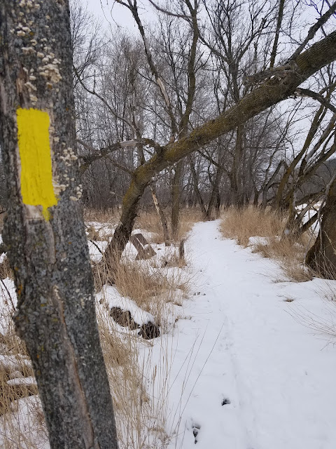
It was a mostly sunny day, with light blue skies and whispy clouds above. It was 20 degrees out, and there wasn't much wind, but when it did blow it cut right through us. The first leg was a 1.5 mile piece that cut west, and then south again to Bolt Road. We started hiking at 10:07 am, and we were hiking with a purpose. 


The roadway was bleak and empty. I think there may have been one car that passed us as we walked, but I know there weren't two.  


The bright sun made for scalloped shadows along the snow drifts on the south side of the road. 


A cattail scene next to the road. I can't count how many ducks unlimited prints I've seen that look exactly like this, only with a deer or a pheasant in the scene. 


The next leg was a two mile hustle all the way to Bolt, in a straight line along Bolt Road. I don't remember if I took any photos along this stretch. I crossed paths with Theresa somewhere in the middle and I'm sure I took at least one photo of her, but alas, my phone was eating pictures again. 

When I picked up Theresa it was time for us to boogie up to the starting place where we would be meeting up with Laura. We were there at 11:45, and she wasn't there yet. Puzzled, we went to the end of the proposed hike. Not there either. Not even a car waiting. 

What gives?

We went back to the start, and we were turning around and parking at one minute to twelve when a little black car comes down the road, pulling to a stop at the corner. Out popped two enthusiastic women, one of whom we recognized as Laura, the "Energizer Bunny" to our "Snail". With her was a friend of hers, Tonya Teeters, whom Laura introduced as the inspiration behind her first end-to-end walk on the Ice Age Trail. Tonya said she has been at it for many years, and has 'only' covered 32 segments, so she felt like she would fit right in with us. 

I know for certain I took photos of Tonya, because we gave her a SnOTT patch and welcomed her to the Snails. 

We watched her walking down the road with Laura when we jumped in the car to drive down to the other end. I don't think Tonya has an 'inner snail'. Whatever prevents her from walking more segments on the Ice Age Trail, it certainly isn't speed

We decided to walk just a bit up the road and wait for Laura, so as to finish hiking the last couple hundred feet with her. Laura had her walking music going, cranked up to about 128 beats per minute, and she was feeling the love as she got to the finish line. Cheers roared up from the small crowd, standing in the chill winter air holding signs and clapping gloved hands together. Her parents and brother were there to welcome her to the end, and it was a far cry from her first trip, where she ended the hike alone. 


We ended up going into the winery and sitting at the table as a few flights of wine were sampled and a few bottles purchased in celebration. Toasts were raised, and then it was off to the pub for burgers and fries. 

"We made it to Bolt", we told Laura. 

"Bolt?" she asked, puzzled. "You must be looking at the old map." 

Nope. We're still using the most up-to-date printing available, but once again the printed map shows a different route than the online version, or the Guthook version. In fact, the printed map route was literally five miles longer than the new route. We never had to walk all the way to Bolt. We could have turned north on Sleepy Hollow Road all the way down on Collegiate Avenue and walked straight north. If we had, we would have been all the way off map 98 already, and likely would have been able to walk all the way to the winery before noon. Instead, we were still three miles from the edge of map 98, and six miles from the winery. 

When the party was still going strong, we told Laura, "You may be done hiking the Ice Age Trail, but we're not! We have hiking to do." She understood completely, of course, and we parted ways a little better friends than before. 

It was too late to go up to the Kewaunee River Segment, so we just went back to Bolt to pick up the connecting route and head north. We figured that doing it any other way would look messy and strange on the map, and in the end it would only save two and a half miles. 

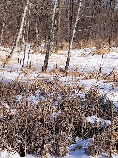
We crisscrossed our way along the first two miles of roadway north of Bolt, seeing more flat, snow-covered Wisconsin farmland along the way. There were places on the road that probably get more deer crossing than cars. 


I love the pampas grass that grows wild along the roads up here. 


The sun was getting lower in the sky.


The horizon was flat and cold. 


I drove back and picked Theresa up and we set up for the next leg, another two miles north that would get us off map 98 and all the way to County J, where there was a bar for convenient parking. 

As I walked, I was doing some quick calculations in my head. How far to the winery? How long until dark? How many more miles until we reach 900? 2.2 miles, I figured. 

When I crossed paths with Theresa this time, we decided we would just keep hiking and go for it. The last leg was three miles, north on J to Pine Grove Road and then east two miles, the same otherwise unnecessary two miles we hiked in the morning on the way to Bolt. 


It was completely dark by the time I crossed County Road AB, but I still had a mile to go. At the very end there was a nice looking old barn. It was too dark for a photo. 

We ended our day somewhere about 5:30, and full darkness had descended upon us, but we were both satisfied with the result. This weekend we finished one more segment and one more map. It's getting to the point where we're going to start running out of those things. 900 miles down, 300 miles to go. 


Running Total: 900.8 miles of trail covered, 145.7 miles 'extra' hiking/biking. End of Day 133.
 

Saturday, January 29, 2022

Day 132Tisch Mills Segment, Kewaunee and Manitowoc Counties

Day 132: Saturday, January 29th, 2022

Total Miles covered for the day: 2.6

LocationThe Tisch Mills Segment
2.6 miles of trail covered

On one of the Ice Age Trail Facebook... er... Meta pages, someone posted a list of the Ice Age Trail Segments best hiked in the winter time. The primary reason was water

Water graces the trail frequently, or plagues it depending on whether your walking past a kettle lake, along a stream or through a bog, marsh or swamp. The Tisch Mills Segment has the stream, often pleasant, but also has a bit of bog. That would be bad enough in the summer, but it also has a bit of a mold problem, so we definitely agree with the 'do it in winter' designation. 

We drove out here this weekend for two reasons. We wanted to hike Tisch Mills, but we also want to drop by a special event on Sunday. Tomorrow, Laura Hinesh will be finishing her SECOND complete round of the Ice Age Trail. What an achievement! We plan to be there to help her celebrate. 

So today, our only goal was to finish Tisch Mills, and in that we were successful. The parking is terrible on the trailhead ends, so we came in one vehicle, planning to crisscross hike our way from end to middle. For the first leg, I dropped Theresa off on Nuclear Road at the north trailhead at exactly 2:00 and she started hiking south.

The temperature was a perfectly balmy 22 degrees when she started. 


Bye! See you soon!


Meanwhile, I drove into town to park at the end of Mill Road and hike north. 


The leg north of town is a little over a mile long and runs alongside the East Twin River. 

The river was thoroughly frozen today. This fact did not go unnoticed by a recent cross-country skier. 


The walking is level, and there is a single bench along the way on which to sit and enjoy the view. 


The majority of the time, I was walking within 10 feet of the edge of the river on a single-track footpath, occasionally framed by close-growing alders. 


I crossed paths with Theresa somewhere in the middle. She was dressed very warmly, and as it turns out, too warmly for the day. 


There are a couple of bridges to cross, each of which was likely a critical part of making it through dry in the summer time. This time of year, I think I could have just walked straight across. 


I had a very quiet and close-to-nature hike. The sky was a leaden gray, and the world lay in a state of frozen hibernation. The river lay quiet under the snow and ice. The trees were naked, save for a frozen apple or two. 


Bird's nests, filled with snow, showed plainly in the trees bare of leaves. Field flowers gave the impression of death, even though inside the dried and frozen seed pods the essence of life lay waiting for the warmth of spring. 


Only the footprints of deer, rabbits, people and dogs gave an indication that the land was anything other than totally dormant. 

Near the very end, the trail spilled out onto a shared snowmobile trail, making for easy walking to the end. This part of the segment was very pleasant in January. Heavy snow would have made it a lot more challenging, but we were here after many footfalls before us. 

I reached the end just as Theresa was arriving with the van, and we drove to the other end to set up our next leg. 

As we drove into town to scope out the parking, we ran across two hikers. Welcome to the Snails, Thimms family!


For our second leg, Theresa dropped me off at the west trailhead on County Road B and I walked east, while she drove into town and parked at the Post Office. While she walked the roadway I headed across the field. We were planning to meet at the river ford. 

The walk across the field, a little over a tenth of a mile, wasn't very pleasant. Drifting snow across the field made for challenging footing as I alternately broke through the crust or smooshed deep into the grainy, dry snow. I was happy when that portion was over. Theresa agreed with me that it was a terrible way to finish her walk on that leg.


Once into the woods, however, everything changed. The trail here was well-established, trodden firm, and made for easy walking as I dove into the cedar bog. 


Thank goodness for the boardwalks, bridges, planks and what looked like pallets that were laid through the boggy ground. In winter they weren't as important, but in the summer this would be unpleasant to cross without them.

Here in the pines and cedars, there was evidence that the woodpeckers were still very busy. They tend to select one tree and cut many holes, often in vertical lines, coming back season after season. These holes were the size of tennis balls. 


There was also evidence of deer and turkeys as I walked along the edge of what looked like an esker snaking through the woods. 


Finally, I reached the river ford. This is a sign familiar to anyone who has walked through this segment. 


Today, the safest thing to do was walk through on top of the ice. Wading would have been distinctly unpleasant. The river was mostly frozen and easy to cross.


However, as can be seen in video below, it wasn't totally frozen. 


The same characteristics that make for this to be an excellent place to cross in the summer - shallow and narrow - make for it to be a little hazardous in the winter. The river, frozen almost everywhere else, is forced into a smaller space here. The water that runs lazily under thick ice in other parts of the river runs swift in this narrows, keeping the water open year-round. We crossed easily in places that remained frozen, but hikers are well-advised to use sounding sticks to check the soundness of the ice before they cross. 

I checked out the Distributed Camping Area while I was waiting for Theresa. It seemed like a nice spot to camp, and I left behind a SnOTT patch for the next lucky hiker who happens by and opens the trail log. 

When Theresa came, we spent a minute chatting, but wanted to keep moving. We were both starting to feel overheated, dressed as we were for the much colder temperatures we had encountered the last couple weeks. She went west and I continued east. 

Across the river I was in higher ground, and the trees were thicker and more mixed hardwood than cedar. The whole trail was well maintained and had plenty of blazes, so I didn't have to think very hard as I walked. I came upon the stone memorial from the backside identifying this as the Weber Memorial Natural Area just before reaching the road. 


I walked the road into town, more downhill than up in this direction, and noticed that there was bird art on many of the telephone poles. 


I got to the car and drove out to pick Theresa up. She had just finished a minute or two earlier and was walking down the road. 

We had about two tenths of a mile to finish, between the end of Mill Road and the post office. We did one more crisscross to complete the day. 

I saw this sign that was worth a mention. I felt very elcome. 


I finished at 4:47 pm, and Theresa picked me up a minute later. 


Mission accomplished. Tisch Mills was behind us. Next up for the winter checklist: Storrs Lake Segment near Janesville. 


Running Total: 890.3 miles of trail covered, 145.7 miles 'extra' hiking/biking. End of Day 132.
 

Sunday, January 23, 2022

Day 131Connecting Route, Merrimac Segment (Part 2), Sauk County

Day 131: Sunday, January 23rd, 2022

Total Miles covered for the day: 2.9

Location 1The connecting route south of the Merrimac Segment between the eastern trailhead of the Merrimac Segment and the railroad tracks
1.0 miles of trail covered

Today started out gloriously cold, with a fresh 'dusting' of about 3 inches of light, fluffy snow on the ground. The Willowood Inn is a lovely place to stay, as far as motels go, but they don't do much in the way of snow removal. I had to shovel my way out to the cars, then shovel a path over to the office just do I could drop off the key in the morning. Not that it was heavy snow, I was just surprised that by 10:30 in the morning I hadn't seen any sign of life at all from the proprietors, other than the meager continental breakfast laid out in the lobby. 

Once we were packed up, it was time to hit the trail. We didn't have much to do today, so we were taking life easy. 

The first bit of business was to cover the remaining portion of the connecting route that lies between the Merrimac Segment and the Wisconsin River, where we had taken the Colsac III, better known by absolutely everyone as the Merrimac Ferry, last November. It was a little challenging finding places to park, so we settled for just pulling most of the way off the road and trusting that we wouldn't upset too many Sunday drivers. 

It was 13 degrees when we started walking, and it was bright and sunny. High cirrus clouds blew by overhead, making occasional bright sun dogs. An eagle soared by silently, traveling from the open water on the river to an unknown destination in the bluffs. 

I took exactly two photos as we walked along the road. The first was of this old weathered barn. 


The walk was chilly, but there was no wind, so it was fairly pleasant. By the time we bent around past the cemetery, still and undisturbed but for the deer tracks that ran through, it was 12:15 pm. 


Time for the next leg. 

Location 2The eastern half of the Merrimac Segment between the east trailhead and the trail crossing on Marsh Road
1.9 miles of trail covered

Parking at the center of the Merrimac Segment, where the trail crosses Marsh Road, is a bit precarious even in good weather. With several inches of snow on the ground and three of it fresh, the pickings are slim indeed. Nevertheless, we managed to pull off the road far enough to not get hit, and we started the second half of the Merrimac Segment right where we left off yesterday. This time, however, we would be breaking fresh trail rather than walking on top of the heavily trampled snowpack left behind by dozens of other hikers. 

Leading down from the road to the tiny gap in the fence where the trail went through was a depression of sorts, indicating where the hard packed snow lay buried beneath the new fluffy layer. We followed that narrow depression in the snow and it guided us faithfully for the rest of the hike. 


The trail cuts briefly along the road, then takes several looping switchbacks that gracefully took us up and over a small hill. These switchbacks were not absolutely necessary, but they were greatly appreciated, turning what would have been a steep climb into a gentle stroll. 


We didn't always have to break trail. Our first animal friend who did that for us was a squirrel. 


In several places, there was a fantastic overview of the moraine that stopped up the river and formed Devil's Lake. We were standing on a spot that would have been a quarter mile underneath the leading edge of the Green Bay Lobe of the glacier, and the unnatural looking moraine that spread between the two great bluffs looked more like a giant earthen dam than something a glacier may have left behind. 

Here is a photo I took of one of the sun dogs high in the cirrus clouds. 


When we crested the hill and started walking east through the trees, we found ourselves among the tracks left behind by an entire herd of deer that had stomped through and done a lovely job of breaking trail for the next half mile or so. Usually this was only one or two sets of tracks at a time, but occasionally it was several deer that had passed. 


I saw interesting growths on the aspen trees, a fungal invasion I don't remember ever seeing before to this degree. These fungi grew on the underside of the limbs where they attached to the trunk, and it was on many of the trees, if not all of them. 

Apparently, this is called Aspen Trunk Rot, or False Tinder Conk. I think the first name makes more sense. As much as I love mushrooms and their fungal kin, I tend to think this one is best eradicated if seen, by eliminating the infected trees. This little devil can take down an entire forest of aspens, given time. 


I loved the look of the red cedars along the trail. I've always loved red cedars, if for no other reason than because there was one growing at the house where I grew up. I think they smell wonderful, even if they do prickle when you get too close to them. 


Whoever laid this trail really took time to find a path that was part of the landscape, rather than simply slashing a line across the terrain. It made me feel like I was a welcome visitor or family member rather than some intruder. The last loop through the woods before heading south was the one place where I actually saw a squirrel. It made a mad dash through the snow and hid on the opposite side of a giant oak tree. 

We stopped briefly at the signpost indicating that Marsh Road was one mile in either direction. Sadly, I dropped some hand warmers when I was there, and I feel terribly guilty for having left behind this bit of litter. It was unintentional, but by the time I discovered it, it was too late to go back and retrieve them. 


A little further down the trail we stopped to commune with an oak tree that was so old and massive it looked like a giant cottonwood. No photo would have done it justice. 

Instead, I chose to take a photo in the other direction, where the fields ran flat for miles. You'll have to scroll to the right to get the full effect. 


The last tiny bit of trail went through a thickly wooded area, well back from the Roznos Meadow to the west, and eventually went completely around a large kettle. As we neared the waiting vehicle I was pleased to see that we had this small section of trail to ourselves today, save for the wildlife. We were still breaking trail as we made our way to the parking area, and the only car tracks in the parking lot were those we made ourselves. 


We ended our day at 3:15 pm, temperature up to around 13 degrees. We counted our achievements for the weekend as we took the last few steps to the car. 

  • Two more segments were done.
  • Map 61 was done.
  • The two trailing lines of the Bifurcation were connected.
  • Map 62 was done.
  • Sauk County was done.
  • All hiking north and west of the Wisconsin River was done. 
  • Our continuous line of trail covered now extended from the St. Croix River al the way to Dane County. 

Not bad for a cold, snowy Sunday in January. 


Running Total: 887.7 miles of trail covered, 145.7 miles 'extra' hiking/biking. End of Day 131.