Day 43: Saturday May 2nd, 2020
Total Miles covered for the day: 4.9
Location: Middle part of the Ringle Segment between Meadowlark Lane to the north and The Mountain-Bay State Trail to the south.
4.9 miles of trail covered.
This was a gloriously wonderful spring day in Wisconsin, with sunny skies, light breezes, and temperatures in the low 70s. Pair this up with how cold it's been all spring and how cooped up everyone has been for the last two months, and we could hardly do anything BUT go hiking. It was imperative.
If you are reading this blog at some point in the future, and you look up to notice the date, you'll undoubtedly say to yourself, "Oh - spring of 2020. Yeah - that was a bad time." And it is. It has been very bad. This was the year of "The Virus". You wouldn't think that sort of thing would make it into a blog about hiking the Ice Age Trail, but this spring EVERYTHING is about The Virus. How to avoid it. How to know if you have it. How many new cases are in the county? Has anyone died lately?


So let's get back to the trail. We actually did this walk in two sections, at two different times of day. The first section was from Poplar Road to the north (N 44 54.026, W 89 22.957) to the Mountain-Bay State Trail to the south, at approximately N 44 53.169, W 89 22.170. We hiked it from north to south, a direction I highly recommend. There's good parking to the north, and enough room on Duncan Road to park without falling in the ditch.
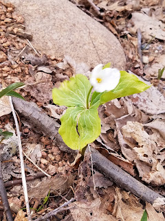
This section of trail was relatively level and dry, and we encountered almost nothing by way of obstructions. There were a few small trees down across the trail but I cleared those up as I went along. There were basically no leaves on the trees yet, and even the wildflowers had barely started to poke through, with only the trout lilies and hepatica in bloom. Even the Trillium were stubbornly refusing to show anything more than the merest sliver of white. I also noticed again how few birds there were as we walked. Occasionally I could hear a distant spring whistle or warble of a distant, unseen bird, but very, very few made an appearance.
About halfway through the hike, there is a rather large erratic on a hillside, not more than fifty feet from a kettle pond. Two fine examples of glacial remains that you can get in one photo if you're creative. (We weren't.) We were also quite fortunate that the wind was blowing the right direction because a lot of this section skirts the rather enormous and stinky Marathon County Landfill. There are times of year when you could walk this section and spend time thinking of new and grander words to add to the collection of adjectives like stinky, malodorous, noxious, nauseous, nauseating, odoriferous and noisome, to name a few. It's places like this that really give rise to colorful adjectives. Thankfully, due to the direction the wind was blowing, we could just enjoy the view and the cry of the crows at the landfill.
It's hard to know exactly how far we walked, because the trail has been rerouted recently, and there is no accurate distance measure available that I could find. So we guessed at approximately 2.1 miles and called it a hike. We started the hike at 10:19 am, with a temperature of 64 degrees, and ended at 11:50 with a temperature of 68 degrees. All-in-all a very nice walk.
Then we took a break for a while to do other things. We didn't get back to hiking until 3:40 pm, after we had parked our car at the end of Meadowlark Lane, at about N 44 55.471, W 89 22.025. This is at the end of a private driveway, so it's very nice of them to allow the trail to go through there. The temperature had risen to 74 degrees, so we were glad for the now-heavy wind.
This was a section that had undergone recent trail work. I like to think of it as the "Thirteen Bridges Troad", because there are a number of very nice boardwalks built along the trail to make delightful what would otherwise be quite wet and unpleasant. Again, this section is best walked north to south, and the hiker has many opportunities to take in an unusual combination of young northern temperate forest sprinkled with hemlock bogs. The water is everywhere, seeping from the bogs and groundwater to form little streams that lace through the area, and as long as the bugs are down it's a very enjoyable hike.
We noted with delight how well-marked this section was at the north end until we hit the place where it veers off on a logging road. At that point, it's hikers beware, because the trail is very suddenly not well-marked at all. For the next mile or so, you occasionally have to turn around and look both ways to see if you're still on the trail, which is unfortunate since there are places to make wrong turns. I believe the reason is that they are planning to reroute this soon, and they didn't want too many markers to remove, but still - you have to keep your eyes open.
About midway through the hike one encounters the Klaver Kame. A kame is a conical feature made of sand and gravel, and is distinguished from the surrounding area because there are no visible surface boulders on its slopes. But once off the kame, you will see rocks and boulders strewn about like the leftovers from a game of mountain-marbles. There is a lovely bench at the top to sit on and enjoy the view. We stayed for a few minutes to enjoy our snacks and off we went.
Once off the kame, the trail is nearly level, and relatively soon we ran into the new trail that had been put in a couple years back. Honestly, I question some of the reroute that is planned for the future. The logging road that leads to the Kame is a very nice place to walk, and is well-maintained, and I can tell from the flags the new route will go a very different direction. Seems like a lot of work to me, for very little gain. That said, the new trail they cut in 2017 was very pleasant walking, and was well-marked. With little effort and seemingly little time, we found ourselves back at the car. The time was 6:23 pm, and the temperature was 70 degrees. A day well-wasted.
Running Total: 331.2 miles of trail covered; 30.7 miles ‘extra’ hiking/biking. End of Day 43.


