Day 124: Cross Plains Segment (Part 4), Connecting Route, Table Bluff Segment (Part 1), Dane County
Day 124: Saturday, December 4th, 2021
Total Miles covered for the day: 8.0
Location 1: The trail portion of the Cross Plains Segment between West Old Sauk Road and the parking area on West Sauk Pass Road
1.1 miles of trail covered, plus 0.1 miles extra hiking
Wow! What a busy day!
This morning we woke up in our Airbnb after a terrible night's sleep. How to describe it? The bed was a sway-backed nag, and Theresa and I spent the whole night trying to keep from rolling into the abyss in the middle. To top that off, someone was playing an electronic device loudly, and with enhanced bass, until about 6 o'clock in the morning. The walls and ceiling pounded all night long.
So we fell asleep late, and then overslept in the morning. We are accustomed to sleeping in total darkness, but we are also used to some amount of light making its way into the room with the sunrise. Not in this room. This room had no windows, and was a total black-out even in full daylight, so it was no surprise that we had to hurry to get ourselves ready for the day.
It's hard to say which takes longer. Getting ready to go hiking after staying at an Airbnb or getting ready to go hiking after sleeping in the van. The jury is still out on that.
Despite our early setbacks we still managed to be a few minutes ahead of schedule when we arrived at the parking lot where we intended to drop our target vehicle, near the intersection of Timber Lane and W Old Sauk Road. But when we arrived, we found a small cadre of hikers waiting for us. At the wrong spot.
We had just enough time to reverse our plans and hike in the opposite direction, so we dropped a car off at the parking area on Old Sauk Pass Road (where we made sure no one was waiting for us at the right location) and headed back to where the group was waiting for us at the other end.
They had a long way to go, those six people, and they were antsy to get started. We handed out patches and took our group photos at precisely 9:00 am, the exact time we planned to begin the day. A hearty welcome to the six eager new snails.
Left to right, Donna Scott Bucholtz, Sue Willett, Norm Bucholtz, Mike Willett. Theresa (a.k.a. The Snail) Jansen, Dave Berner, and Bonnie Berner
Donna and Sue have a charming nickname for themselves - The Wandering Nanna's.
We had just a bit more preparation to do after sending the Nanna's and their counterparts on their way, so we bid them fair journey and started walking at our own pace a few minutes later. We started our hike at 9:06 am, temperature 31 degrees. The sun was shining, and it was indeed a beautiful day.
I often take a photo of the maps before I start. In this case, I had a little trouble orienting myself to what I was looking at. Until, that is, I noticed that North was on the right. Then it all made sense. What was important for me to see was the location of the blue spur loop trail that led down to the parking area where our car was waiting.
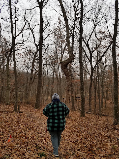
The hike started out on a hard-packed dirt surface, on a downhill track alongside a tangled woodland of small hardwoods, with a few aged open-grown oak trees thrown in. The initial descent follows some nice switchbacks, and we made great headway. Our new friends could still be seen in the distance as we made our way across the field.
There was quite a lot of storm damage to the trees, including one that required a walk-around or a step-over. This one had been there for a while, making me think they were leaving it in place for a reason. There is an easy walk-around on a well-worn path, so climbing over it isn't necessary, but it seemed like more fun, so we both climbed through the mess.
Rounding the bend and heading into the woods for a bit, we passed this interesting exposed rock formation. Clearly there was an inland sea here at some time in the past.
We quickly got through the woods and out into a wide open prairie area, the trail passing in a gentle arc through the long grass and over a hill. We passed several dog walkers as we made our way along, but no one was looking for patches.
Not completely sure what the Mobile Skills Crew did here in 2018-2019. Either it was one of their easiest projects ever, or they cleared away a little too much brush.
Eventually, we came up to the back end of an old farm house, barn intact. It made us wonder who would give the IATA permission to waltz up from the back and wander through the farm on their driveway, but it ended up being a government building of some kind. Once we passed the barn, the spur trail was easy to spot.
A tenth of a mile later we reached the car waiting in the parking area. Theresa spent some time admiring the three interesting rocks on display, but we didn't linger long. We had hiking to do!
We finished the first leg at 9:45 am, and we drove back to the start to pick up our car to reposition for the next leg.
Location 2: The trail portion of the Cross Plains Segment between the IATA Headquarters and the new parking area on Stagecoach Road
2.6 miles of trail covered, plus 0.1 miles extra hiking
We actually did this leg in several pieces. We had a lot to do, and we weren't sure how much we would get done before the scheduled event at the IATA Headquarters. So we dropped a vehicle at the large new parking area on Stagecoach Road and drove our launch vehicle to the tiny, little parking spot where the trail crosses CTH P. It was 10:22 am and we were having a great day.
The new trail, which does not appear on even the most recent of printed Atlas maps, appears on the online resource map. It was opened earlier this year, apparently, and I discovered it only after hiking around it on the road, thinking I was knocking off connecting route. A little more 'extra' hiking, I guess.
The trail cuts directly east from CTH P and threads between a number of farm fields. There is a mystery of a boardwalk right at the beginning, which I can only assume is an area that gets wet occasionally, but not that I was able to tell. Grass looked pretty good to me.
After a straight-line half mile of walking across the very flat terrain, and just south of a cluster of farm buildings, the trail turns abruptly 90 degrees to the right, where it spends the next quarter mile running due south, still threading between farm fields. Only then, as it approaches the base of a small drumlin, does it do anything interesting at all.
Actually, just before the drumlin, we crossed paths with the six hikers we saw at the beginning of the day, and we stopped to chat a while.
"You inspired us", they said. Then they told us that they had been walking and talking, and thinking about maybe creating their own personalized patches to hand out to people they meet along the way.
"We're going to call ourselves the Nanna's and the Pappa's!" they said.
I don't remember what their idea was for the patch itself, but it doesn't matter in the slightest. Whenever they get it done, I want to be one of their first recipients. Theresa thinks it might start a trend. I certainly hope so.
The trail actually splits when it reaches the drumlin. It's an obvious land feature that rises 100 feet in elevation from the path. A white blaze trail cuts west and south along the hill, and the official IAT yellow blaze trail goes on the north and east side of the hill. The official trail was recently bulldozed, and was really, really muddy. Despite my best efforts to walk like a Tolkienesque elf, I wound up with just as much mud on my shoes as Theresa, who simply marched along.
We should have taken the white trail.
Having gotten around the drumlin, we reached the car in a couple of minutes. The time was 11:00 and we spent the next 20 minutes cleaning mud off our shoes.
Next, we repositioned again by driving back to the IATA Headquarters and walking the leg that travels first along Black Earth Creek, and then south to CTH P. We actually didn't start this walk until 11:45, because we made a stop in town and had a bite to eat.
Right at the IATA Headquarters, there is a small bridge that seems more like a symbol than an actual need. Spoiler: If you're looking for the geocache, look under the bridge!
We turned around from there and headed south across the creek.
And lest you get any crazy ideas that you should just hop over the railroad tracks and skip right over to Bourbon Road, think again. There are numerous signs posted along the path letting people know about a $250 fine for crossing the RR tracks.
Seriously?? $250 bucks??
Finally, after a lovely stroll along the creek that was less than four tenths of a mile long, we were 'allowed' to cross the tracks on a properly built Railroad Crossing. It was behind the Fire Station, and the trail walks around the east side of the station before crossing Bourbon Road and heading up the hill. Before I crossed the street, though, I stopped for a photo with the bronze fireman out front.
The trail then heads up into the hills, after crossing the street and threading between some apartment buildings.
The trail is shared, very briefly, with a blue-blazed Conservancy Trail, and it's a little ironic that the Conservancy Trail is the one that heads steeply straight up the hill, and the IAT is the one that heads off at an angle, with stone steps and switchbacks to reduce erosion. The limestone masonry was pretty good work, but in a few places it could stand some repairs.
Here was a nice fungal bloom on a stubby stump.
We eventually reached the shoulder of the hill, then we doubled back to go straight up over the top and to the other side. We came out to a gorgeous view of the Cross Plains area and sat on a bench for a bit before moving on.
Then we ran into a new snail, our seventh SnOTT patch recipient of the day. His name was Andy. He was just finishing up Dane County. He said he hadn't quite set the whole trail as a goal yet, but that he hadn't ruled it out. He's young. He's got time.
We meandered along across the top of the hill for a while, then started the eastward turn to CTH P. It took longer than expected because we had to cross the top of an open field before making the final, somewhat steep descent.
We reached the car again at 1:00 sharp, and it was 35 degrees. We had achieved our goal of getting to the IATA headquarters before 3:00 when the group hike was scheduled, and we weren't sure what to do next. But logic told us that if we waited until 3:00 to start walking the last 2.7 miles of trail, we simply wouldn't finish. We didn't know what kind of jackrabbits would show up to a hike like that, but we weren't going to be able to keep up with them.
It was a good decision, but there was a twist at the end.
Location 3: The trail portion of the Cross Plains Segment between the west trailhead on Hickory Hills street and the IATA Headquarters
2.7 miles of trail covered, plus 1.0 miles extra hiking
We decided it would be important to get our van out of the IATA parking lot, since a bunch of people would be showing up there in a couple of hours. So we drove up and parked at the spot on Lewis Street where the trail heads up into the hills and walked the in-town portion of the trail back to the IATA Headquarters.
We were under the impression that the IATA hiking event would start at 3:00 at the IATA office and would take a full loop, so as to get back in time for the tree lighting in town at 4:45 pm. Three plus miles, 1 hour and 45 minutes - yeah, that wasn't going to happen. We decided we would hike in the opposite direction of the planned hike. That way, we would eventually cross paths with the group and anyone who wanted a patch could get one. There were a number of people who would be looking for us, because we advertised on Facebook that we were planning on attending.
But we needed to make sure we knew which route they were taking, so we'd be sure we were walking in the opposite direction. We rang the bell at the IATA headquarters, and someone just happened to be walking past the locked door as we did so.
At 1:30 pm we presented Amy Lord with her very own SnOTT Patch, our eighth recipient of the day.
"You two have quite the cult following", she told us. 'Cult' following? LOL
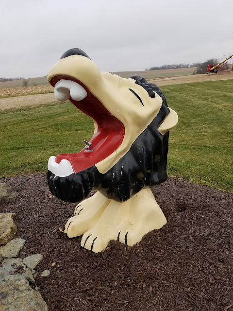
We also took a couple photos with Monty. He is famous, after all.
Having confirmed the direction and timing of the hike, we drove to the end of Hickory Hills Road and parked at the trailhead. We started up the hill at 2:00 and made slow, steady progress up the steep gravel incline.
The hills in Cross Plains are unrelenting. They go up, and they don't apologize for it. Theresa said earlier today that even when she lived out in Cross Plains she never hiked up into the hills. But then, she never was much of a hiker back then. Things are different today.
We hiked a slow reverse question mark through the trees, then made a sharp right turn to break out onto the hilltop open fields.
There is a spot where a white blaze short-cut can cut a mile off the trail, but of course we wanted to stick to the yellow trail.
Regretfully, we didn't check out the Disbursed Camping Area at the end of what looks like the nose on a cartoonishly drawn wolf head, but I can only imaging the view would be spectacular. It could be windy, though, so camp here at your own counsel.
After turning the corner we were walking back into the trees, and we clung to the side of a very steep hill, along a nicely cut trail.
We found a lovely bench to sit on and we started encountering people. We weren't sure when we would start seeing the IATA group, but of course that wouldn't be until after 3:00, and we were still fairly early. At first we saw just twos and threes, then a while bunch of about 20 came through that were part of a Meetup group. We didn't give away any patches, though, because none of them were serious IAT hikers.
One of them made a silly response when we asked if they were hiking the IAT. She said, "Oh, yes, we've hiked about 1000 miles and we're just cleaning up this section." Then she smiled and went on her way. I turned to Theresa and said, "Well - that's what we're doing..."
As it turns out, we were almost exactly at the 1000-mile mark at that point, if you include all the hiking and biking we've done, both as trail miles and 'extra'. As I sit here and write that down I am simply amazed at how far we've come. It has taken us 124 days to get here, but it's still amazing to me.
A little further along, and we saw, off to the right, a group of 14 people coming up the trail, and we were relieved because we realized we had only brought about 20 or so patches with us. We weren't sure how many people would be on the sponsored hike, but we thought we might get lucky and have just enough patches.
We never did cross paths with that group of 14, but a quarter mile or so down the trail, just at the point where we would have to turn and head down the hill towards Lewis Street, we saw them. Not 14. Not 20. Not 50. They were legion. There were over 100 people coming up the trail, half of them kids.
"We don't have enough patches", I said.
We had long since decided that if we were overwhelmed, we would hand out a limited number of patches if anyone specifically asked. Then we would circle back around and meet the group at the other end to finish giving them out. In the car we had a brand new bag of 200 patches, and it was feeling like we'd be giving away more than half of them today.
As we waited patiently off the side of the trail for the group to pass, a few people recognized us. Some even came running back down the tail after passing by, once they realized who we were.
 |
| Molly Meinholz |
 |
| ?? + Carrie (And Monty) |
I feel bad that I somehow neglected to get the name of the charming gal on the left in the photo above. She was the one who had come running back down the trail to get her patch, and she was as excited as she looks in the photo.
 |
| Ben and Ollie Swanson |
Ben is on the IATA Board of Directors, and he was bringing up the rear for the first group. He told us that they probably wouldn't be hiking the whole trail, but rather would be taking the shortcut because there wasn't enough time.
The shortcut? Holy Smokes! Not only would it have been possible to completely miss the group as we walked the trail in opposite directions, had we chosen to hike with them we would have had to leave the group and walk the actual trail in the gathering darkness while they beat feet for the Christmas Tree lighting.
Another recipient chose not to be photographed or named, which is fine with us. That made... 14 so far?
There was a little girl who recognized us, too, and even said 'Hello', but was too shy to ask if we were the 'Snails'. Thankfully, we did eventually run into her and her family again later, so we got patches to her as well.
We made it through, but we knew there were a LOT of people who would have wanted patches had we just stood there handing them out, so we knew we had to circle back to the other end and catch them on the way out.
Headed down the hill, we saw another group of stragglers, perhaps 10 in all, making their way up. One of them was Melissa Pierick, who happens to be Director of Marketing and Community Relations for the IATA. She told us how much she appreciated that Theresa and I were there, and handing out patches. She told us that we generate a lot of fun and excitement on the trail, and I guess I get that. By our own doing, we have become minor celebrities, and people travel long distances to cross paths with us, all for that silly snail. Leave it to the Director of Marketing and Community Relations to totally latch onto that.
After the descent to Lewis, which took place on a series of expertly cut switchbacks, we reached the sign at 3:45 pm. The Cross Plains Segment was officially behind us, and everything remaining for the day was just going to be easy and relaxing. We took a leisurely trip back to the other end to wait for the group as they came back down the hill on the other side.
And waited...
And waited...
The end of the trail was a busy place. Cars were pulling in. People were walking up the hill, not down. The truth dawned on us slowly, or perhaps fell on us slowly like the gathering darkness. We were not in the right place.
By 4:30 pm, we accepted our mistake. Yes, there was a tiny, little tree back in town that would be lighted at 4:45 pm, right next to the location we had identified where the campfires would be lit, and the hikers would all hang around and drink hot cocoa. But there was also a second tree up there on the hill, and it was there that the group of hikers planned to gather at 4:45 pm, together with the people of Cross Plains who were familiar with the tradition, to light up the town 'tree', an artificial construct on the edge of the bluff that could be seen for miles.
We were at the bottom of the hill. Everyone else was at the top. We had 15 minutes before the lighting of the tree. 160 feet in elevation in a little over a quarter mile, then another quarter mile to the finish line. There was no way we could make it in time, but we had to try.
And we made an admirable go of it. I'm not sure how we did it, but by 4:47 pm we had reached the first group of people as they were walking away from the tree lighting.
"Are you looking for the Snails?" we asked, as people walked by. If they knew what that meant, then we handed out patches and took photos. If they didn't know, then we let them wander on by. There was no time to get names.
This group below was kind of funny. They were townsfolk who had hiked up the hill while we were at the end, waiting for others to come down.
"Are you looking for Snails?"
"No, what do you mean?"
"If you're on the the Ice Age Trail and you find us - we're the 'Snails' - then you get one of these SnOTT patches."
Pause.
"Well, then, hell yes, we're looking for Snails!"
And thankfully, here was the family that saw us earlier on the hike, but the little girl was too star-struck to ask for patches.
 |
| The Powers family, plus one |
We had a great time talking with them later on, down by the campfire in town. The kids, as it was explained to us, aren't allowed to spend much time on Facebook - only allowed to read the posts on the Ice Age Trail sites. Apparently, Theresa and I were 'famous' according to the kids, and they were totally psyched that they might be actually be meeting us in person at the hike and getting patches.
I never thought of us as Social Influencers, but...
We were the last ones left at the top of this hill, save for Ben who we had chatted with earlier. He was up there making sure no one was left behind, still bringing up the rear.
"No need to worry about us," we told him, as we strapped on our headlamps and made our way down the hill, slowly hand in hand, marching off the rest of that extra mile we added to the day, just so we could hand out SnOTT patches. It was totally worth it. With the addition of the Powers family we had handed out 32 patches so far today, easily our biggest day ever.
Ours was the last car at the street parking area at the end of the segment, and we drove into town to the campfire and the OTHER tree. We hung around there for about an hour. All the cocoa and treats were gone, but we had our own dinner with us. We had gone to Culvers and gotten hot soup to go with our sandwiches so we were all set.
I don't remember handing out any more patches by the campfire, and things were winding up by 6:30 when we snapped that last photo above.
Hey - wanna hike some more?
Location 4: The connecting route between the Table Bluff Segment and the Cross Plains Segment
1.5 miles of trail covered
It was late, it was dark, and we had already hiked many miles today with lots of climbing involved. Tomorrow there would be more hiking. Still - we were feeling strong, and we're getting used to doing a little night hiking at the end of the day.
We started at 7:09 pm. After putting our car back up at the end of Hickory Hills Street, we drove to Market Street and up into the parking lot. Walking back up the road to the car was no problem, and then we drove to the very end of the connecting route where it intersects with the Table Bluff Segment.
Table Bluff ends at the spot where Scheele Road turns into Cowling Road, and there is an unnamed gravel road that curves north and to the east to a parking area. There is no real parking at the end of the Table Bluff Segment, but it felt very dark and quiet out there, so we just pulled over onto the side of the road and started walking back to the car.
The first leg was on Scheele Road, then briefly south on KP, then to the very end of Sherwood Forest Lane. This was all relatively level, easy walking, and I don't recall any cars. There were no stars, and tonight was New Moon, so there was no moon either. The clouds were heavy, and winter was setting in. Our headlamps were the only thing moving.
At the end of Sherwood Forest Lane there was a path, as expected, with a sign saying "Keep out, this means you, unless you're walking the Ice Age Trail", or something like that. A very brief walk later and we were back at the car.
Which left us with a problem. We left off at the end of the Table Bluff Segment, where there is no reasonable parking, and even a sign imploring people to "Please park at the new parking area". So in order to prevent having to park again at this terrible spot, we needed to end our day at a more reasonable location.
We drove up to the new parking area (which was fabulous, by the way, including a picnic table and a fire ring), and hiked off the first/last 0.1 miles of the Table Bluff Segment.
Location 5: The first 0.1 miles of the Table Bluff Segment north of Scheele Road.
Gravel road. Not much else to say. Tired. Cold. 9.1 miles of walking. Enough was definitely enough.
Running Total: 859.8 miles of trail covered, 144.5 miles 'extra' hiking/biking. End of Day 124.