Sunday, October 24, 2021

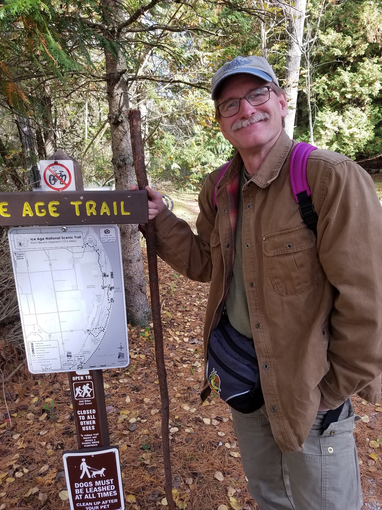
Day 114: Kettlebowl Segment (Part 3), Langlade County

Day 114: Sunday, October 24th, 2021

Total Miles covered for the day: 4.4     

LocationThe Southern half of the Kettlebowl Segment between the south trailhead and the place where the trail first intersects with "Burma Road"
4.4 miles of trail covered plus 6.8 miles extra hiking/biking

Joy of joys, hope beyond hope, success against all odds! Today we managed to go back and hike the last 4.4 miles of the Kettlebowl Segment! 

"But it is CLOSED!" I hear you say. "Why would you go there and hike when the IAT and the Chapter have said you shouldn't go?"

To those who would stone us for our transgressions, let me ask the simple question. If a sign says, 'No trespassing without permission', what's the best way to get around that?

Ask permission. 

A week ago we stopped by on a Sunday and checked out the condition of the Closed section of trail. We discovered that though there is active logging, the machines are not active during the weekend. We believed, logically, if we asked the landowner to go through on a Saturday or Sunday, we might be given such permission, and thus get around the prohibition. 

We wanted to achieve this for the single-threaded purpose of closing out map 36, thus extending our continuous line from the St. Croix River all the way to Devils Lake. This last 4.4 miles was all that stood between us and finishing that goal. 

So on Monday morning this week Theresa started the effort to contact the landowner and seek permission to hike on the weekend. I'm going to make a long story short. After a series of steps that involved researching the tax assessors office, Google.com, Findagrave.com, the Wisconsin Society of American Foresters and the Wisconsin Secretary of State (among others), Theresa found herself talking to the landowner who not only gave us permission to hike there on the weekend, but was seriously puzzled why we felt we needed to ask.

As it turns out, the closure of the segment was a decision made by IAT management, not the landowner. There is logging going on, and at some point the fact was discussed between the IATA and the landowner. A request was made by the landowner that signage be put up alerting people to logging activities, and asking them to not hike through an area where there was active logging. The landowner (this person is intentionally being left unnamed) didn't expect that people would stop hiking through there, but wanted them to be aware of the logging activities and use caution while hiking. In fact, the landowner was a little irritated to learn that the segment had been 'Closed', and that the landowner was being named as the person who requested that it be closed. 

Theresa learned a great deal while looking for the landowner and how to contact them. What she learned gave us great respect for the landowner, their family, and the corporations they are involved in. In brief, their goal is to acquire and preserve land for the conservation of wilderness and habitat, and for the shared use by the public at large. They want everyone who is physically capable to walk, run, bike, ski, snowshoe, snowmobile, horseback or swim through their land holdings. This largess has been a family tradition for generations, and it is their honor and privilege to be able to play host to the enjoyment of others. 

Because we don't want to trouble these folks with phone calls from other hikers, we have left them unnamed, and instead have shared their wishes, to the best of our ability. If you want to hike the Segment while it's 'Closed', be aware that the landowner has given ALL hikers permission to walk through, so long as you take care to completely avoid the logging equipment. If you can be responsible enough to turn around, or take alternate routes as appropriate, then go ahead and hike there. You have to make your own decision on whether our word is good enough to make you feel OK about going there before the warning signs come down. 

Onto the hike!

As I mentioned in yesterday's post, Theresa was suffering from the side effects of her COVID-19 booster shot. The fever was gone, though, and she felt like she could tough it out if it meant getting this last piece of Langlade County behind us. 

As I have mentioned previously, one of the challenges with hiking in Langlade County is the ordinance forbidding anyone from parking along the County Roads. That meant we would be unable to park a vehicle at the trailhead, or at the mid-point on Kent Pond Road where we chipped off the northern half of the segment a week ago. 

So in the end, and after much discussion, we decided that I would drop her off at Kent Pond Road, where she would retrace the steps we took last week to walk in as far as the trail and then head south. I would drive to the other end, park in the designated parking area, ride my bike the 0.35 miles to the trailhead, lock up my bike and walk the other way. That meant that Theresa had to hike an extra 0.7 miles, and I felt that might give me enough of an advantage that I could actually walk the whole segment out and back and catch up to her before she reached the end. This, then, was my plan.  Even after putting in 10 miles yesterday at Point Beach, I was eager to walk the 8.8 miles necessary to get it done. 

I dropped Theresa off at the gate on Kent Pond Road right at 12:00 noon, and by 12:19 pm I had driven to the other end, parked my car and biked to the starting gate. It was 47 degrees and mostly cloudy with very little wind.


While Theresa was following her set of coordinates that led like breadcrumbs to the place she needed to go to start her hike, I started walking north as fast as my little feet could take me. Little did I know that Theresa would not actually get to her starting gate until 1:10 pm. More on that later. 

I started out with a great deal of enthusiasm, engaging in something I refer to as a run-walk. It's the kind of uneven trot one might expect of a person like me who is built more for endurance than for speed, where I'll half-jog for a hundred steps or so, then walk for thirty, then trot for fifty more. The goal was to cover distance without getting too overheated. 

The first seven tenths of a mile or so went along an area that was receiving a lot of traffic from logging trucks, feller-bunchers, and similar such machinery. The blazes were scarce, and the going was muddy and rutted. It wasn't so torn up that I had to bypass in the woods, but care needed to be given to the footing as I bounded through like an overfed circus bear trying to run on two legs. 

As soon as I reached 'the turn' up on Oak/Sherry Road, everything changed, and the trail became incredibly pleasant. For the next mile, the trail was fabulous. After that, it jut became merely really nice.  


There are a number of crossing trails, mostly ATV-type, but for the most part there are plenty of blazes. There are one or two places where it is necessary to keep your eyes open, but nothing too bad. Bottom line - if you're not seeing blazes as you walk, you missed a turn somewhere (and there aren't many turns). 

As I hiked (or jogged) along, I took very few photos. In fact, both of them are above. My goal was to get to the end as fast as possible and then motor back until I caught up to Theresa so we could finish together. 

I recall going downhill a lot, or at least it felt that way. This doesn't bear out on inspection, though, because the overall hike for me was an increase of 160 feet in elevation from 1480 feet to 1640. I guess the downs just came at me so fast that they somehow dominated the ups. In any case, I was making what I considered to be excellent time, and as I reached the 2.5 to three mile mark I started wondering where I would cross paths with Theresa. 

Except I didn't. With every passing bend in the trail or crossing of a hilltop, I got more and more concerned that I hadn't seen her. By 1:20 pm, I was seriously worried, and I attempted to reach her by text, by Messenger, and by phone. No luck. The cell phone coverage out there is terrible, and I was unable to get through. 

I had no idea what had happened. All I could do was keep running as fast as I could to get to the beginning, and then do - something - to start looking for her. I had an idea for what I would do to find her, but it would all take so long, and if she was having some kind of emergency - I didn't need to focus on that. All I did was run. 

Finally - and I do mean finally, I came over the top of a hill and saw her on the trail ahead of me. She was fine, and I bent over double to suck fire into my lungs for a minute, then stood up to drink nearly an entire bottle of Gatorade. Then I closed the gap between us to find out what had happened. 

As it turns out, she had followed the same set of breadcrumbs I had followed a week earlier, and had made the exact same wrong turn that I did. The difference was, she was using yellow tape as she went to tie markers onto tree limbs, so that if she made a wrong turn out there in all those paths she could follow her own trail backwards. And in fact, she had made not one, but two wrong turns. After each one she backtracked, removing ribbons as she went, until she found the correct path forward. Though she only had 0.7 miles to the start of the trail, it took her over an hour to get there. By the time she reached the sign indicating that she had found the trailhead, she was exhausted, discouraged, and her feet already hurt. She was still suffering from side effects of the booster shot, and she was not having fun. Needless to say, she was not 'running' down the trail when I found her. After walking just over 2 miles, she had barely gotten started, and had over four miles left to go. She wasn't in a very good mood, and I helped her sit down to take a break and have a bite to eat. 

I asked her if she got my messages. She had not. Did her phone ring? Of course not. Missed call on the log? Nope. Nothing. Some of my messages finally got to her about two hours later while we were hiking. The rest she never received. 

I told her to take as long as she wanted, and I would go finish the segment and come back to walk with her as planned. I made it to the end at 1:48. 


No rest for the weary, I turned around and started trotting back down the trail, knowing that it would take me at least a little while to catch up to her. One problem I was having was that my toes were starting to hurt. I thought that all that downhill trotting was jamming my toes up against the front of my shoes and causing me some pain, but I learned later that wasn't the case. 

My toes were hitting something, that was true, but it wasn't the end of my shoes. It was the end of my socks. You read that right. I was jamming my toes on the end of my socks, and it was causing me pain. Let me just skip to the end of that story so I don't have to revisit it. a while back Theresa needed to buy some black socks on an emergency basis. Never mind, that's a story all its own. Anyway, they ended up being a size small men's compression stocking that fit her feet remarkably well. Unfortunately, they look an awful lot like my black compression stockings, and when I put on the socks I was going to wear for this impromptu jog through the woods, I put on the wrong pair. The socks were so tight and so unforgiving that my toes were getting bruised. I didn't know this at the time, of course, though if I did I'm not sure what I could have done about it. UPDATE: Weeks later I still have bruising under the toenail on both big toes. It's a wonder I didn't lose the nails entirely. 

By 1:55 I had Theresa in my sights up the trail, and I caught up to her a few minutes later. 


It was only here that I mentally paused to take in the trail and start thinking about what I was encountering as I went. From the north end, where the trail leaves the laughably named 'Burma Road', there are heavy woods and a narrow uneven tread for about 2 tenths of a mile, that is overgrown with berry bushes and riddled with rocks. Then the IAT lets out onto an ATV trail that is far more open, as in the picture above. 

This goes on for quite a while, over small hills and through the woods. We were only one grandmother's house short of a Christmas carol. I can't explain why I took so few photos as I walked, and my mind is a little hazy on what I may have seen. 

I do remember a quarter mile stretch where the wide trail turns into a single track, more or less. On either end, the broad, easy to walk path rises up and over an intentionally built set of hummocks, here to prevent ATV crossings, I presume. In-between, the trail traverses an open field area, where the footing is less certain, but very passable nonetheless. And all along the way the blazes are great. There is nothing of the weirdness in signage that is found along and north of Burma Road. Everything here is yellow rectangles of the precise height and width of an official IAT blaze. 

We hiked this way, Theresa subdued by the booster shot and me subdued by my unexpectedly long jog, for the next hour and forty-five minutes, finally settling down on the ground to take another break. For once, both of our feet were hurting, and the rest felt good. 


"Hey - look over here", I said. "Cool rock."

"Take a picture", she said. 


This rock was the size of my foot, so it was fun to think about everything that had to happen to form that pattern in the granite, then transport it all the way here for me to look at. Literally millions of years of chance all lining up to drop this rock in my path and then have me look down at the exact right moment to see it. I realize only now that you could polish this thing up and drop a Snap-On Tools logo on there, the colors are so perfect. 

I loved seeing all the open forest and the many boulders along the way as we hiked. The Frost Pocket was amazing; a huge hole in the ground (best seen from above). A little while later, we ran into another great place to sit down, and Theresa decided another break was in order. And why not? We had all day, and we would never be coming through here again. 


It was then that I noticed a large 'stump' off in the woods that didn't look right. It was about two feet in diameter and didn't match anything I could see around me. I took a closer look and found a hollowed-out drum-like thing, with smaller cut logs around it in a semi-circle.


It didn't look burned, or at least not the part I looked at. It could have been burned on the other end, I supposed. But what was even stranger was that the log was sitting on top of the dead leaves that had fallen. This thing - which must have weighed at least 200 pounds - had been placed there recently, and for no purpose I could discern. I'm really glad we weren't hiking this section at night, because that would have creeped me out. Even writing about it later gives me the willies. I was happy to leave. 

Fortunately, I spotted this late-season daisy to make me feel better. 


The trail conditions just kept getting better and better as we hiked south. The day was warming up a little, and we passed a jogger and his dog. Another guy came motoring through on his ATV. This second guy was grouse hunting, and definitely not doing it legally. 

For the second day, Theresa was trying out her new running shoes. They were a miracle cure the day before on the sands of the Point Beach Segment, but didn't completely solve all problems here over the good old-fashioned IAT dirt. 

It remained cloudy all day. We saw lots of grouse, but didn't hear any banging from the guy on the ATV. Maybe we scared off all the birds before he got there. Theresa's feet were in pain again long before we reached the end. 

The last eight tenths of a mile was less easy, because we had to deal with the road conditions left behind by the logging activities. For me, I was reaching the end of 8.8 miles. For Theresa, she was reaching the end of 5.1 miles. Both of us were tired, in pain, and we were more than ready to get away from the mud and ruts as we got to the end. We reached the sign at 5:11 pm, and I biked slowly back down the road to get the car. 


"OK, one more. Look happy this time."


"Come on - Celebrate!!"


These were all terrible shots. I didn't care.

It was done. This was our last major goal for the year, and it seemed so impossible six months ago. We finished the Kettlebowl Segment. We finished Map 36. We finished Langlade County. We finished the Northern Gap. Before that we finished the western gap of over 130 miles and the Central Gap of more than 100 miles. Our unbroken line now extends from map 1 through map 59, including both the eastern and western bifurcation. The 'river' now extends all the way to Devil's Lake. 

To celebrate, we ate a trail dinner of pork sandwiches, apples and potato salad with the heat cranked in the car on the way home. 

Not that it was still important to track, but we were still logging miles for the Mammoth Hike Challenge, where we were supposed to walk at least 41 miles in the month of October. We blew that number away a while ago. This was just frosting.  

Brock's Progress on the Mammoth Hike Challenge: 66.6 miles
Theresa's Progress on the Mammoth Hike Challenge: 59.1 miles


Running Total: 797.8 miles of trail covered, 0.8 miles of trail half-covered; 138.8 miles 'extra' hiking/biking. End of Day 114.

Saturday, October 23, 2021

Day 113: Point Beach Segment (Part 5), Manitowoc County

Day 113: Saturday, October 23rd, 2021

Total Miles covered for the day: 10.0     

Location 1The Point Beach Segment
10.0 miles of trail other-half-covered, plus 5.4 miles extra hiking

Saturday October 23rd. For the 69th time in the last 217 days we woke up with the intention of going hiking. That's not quite one out of three, but it's darn close. So far this year, one or the other of us has covered 461 miles of trail and connecting route, and it's only the madness of the October Mammoth Hike Challenge that has made it so that Theresa and I have been hiking in different places at different times, leading to half-covered this, and half-covered that. Mostly we have both hiked the same bits of trail, but there were still two places where catch-up was needed. Today was a day to clean up most of that mess. 

Of the two days this weekend, today was the one forecast to have pleasant weather along the coast of Lake Michigan, so that's where we were headed. My plan was to hike the ten miles of the Point Beach Segment, which Theresa had already hiked, while Theresa did as she pleased. Her participation was uncertain, because she got her COVID-19 booster shot on Friday afternoon, and we didn't know how she would be feeling today. I would be walking at a brisk pace for a long distance on ground she had already covered, so for certain we wouldn't be walking together. There was no need. 

When we got up there was light frost on the roofs in Wausau. Theresa was feeling good enough that she felt like she could ride with me and give me shuttle service. At least that meant I wouldn't be riding my bicycle ten miles to get back to the car. The drive out to the lake was pleasant, and the weather looked perfect. 

Theresa dropped me off at the south trailhead at 12:30 pm. The temperature was a chilly 49 degrees with a light northeast breeze coming in off the lake. There are times when 49 degrees feels balmy. And there are times when 49 degrees slips down the back of your neck and slips icy fingers into your body like a spinal tap. I overdressed for the weather just to make sure today wasn't one of the latter. Layers, as they say, are the solution. My own secret weapon is a neck gaiter. If you've never worn one in the cold, I recommend it highly. I didn't need it today, but a neck gaiter will add ten degrees to the comfort level of whatever garments you're wearing. I had it with me just in case. 


I was warned that this might be one of my favorite hikes, and I wasn't disappointed. The trail starts with about a quarter mile of sandy path leading through a cedar grove that spills out onto the shore of Lake Michigan. 


2.1 miles, the sign says, and for the next couple miles I enjoyed a unique, memorable and treasured hike along the beach, which I had all to myself but for the driftwood, gull feathers and the zebra mussels. 

It was 50 degrees, with light wind, forming 12" waves that lapped the shore with a persistent hissing roar. Who wouldn't want to be here at this exact moment?


Despite the isolation, there were reminders that I was not the first one to ever discover this stretch of shoreline. There were footprints in the sand. Remnants of small beach fires. The occasional bit of jetsam or beach trash. And there was this structure, a whimsical cross between a teepee and an igloo, left behind by an energetic crew of beachgoers as a means of passing the time. 


I mentioned the zebra mussels. To be honest, I don't know the difference between zebra mussels and quagga mussels, but both are invasive and both are a problem for the lake. I have a better understanding now of why there is a big concern. I found one site discussing declining populations of zebra mussels over the last 15 years, but only because quagga mussels are taking over. Population densities being described were a staggering 5,200 mussels per square meter of lake bed. Each mussel filters up to a liter of water per day, removing virtually all organic materials from the food chain. This increases water clarity, which causes other problems, as the sunlight penetrates further down, increasing the growth of other types of plants like bottom-dwelling algae. 


Both zebra and quagga mussels also perform the function of cleaning up all the toxic contaminants we humans dump into our waterways. They have high fat content in their bodies, making for perfect storage vessels for PCBs and other chemicals, thus allowing these poisons to travel up the food chain through ducks, drums (a.k.a. sheepshead), carp and lake sturgeon. Zebra and quagga mussels get a lot of bad press for making fish inedible but as far as I'm concerned, they are just the messenger. They aren't to blame for the PCBs being in the water they have to live in - they are just less susceptible to dying from it. If we want to blame someone for inedible fish in the lake, we need to look no further than all the selfies on our cell phones. 

The shells of these creatures are ubiquitous on the sand. They are underfoot with every step, either in the full half-shell wrapped around bits of seaweed as in the photo above, or as tiny bits that make up the sand itself, crushed by the relentlessly pounding surf. 


There were occasional other objects on the beach that seemed out of place. Black rocks and stones, some of them fairly large. I finally bent over to pick one up and it was impossibly light. It had the look of obsidian but the weight of pumice. After showing it to Theresa later we determined it to be black anthracite, the name given to raw, unprocessed coal. We figured it must have been spillage off a ship carrying the substance, since the floor of Lake Michigan is made of dolomite, and anything so soft as anthracite would have been long-ago eroded away and would not be washing up on shore as big, blank hunks. 


As my two miles of beach were nearing an end, I finally saw another person ahead, walking a small dog. It marked the location where the trail comes down to the beach, and was in fact the first place in two miles that I had seen a yellow blaze. This isn't surprising, because no blaze could possibly survive the storms if it was down on the beach itself, and anything placed up higher on the dune would just be confusing. So in fact, it would be easy to miss the turn if you were looking down and not up, though you wouldn't get far. The creek just north of the turn would force you to come back. 


I thoroughly enjoyed my time on the beach. Though the trail would come close to the beach later on, it would never get back to the point of walking next to the waves.


Walking inland, I had to march up and down over repeated swales and ridges, the evidence of long-ago changes in water level. The path was gorgeous, passing through cedar and hemlock groves, and all along the way staying near the edge of Molash Creek, which turns into a broad, slow-moving backwater as it nears the shore. 


As I got closer to the Viceroy Road parking area, I started encountering more people. There was a dog walker or two, and a couple getting photographs taken with a new baby. Then I briefly joined the bike path, a wide gravel road, that led west to the roadway. When the parking area came in sight I could see the blue blaze leading west, but I turned north again and crossed the bridge.


I started seeing a lot more people, including a few that were real Ice Age Trail hikers, but none of them recognized me or was looking for a snail patch, so no patches were given out. 


The bike path, a broad gravel expanse as shown above, goes due east about a third of the way back to the lakeshore before turning north again. The IAT continues east from that point, getting close to but never reaching the shore. Just before turning north again, there is a spot with a bench overlooking Molash Creek and if you look across the creek you can just see the yellow blazes on the other side. 


Continuing north, the trail passes land-side of some group camp cabins, that were filled to capacity with a boisterous crowd loving the odd combination of isolation and togetherness. I'm quite sure no one spotted me as I slipped past quietly just a few dozen feet away. 

Shortly after crossing the road that goes to the group camp (don't park here!) I got a text from Theresa with the cryptic words, "Loma Family". The reception out there was poor, so I didn't get a chance to find out what she meant until I unexpectedly crossed paths with her a short while later. The 'Loma' family (it was actually the Luoma family, as we later learned) was a family out for a walk that day. When Theresa stopped to talk to them, they recognized her from her Facebook posts (actually - they recognized the patch) and Theresa gave them all patches. The photo is a classic. 


When I crossed paths with Theresa a few minutes later, I learned that she had decided to park up near the Rawley Point Lighthouse and take a stroll down the trail for fun. I thought I would be meeting her up by the lighthouse parking area, but she said she really enjoyed this segment and didn't want to be cooped up in a car waiting for me. 

Here are some photos of her adventure:

Starting her hike

Showing off her new shoes


Theresa and I shared plans for the rest of the hike. It was a little after 2:00 and I still had a ways to go. Even so, I had been moving fast, so there was plenty of time to finish. 

Within a few hundred feet, though, I encountered an oak tree down across the trail. If you've ever hiked with me you know that i have trouble just walking past such an obstruction without pulling out my folding saw and doing something about it. Even though this tree was over a foot in diameter, I couldn't just leave it be.

There was no way I was going to clear all of it. But I figured if I could just clear away a few of the many limbs I could at least make the way passable. I got started with a limb here, and a branch there. The more I cleared away, the more I thought, 'if I just get a couple more branches out of here it would really be nice.' So I stayed and kept clearing, probably much longer than I had intended. I know from the timestamp on a couple of photos that I wasn't there a half hour, but it was probably pretty close. When I was finished and looked back at my work I was highly satisfied with the result, and off I went. 


The trail danced along just out of sight of the beach and the lake, a large dune blocking both the view and the off-shore breeze. Suddenly, as I neared the kayak and IAT remote campsites I found myself surrounded by dogs. Nothing terrible, mind you. They were all tethered to their people. But when I hit that trail intersection there were two sets of dog walkers coming up off the beach, and three sets of dog walkers coming down the trail headed in that direction. Top that off with a family who was out there just hiking along, who was asking me if I knew where the 'Red Trail' was, and I was feeling like I was stuck in the double-gated entrance to a dog park. I was in such a hurry to get out of there I didn't even bother to go look at the remote campsite to evaluate it for the blog. (Theresa said she looked at it, and it was exactly what you would expect from a beachy camping area, with better-than-expected protection from the wind. I'll take her word for it.) 


So now I was headed inland again for the last time as the trail left the shoreline and wallowed into the dunes. I know the Dunes Segment is further south from here, but this whole hike thus far could have satisfied a claim to that title as well. There were lots of trails through here, and thankfully the IAT was well-blazed as it passed over the ridges and threaded through the swales. Along the way I met yet more dog walkers, and as I neared an Earth Cache in the middle of all that I met one of the biggest German Shepherds I have ever encountered. He was a big, goofy lug who lumbered up to say hello, and I'll bet he cleared 130 pounds. He could have stood on all fours and sniffed my armpits if he had wanted to, though that wasn't his first choice. I dutifully patted his huge shoulders (without bending over) and he and his humans wandered past without incident. 

There were other geocachers there at the Earth Cache. I was better at judging distances and they were better at judging land formations. Both were needed to claim the find, and I was glad that I was walking a little faster than they were.  One of their group showed a deep curiosity for the flora, fauna and land formations, and I realized that I had learned enough about each that I could have been delayed for an extended time with their questions. I managed to answer only the first question as I breezed past. 

"It's a club moss of some kind. I think it's a... Northern something-or-the-other Club Moss. Those little yellow things are the flowers." 

Most of the time I would have enjoyed lingering and sharing what I know, or what I think I know, but I knew the oak tree had set me behind schedule a bit. I kept moving. 

Eventually the trail dumped out on Service Road, where I took a left turn and headed for the big parking lot. Here I crossed paths with a person whose car license plate read, "IATCC". I had to stop her and let hew know that I knew what that stood for, and I was also out walking the IAT and hunting 'Cold Caches'. After she left I just about kicked myself, because I was carrying with me, in my fanny pack, a button bearing a picture of Monty the Mammoth and the letters IATCC on it, and I didn't give it to her. Talk about a missed opportunity.


When I got to the car, I reloaded my beverages and ate a snack, thinking Theresa might be showing up at any time, but I didn't see her, so I kept hiking. 

From here, the trail had a completely different feel. There were more deciduous trees, and it had more of that 'single-track' feel to it. I knew that there were a couple of geocaches in this section and I did stop to get them even though they were a bit off-trail. This delayed me even more, and I reached County Road V a good forty-five minutes later than Theresa expected me, mostly due to the delay caused by cutting the oak tree. 


I had only the last mile or so to go before finishing the segment, but here is when I learned that Theresa wasn't feeling well. It was now about 24 hours after getting her booster shot, and the side effects were kicking in. I found out that after I passed her on the trail, she started feeling ill, and had stopped to take an extended break. She ended up walking a total of 5.4 miles round trip, and she said it was really a tough walk getting all the way back to the car, because the sick feeling had come over her suddenly and hit like a ton of bricks. 

Even so, as she reasoned, she would be feeling awful whether I walked that last mile or not, so rather than stopping I pushed on for one last one mile through the swamp. 


South of V the woods had a thick understory, the product of a carefully managed clearcutting that removed all but a few mature white pine trees. Clearcutting is not always the evil practice it is made out to be. There are legitimate ways to use it as a means to propagate habitat for specific species, and responsible use can be enormously beneficial. Unfortunately, there is little to no regulation covering the practice, and too often it leaves behind an unusable wasteland covered in small branches that are both a physical barrier to foot traffic and a fire hazard. 


North of V, as I got into Rahr School Forest there was no understory at all. This section had been managed using a different practice, where all the best and most mature trees were left behind and everything else was removed beneath it. The result, ten years later, is more park-like, with lots of mature overstory but very little growing beneath it. The land is more usable from a human perspective, but less usable for a number of other animal species. This is not a forest that will be filled with deer and grouse, or for many other forest floor bird species like the oven bird. On the other hand, there will be more owls and woodpeckers in an area like this. In the end, there is no single best 'forest management practice'. There has to be a variety of landscapes and habitats to maintain the diversity of life forms that are independently adapted to each. 

An unexpected and unwelcome discovery north of County V was that trail markings suddenly vanished. It was now possible to lose one's way. I knew that the trail would eventually cut to the west, so I kept going generally north, and I was rewarded with an occasional yellow blaze, but the trail was indistinct as it wound through this multi-purpose landscape, and only my confidence that a major turn would be made obvious through signage kept me walking with purpose. 

I reached the beginning of the boardwalk at 4:30 pm, and it was every bit as amazing a structure as Theresa had described from her earlier hike. 


This was truly a walk through the swamp, giving a view of the area that would have been impossible to reach without the boardwalk. Swamps are inaccessible even in the heart of winter, because there are places where the water never freezes no matter how cold it gets. People who are unwilling to wallow in muck up to their armpits don't usually get to see this fascinating landscape. I wonder if the kids who come here on field trips ever truly appreciate what they are seeing, or how rare it is to get such a view. I doubt it. 

The boardwalk is three tenths of a mile long, though it feels longer. Winding gracefully to the left and to the right, with an occasional platform or viewing spot, the boardwalk turns what would have been a multi-hour test of endurance into a casual 15-minute stroll. I can only imagine the hundreds or even thousands of volunteer hours that went into building this thing, and the conditions in which it was done. Summer or winter, either approach would have limitations and challenges. My thanks go out to whatever team of people conceived of, funded, and eventually built and now maintained this walkway, so that I could be here to appreciate it. 

Once the trail left the boardwalk, I needed only go around a small pond where I unexpectedly passed one last hiker going the other way. By 4:48 pm I reached the northwestern trailhead of the segment, and it was time to go home. I don't know the temperature of the air, but I could tell that Theresa was running a slight fever. I was a little worried for the next day, because we planned to drive back to Langlade County to finish the Kettlebowl Segment, and that would depend entirely on how Theresa was feeling. She slept in the car seat next to me for nearly the entire ride home. 


Brock's Progress on the Mammoth Hike Challenge: 57.8 miles
Theresa's Progress on the Mammoth Hike Challenge: 54.7 miles

Running Total: 793.4 miles of trail covered, 0.8 miles of trail half-covered; 132.0 miles 'extra' hiking/biking. End of Day 113.

Sunday, October 17, 2021

Day 112: Lumbercamp Segment (Part 2), Langlade County

Day 112: Sunday, October 17th, 2021

Total Miles covered for the day: 5.1     

Location 1The western third of the Lumbercamp Segment between Country Road S and the western trailhead on County Road A.
5.1 miles of trail covered

Last night was our last night at the Timberdoodle Lodge, a delightful cabin at Jack Lake Campground which we secured for the meager price of $75 per night. Considering the nearby showers and a thermostat-controlled fireplace/stove to keep us comfortable, this was a steal. No wonder the place books out for the entire summer. 

We needed to break camp before we could head out hiking, so that chore took us a while. After sweeping the floor and making sure everything was a little better than we found it, we said good-bye to the cabin and headed for the woods. 

Once again, there was a possibility that we would be meeting up with someone who wanted a SnOTT patch, so being at the designated starting place on time was a must. 

Our goal was to hike the last 5.1 miles of the the Lumbercamp Segment, a hike that would take us through land in three different townships and through the unknowns in the Peters Marsh State Natural Area. I have noted before that the most inhospitable, remote and generally unpleasant tracts of land tend to be declared 'State Natural Areas', and I had little hope that the Peters Marsh would prove differently. 

We dropped a vehicle at the end of the line on County Road A, and drove back to the starting point on County Road S where we would begin the hike. It was 10:00 am, and it was 48 degrees. Our possible Snail Hiker was nowhere in sight, and we started hiking west. 


The hike started out on an ominous note. The trail was really awful, rotten muddy road to start with, but this lasted only about a quarter mile.


After that, the trail dried up and we found ourselves walking on an open-skied track leading through a young forest of birch and aspen, with densely matted grasses growing underneath. Absolutely perfect habitat for grouse, rabbits and pheasant, but a little sparse for timberdoodle. If you don't know what a timberdoodle is, neither did I until a couple of days ago. Apparently that's another common name for a woodcock, though I wouldn't have known it if Theresa hadn't made a keen observation and logical leap a couple of days earlier. 


Even though the grass had been mowed, we could tell doing so was a never-ending chore, because the grasses in this area can only be suppressed, and never tamed. There simply isn't enough foot traffic on this segment to establish dominance over these durable and persistent stalks of green. 


Nevertheless, we both found this to be surprisingly pleasant, and once we had crossed over the berm, designed to keep four-wheel drive trucks at bay, we had the world to ourselves, and it became a positively beautiful trail that was wonderful walking. 

Turning a corner, where we had a very brief and awkward walk-around, we entered the Peters Marsh area, which we had been dreading. We didn't look to the south to evaluate the access route from Hill Road, but since we weren't going that way and it was theoretically under chest-deep water somewhere along the way, it really didn't matter. 

I took these two shots of the marsh as we walked past.


The trail along the Peters Marsh area was anything but marshy. We had gorgeous flat easy walking on a well mowed and well maintained trail. The sun sparkled merrily on the water as we passed. 


We were enchanted. 
This is what Sundays are for. Who knew the path to heaven started out with muddy ruts?

We encountered a lovely bench at the pond, located at coordinates N 45 17.149 W 089 02.556, and we stayed there a bit to appreciate the world and all its wonder. 


Nearly every inch of the walk through and past the Peters Marsh State Wildlife Area was on broad, grassy mowed trail, shared with snowmobiles and occasionally horses, though we saw nothing of either one other than the signage. As far as signage goes, there was an abundance of excellent yellow blazes all along the way. It really couldn't have been nicer. 

Club Moss


Who wouldn't want to be hiking Lumbercamp in weather like this?


Even the most idyllic hikes come to an end eventually. We reached our destination vehicle at 2:30 pm, temperature a balmy 
62 degrees. There were no ticks, no mosquitoes, no gnats or deer flies. The day was glorious, with bright sunshine and gentle breezes. 


Walking across the road, we touched the sign for Summit Moraine, metaphorically representing the St. Croix River, because we had already covered every inch of maps 1 through 33. Now, map 34 was done. Map 35 was done. Where once yawned an imposing and rugged 72-mile gap in our coverage of the northern half of the IAT, now only 4.4 miles of Kettlebowl on map 36 remained before we could call Langlade County 'Done', and we could extend our river line all the way to map 60. Unfortunately, that way was blocked to us, and we had no idea when we would be able to return and complete the mission. 

Brock's Progress on the Mammoth Hike Challenge: 47.8 miles
Theresa's Progress on the Mammoth Hike Challenge: 49.3 miles

Running Total: 783.4 miles of trail covered, 10.8 miles of trail half-covered; 126.6 miles 'extra' hiking/biking. End of Day 112.