Day 34: Sunday August 18th, 2019
Location:
3.0 miles of trail covered
Today was supposed to rain. Last night's forecast said rain by 4 am lasting all day until 5 pm. Not a problem, because we have plenty of rainy day activities to do around the house. But then I woke up and made coffee, and at 8:30 I suddenly realized it wasn't raining. 'OK', thinks I, 'maybe I can get the lawn cut before it starts raining.' I knew I was out of gas, so I put the empty can in the car and headed for the gas station. A quarter mile down the road, the skies opened up and it started pouring.
I got the gas anyway. Then I got home and started catching up on my blogging, since I was seriously delinquent in posting some of the details from previous hikes. At about 10:00 I noticed the rain was easing off considerably. By 11:00 it had stopped completely.
"Hey Google - is it going to rain today?" Nope - all done raining.
My mind starts thinking about that tiny, little section on Map 40 that we didn't finish yesterday. But I stay on my task, and keep blogging. By 12:00 it was almost sunny. 70 degrees. Light breeze. Our daughter calls.
"What are you guys doing?"
Long story short - time for another day of hiking.
Today was going to be shorter, if for no other reason than we had not actually planned on hiking today, and it was already noon, plus we were just a little weary from yesterday's hiking and biking. We left home at about 2:30, really planning just to hike the northern half of Thornapple Creek Segment, about 2 miles. Here's why.

Even in the guidebook, there is a warning for hikers.
"Note: This rough and rugged stretch is often wet and may be difficult to pass. Hikers may bypass this area - and must bypass it from Sept 1 to Dec 31 for hunting seasons - by continuing south on Thornapple Creek Road and then heading east on Partridge Road."
They publish warnings. They put up signs. How bad could it be?
We decided to find out.
After dropping a car at the north end of the segment, we drove the route of the suggested bypass and parked at the end of Partridge Road, which is now actually Gold Dust Road. We were chased by a farm dog who couldn't believe his luck that he had something to bark at today, and when we were parked his owner came driving down to see if we were dumping garbage. He was all smiles and friendly when he saw we were just hikers. A little mosquito repellent and we were on our way. Not sure what time it was when we started, exactly. 4 pm?

When starting on this piece of trail, from south to north, it is not at all imposing. It is long, level, broad, and actually mowed recently. For nearly a mile in a straight line, it is possible to walk along what is obviously a fire lane, which remains in fairly good repair. So far so good, we think, knowing that things can get muddy fast. At the point where the trail cuts west into the woods, it got a little thinner and grassier, but still, not a bad trail. There were some spots where the mud puddles are clearly a year-round feature based on the cattails and water lilies, but I have definitely hiked worse trails.
After a half mile enjoying the deep woods and the light breezes, we reached the power line section, which heads due north again under the crackling canopy of electric wires. Here at this intersection we saw another information kiosk/log book, and we opened it up to discover that someone had hiked that same section today, north to south, and left notes about the trail ahead. "Passable, but wet in places. Many streams crossing the trail - logs poking out into trail - maybe better in winter if not too much snow? Black bear sighting."

Awesome! Looking forward to it!
So we looked north, and even here we could see that someone had come through recently with a brush hog or something and tried to keep a path mowed through the thick weeds. Amazing. That's what I call trail maintenance dedication.
The walking at first was still pretty good. A lot better than we expected, really. Then the trail took a sudden turn into the woods, and that's when we started feeling like Frodo and Samwise in the dead marshes.
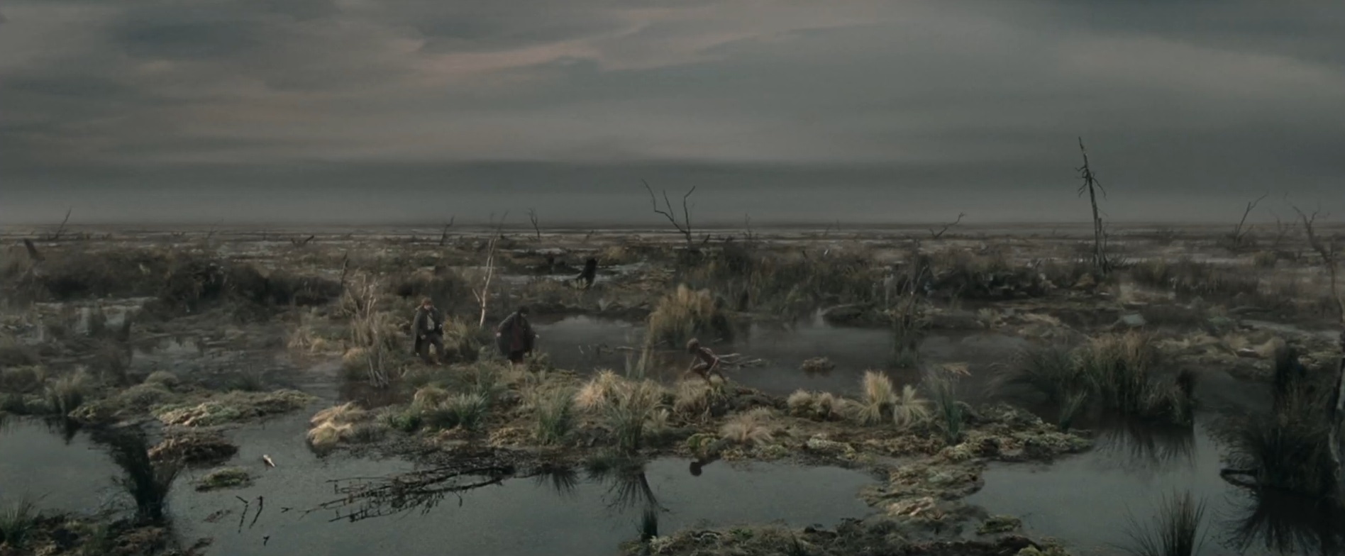
OK, it wasn't that bad. In fact, it wasn't any worse than some of what we encountered along the southern end of the Plover River segment just to the north. But it definitely took some careful walking. If you look on the IAT maps, this is that little bump that extends west and then east again near the top of the segment which I now know is a way of avoiding ... something worse ... had they continued straight north under the wires. I'm starting to have doubts that the area under the wires was worse. I hope this is on someones someday list for trail improvement. It could stand some love.
Finally, we headed back west again, where we encountered a sign saying we were a quarter of a mile from the section of private land that closes during hunting season, a mere two weeks from now. Hence - why we are hiking it today. Along the way, there is one more little run-in with a creek, but if you take your time you can find the boarded walkway that leads you to... A NEW BRIDGE!! Wow. Didn't expect that one. But very welcome. Onto the private land, up through the woods, along the edge of the field (saw some deer there) and around the bend, and there was the car. Boo yah!! Take that, Thornapple Creek Segment!! Wet and overgrown? HAH! Is that all you got?? Your mama wears galoshes!!
We paused for a while at the car, had a little snack and thought, how about tackling the last mile to the south? After getting ourselves geared up for battle and coming through so easily, it seemed only fitting to go down and finish the rest of the segment. So we drove down to County Road N and out to Fire Lane Road where we parked the car and headed north to kill of the last of Thornapple Creek.

This section is a road. Most of it, anyway. The gravel is wide and well-tended. We could have driven our car along here, and obviously many people do. After 3/4 of a mile or so, the gravel ended and it turned into a two-track, then cut through a corn field, always as north as the aurora borealis. Last, it dove into the woods for a leisurely stroll the last couple hundred yards until we found the car waiting for us. Easy Peasy, and happily so, because even the dog had lost the wiggle in its step.
Running total: 253 miles of trail covered; 29 miles ‘extra’ hiking/biking. End of Day 34.
3.0 miles of trail covered
Today was supposed to rain. Last night's forecast said rain by 4 am lasting all day until 5 pm. Not a problem, because we have plenty of rainy day activities to do around the house. But then I woke up and made coffee, and at 8:30 I suddenly realized it wasn't raining. 'OK', thinks I, 'maybe I can get the lawn cut before it starts raining.' I knew I was out of gas, so I put the empty can in the car and headed for the gas station. A quarter mile down the road, the skies opened up and it started pouring.
I got the gas anyway. Then I got home and started catching up on my blogging, since I was seriously delinquent in posting some of the details from previous hikes. At about 10:00 I noticed the rain was easing off considerably. By 11:00 it had stopped completely.
"Hey Google - is it going to rain today?" Nope - all done raining.
My mind starts thinking about that tiny, little section on Map 40 that we didn't finish yesterday. But I stay on my task, and keep blogging. By 12:00 it was almost sunny. 70 degrees. Light breeze. Our daughter calls.
"What are you guys doing?"
Long story short - time for another day of hiking.
Today was going to be shorter, if for no other reason than we had not actually planned on hiking today, and it was already noon, plus we were just a little weary from yesterday's hiking and biking. We left home at about 2:30, really planning just to hike the northern half of Thornapple Creek Segment, about 2 miles. Here's why.

Even in the guidebook, there is a warning for hikers.
"Note: This rough and rugged stretch is often wet and may be difficult to pass. Hikers may bypass this area - and must bypass it from Sept 1 to Dec 31 for hunting seasons - by continuing south on Thornapple Creek Road and then heading east on Partridge Road."
They publish warnings. They put up signs. How bad could it be?
We decided to find out.
After dropping a car at the north end of the segment, we drove the route of the suggested bypass and parked at the end of Partridge Road, which is now actually Gold Dust Road. We were chased by a farm dog who couldn't believe his luck that he had something to bark at today, and when we were parked his owner came driving down to see if we were dumping garbage. He was all smiles and friendly when he saw we were just hikers. A little mosquito repellent and we were on our way. Not sure what time it was when we started, exactly. 4 pm?

When starting on this piece of trail, from south to north, it is not at all imposing. It is long, level, broad, and actually mowed recently. For nearly a mile in a straight line, it is possible to walk along what is obviously a fire lane, which remains in fairly good repair. So far so good, we think, knowing that things can get muddy fast. At the point where the trail cuts west into the woods, it got a little thinner and grassier, but still, not a bad trail. There were some spots where the mud puddles are clearly a year-round feature based on the cattails and water lilies, but I have definitely hiked worse trails.
After a half mile enjoying the deep woods and the light breezes, we reached the power line section, which heads due north again under the crackling canopy of electric wires. Here at this intersection we saw another information kiosk/log book, and we opened it up to discover that someone had hiked that same section today, north to south, and left notes about the trail ahead. "Passable, but wet in places. Many streams crossing the trail - logs poking out into trail - maybe better in winter if not too much snow? Black bear sighting."

Awesome! Looking forward to it!
So we looked north, and even here we could see that someone had come through recently with a brush hog or something and tried to keep a path mowed through the thick weeds. Amazing. That's what I call trail maintenance dedication.
The walking at first was still pretty good. A lot better than we expected, really. Then the trail took a sudden turn into the woods, and that's when we started feeling like Frodo and Samwise in the dead marshes.
OK, it wasn't that bad. In fact, it wasn't any worse than some of what we encountered along the southern end of the Plover River segment just to the north. But it definitely took some careful walking. If you look on the IAT maps, this is that little bump that extends west and then east again near the top of the segment which I now know is a way of avoiding ... something worse ... had they continued straight north under the wires. I'm starting to have doubts that the area under the wires was worse. I hope this is on someones someday list for trail improvement. It could stand some love.
Finally, we headed back west again, where we encountered a sign saying we were a quarter of a mile from the section of private land that closes during hunting season, a mere two weeks from now. Hence - why we are hiking it today. Along the way, there is one more little run-in with a creek, but if you take your time you can find the boarded walkway that leads you to... A NEW BRIDGE!! Wow. Didn't expect that one. But very welcome. Onto the private land, up through the woods, along the edge of the field (saw some deer there) and around the bend, and there was the car. Boo yah!! Take that, Thornapple Creek Segment!! Wet and overgrown? HAH! Is that all you got?? Your mama wears galoshes!!
We paused for a while at the car, had a little snack and thought, how about tackling the last mile to the south? After getting ourselves geared up for battle and coming through so easily, it seemed only fitting to go down and finish the rest of the segment. So we drove down to County Road N and out to Fire Lane Road where we parked the car and headed north to kill of the last of Thornapple Creek.

This section is a road. Most of it, anyway. The gravel is wide and well-tended. We could have driven our car along here, and obviously many people do. After 3/4 of a mile or so, the gravel ended and it turned into a two-track, then cut through a corn field, always as north as the aurora borealis. Last, it dove into the woods for a leisurely stroll the last couple hundred yards until we found the car waiting for us. Easy Peasy, and happily so, because even the dog had lost the wiggle in its step.
Running total: 253 miles of trail covered; 29 miles ‘extra’ hiking/biking. End of Day 34.
No comments:
Post a Comment