Day 95: Deerfield Segment, Waushara County
Day 95: Saturday, September 4th, 2021
Total Miles covered for the day: 3.7 plus 3.6 miles extra hiking/biking
Location: The Deerfield Segment, from eastern trailhead on Cty Rd O to the western trailhead on Beechnut Drive
3.7 miles of trail covered
It's Saturday, Labor Day weekend, and it's not raining. How is this possible??
It did rain last night. It was even wett-ish on Saturday morning. The skies were overcast and brooding, yet the forecast called for no rain, and for once, it was right.
Over the last couple of weeks, we've been laser-focused on closing out our Central Gap, which is to say the miles of trail that comprise the vanishingly short distance remaining before we could color in map 50. Once complete, our continuous line would extend from map 1 all the way through map 60, including both halves of the bifurcation, assuming of course you ignore the 'Northern Gap' that still plagues us in Langlade County. But that's another story. Bottom line - we had only 3.7 miles of trail left to go before we finished map 50 and all of Waushara County in the process.
Our goal had been to finish it before Labor Day, and today we would achieve that goal.
We dropped our bikes at the east end of the segment on County Road O, then drove to the parking area on Beechnut, about a quarter mile south of the southwest trailhead. In truth, it would have been possible to park at the trailhead, but since we were given such a nice place to park, we decided to take advantage of it.
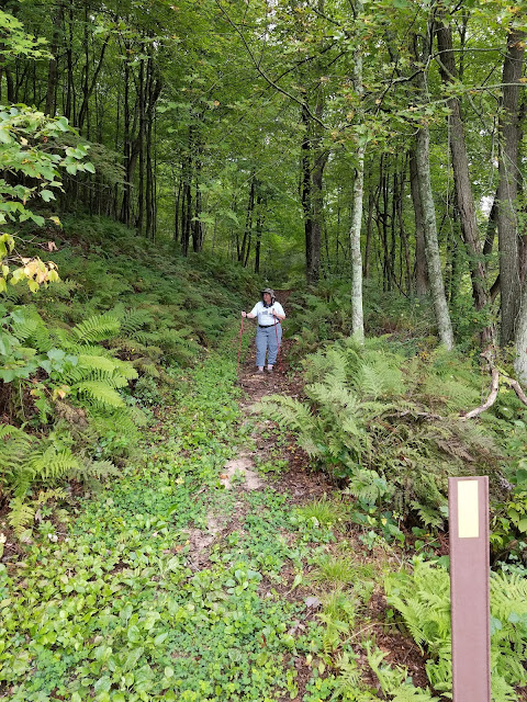
We walked the spur trail to the trailhead, which was easy to follow. There was one split in the trail, but it was obvious which way to go. We started the walk down the trail at 12:36 pm, temperature a lovely 65 degrees.
The downhill portion was probably an old logging road, cut well enough that for the most part there wasn't any erosion to speak of, but right at the bottom there's an area with high banks on both sides, and water is doing its inevitable worst, creating ruts.
At the bottom we saw a sign saying something like 'Pond Spur', indicating that it would be possible to walk to the water's edge to fill canteens I suppose, but since we're not through hikers we've never had to face the reality of using 'natural' water sources like this. Between me and whoever is reading this - I would have to be one desperate trail dog before lapping water out of the pond at the bottom of that hole in the earth.
On the other side we saw the loop trail that no doubt would take us right back up to the first spur trail, in the place where it split, before we ever got to the segment trailhead. We didn't explore that one, either.
On the way up, there was a little more erosion, but the trail wasn't quite as steep, so it wasn't too severe. The bugs weren't too bad, and some of the late season bloomers were showing their glory.
 |
| White Snakeroot |
Once we got out on top, the trail opened up a bit, with not much canopy and lots of low brush, mostly hazelnut.
We encountered several signs along the trail ranging from whimsical to historical. One sign commemorated a small pile of boulders, labeling them as "Ice Age Rocks". The sign was not wrong, I suppose.
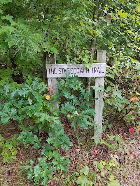
Another sign we saw identified one of the many crisscrossing trails that intersected with the IAT as the Stagecoach Trail from Wautoma to Plainfield. Presumably, this marks an erstwhile thoroughfare from when a stagecoach was an elite form of travel, and certainly there appeared to be worn ruts that could have been made by stagecoach wheels. On the other hand, I could find no mention of this 'Stagecoach Trail' anywhere other than on other hikers' blog posts.
So the mystery remains. Is it someone's fantasy, or is it real? A joke played on hikers, or the only remaining evidence of oral history passed down through generations and finally carved in wood if not in stone? I prefer to think the latter. That would make it all the more astonishing that the roadway itself remains, cleared and usable, after what must be at least 100 years of potential neglect. If this is true history, my hat is off to the keepers of the lore, and the trail.
The first time we spotted a bench, we crossed paths with another pair of hikers. I told them jokingly that I would arm wrestle them for the bench and a chance to sit down, and they graciously chuckled and said it was all ours. Little did we know that this was the first of many, many benches along this segment, more than any other segment we have hiked before. There must have been at least eight benches in all.
Another sign mentioned that back in 2001 there had been 37 acres of selective cutting, followed by the planting of 6000 white pines. I didn't see many 20-year-old white pines (most of what I could see in the area was red pine) but I'm sure they were good to their word.
Of course, I spent time along the way photographing things that caught my interest, like mushrooms, vines, and flowers.
 |
| Blue Wild Indigo |
 |
| Button Eryngo |
There were an astonishing number of trails that cut across the IAT along this section, and if not for the excellent signage it would have been very easy to lose our way. There was one notable exception, where the trail took a 90-degree turn and it wasn't well marked in either direction. We ended up walking quite a ways before finally spotting a Carsonite sign with a yellow blaze on it some distance off in the woods.
 |
| Amanita Regalis? |
Euphemistically, one could say this afforded a more 'intimate' interaction with nature. But honestly - I can't even say it was unpleasant. Nothing in Waushara County is unpleasant. And even this more-typical single track trail is well above average for most of the IAT.
One of my discoveries today was this mushroom, or I should say, mushroom cluster. There were thousands and thousands of these tiny little fungi, known as horsehair fungus, or horsehair parachutes. They are so bright and cheerful, so tiny and white, so utterly whimsical, that they are sure to bring a smile and have you thinking about fairies and gnomes if you slow down enough to take a look.
 |
| Horsehair Fungus |
 |
| False Solomon's Seal |
And before we knew it, there were the bikes waiting for us at the end. We still had a 3.6 mile bike ride ahead of us to get back to the car, but by the time we reached the trailhead sign at 4:49 pm we could take pride in yet one more goal achieved. We have exceeded our wildest hopes for the year 2021, and it's not even Labor Day.
Running Total: 709.7 miles of trail covered; 86.6 miles 'extra' hiking/biking. End of Day 95.


No comments:
Post a Comment