Day 125: Valley View Segment, Dane County
Day 125: Sunday, December 5th, 2021
Total Miles covered for the day: 3.4
Location 1: The Valley View Segment
3.4 miles of trail covered
Spent last night again in our less-than-ideal Airbnb, and woke at 8:00 am. The forecast was for light rain, and 34 degrees. The forecast was basically spot-on.
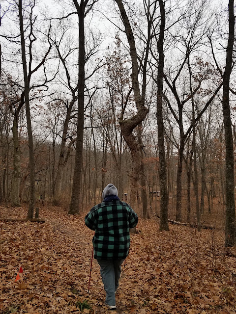
By 9:34 we were packed up, shipped out and in position to start hiking the Valley View Segment. It was, as predicted, 34 degrees, and that didn't change much through the day. We left a car at the non-existent parking on the south end of the segment (what a weird place to end the segment!) and drove up to Moraine Ridge Road to park in and amongst the Hay Chapman homes. There was a hint of a light mist falling.

The walk started out easy enough, following the roadway to the end of Saracen Way. There it takes a sharp 90 degree turn, heading up the hill and into a narrow corridor of trees between some very expensive homes.


In one or two places it was EXACTLY like walking through someone's back yard. And the last 150 feet felt almost invasive as we finished the leg by strolling on the house side of a row of trees, not more than 50 feet from someone's kitchen window. What a weird place to end the segment, but when we got to the end there was indeed a sign.
There was also a big rock there, proudly proclaiming the spot as 'Glacier's End'. They weren't wrong, I suppose. Just about any point along this 1200 mile trail could be considered the 'Glacier's End'. That's kind of the whole point of the thing. We moved on.

Once again, we walked a little ways next to some rather pricey homes, but quickly dove downhill into a heavily wooded section that had some well-executed switchbacks making the steep descent much easier.
A couple of boardwalks made the going a little easier in places, and then we crossed the parking area at Ice Age Lane and continued east.

We were walking along, minding our own business, when all of the sudden Theresa shouted out, "Narnia!"


The mist had turned to ice, and the wind had picked up significantly. We stopped at one bench long enough for a crazy jogger to come passing by with two dopey dogs tied to her waist.

The view would have been wonderful, if not for the horrible weather.


The trail is actually off the road the entire distance along here, and we learned later that this, too, was now considered part of the Valley View Segment. Good thing we did it, or we wouldn't have been able to check off the segment on our list.
Theresa and I crossed paths in the middle somewhere, though of course I reached the car first because I started walking first. Then I drove back to the north end and parked in a spot that really wasn't appropriate and walked back down the trail a tiny bit to meet her and walk the rest of the way back to the car.

I looked, and indeed we had found Narnia, or at least the lamp post.
And, when I looked to the north, I could see the castle.
I'm pretty sure this was the mansion at the end of Noll Valley Circle. I'm pleased, and a little surprised, that they allow the trail to cut across their front yard like that, even if it is a tenth of a mile away.
Then we headed uphill into a large open restored prairie, with many interpretive signs, though they were weathered and hard to read.
After peaking out at a good 100 feet in elevation higher than when we entered the prairie, the trail dips back downhill and through a copse of trees. It is clearly well-used when the weather is good. Today, but for that lone jogger and we two crazy IAT hikers, the trail was left alone to be lashed by the wind and the freezing rain. Somewhere along the way we passed from the world of $1M houses to the world of $2M houses, but the ground felt the same when we walked on it.
As we made our way past the prairie and uphill through the perimeter of trees, then through another stretch of prairie, I was thinking what a beautiful walk it had been, and what an incredibly bad day it was to be hiking. By now we were dealing with a pelting ice-rain, and when we reached the car I had to scrape off a layer of ice before we could go anywhere. We ended this leg at 11:30 am.
The last thing we wanted to accomplish was to walk off the short connecting route between the Valley View Segment and the Cross Plains Segment, but the parking was terrible. So instead, Theresa dropped me off at Mineral Point Road, and I started walking south. she drove to the trail crossing, parked, and started walking north.
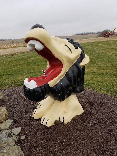
We passed this charming lawn decoration along the way. It's a defunct water fountain, in the head of a fiberglass lion. The kind that you might find at a zoo. I have no idea what the story is behind the - sculpture? - but it sits proudly as the welcome beast for someone's home.
I almost killed myself getting up to see if there was any water. I stepped on the landscaping rocks that surrounded it, forming a little garden area, and the coating of ice on it had so little friction it could qualify as a new superconductor. My first foot went out from under me, and had I put all my weight on it I would have splayed out onto the frozen rock pile rather than just do a little Bojangles impression.
It was 12:55 pm. It was now 31 degrees, and it had gone back to raining. We had a 2+ hour drive home ahead of us and it had been snowing up north where it was raining down here.
That, and the icy near-fall, convinced us that it was time to call it a successful weekend and live to hike another day. We headed home. We did catch bad weather and slow traffic on the Interstate, but we made it home just after sunset and before full dark.
This ended up being our last hike of 2021.
Successes for the day: We finished one more full segment, and walked off of the bottom half of map 65.
Successes for the weekend: Completed two segments, and added 32 new snails to the list.
Successes for December: 14.1 miles of trail covered. Not as impressive as the 50.5 miles in November or the 62.1 miles covered in October, but I'll take it.
Successes for 2021: 530 miles of trail and connecting route covered; 341.5 miles on foot and 188.5 miles covered on bicycle, plus 113.8 miles of extra hiking and biking. Over 125 SnOTT patches given away. Extending our unbroken line of 'done' segments from Map 1 all the way through map 60.
As always, the number of miles of trail covered keep going up. Just as inexorably, the number of miles remaining goes down. We now estimate that we have a total of 346 miles left to go. If fortune favors us, we might even finish this beast in 2022.
Running Total: 863.2 miles of trail covered, 144.5 miles 'extra' hiking/biking. End of Day 125.
No comments:
Post a Comment