Day 206: Connecting Route, Langlade County
Day 206: Sunday, July 3rd, 2022
Total Miles hiked for the day: 11.5; Net Miles 0.0
I have heard it said that nature is simply made of love, in three dimensions. That our universe is nothing more than an interwoven mycelial mesh, literally and figuratively, and that there is no action that can take place anywhere that does not ultimately affect all things everywhere.
On the one hand, that concept makes me feel incredibly small and insignificant. On the other hand it makes me feel the importance of every action I take, knowing that what I do contributes - inevitably - to the health or destruction of our planet.
Think globally - act locally.
Location: The portion of the connecting route south of the Kettlebowl Segment, between the intersection of Stubby Lane and Polar Road and the Intersection of Springbrook Road and Old 26 Road
11.5 Miles of trail covered
Today was another auspicious day with audacious goals. We have put three counties behind us over the last two days. With one more great shove we could put one more behind us. Only 11.5 miles separated us from the last of Langlade County. Don't get me wrong. I like Langlade County. It's very pretty. But it also sports some long and difficult Segments and a long and inhospitable road walk. I might feel better about it but the parking along the road is basically non-existent, not to mention illegal.
We were up and running fairly early today, at least as we saw it. We made it to the starting gate by 11:15 in the morning. I'll grant you that was a full six hours after sunrise, but it was also a one-hour drive from home.
Even the grasses were blooming. And so was the marsh valerian below.
It was quite a day, and I was feeling happy, so I was apparently much in the mood for snapping photos. Below is what the leaves of the marsh valerian look like.
And below is a fine example of sensitive fern. It's my understanding they got that name because they are particularly sensitive to the first frost of the year.
I'm pretty sure this one below is just common ragweed. Still very pretty overall. It would be a popular groundcover if people weren't so allergic to it.
And already some of the grass seeds are nearly mature and ready to drop.
All of this roadside picture-taking took place in the course of about five minutes in one small place, a road distance of no more than 50 feet. I took those photos while I waited for our hiking companions of the day to show up.
At 11:30 we met Vicky Voelker and her novice hiker friend Joy at the intersection of Forrest Road and Stoney Road. You could say that Vicky brought us Joy that day.
Vicky had already received her snail patch before, but Joy was a new addition to the club.
I got a chuckle at the style of headgear selected by all three of these women for this warm sunny day. It's almost like they knew how hazardous it was to walk in the direct sunlight for hours. As to Theresa's shoulders, I always make sure she gets sunscreen, and I do the same for my exposed ears, neck, face and arms. And if I'm wearing shorts, as I have been lately, then I make darn sure I get the back of my knees and calves. Sunburn in that area can be really painful.
The road before us was lonesome and level on the way to Polar, with the hot paved surface of the road blending almost invisibly into the shoulder.
When I wasn't joining the group in their chatty stroll down the road I sometimes drifted off to the side to resume my photography. I don't know what kind of flower or what kind of moth this was, but I was happy with the result.
The route we chose to get to Polar was the one identified on the 2020-2022 Atlas, which is different than what now shows up online. Both routes travel north and east on Crestwood Road, but the older route continues east on Crestwood all the way to Polar Road, and the newer route goes north on Orchard Road all the way to Hwy 64. I have noted in previous posts that near that intersection exists the IATA Moraine-Outwash Preserve, a piece of land owned by the IATA that will undoubtedly host a trail segment, but for now I would recommend skipping that route and going the way we did. Highway 64 gets a bucket load of travel, and I know I wouldn't enjoy walking on it. Besides, if you go the way we did you get to walk past T-Bone Acres, which is really a once in a lifetime opportunity. (Sarcasm. There's nothing there more exciting than the sign. Still...)
Short strides and short shadows. Three mature women out walking in the sun. We no longer question why we do this, but maybe we should.
A funny thought just occurred to me. The term 'pedestrian' is used to describe something that is commonplace, routine, normal and average. How ironic that walking is no longer a pedestrian activity.
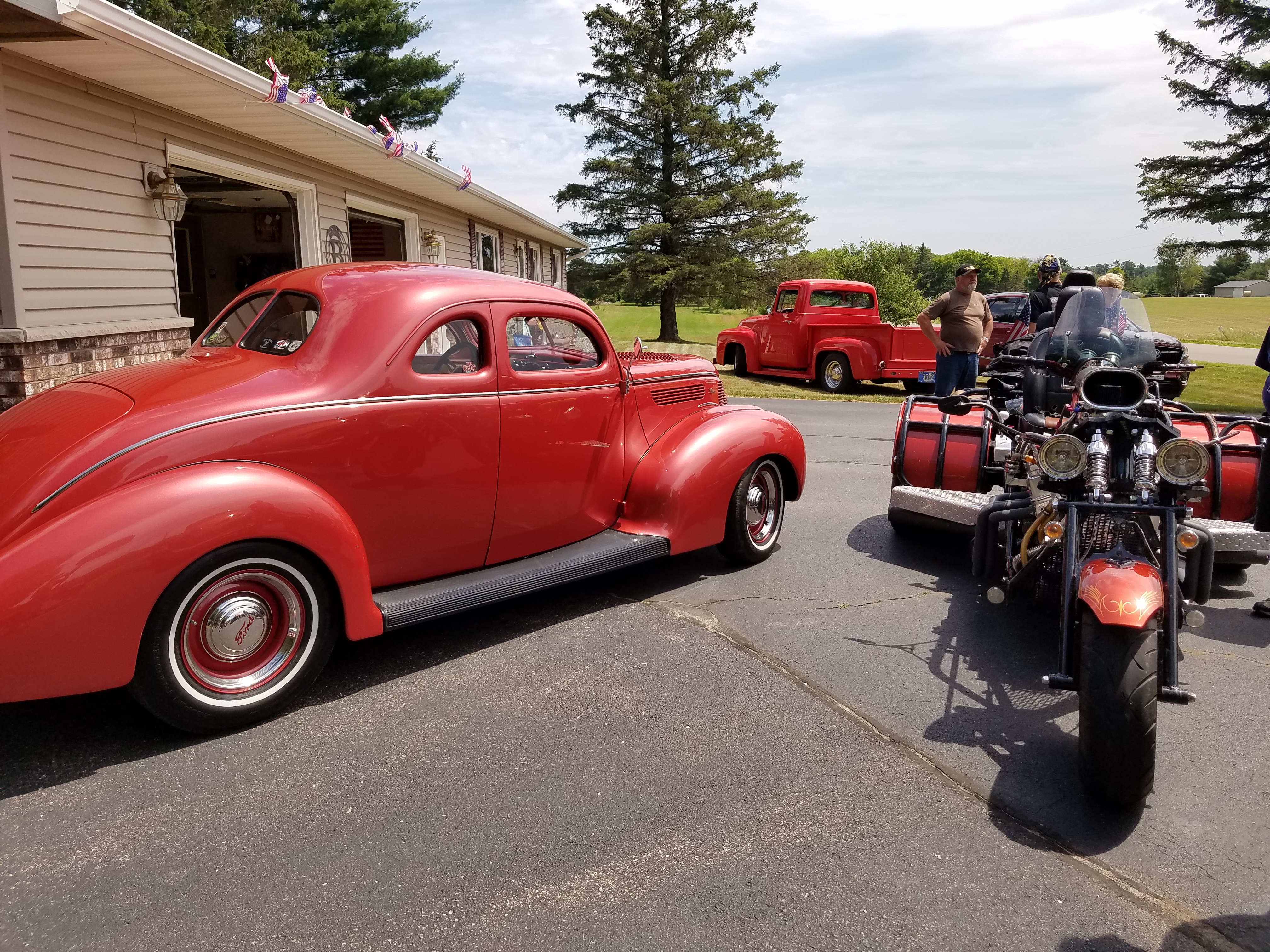
When off in the distance I saw a commotion
A gleaming display of machine locomotion
I hurried my pace, down the road I did strive
The trail forgotten, I turned down the drive
The sun on the lawn made a carpet of green while
American flags like small banners were streaming
When what to my wondering eyes should appear
But a gathering of hot rods with people drawn near
I didn't even ask. I just veered off the road and started walking through the display, taking pictures. It was an Independence Day hot rod rally in miniature, with folks gathered round at a rural house, drinking, laughing, eating meat from the grill and in general doing all things Fourth-of-July.
"Sure - come on in!" they said.
All of us spent a little time wandering through, though the three gals felt less comfortable intruding on their private party than I did.
But I think I understood exactly what was going on here. They didn't know me, but they had spent countless hours acquiring, refurbishing, perfecting and polishing their gorgeous cars, and if some stranger comes wandering on down the road and wants to admire their beloved cars, there is nothing but pride. "Hell, yes. Come on in. Take some pictures. Glad you like her."
I really only took enough time to say thank you and tell them that we were out hiking the Ice Age Trail, but by the time I was talking to the group the three gals were already on their way down the road.
The hike along Crestwood Road did have some hills on it, as the name implies. There is also some small amount of water visible from the road, though clearly not fast-moving.
Red Elderberry. The leaves, stems, roots and seeds are poisonous, but the berries themselves are not. If you remove the seeds the fully ripened fruit can be eaten either raw or cooked. The plant contains cyanide-producing glycosides and a toxic alkaloid, so it's important to take the warning seriously. Don't eat the seeds. Also, glycosides alkaloid toxins present in elderberry are dangerous for dogs, so don't let them eat the berries or chew on the sticks.
Curiously, the toxins have no effect on birds. It is especially common to see Tanagers, Cardinals and Grosbeaks dining on the ripe berries.
At the intersection of Crestwood Rd and County Road S is this church, and we took advantage of their empty parking lot as a place we could safely and legally park on this connecting route.
Turning north on Polar Road, we started getting into more hills. The photo below does a better than average job of depicting a hill in a photograph, and is an indication of the surrounding terrain that is mostly covered up with trees if not turned into agricultural fields.
A little further north we came to the area with Rabe Lake on one side and Krause Springs on the other. This is another good reason to come this way, since there is limited parking available and the water from Krause Springs can be considered safer than most to use as a resource for thru-hikers.


We reached the end of our first leg when we reached Stubby Lane, having hiked the road north of here about two and a half weeks ago. Joy and Vicky had a car waiting to the north in Polar, so they kept hiking. We had our car waiting back down at Rabe Lake, so I backtracked down the road a bit to get it while Theresa said her good-byes. Then I picked her up and we went down to start leap-frogging our way towards home.
In bits and pieces, we started making our way west and south along Forrest Road, then Parkway, then Maple View and Sunnyside, and finally to the end of the line when we reached Old 26 across the highway.
I resumed my picture taking as we went.
Below is a picture of Climbing Nightshade. I want to point out that I am not an expert with this plant, and different websites have different but not really conflicting information. First - identification. Two key factors here are the purple and yellow flower where the purple corolla is pulled back like a shooting star, exposing the bright yellow anther in the middle. The second important factor is that the flowers, the the berries that follow pollination, are in clusters. Both of those are important in distinguishing this plant, Solanum dulcamara, from its far more sinister cousin Atropa belladonna, also known as deadly nightshade.
As the name implies, you don't want to mess with deadly nightshade. But that doesn't mean that all members of the nightshade family are dangerous. Far from it. Tomatoes are in the nightshade family. So are potatoes and eggplants, and basically all varieties of peppers. Solanaceae are a widespread source of food around the world, but most of them don't carry the label 'nightshade', and the mere association with Belladonna is enough to give most rational people pause.
And yet, there are people who actually go out and harvest these, or plant them as a sort of cover-crop in places that will grow little else. It's not as common as growing Black Nightshade for the fruit, but still not unheard of.
What's important to know is how to safely harvest the fruit. You don't want to harvest green berries, because those are still toxic. You should wait until the fruit is good and black. But you don't want to eat green potatoes either. The solanine would make you sick. 300 mg of solanines are enough to kill.
Having said all that - I was raised to stay away from this plant. I was told from my youth (incorrectly) that this was 'deadly nightshade', and I have yet to go pick the berries out of my own backyard and eat them, green or black. The main hesitancy at this point is that some sites indicate that even the ripe berries could be toxic for some people. On the other hand, fully ripened Black Nightshade berries are well-established as highly edible and delicious.
Maybe I'll plant some of those out in the garden.
This little monster, though, I know to stay well away from. This is one of a variety of toxic plants known as baneberry. It's a cluster berry that grows from a stem sticking up from the ground and the fruits come in several colors, The berries on this one are solid and pithy, bright red and waxy when ripe. Others are olive green in color, and some a ghostly and ghastly white.
If it says 'bane' in the name, do yourself a favor and admire it from a distance. Don't even pick it, and don't let your dog or cat eat it, either. The ones below are green, but will turn bright red like the photo above.
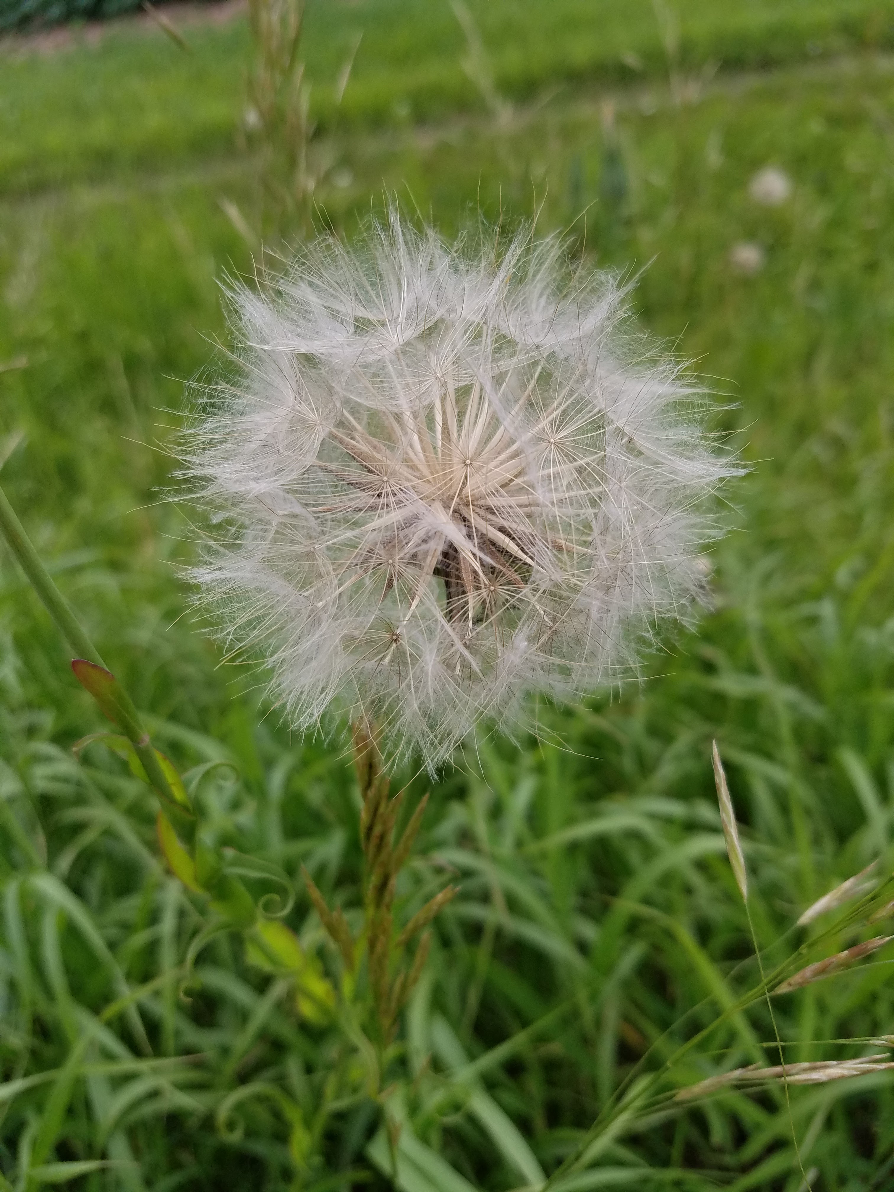
I must really like salsify. I take pictures of it every time I see it.
Here is one that hasn't yet spread its seeds into the unmistakable snowball.
I'm not completely sure what this one is. It looks like some kind of horsetail or club moss, probably the latter. But this was such a healthy specimen I couldn't resist getting up nice and close.
When we got to the last leg, we actually reversed our car configuration so that we were walking in the direction of the end, rather than back-tracking in our normal leapfrog fashion. It felt right, somehow, to walk this last little bit of roadway in a face-forward direction.
Right near the place where Sunnyside Road meets Highways 45/47/52, there is a property on the north side of the road that is a graveyard of sorts, or maybe someone's idea of art. This, apparently, is where lawn mowers go when they die. There were dozens of them - perhaps hundreds. Riding, push, tractor - everything. And snow throwers, too, along with other odds and ends like the occasional rototiller. I can't explain the reasoning for why anyone would want to maintain such a collection of these things, piled on on top of another, exposed to all that Wisconsin has to offer, including the scorn of their neighbors.
There is a parking place very near to the highway intersection, and that was almost exactly one half mile from the end of our hike today. This was where we started from after repositioning our two cars, and we walked together, hand-in-hand on this last piece of roadway until we got to the sign at Old 26 Road.
Looking back at how far we've come, we have a great sense of achievement. It's almost unbelievable to us how little we have left.
Farewell, Langlade County. We hardly knew you.
Four hikes left. And because of just how hard we've pushed these last few days, the hikes remaining aren't even as imposing as they might have been.
The tally:
- 1 new Snail today
- Completed maps 37 and 38
- Completed Langlade County
- Converted 11.5 miles of biking to the 'hiked' category
- 25.7 miles to go.
Running Total: 1211.7 miles of trail covered (1111.3 hiked), 408.2 miles 'extra' hiking/biking. End of Day 206.


No comments:
Post a Comment