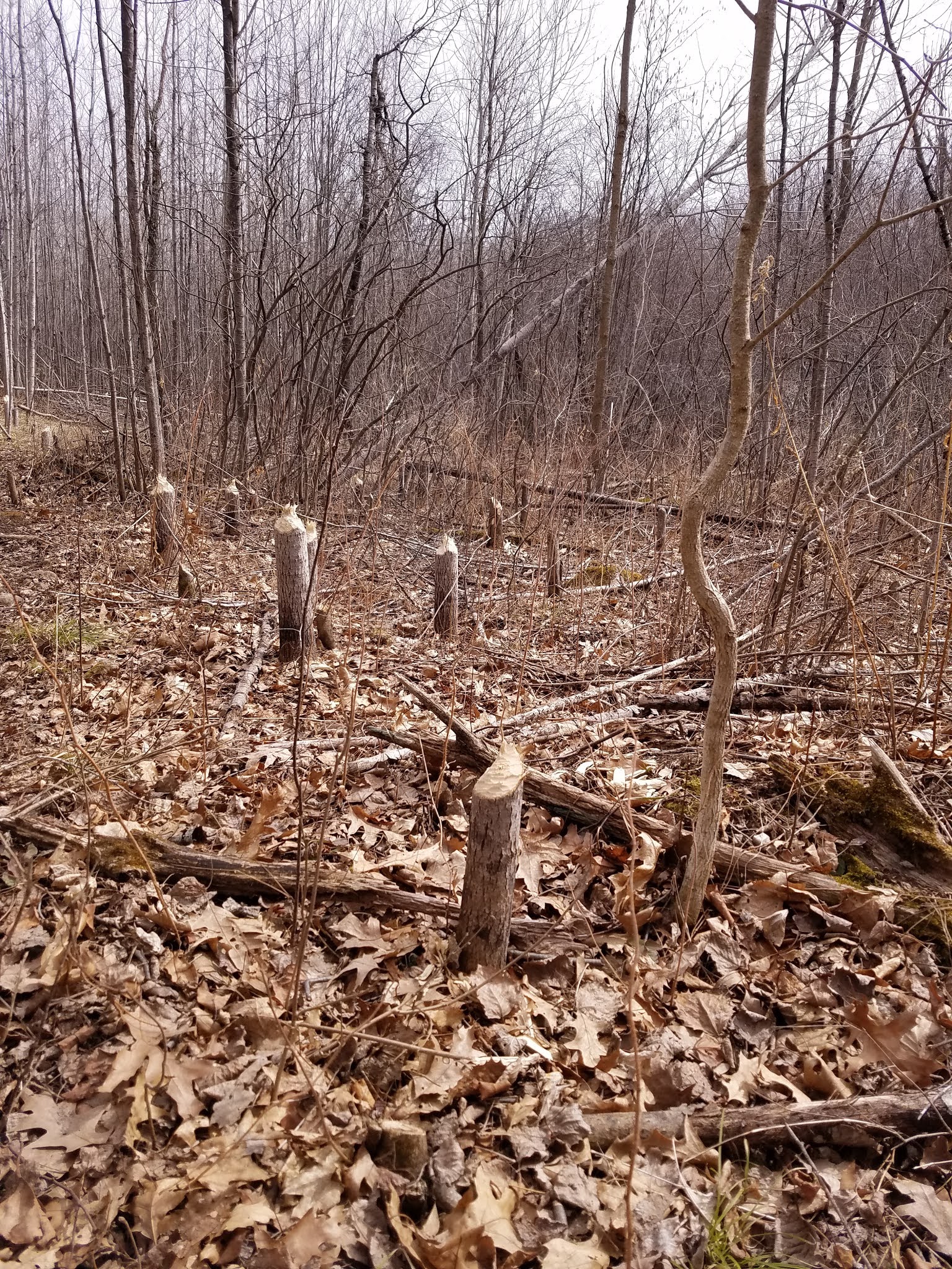
Saturday, April 3, 2021

Day 48: Parrish Hills Segment (Part 1), Langlade County

Day 48: Saturday April 3rd, 2021

Total Miles covered for the day: 4.4

Location: Western third of the Parrish Hills Segment between the trailhead to the west and a remote intersection with a logging road north of Five Cent Rd to the east.
4.4 miles of trail covered.

Saturday morning, up and 'running'. Or at least, up and walking. Having just completed Lincoln county to the west, we immediately set our sights on Langlade County, a tough 60+ miles of rugged, remote wilderness. 


We had taken to printing copies of the trail maps to take with us on the hikes, and using Google Maps or the IAT Resource Map to get coordinates for various points along the trail. This makes for great hiking when you can ask the question, 'How far is it to...?' and actually have an answer. 


We started out by dropping a vehicle at the parking area on the Lincoln/Langlade county line on First Lake Road, then took our launch vehicle to the place where the trail crosses County H. It was here we started our day at 12:10 pm, temperature 60 degrees and overcast. This first 1.5 miles went quickly, except that Theresa's feet were hurting again from what turned out to be ill-fitting boots. What I remember most about this was fairly easy hiking except for the hike up and down the shoulder of Baldy Hill. Come on, people, WHY? 


Baldy Hill is a nice hill. Lovely view from up there. But there was no point in climbing it. At Baldy, the path (an otherwise enjoyable stroll through the woods on troads and lovely trail) went 100 feet straight up one side, only to careen 100 feet straight down the other side at an unreasonable and ecologically unsound pitch. Just a slight detour on to this glacial 'feature' to suck the life out of you. If you want to avoid this - walk the troad at the bottom of the hill. 

As we neared the end of the Baldy Hill experience, we saw a group of three hikers headed the other way. "You have a choice", I offered, telling them about the troad bypass in case they wanted to avoid the hill. "We know", they said, "we hiked it yesterday the other direction." As we headed down the trail, I looked back and saw that they were indeed headed back up the hill. 'Good for them', I thought. 'Not sure I would do it twice carrying those heavy backpacks.'

The rest of the walk was fairly easy, with only a few muddy areas, and we soon found ourselves at the car. The time was 1:10 pm, and it was 64 degrees. Thank goodness it was overcast. 

We drove ourselves to the next launch point, parking along Pine Road at 1:35 pm. Just as we were parking the car, we saw the same group of three hikers passing us on the road. "Wow!" we said. "You guys made great time!" I mentioned that we saw them headed up Baldy Hill again, and one of them gave a sheepish grin and said, "Nah - we got halfway up and decided to come back down and walk around." Apparently once was enough for them, too, and I couldn't blame them.


They told us they were headed all the way back to the end of the segment at Townline Lake, and we wished them good travels, knowing how far that was. Later on I regretted not asking them about the ford. Oh well. 


This should have been an indication to us how easy this next 1.0 miles of trail would be. It's not much for scenery, but it's a nice, easy march along the troads and flat trails. I thought we would really make time through here, but unfortunately Theresa's feet weren't having it. She was literally in pain with every step. Something was definitely wrong, but she pushed through the pain and we made it to the car by 2:10 pm. I don't want to belittle the effort. She really gutted it out the last two tenths of a mile. I felt bad, but I was really impressed. The temperature was now 64
degrees.

I was concerned about the next part of the hike. Our plan was to drive to a spot along the Logging Road north of Five Cent Road, parking at N 45 24.797, W 89 22.340, or actually a little southwest of there. From there we had 1.6 miles of hiking, then fording the Prairie River, then a final 0.4 miles back to the car. With Theresa's feet in such pain, I didn't think we could do it. But she decided to change shoes and just wear her water shoes the entire way. They're pretty good shoes, really, but have very little traction. I kept it in mind we could always turn around if needed. 

We got to our parking coordinates and took off about 2:45 pm. Before I go any further, I want to talk about Five Cent Road, and the Logging Roads that fork off of it. I don't know how Five Cent Road got it's name. Maybe it's because someone at the Town Hall said 'We should call it Five Cent Road, 'cuz it ain't worth a dime!' Or maybe they called it that because that's all they spent building it, or because that's all your car will be worth if you drive it. Five Cent Road, while drivable, isn't easy or enjoyable. It's downright hard on your car. And then the Logging Roads... The IAT Guidebook advises you not to drive on the Logging roads because they are only maintained for ATVs. I'd say that's sound advice. You really, really don't want to get stuck out there. If it's been raining - I would stay off of Five Cent Road, too, just to be safe. Go somewhere else. Save yourself the headache. 


But - it had been dry, and we didn't bust an axle getting to our parking coordinates, so we grabbed our trail lunch and started following the yellow blazes. I haven't mentioned those yet, because they were well-done. Never a concern that you would lose your way, except that one part walking the troad when you come to a no-trespassing sign, and you don't see the next blaze immediately... but I digress. 

One notable feature was a rather outstanding camping area we passed that was built by the local snowmobile club, with a firepit and a covered structure. There was a tent there, doubtless belonging to a hiker we never met, in the middle of the large, open field at the end of what was probably the logging road to the south. It would be a nice place to stay if you're through-hiking. In fact, as I think back on the day one thing I remember is there were numerous places where it would be easy and pleasant to set up a tent. You can find this one at N 45 24.916, W 89 22.559. 

We were really hoping to see our three trail-friends again, to ask them about the ford, but after walking a while, and then sitting down to enjoy our lunch, we decided we must have missed them. But then as we kept walking through a rolling and largely uneventful trail, suddenly we could see them ahead of us. We were surprised, because they had been moving fast earlier, so we assumed we had missed them. We asked if they had stopped for lunch, and they said yes.

So we laughed about crossing paths so often, and finally had a chance to ask about the ford. "Cold!" came the immediate wide-eyed response. "Stick to the right side", was another piece of advice, meaning the upriver side. "Thanks for taking a lunch break", we said, so we could ask you about the river crossing." Grins and nods, and we were both off hiking. We would not see them again. 

It should have been a hint to us that after so much time had passed, we encountered them again. That means something slowed them down, and it wasn't just the river, or even the lunch break. No, it was muck. Tree roots, and muck. There is a section of private land that needs to be walked around to get to the river, and as a result, the approach to the river isn't very nice. The last quarter mile or so takes you hopping through an alder bog, looking for ways to keep your feet dry. It wasn't quite as critical for Theresa because she was already wearing water shoes, but it was a little tougher for me in my hikers. 


Just before the river we spotted a very nice painted rock talking about the ford, and we left it there for future hikers to enjoy. And then the river. 

Just on the east side of the river is a large evergreen with exposed roots to sit on, perfect for changing your shoes. I sat there and changed into water shoes, actually taking my pants off because I heard the water could go as high as your knees, and I was in no mood to walk in wet pants. Once I had everything loaded, I walked along the many branches that had been laid down to minimize the mud and stepped into the river. 

They said it was cold. I was thinking I would just walk my stuff across, lay it down on the other side, then come back to to take Theresa's bags across, or hold her had while she crossed. Nope. Nope, nope, nope. This water was COLD!! My feet were in pain by the time I reached the other side. Theresa was on her own. "Stay upriver and just keep moving!" I called out for advice. I don't think it was wider than 20 or 25 feet, but it felt wider. 

Theresa plunged in, and to her credit, she made no complaints at all about the water. "How far to the right?" she asked. "Go!" I said. "Just keep moving!" She admitted to me later that the cold water actually felt good on her aching feet, and she made it across just fine. I count myself a lucky man, because I would have felt terrible guilt if she had fallen in. 


On the west side of the river is the foundation of some old building, with concrete blocks sticking up like widely-spaced teeth, providing yet another perfect place to sit in the sun, change your shoes, or enjoy a picnic. A stamp in the concrete shows that this foundation was laid by the Alamo Cement Works, August Marmes Proprietor. We sat in the comfort of those blocks of concrete as many hundreds of travelers before us, and many hundreds to come. Most won't pause to thank August for his labor of many years before, but we sure appreciated it. Thank you, August. I changed back into my hiking shoes while Theresa kept going. Her feet were feeling better, having walked in different shoes* and getting that nice, cold soaking, but they were still sore, and we were very near the end. 

The last quarter mile or so before we reached the road was along a wide-open grassy field, which was delightfully sunny and warm as it had now reached 64 degrees. A short walk back up the road to the parking area, and we touched the last sign for the day, ending at 4:45 pm. 

Just as we were getting ready to leave, we saw a couple walking down the road, a garbage bag in tow. "Thank you", I said, "for picking up trash". He looked at us funny, and said, "I saw you two earlier walking that way (west) and now you just came walking up from that way (east)." We laughed and explained to him that we cover the trail in little snippets, always walking to a waiting car. We proceeded to chat for quite a while standing there on Pine Road, with him telling us about all the interesting people he meets who walk by his place while on the trail. We showed him our maps and told him we had already covered nearly 400 miles in our adventures, and he was quite impressed. He told us he had walked a ways in both directions, but wasn't keeping track. I'm not sure his wife ever said a word.

Running Total: 360.9 miles of trail covered; 36.7 miles ‘extra’ hiking/biking. End of Day 48.

* Post Log Note
There is a lesson here about footwear that is worth knowing. Theresa had been wearing boots that for whatever reason were causing pain. We discovered this by accident. Knowing that we had a water crossing at the end of our hike, she decided to change into her water shoes and walk the whole section in those. After only one or two tenths of a mile, she realized that her feet, which were throbbing points of agony only a short time before, were almost entirely pain-free.  She was able to continue the rest of the hike with only normal foot fatigue. 

The lesson is, that if you are experiencing pain with your boots/shoes, either in the toes or the balls of your feet, or your heels, or whatever - you're wearing the wrong shoes. Even boots you have used extensively that used to feel oh-so-good will break down eventually, and you shouldn't suffer along on bad equipment. If you're spending a lot of time hiking, be ready to replace your footwear occasionally to protect those all-important points of contact with dear mother earth. 

Friday, April 2, 2021

Day 47: Grandfather Falls Segment (Part 2), Connecting Route, Lincoln County

Day 47: Friday April 2nd, 2021

Total Miles covered for the day: 13.6

Location 1: Western half of the Grandfather Falls Segment between the trailhead to the north and the beginning of the out-and-back eastern half of the segment to the south (Newwood County Park).  
2.4 miles of trail covered.

Map 28 is a mess.

Seriously - is there another map in the whole book that is this difficult to figure out what part is trail, what part is connecting route, and where to go next? It looks like someone accidentally cut the trail in two pieces and tied a very ugly knot to put them back together again. 

Two weeks ago we had the entire Turtle Rock segment to do, half of Grandfather Falls, the Connecting route between them and part of yet another connecting route to finally get us off the map. Plus we had the Harrison Hills to finish up further to the north. So we got serious and knocked off Turtle Rock on 3/21/21, followed by the last of the Harrison Hills on 3/29/21. Suddenly Grandfather Falls and some connecting routes on Map 28 and a little bit of connecting route on Map 29 was all that was keeping us from finishing the entirety of Lincoln County. Challenge accepted.

I had to take the wayback machine to figure out that we hiked the first part of Grandfather Falls back on August 30th of 2013, exactly 2,798 days ago. I think that's the record-holder for the longest break between starting and finishing a segment. That was our fifth day of hiking the trail, and we hiked only the out-and back segment, mostly because it was an insane late-afternoon Sunday run up to the IAT to do ANYTHING. We looked at the the beautiful hike along the river and decided we would save that for another day, since it was so close. I don't think we had another 2,798 days in mind, but - that's the way it turned out.

So - back in 2013 (has it really been almost 8 years?) we claimed 1.6 miles of trail covered, though now the guidebook says that piece is 1.7, so now I guess we get an extra 0.1 miles to tack onto our trip. Bonus! 

Because today we were hiking with our daughter (who has bed knees) and her dog (who has bad knees) we decided to break the remaining 2.3 miles along the river into three bite-sized chunks. But we were also in only one car, so we brought along bicycles to work the logistics, planning on covering the connecting routes before we were done. Much thought and planning went into it - most of which worked out well.  


We started out by having Theresa drop me off at Camp Newwood Park. Then she and our daughter drove to the north end and started hiking south. The plan was to have me hike north, cross paths  with them along the way and give them a trail report to see if we felt daughter and dog would be able to safely make the rest of the trip. Having just hiked the Turtle Rock segment across the river we knew just how rugged the shoreline could be, so it made sense to do a little reconnaissance. Theresa was hiking north to south because first, it was downhill, and second we thought the northern piece would be the easiest. Well - it was downhill, but as for easy, it was not. More on that later.

I started out at 11:31 am, temperature 43 degrees, raring to go. I hiked down the stairs only to see that the trail actually didn't go down the stairs, but actually started out by the road, so I cut right, walked across the road, touched the post from so many years ago, and doubled back to start my hike. Right away I saw the efforts of the Mobile Skills Crew, who had obviously wanted to make this a feature segment. 

After a brief jaunt I came to the stairs that led up to the Campground, and found them to be in good repair. Then I marched through the Campground, passing by some open but unneeded outhouses, and took the rather steep hike back down from the campsite on the north end. Frankly, I don't know why they didn't take the trail along the river, except that for many hikers the outhouses would be a welcome sight. Even so, the path they took was really far too steep, and has been causing some erosion. On this day, I found it to be particularly hazardous because the top 1/4 inch of soil was thawed and muddy, while the ground below was still frozen. This made for dubious footing along the entire length of trail, when unassuming lovely path turned into a circus act if you step just the wrong way. 

Thaw/frozen trail footing aside, this stretch of river couldn't have been more lovely. It was scenic, easy walking, and there were several short bridges to prevent erosion and improve footing over this obviously highly used piece of trail. And it was scenic. Really pretty. Some of the bridges were a little tilted and could use shoring up, but they were still quite passable. Did I mention the scenery? Plus there was a bench along the river. Speaking of the river, there were places you could clamber out onto the rocks if you like (we didn't go out there) and one or two places it looked like you could actually rock-hop to the other side if you were a bit athletic. We didn't try that, either.


The lower 1.1 miles of trail (up to the first parking area north of Newwood) flew by, as did the second 0.4 miles to the second parking area just a little upriver. I don't know exactly what people were fishing for, but there sure were a lot of people fishing. Like others, I stopped to marvel at the penstocks, imagining the days when they were made of wood. A cooper's nightmare, to be sure. Then I popped up and around and over the bridge, and that's where things started to get a little dicey.

Immediately as I got into this last 0.9 miles along the north end of the Grandfather Falls segment (below the dam), the terrain got less friendly, with more rocks and more mud, too. It is only now I realize, long after finishing the hiking, that the worst part of Grandfather Falls, the northern 0.9 miles, is directly across the river from the worst part of the Turtle Rock segment. We should have known. 

This was about where I expected to see Theresa and our daughter, her dog in tow, and the further I went, the more concerned I got. The footing here was really getting poor. There were very rocky sections, and worse, places where the ice hadn't finished melting, creating truly hazardous ice crossings where there should have been trail. After about two tenths of a mile, having come to the conclusion that the three of them had reached icy, hazardous hiking and turned around, I finally saw them inching down the trail. 


My trail report was exactly as above. very bad hiking ahead, until they reached the parking area, then easy sailing downhill and downriver. I decided it would be best if I turned and walked with them, at least to get past the worst of the ice. We walked as a group until the footing was less treacherous, and then I turned around once more and headed north. I danced around the boulders and ice to the car without any incidents, reaching the north signpost at about 1:00, with the temperature hovering at 47 degrees. I immediately drove the vehicle down to the first Parking area south of Tug Lake Road, where Theresa and our daughter were waiting for me. 

From here, I assured them, the trail was much better. We made a hasty plan for me to go back to the north end and bike the connecting route across the river to Turtle Rock and back, thus cutting off some time later in the day, and I would meet them, I assured them, at the next parking area. I truly don't know what I was thinking. Bad, bad planning. There was no way I was going to finish that and get back to them without making them wait an eternity for me to get there. 


But wait they did, while I biked both ways on the connecting route. 4.2 miles took me a lot longer than I expected, with the hills and the wind factored in. I was 20 minutes later than I expected to be, and they almost could have finished the lower .9 miles by the time I got back. I wished them well on the rest of their hike, and drove down to the park to drop off the car, and walked back up the trail to meet them, so we could walk the remainder of the trail together. 

All in all, I think I covered about an extra 1.4 miles of hiking, though Theresa just did the straight through mileage of 2.3, plus the bonus 0.1 we didn't take credit for the first time. Because I made her wait so long for me, she and her two companions didn't reach the end until 3:00, where it had warmed up to a full 51 degrees. 

Time for more biking.

Location 2: Connecting Route between the Eastern trailhead for the Turtle Rock Segment to the west and the western trailhead for the Grandfather Falls Segment to the east.  
2.1 miles of trail covered.

As I mentioned above, I biked both directions on this 2.1 mile connecting route, and having done so I can tell you there's a right way and a wrong way to do this. Traveling north from Grandfather Falls wasn't so bad, even though it was upriver, because I had a stiff wind at my back. But once I crossed the bridge and turned left to go the last 1.2 miles up CTH E to the start of Turtle Rock, it was uphill and upwind the entire way. Going back down was a breeze, but then once again, after crossing the river and heading south on 107 I was fighting the wind. Tough going all around. 

But that was hours earlier, and now it was Theresa's turn. Because we had only one car, only one person was able to ride at a time, and we wanted the very dangerous part of the connecting routes, along Hwy 107, to be done as soon as possible. To that end, I drove her up to the top of the hill on Tug Lake Road, and had her bike down to Newwood Park, with me trailing behind in the car, flashers going. This was actually part of the NEXT connecting route, but we took it how it came. We repeated the maneuver having me bike the same route south, before actually taking Theresa north to finish this 2.1 mile piece. All in a day's work.

We had a lot of miles to cover, and we didn't want to mess around with Hwy 107 any longer than necessary. I had Theresa go north from Grandfather Falls, the same way I did, until she had crossed the bridge and gotten to Cty E. Then I picked her up and took her up to Turtle Rock and had her bike down again to the bridge. Distance covered, 2.1 miles for Theresa, 4.2 miles for Brock.

Location 3: Connecting Route fragment between Newwood County Park (middle of Grandfather Falls Segment) to the west, and the intersection of Horn Lake Rd and Horseshoe Lake Drive to the east.
9.1 miles of trail covered.

At this point, the only thing separating us from the end of Lincoln County, connecting us from Map 16 in Chippewa County all the way to the near edge of Langlade county on Map 31 was approximately 7 miles of connecting route. We WERE going to finish this today, even though we had to do it one biker at a time.  

We took turns, Theresa and I, biking along while the van trailed slowly behind. First we reached the edge of map 28 (my God, that took how many trips?), then finally to the intersection of Horseshoe Lake Drive and Horn Lake Rd where we had nipped off a bit of the connecting route earlier in the week. Theresa reached our 'sign' to touch at 7:10 pm, on a sunny evening, with diminishing winds and the temperature stubbornly holding at 47 degrees.

I'll describe the route as mostly paved, quite hilly, and largely uneventful. We biked it west to east to avoid the sun in our eyes, and to make sure vehicles coming from behind would see us easily. The last 0.8 miles is gravel (as is the 1.2 miles down to Underdown) but all very passable. 

So this moment was important for many reasons. 
1) We had just completed Lincoln County.
2) We had just completed maps 28 and 29
3) We now had a continuous line on our maps going all the way to Chippewa County.
4) This is a cute story. Back in 2013 when we started all this insanity, we were driving south on Hwy 51 when Theresa pulled out the guidebooks and maps and said, "Turn here!" I did, and she ended up taking us left and right and up and down, and all the way to the end of Horn Lake Road, only to turn back around again and drive the 10 miles to Newwood Park. "Why," I asked, "did we do that?" She told me it was called a 'Connecting Route' and was how they got hikers from one part of the trail to another, and she wanted to see what it was like. So this was our very first 'Connecting Route' experience, and it took us eight years to come back and actually cover it. 

Mission accomplished, after a long but satisfying day.

Running Total: 356.5 miles of trail covered; 36.6 miles ‘extra’ hiking/biking. End of Day 47.

Monday, March 29, 2021

Day 46: Harrison Hills Segment (Part 3), Connecting Route, Lincoln County

Day 46: Monday March 29th, 2021

Total Miles covered for the day: 4.7

Location 1: Harrison Hills Segment between Turtle Lake Rd. to the north and Alta Junction Segment to the south.  
3.5 miles of trail covered.

For many long seasons we've dreamed of the thrill
Of the day we completed the Harrison Hills
Three segments of walking, we took in three bites
On three different days, three very long hikes

I recall Lookout Mountain's spectacular view
And the cute little campsites, Herb Schotz' bench, too
And the ATVs ripping around through the woods
I remember the ugly, the bad and the good

I remember the sun and the wind in the trees
And seeing more hills, thinking 'Oh dear God, please!'
I remember that feeling of reaching the car
Fourteen long miles, though it felt twice that far

I have heard others' tales of the ups and the downs
Of the ponds and the muck and the short work-arounds
And the hills - Oh! the HILLS! - Yes, they all mentioned that
Which is why, I suppose, it's not 'Harrison Flats'

On this day we declared, Once more unto the breach!
And we took on the last of the hills and the creeks
And we saw the storm damage, beheld nature's wrath
And we followed the blazes that showed us the path

Until at the end, for the very last time
We saw 'Harrison Hills' on the Ice Age Trail sign
And we patted it fondly - 'Good-bye my old friend'
Knowing we and the sign would not cross paths again
. . . . . . . . . . . . . . . . . . . . . . . . . . . . . . . . . . . . . . . . . . . . . . . . . . . . . 
OK - now that I've had time to wax poetic, I should talk about the hiking. 


If you've been following along, you will have read that we always looked at the 14 miles of the Harrison Hills, with a 7-mile stretch including Lookout Mountain, to be fairly imposing. However, knowing that we knocked out the two longest pieces and survived, it seemed like the perfect time to finally put a 'done' checkmark next to the segment name in the book.

It was a beautiful early spring day, and we drove two vehicles up to County Rd J at the north end of the Alta Junction segment and dropped a vehicle, then went back up Turtle Lake Road and parked at the designated parking area at N 45 22.591, W 89 31.584. 

The time was 11:42 am, and the temperature was 46 degrees. The sun was shining, and the wind was blowing. It was cool, but pleasant. 

Let me start by saying that this lower third of the Harrison Hills segment was by far the easiest hiking. I can't say it was the most beautiful, because it was often scarred by storm damage and logging, but it had the least amount of elevation change, and the trail was mostly not very steep. 

The biggest hill you face, if you're hiking east to west, is right at the beginning. All the way up, then all the way back down to Beaver Trail Road, before heading off into the woods. 

The snow wasn't completely melted from the little bit we had a couple days ago, so as we were walking we noticed we were following a GIANT. I'm pretty sure Bigfoot doesn't wear hiking boots, so I'll assume we were following a person, but those had to be size 16 shoes, and the stride, even through the snow, looked to be at least 40 inches to the step. This is a person who can really eat up the trail. 


As we were hiking, we came to appreciate the times we were out of the wind, because it was howling away at 18-20 mph, and there was a definite chill to it. It's not too bad when you're moving along, but it's a little brisk when sitting to take a break. 

As we hiked along, we were never very far from the ATV trails, and crossed one at one point. There were some ATVs on the trail, but for the most part they were far away from us. 

I typically have a lot to say about each segment I hike. Not so on this one, mostly because it was six days ago, and we've covered a lot of ground since then. OK - here are some highlights:


* There are a number of places where we had to cross boggy areas
* There were a lot of downed trees (I already mentioned that), but they had been cleared from the trail.
* Whoever had to come through here with a chainsaw to clean up - thank you for keeping the trail open. Well done.
* There were plenty of yellow blazes.
* The footing is good, with not too many roots or rocks. Unless it's boggy, then it's hopscotch time.
* The part of the hike that goes all the way to North Branch Prairie River is worth it. Just ask Herb Schotz.
* The very, very last little bit that crosses the horseshoe road and through the alder bog, then out onto Cty J isn't worth it. It shouldn't even be there.

All in all I would call this a successful day, except we weren't quite done yet. We finished hiking this piece at 4:22 pm, with the temperature all the way up to 62 degrees. 

Finishing the Harrison Hills should have been more of a celebration. Instead, it felt like reaching the end of a movie where you knew the ending half-way through, and it was about 20 minutes too long. We were glad it was over with, but only because it brought us one more segment closer to our goal. 

Even better, it meant we were finally done with map 30. OK - now that's worth celebrating.

Since it was such a long drive to get here, we decided were would kill off the rest of the day by biking a bit of connecting route. 

Location 2: Connecting Route fragment along Horn Lake Rd between Horseshoe Lake Drive to the north and the East end of the Underdown Segment to the south.  
1.2 miles of trail covered.

This is a short piece of gravel road that seems to run uphill in both directions. We decided to park at the southern end, then go back to the northern end to bike the short, winding and oddly hilly road down to the start/end of the Underdown segment. We biked most of the way, but had to walk up a couple hills. Nothing eventful, except we were inching closer and closer to finishing Lincoln County. 

Running Total: 342.9 miles of trail covered; 33.1 miles ‘extra’ hiking/biking. End of Day 46.

Sunday, March 21, 2021

 Day 45: Turtle Rock Segment, Lincoln County

Day 45: Sunday March 21st, 2021

Total Miles covered for the day: 5.1

Location: Turtle Rock Segment between Averill-Kelly Creek Wilderness Segment to the West and Connecting Route to Grandfather Falls Segment to the East 
5.1 miles of trail covered, plus 2.4 miles extra biking.

One does not 'hike' the Turtle Rock Segment of the Ice Age Trail. One survives it. With planning. If you're worthy. Under the best of conditions, the journey is long and difficult, covered with ankle-twisting rocks, festooned with fallen aspens (thanks to the beavers), and just for the joy of it, right in the middle of this 5.1-mile bear-filled woods is a granite-boulder obstacle course, frequently and not always lovingly referred to as the 'Rock Garden'. This is the first time on the Ice Age Trail that I have been compelled to scale a small wall, and I wasn't entirely thrilled to see it.

Today, we felt, was about as good as conditions get on this segment. And I still have no desire to go back and do it again. Ever. The temperature was warm, and there was a breeze. The winter had been mild, and the snow was mostly melted. The water level was down in the creeks and the boggy areas. There were no bugs out, the bears were apparently still sleeping, there were no ticks - perfect hiking weather. Though we really weren't conditioned for a long-ish hike yet this year, we thought we would take a chance and hike this segment that we had been staring at for 8 years now, wondering when and how we would ever tackle the thing. This was the day. Today we would take down Turtle Rock or it would take us down. Turns out it was a near thing.

The Turtle Rock segment is theoretically 5.1 miles. I say theoretically, because my feet tell me it was longer. Maybe it was the rocks. Maybe it was the heaved soil that kept literally collapsing under our feet, breaking through a frozen crust to the muddy glop 2 inches below. Had it not been for the walking sticks to help us keep balance, I imagine I would have fallen at least two or three times. As it was, Theresa fell twice. That was the one thing about the conditions that was less than ideal. The footing was uncertain and treacherous. But that's enough grousing for now. Let me tell you about the hike.

We started out by dropping a bicycle off at the west end at the Burma Road parking area and drove to the East, or North end and parked at that lot. The plan was to hike the segment and then I would bike back to the car. 2.4 miles. Not too bad. 

The plan in place, we geared up and headed for the trailhead. We got exactly four steps before Theresa realized she had worn the wrong boots. The ones she had on were too small, and she didn't bring alternate footwear. A prudent decision would have been to just bag it for the day and go home, without hiking. But we REALLY wanted to get this segment over with. It was now or never. We chose now. As of this writing we're not really sure how many toenails Theresa will lose as a consequence of that decision. Maybe we'll update the blog later when we know. (Update - one.)

The time was 1:11 in the afternoon. It was 60 degrees. We hadn't been hiking in 322 days. This is frequently described as one of the most difficult segments on the whole trail, and Theresa's boots were too small. We touched the sign, and headed into the woods. 


The trail starts out innocently enough. A nice, broad Troad with a gentle slope and a little horse poop to avoid. They do that a lot on the IAT. 'Come hike this trail', they say. 'It will be fun' they say. Well, beauty is only skin deep, as they say. This little segment is a lot like an ogre. It has layers. The trail heads south for a little over 3/10th of a mile, where you encounter the beaver dam. 


The guidebook describes a rock-hop across the stream. There were rocks - and there was a stream, but I think the beavers have had something to say about where the trail goes, and the crossing is a little more harrowing than it used to be. I think a temporarily-permanent side-route has been created to avoid the dam, and the crossing can be managed dry with a little imagination. Just a tiny bit further and we headed east along the top of the bank overlooking the river. 

This really was a beautiful piece of trail, relatively flat, very well marked, and the scenery was beautiful. We stopped at the bench overlooking the creek and enjoyed our late lunch. It was so pretty we didn't want to leave, but we had a long road ahead of us, so off we went. 

The walking remained smooth and easy with a few hummocks, mostly dry, until we reached the banks of the Wisconsin River, where we coincidentally spotted a raccoon. Or - just the head of a raccoon. What eats raccoons? Taking a glance around for bears, we moseyed on down the trail. The trail south along the Wisconsin River reminded me of many, many water's edge trails in northern Wisconsin. A little hummocky, basic northern deciduous forest mix, sun dappling off the water - this could have been anywhere in the northern half of the state. 

We were a little over 4/10ths of a mile from the dam. Quite near the dam we encountered a couple that had canoed across the river with their very well-trained chocolate lab, who greeted us enthusiastically. The dog - not the couple. The couple was nice, too. We told them the trail went all the way across the state in both directions. They were interested, but I don't think they'll start hiking tomorrow. 


South of the dam is where the fun begins. Behold - the Rock Garden. From the north, it starts out fairly easy. A few boulders here, a steep step or two there. And then there are bigger boulders. Huge, cleaved boulders. Jumbles of boulders. The trail clung to the edge of the water like burdock on a sweater, because... well...  who wouldn't want to clamber in and among all those boulders?

Don't get me wrong. There is a trail. But this is where the Turtle Rock segment earns its reputation and well-earned 5-out-of-5 rating for terrain. I mean - the view is breathtaking. There was ice on the river, water crashing through and over the boulders littering the river bed, cascading headlong toward the falls further downstream. But still - it didn't have to be this way. 50 feet away from the shore it would have been possible to walk with significantly less difficulty. In many ways, I would have preferred it. 

Just south of the dam there is a turn on the trail that would be easy to miss. The whole point of this little away-from-the-river jaunt is to walk past the famous Turtle Rock, located at N 45 18.643 W 089 47.238 between the trail and the river. Going south, it's hard to miss. Going north, you could actually miss it. It's worth seeing. Cool rock. On we go.


A little further south you should stop at N 45 18.370 W 089 47.373 and look for the Geocache, GC1PYDK. It's just south of that place where you have to literally scale a small wall of pointy granite to get through. Only a couple feet, sure, but I'm not the Billy-goat I was 45 years ago, and neither is Theresa. Again - why? 


After what seemed like an interminable amount of hellish torture, we finally reached the southern tip of the trail along the water's edge, and headed inland, only to see that the trail rose rapidly uphill, and over - yes - more rocks. Not big ones, but by this time it started feeling like a cruel prank. And the closer we got to the top, the steeper it got, until we were digging our toes in the mud just to keep from sliding backwards. I feel a trail re-route coming to this spot someday. 

I have not revisited the agony of Theresa's too-tight boots yet. By the time we were only a half-mile in, we were seriously considering turning around. The solution, if you call it that, was to remove the inner soles of her boots. This gave more room for the toes, but also removed anything that you could call a comfort cushion on the soles of her feet. Knowing how my feet were feeling at this point, I can only imagine how hers were feeling, and write now in amazement that she made the journey at all. We stopped and rested briefly at the top of that steep incline, she almost in tears, not knowing how she could finish the trek at all, let alone before dark. Though the day remained balmy, actually warming up to the mid-sixties while we walked, we had burned much daylight and it was already 5:00. As much pain as she was in, I was rationing power bars in my mind for breakfast. 

Thankfully, within another 100 feet, we hit troad again, a long, sweeping level piece of trail that at least made the last leg of the hike seem possible before dark. The way was muddy at times, but at least we had left most of the boulders behind for a while. We still had more than two miles to go, but we had planned in advance to leave this section for the end, knowing that it was mostly level, and spent a lot of time on troads. 


We plodded along, we two, alone but for a few sparrows, our bear bells jangling away on our walking sticks. I think the bear bells were successful at keeping the bears away because we didn't see any. 

Into the woods again. Onto a troad. Into the woods again. If not for the abundance of blazes it would have been easy to take a wrong turn. The trail is narrow, and at times ducks through thick groves of trees with little by way of an obvious route. Only once did I stop in my tracks and scan forward, unable to spot the next yellow blaze. Then a few feet farther, and there was the next one. Well done, trail blazer! Well done!

I have little to say about the last leg of our trip, except that you get to see a small pond, some clearings, a few grouse, and if you keep your eyes open a whole lot of coyote scat on the trail. I'm saying it was coyote scat because it was full of hair, and I don't want to think it was wolf scat. At least now I know what ate that raccoon. 

The sun had sunk below the westernmost clouds by the time we got to the end, and may have actually set. I'm not certain. I believe we reached the trailhead at 7:11 pm, exactly six slow hours from when we started, and the temperature had dropped back to about 60 degrees. Oh yeah - no car. 


Back on the bike, I rode the 2.4 miles back to the car and went back to the trailhead to rescue my wife, just as deep dusk was setting in. We were well down the road by 7:40, and it was full-on dark by then. Another half-hour in the woods and we would have been hiking at night. 

Some things are like giving birth. You go through all the pain, but by the time you look back on the experience it was all worth it, and you hardly remember the pain at all. This was not one of those things. In fact, my wife tells me birth isn't like that, either. You never forget the pain. 

At least we got this one over with. Turtle Rock, we won't miss you.

Running Total: 338.2 miles of trail covered; 33.1 miles ‘extra’ hiking/biking. End of Day 45.