Day 77: New Hope-Iola Ski Hill Segment, Portage and Waupaca Counties
Day 77: Saturday, July 3rd, 2021
Total Miles covered for the day: 7.8
Location 1: The New Hope-Iola Ski Hill Segment, from the Western trailhead in Portage County on Sunset Lake Road to the eastern trailhead in Waupaca County on CTH MM.
5.1 miles of trail covered.
Today was... eventful.
I don't even know where to start, really, so I'll just start with the planning. The holiday weekend for the 4th of July (Sat-Sun-Mon) was forecasted to be hot, hotter, and 'Holy lava soup, Batman!' What we wanted to do was go up to our Langlade Gap and knock off the rest of the Highland Lakes segment, about 6 miles, but with temperatures at 90+ degrees, a six-mile hike didn't seem like it was in the cards.
Even more than the truly dangerous heat, Theresa had just been to the podiatrist the day before and got two steroid shots in her right foot. When she (the Doctor) learned that we were hoping to hike a six-mile segment with no break in the middle she said that may be a little ambitious, and that Theresa's foot was likely to be a bit sore on Saturday.
Did I hear someone say, 'Steroids?' Well, thank you for asking. Avid readers of our blog (that would pretty much just be my mother) might remember that way back on March 21st of this year Theresa embarked on her first hike in a very long time, and accidentally wore boots that were too small. The repercussions for that mistake have been long-lasting and expensive, and she is still recovering from the neuroma she inflicted upon herself that day. Please, please, please - if you're feet are hurting when you hike, GET DIFFERENT SHOES. Wearing ill-fitting footwear during an exercise like hiking the IAT can lead to life-long injuries. Be sure to get properly fitted boots if you're planning to do any real hiking.
But back to today, and the planning. Everywhere we looked, it was going to be hot and sunny, each day at 90 degrees or higher, and there was thick, smothering humidity to go with it. This was the year that temperatures in Canada and the Pacific Northwest were reaching an obscene and ridiculous 115 degrees Fahrenheit and some towns were bursting into flames, seemingly of their own accord.
So instead of going north to hike one of the really long pieces we had waiting for us up there, we chose instead to load up our bicycles and head south, to work on some connecting routes.
The theory is that on a bicycle, the wind is moving past you and it feels cooler, right? Well, I can tell you from experience that this is a myth. When you're sucking down hot air and the wind that's hitting you is blowing off the scorching-hot pavement, the effect is more like a convection oven than a nice, cooling breeze. But that's a story for another day, because before we did our biking, we saw that if we just hiked that little tiny piece of the New Hope-Iola Ski Hills Segment (NHISH) at the top of map 45, then when we did the biking...
Which of course led us to investigating the NHISH Segment, and our interest was piqued looking at the middle third. Was it still closed from 2019? Were the boardwalks still underwater? Long story short, our first stop of the day was the parking area on Krogwold Road, and we just about got killed getting there.
Let this be a warning to anyone driving through this area. The sides of the road are not being maintained. This means the grasses are four feet high all the way to the very edge of the road, but it also means the tree limbs have been allowed to grow and bushes have sprung up in the ditches. It also means that stop signs may be partially or totally obscured until it's far, far too late to stop. As I was driving east on Krogwold Road at about 40 miles an hour, approaching Sunset Lake Road, I spotted the back side of the stop sign on the other side and threw on the brakes, thinking that I also might have a stop sign. Theresa, seeing nothing and expecting nothing, almost rear-ended me, and when we were within about 50 feet of the intersection a bright red octagon peeked out from behind a tree branch. It was NOT a four-way stop.
I got out of my car and went back to cut down several offending branches using the saw I always carry with me on the trail. Did I save a life? Maybe. I can tell you that this wasn't the only stop sign in saw in the area that was bad. Drive carefully out there!
Back to the hike. Our intention was to drop a vehicle on Krogwold Road, then we were going to go down to County T and try hiking the middle third, doing an out and back if we encountered an area that couldn't be crossed. However, at Krogwold Road, the large, metal, semi-permanent signage made it clear that the section was closed, and hikers were expected to go around.

We decided that we would be good little IAT hikers and not hike through a section that was so obviously CLOSED.

Of course, that threw everything off kilter, because we now had a car positioned badly to get started on either end, but we just made the most of it. We drove the launch vehicle up to the large, luxurious parking area on Sunset Lake Road and started our hike. The time was 10:07 am, and it was only 75 degrees. So far, so good.
 |
| Trail Bench! |
 |
| May The Forest Be With You |
The trail, starting at the western end, is actually quite lovely. It's nice and wide (wide enough for an ATV) and progresses for quite a ways downhill. The canopy layer was thick enough to provide shade from the overbearing sunshine, and the understory was open enough to make for a nice view and lots of pretty flowers. My first impression was that we had wandered onto El Camino Verde. Everything, everywhere was green.

 |
| Red Elderberry |
 |
| Black Raspberry (not ripe) |
Unfortunately, the heat and the season, and the presence of alga-covered ponds made for a broad variety of insects as well, and the gnats were even more insistent than the deer flies. Deet was a must, and not 100% effective. We heard cicadas, though not many, and there were enough other six-legged creepy-crawleys to make any budding entomologist grin from ear to ear. One notable exception - we picked up absolutely no ticks on the day. Add that to the fact that we saw no poison ivy, and this becomes a much more appealing hike this time of year.
In very short order we crossed CTH Z, where we had to pull out the maps to remember that the trail cut east along the road for a bit before heading back into the woods. Actually, the parking area on Z is the best one on this whole segment, so it's worth knowing about and using.
Back in the woods headed south of Z we found the hiking continued to be easy, with almost no hills. One thing I noticed is that we were about four to six weeks from the local crop of hitchhikers becoming absolutely ferocious. This little devil pictured below absolutely covers the forest floor in some areas, and is one of those species that will fill your hiking socks with small, green, obnoxious tagalongs. It has a log of common names, but you'll probably come up with one or two new ones as soon as you connect these innocent little July flowers with the August ritual of removing stickers from your shoes and socks.
 |
| Broad-Leaved Enchanters Nightshade |
Of course, these flowers pictured below were also abundant. Given the name (Tick Trefoil) I was quite happy to see that we got through the day with no ticks.
 |
 |
| Desmodium glutinosum Pointed-Leaved Tick Trefoil |
There was a bench just south of Z, and not in a place that made any particular sense. I like those the best. Just a place to rest along the trail, there if you need it.
The trail between Z and Krogwold Road was a little closer-in, and hadn't been mowed in a while. The trees were a little closer, and we found ourselves walking past a small pond or two on what appeared to be brand new trail. We could tell because the trail was marked with yellow-painted sticks rather than with normal blazes.

 |
| Trail Marker |
We think the trail used to go much closer to the pond and it has since been drowned and rerouted. Even if the blazes fail, there isn't much opportunity to get lost in here, since there is only one trail to follow, and the temporary stick-blazes only last for a tenth of a mile or so.
 |
| Star Flower, no longer in bloom |
 |
| Red Raspberry |
 |
| Is this a Death Angel? Not sure, but I don't mess around with white mushrooms with white gills |
 |
| Very Large Erratic Boulder in the Woods |
 |
| Japanese Barberry |
I was a little surprised to see the Barberry bush, since I didn't realize it was wild-growing, but then I discovered that it has escaped from people's gardens and is considered to be an invasive nuisance in Wisconsin.
Then we came suddenly out of the woods and into the open as we walked along the edge of a large farmer's field. The flowers here were amazing, with several varieties I hadn't seen yet this spring.


 |
| Sulphur Cinquefoil |
 |
| Maidenstears |
Along the edge of this field I pulled out my trusty saw and created a little more headroom for the hikers, but it could still stand a lot more limbing.
 |
| Hoary Alyssum |
 |
| Common St John's Wort |
 |
| First Black Raspberries of the year |


 |
| Eastern Daisy Fleabane |
 |
| Flowering Spurge |
We reached the car on Krogwold Road at 11:45, and it was already 83 degrees out. The next part of the trail was closed, of course, so we decided to reposition the cars and start hiking south to north like normal. We left one car at Krogwold and drove the other car to the spot on CTH T where the other end of the closed section was. There was literally no parking at that trailhead, save for the entrance to the farmer's field that is clearly marked as not a viable parking area. We found a spot to tuck the vehicle that was out of the way (not easy) and walked up the road.

Along the way we were passed by a vehicle with disabled plates, which slowed as it passed us and came to a stop at the end of the driveway. A little old lady (I don't use the term lightly - she was little and she was at least in her mid-eighties) got out of the car and walked bent and slow over to her mailbox to get the mail. She was very nice, and gave us a fragile-voiced welcome as we passed, wishing us a nice walk. And out of the open door of her vehicle was blasting some heavy rock-and-roll music somewhere along the lines of Bon Jovi in his metal years. LOUD. We smiled, and kept walking.
There was also a very interesting building we passed that was associated with one of the old brick farmhouses. Was it a chapel? Was it a workshop? Was it a smokehouse? We never found out.
 |
| Stinging Nettles |
When we got to the corner of T and Krogwold we knew there was only three tenths of a mile left, which was great. We wanted to get back under the tree canopy and out of the sun. But as we walked along that three tenths of a mile, we heard an unmistakable sound that means it's already too late, and there is nothing you can do about it. Our shoes suddenly made a 'glitch' sound as we walked, and we looked down to discover that the patching tar was melting on the road, and we had just walked through it. On the edge of the road you could see where the tar slurry had started running off the edge in slow-moving drips. Our shoes were toast.
We did our very best to scrape, scuff and wear the tar off during the next tenth of a mile or so, but there was no getting around it. My van carpeting will have the scars for life. It was 1:18 pm, and it was 86 degrees.

So it was definitely time to get out of the sun again. Oddly, though, Theresa's foot - the one that had received two steroid shots the day before - was feeling just fine. So good, in fact, it was the other foot that was bothering her more. So we decided to just keep hiking.
We drove down to the parking area at the Iola Winter Sports Club, got ourselves ready to do the 'hilly' portion of this segment, and were on our way again at 1:45, still facing 86 degree heat.
 |
| Olaf? |

I will say this: The trail through this lower third of the segment is fabulous. From the ski lodge until we reached Stoltenberg Road most of the walking is along manicured ski trails. When not on ski trails, the way is on well-worn footpaths where the branches and grasses have been cut back nicely. And there is even a stone monument bench at the top of the 'Stairway to Heaven' trail.
But I will also say that the trail markings through here are abysmal. There are so many crisscrossing ski trails, mountain bike trails, hiking trails and other trails that hikers are presented with a bewildering maze. The trail markings should be standardized and plentiful. Instead, we encountered old, weathered, once-yellow arrows, IAT mammoth trail signs, occasional traditional yellow blazes on trees, square yellow blotches, brown-and-yellow arrows, yellow surveyor's tape tied on branches and in one place a piece of caution tape that was hanging off of a limb, which when cobbled together became a Monet mosaic of yellowness to guide us through. Did we get lost? No we did not. Could we have gotten lost? You're darn right we could have.

 |
| Which way? |
 |
| Alternative Trail Blazes |

 |
| Black Eyed Susan |
 |
| Paper Wasp Nest |
 |
| Northern Running Pine |

 |
| It's hot, and we just climbed the 'Stairway to Heaven'. |
 |
| Feeling Jaunty |
 |
| Wow!! Trail Lunch! |
 |
| Wild Bergamot |


And this next set of photos needs some explanation. Someone has been entertaining themselves putting out sculptures in the woods. Lots of snakes, and a few 'people'. There are a lot more of these than I have pictured.


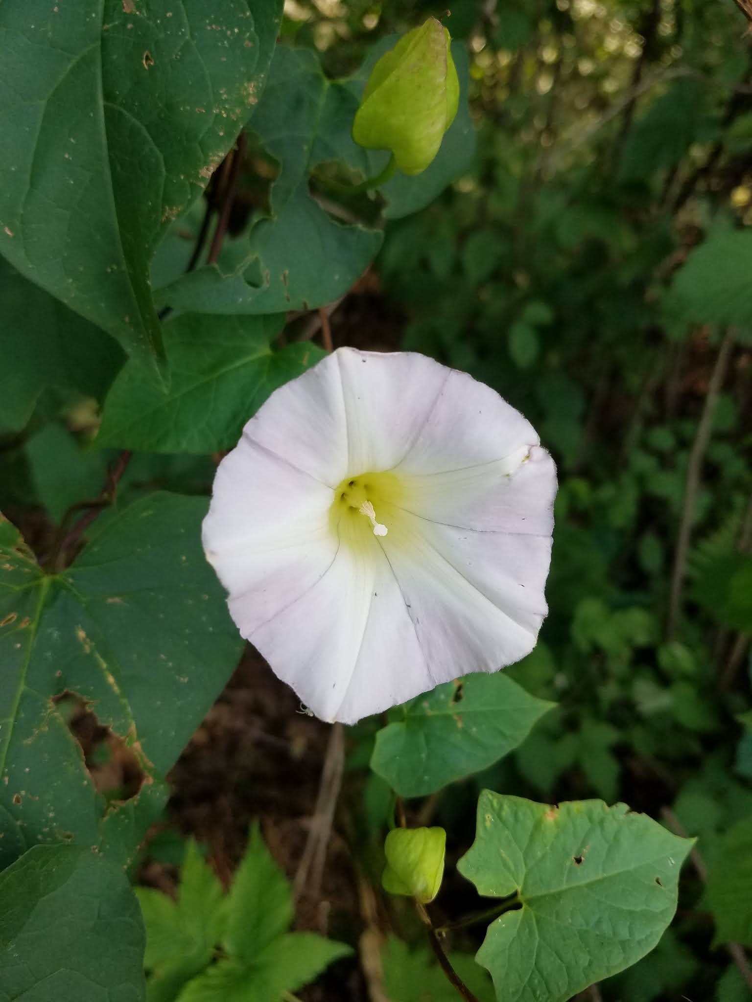 |
| Hedge False Bindweed |
We reached the car at 3:52 pm. It was still 86 degrees, and the real feel temperature was 91. That 1.7 miles of closed trail converted to 1.2 miles of road walking, effectively cutting the segment to 5.1 miles in length.
We drove back to the Iola Ski area to plan the rest of our day.
When we got there, we noticed a lone hiker just getting started on her walk. She seemed sluggish and a little tired, so we stopped her to make sure she was OK. She assured us she was fine, and we double and triple-checked, but off she went. I saw her post later on Facebook, so I know all turned out well.
Probably better than for Theresa.
Location 2: Connecting Route between the New Hope-Iola Ski Hill Segment to the north and State Hwy 161 to the South
3.7 miles of trail covered.
4 pm. Ninety degrees in the shade. 5.1 miles of hot, sticky hiking behind us. And we still haven't started doing any of the connecting route bicycling we came down here to do. Shoot, with all that trail hiking we could have hiked that section up north, except here we were able to break it up and get some air conditioning between stints. That really made all the difference.
But we had our bikes, and we wanted to be able to finish a map today. The most obvious was of course map 45, and if we just biked a little bit of the northern end of the connecting route, we could achieve that pretty easily. So we left one vehicle at the parking area and drove out a ways to start ticking off roadway.
Typically, I would track exact parking places, time and temperature, etc., but I lost track of all that. There was a reason. Coming down from the top of the hill on Wasrud Road, approaching CTH MM, the hill is very steep. We had to ride our brakes down the whole way for fear of losing control at the bottom. And I, at least, was successful. Theresa was not as fortunate.
Before I turned right on MM I had slowed to a near crawl, but still, when I turned, my front tire dug in deep in loose powdery sand, and I had some difficulty making the turn. It was like riding on the part of the beach that doesn't get wet. Theresa didn't slow down quite as much as I had, and if not for the deep sand would have made the corner easily. Nevertheless, five miles an hour was too fast, and the bike literally slid out from under her as she rounded the bend.
I was up the road quite a bit and heard her cry out. I saw that she was on the ground, and I figured our day was over. Bashed, battered, bloodied, bruised and very upset, I helped her assess her injuries. She had landed heavily on the roadway, but by fortune had landed in the deep sand, minimizing the damage. One forearm was scraped and bleeding, sand ground deep into the flesh. The elbow was bruised. Her shoulders were sore and covered in sand. Her knee was hurting, as was her hip. Her palm was scraped and bloody. But there was nothing broken, and she hadn't hit her head.
She did finish the rest of the short trip to the car, and we started the business of getting her cooled down, cleaned and bandaged. We travel with first aid kits in each car, and they both came in handy, as did the anti-coronavirus, antiseptic hand gel which we used to sterilize her arm after washing it down. Then we applied a large sterile pad and tape. Nothing else was bleeding.
We drove back to the place where the van was parked. Before we could even start talking about what came next, a spotted fawn came loping into a clearing about 20 feet from the car. It danced there for a while, and ate some grass, eventually darting into the woods in search of its mama, who was not very far away.
I'm not sure if this was a coincidence, an omen, or a supernatural sign from beyond the grave, but it was the tiny little nudge Theresa needed. She couldn't stay grumpy when there was a frolicking Bambi deer showing off for her.
I was shocked when Theresa told me she wanted to keep going.
"How far do we have to go to get off this @#%# map?"
"About two miles."
"How far is it to Hwy 161?"
"About 3 miles."
"OK - you go first."
So I rode from where we started down to Hwy 161, and Theresa rode it back the other way. I have no idea what time it was, but it was still over 80 degrees. We were not only merely done, we were really, most sincerely done for the day. We clicked our heals three times and headed for home.
As we passed the clearing where the spotted fawn had greeted us, a turkey was there to watch us as we passed.
Running Total: 552.6 miles of trail covered; 60.8 miles 'extra' hiking/biking. End of Day 77.
No comments:
Post a Comment