Day 80: Highland Lakes Segment (Part 3), Summit Moraine Segment (Part 1), Langlade County
Day 80: Friday, July 9th, 2021
Total Miles covered for the day: 7.1
Location 1: The Western Highland Lakes Segment between the Western Trailhead at Townline Lake Park and the corner of Lowells Road and Kleever Road to the east.
5.9 miles of trail covered.
Three days. Forty miles. Impossible? Well, yes, actually. But we wanted to do everything we could to whittle away at our 'Northern Gap'. At the start of the weekend we had only forty miles to hike to close the gap between maps 31 and 37. Forty miles that included the rest of the Highland Lakes Segment, the Summit Moraine Segment, the Lumbercamp Segment, and the Kettlebowl Segment. Seeing that we average between 4-8 miles per day on a hiking day, we weren't going to cover the whole thing, but we figured if we got out there early enough, we could really make a dent.
So the plan was to go out on Thursday night and secure a camping spot at Jack Lake Campground and hit it hard, attacking the longest and toughest part of the trail while our legs were good. That, of course, would have been the Kettlebowl Segment. But we missed out on getting the campsite, so instead we had to scramble around a bit and find alternate accommodations (we slept in the van). In order to make sure we got a campsite the next day, we needed to reduce our ambition a bit and target a shorter segment, because we had to spend the early part of the day hanging around at Jack Lake and making sure we got a campsite when someone left.
I am going to say all kinds of great things about Jack Lake. The sites are terrific. The place is immaculately cared for. The grounds are beautiful. The people are friendly. They have hot showers for only a buck. And the Ice Age Trail goes directly through camp. There's more to tell, but that will wind up in other posts.
So after we woke up and got breakfast, we headed into the office and after a bit of a scramble ended up in Site 47, which was literally less than 100 feet from the trail. We set up a tent and then went to hike what was supposed to be the 'easy' part of the gap, the Western Highland Lakes Segment, a mere 5.9 miles of trail that was mostly level and followed logging roads or gravel roads for the entire distance. Easy, right?
We started by dropping a car off at the corner of Lowells Road and Kleever Road, right in the bus turn-around (school is out for the summer), and then we drove north on Lowells Road all the way to the berm/gate, a distance of 1.7 miles on not-too-shabby gravel roads. We knew we were in for a buggy day, though, because there must have been 500 deer flies following our vehicle down that road, and by the time we parked it was a full-on swarm.
This, however, is what deet was invented for, and we applied it liberally to our exposed skin. Theresa also made excellent use of her hat scarf and made a passible mosquito net. It made the walk tolerable, if not pleasant, and we managed to make the trip in just 45 minutes. I've said it before - deer flies are a great motivator. It was only 67 degrees, and not quite noon.
 |
| Self Heal |
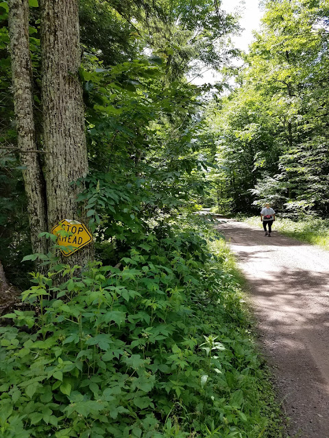
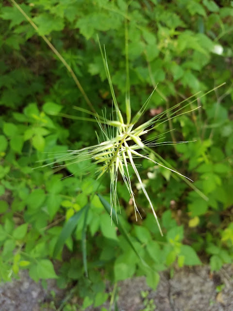
But the farther in we got, the less traffic the road received, and by the time we got a little over a mile in, we had to start darting left and right across the road, walking on the side that had less grass growing on it. From the looks of it, the trail got very little foot traffic and only the occasional ATV. The grass was winning. We were being introduced, blade by blade, frond by frond, root by tangled root to all kinds of Wisconsin Flora. This included a significant amount of plantain, ragweed, goldenrod, burdock, nettles and other assorted greenery. Colorful, if you think of green as a color, but a little hard to walk through.
Another observation is that there weren't enough blazes through here by far. There weren't too many places where one could get lost, but there were places where the trail split, or intersected with another trail, and there was one or two places where we had to go an uncomfortable distance before finding the next blaze.
At 2.5 miles in we finally found ourselves at the ford on West Branch Eau Claire River, at a place where the road became steep and quite rocky. I can tell you that even after a recent inch of rain, with a significant amount of water running down the river, it is still possible to hop-scotch across on the rocks if you're willing to go upstream or downstream a few feet to find the best crossing place. I went downstream about 40 feet, and Theresa just waded straight through. My feet were dry, and she had squishy-sock syndrome, so I liked my method better. Personal taste, I guess.
 |
| The Ford |
For the next mile we struggled through the long grass, following whatever looked like the path of least resistance. If it weren't for the level ground this could have been worse, but when every step is met with clutching resistance, that can wear you out a little. Oh - and the deer flies were back in numbers. Not huge - not hundreds - just many. A dozen or more at a time for each of us, no matter how many we managed to eradicate.
After a mile or so of this, the road did open back up again, and we were able to walk with relative ease the last 0.7 miles back to the car on roadway that had been recently graded to keep the grasses at bay. It was a relief when we finally got to the car at 4:55 pm. We had picked up only two or three ticks each, and we had just completed map 32. A celebration was in order.
Location 2: The last 0.2 miles of the Eastern Highland Lakes Segment from the Camp Susan driveway along County Road B, and the Summit Moraine Segment, for 0.2 miles along the ATV route to the point where it heads east into the woods.
0.2 miles of trail covered.
If you paid attention to all that 'Location 2' description, you'll realize that while I describe 0.4 miles of hiking, we're only claiming 0.2 miles of it because we had accidentally claimed the Eastern Highland Lakes half back on April 30th, unaware that the segment actually went a little further south along Cty Rd B. So now we had to make good on our claim. It wasn't a burden.
After reclaiming our vehicle up at Townline Lake, we parked one vehicle at the spot where the Summit Moraine segment cuts off the ATV trail and goes east. In that location it's possible to pull straight in off the road and plenty of room to stash a vehicle and have it out of the way. Then we took the other vehicle and parked it at the entrance to Camp Susan, where there is a nicely mowed place for a single vehicle. The Camp Susan location was our 'River' spot, where we had covered all the ground from there west to the River in St. Croix. That's starting to feel like a very long distance.
The first thing I noticed was that the trail doesn't actually go ON the road. As I looked over to the west I could just see yellow blazes poking out from behind all the ferns and grasses. The trail theoretically goes along atop a snowmobile trail on the side of the road for the first two tenths of a mile, but we were having none of that, and obviously neither was anyone else. There wasn't so much as a footprint through that chest-high grass, and we weren't going to be the first. We walked along the road.
 |
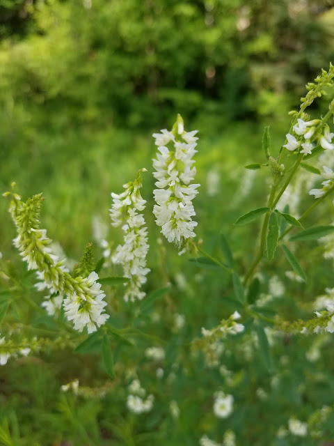
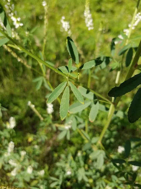
| White Sweet Clover by the Roadside |
When 0.2 miles of nothing but a few roadside flowers and a half-dozen cars had passed, the trail passes uneventfully from the west side of the road to the east side of the road, where we were theoretically supposed to follow a very stony ATV trail for the next two tenths of a mile.
Nah.
We walked the road the rest of that way, too.
We reached the car again at 6:00 pm, having truly completed the last of the Highland Lakes Segment and the first 0.2 miles of Summit Moraine, too. Not sure what the temperature was, but we had one more location in mind that we could chip off before we called it a day.
Location 3: The (mostly) road portion of the Summit Moraine Segment between fabulous Spychilla Lodge to the north and Campsite 47 in Veterans Memorial Park to the south.
1.0 miles of trail covered.
I mentioned earlier that we had managed to secure a campsite at Jack Lake. How cool is it that we had the opportunity to leave a vehicle out there on the trail, go back to camp, then walk out and pick up the car and bring it back to camp? Well that's just what we did, but we did it in two parts.
First, we dropped a car off at Spychilla Lodge, which I have to say is a genuine treasure along the trail. I'll be saying a lot more about that in tomorrow's post, so that's all I'll say about it for now. Then we drove back to the office area back at camp and walked the short piece of roadway, about eight tenths of a mile. Then we drove into camp, took a shower, had some dinner, and then took a leisurely stroll out of camp, 100 feet to the trail, then along the trail that wanders through the campground to the car up by the office. It wasn't quite a moonlight stroll, but it was about as late as we have ever been hiking.
The first six miles of hiking today was somewhat less than wonderful, but the last mile and a half was top-shelf. A successful day in the Northern Gap. Only 32.9 miles left to go.
Running Total: 575.1 miles of trail covered; 64.8 miles 'extra' hiking/biking. End of Day 80.


No comments:
Post a Comment