Day 87: Connecting Route (x2), Mecan River Segment (Part 3), Waushara County
Day 87: Wednesday, August 4th, 2021
Total Miles covered for the day: 7.8
Location 1: The northernmost 3.8 miles of the Western Bifurcation Connecting Route between the Adams/Waushara County Line and the parking area on Czech Road just east of County Road CH.
3.8 miles of trail covered.
Today we woke up in our tent a little drier than the day before. The fog was gone from the morning before, as was last night's rain, but that didn't mean everything was magically dry this morning. In fact, despite the rain it was already in the mid sixties and perversely humid. Today was going to be another day in the mid to high 80s, with humidity that simply refused to go away. Another breakfast of hot coffee and cold boiled eggs and we were on our way. Maybe the time was 10:00, or maybe it was a bit later. We were trying hard not to be in such a hurry on this trip. It was certainly making it all more enjoyable.
Our plan for the week had been to hike and bike our way through Wednesday, then go home for a real shower, a clothes washer, our ever-so-comfortable bed, and some snuggle time with our two cats, Skittles and Zuzu. So instead of heading south today to pick up from where we left off yesterday, we went north, planning to pick off the Mecan River Segment. But even as we sat and looked at our maps, it seemed there was always just one more thing to get done before we got to the part we really wanted to do.
As we stared at maps, we realized that if we were to cover just a few miles of the north end of the Western Bifurcation, we could officially complete the rest of map 53f-E (which we had already thought of as 'complete' prior to deciding we would do the Western Bifurcation). We would also make our way onto map 53f-W, and chip off that nagging little bit of dashed line on the lower left corner of map 52f. It wasn't too far, we reasoned, and it would accomplish a lot as far as maps go.
So we ended up parking a car at the parking area on Czech Ave near the intersection of CC and CH. By the way, don't try to use "Czech Ave" as a way to find anything in Waushara County. There are so many Czechs out there it looks like someone's toddler went nuts with a rubber stamp when the roads were being named.
The first two tenths of a mile we had already covered when we did the eastern bifurcation back in 2013, but back then the suggested route went south on CTH CH. That means to truly connect the dots we had to go an extra mile to 4th Avenue before the real western bifurcation started.
Our target vehicle had been dropped off down the road a bit, and we actually had some trouble finding a safe place to park. We ended up going all the way to the Adams County line at 1st Ave, but that was a fine place to end the first leg of the trip.
The biking was an easy up and down, and the 3.8 miles fell away quickly. I hardly remember it at all, except for seeing a farm vehicle out harvesting something or the other, making Wisconsin what it is.
So now we needed to decide what we wanted to do with the rest of our day. The plan was to go hike the Mecan River Segment. But it was very hot. And it was very humid. And hiking didn't sound like as much fun as it did three hours and 20 degrees ago. Plus, there was this ice cream shop...
As we rode, we saw signs for the Clauson Barn Theater. They had ice cream. They had shows on Wednesday afternoons, and - Hey! - It was Wednesday!
We thought long and hard about ditching all hiking for the rest of the afternoon and hanging around in air-conditioned comfort, listening to the sounds of Johnny Cash played by the Clauson Family and enjoying a leisurely family-style dinner. But in the end, Covid-19 was the straw that broke the camel's back, and we went hiking instead. We didn't even get any ice cream.
Location 2: The Connecting Route between the Mecan River Segment to the north and the Wedde Creek Segment to the south.
2.3 miles of trail covered

It was sometime just before noon, but before we could get to the hiking on the Mecan River, we needed to cover the bit of Connecting Route between the Mecan River and Wedde Creek. As I noted in a previous post, the parking at the north end of the Wedde Creek Segment is not for the faint of heart. Many people would consider that roadside 'not park-able', but having done so once, I figured we could do it again.
In hindsight, our logistics weren't all that brilliant. Theresa took her car to the Mecan River Segment parking area and started riding back to Wedde Creek. I drove my car back to Wedde Creek where I parked my van on the side of the road with the hope that I could get it back out again later, and rode north to the where Theresa had parked her car. After finishing my ride, I would load up my bike and go back to pick Theresa at Wedde Creek.
Which is basically what we did. And while there was one major flaw in our plan - it made no sense to end on the Wedde Creek end - there was also a major benefit. The benefit was that Theresa was alone and traveling at her own pace when she passed by the sign advertising the anchor store of the Town of Richmond Business Center - the R & R Candy Shoppe.
The R & R Candy Shoppe is where we got our treats for the day (cookies) and also samples of several other delicious goods, all made fresh and preservative-free by the Mennonite family that runs the Shoppe and other families in the Mennonite community. The cookies were good, but the granola was great. We ended up going back several times over the next several weeks, and every trip was well worth it.
Location 3: The portion of the Mecan River Segment between Chicago Road to the north and County Rd GG to the south
1.7 miles of trail covered
So having finished closing up the small gap along the roadway, we were finally able to get off the bikes and get on our feet. We had previously hiked two bits of the Mecan River Segment and thoroughly enjoyed both, although one was peppered with occasional poison ivy. We dropped one car off at the parking area on County Road GG, then drove up to the other parking area on 6th Lane, just south of Chicago Road.

We were a little puzzled as we drove 6th Lane, because there are one or two yellow blazes you can see from the road as you drive by, so we didn't know what to expect as far as the trail itself. That quickly resolved itself when we started walking, though, because shortly after passing the trailhead sign, the trail ran right up to and alongside the roadway for several hundred yards. You can see the road from the trail, but you can't see the trail from the road.
And, back on my feet, I found myself taking photos again of all the magnificent mushrooms.


I'm not sure what the first two are. Actually, there are a lot of mushrooms I'm not sure about, but there are a few I know. And some I think I know. Like the ones below. I think these are red chanterelles. But if they are, they are really small, and I didn't bother to photograph the bottoms, so don't take my word for it.

The mushroom below I absolutely DO recognize. It's the Death Cap mushroom, or Amanita phalloides. You won't die from touching it because the poison doesn't go through the skin, but you have to wash your hands thoroughly if you touch one. My advice - don't touch one.
 |
| Death Cap Mushroom |
On the other hand, the one below is the two-colored Bolete, or Baorangia bicolor. It is very edible, though the specimen below is far too large and over-mature to be delicious. They are much better when small, when the red cap is a distinct and bright red color, rather than the blotchy mess in the second picture.
And of course, I must caution anyone reading this that this is NOT a mushroom identification guide. I take no responsibility for anyone using my photos to identify a mushroom. There are poisonous lookalikes for the Two-Colored Bolete, so please educate yourself well on the process of identifying and safely testing wild mushrooms.


 |
| Very Over-Mature Chicken-of-the-Woods Mushroom |
We also enjoyed some late-season blackberries as we walked.

So enough already with the mushrooms. How was the trail? Despite all the recent rainfall, it was fantastic, tick-free, and along this segment, nearly poison-ivy free.
As with the lower sections of the Mecan River Segment, this one passes over sandy terrain, within a loose canopy of mostly oak forest leaning towards oak savannah most of the way. There are parts of the trail that are park-like, passing gracefully beneath trees with limbs that cross the air above you with an almost child-like whimsy.

And there are places that fairly beg for someone to lay down and take a nap, if not set up camp for the night.

And there are places that fairly beg for someone to lay down and take a nap, if not set up camp for the night.

The flowers are plentiful and blooming gloriously.


Though not every tree that grows here is your friend, as this black locust picture demonstrates.
 |
| Black Locust Tree |
 |
| Black Locust Tree |
At one point the trail takes a severe dip to the south, then back to the north, almost touching Cottonville Court. The reason for this is obvious if you look either at an elevation map or simply peer ten feet to the north, where you see the land plunging into a deep ravine. Even the enthusiastic IAT Trail-builders were wise enough to go around that hole in the earth.
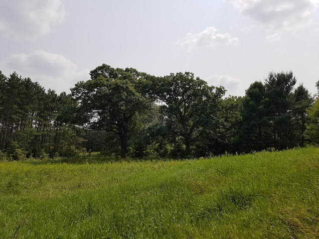
After another similar but less obvious loop north, south, north and south again, we came out into more grassy, open trail.

 |
| Yellow Bluestem? |

 |
| Bee Balm |
The final leg of the trail took us within sight of our car, waiting across the road, then inexplicably further east where we came out on GG, crossed it, then had to re-walk the short spur trail to get back to the car. Why? I have no idea. Certainly could have just walked right on up to the road about 50 feet away and straight to the car, which would have eliminated the need for a spur trail entirely. I'm guessing that the trail went through long before the parking area was realized. We wouldn't have been the first people to take the shortcut, based on the tracks, but we resisted the urge. We needed to tough the sign, after all.
So did we pack up our poles and go hike the last piece of the Mecan River to the north? We did not. It was 3:17 pm, it was insanely hot and humid, and we had over an hour of driving to do before having to do several loads of laundry and make dinner. Besides that, we knew there was going to be severe weather later that night, and we wanted to be home before it hit.
That worked today. We would not be so lucky later in the week.
Running Total: 627 miles of trail covered; 68 miles 'extra' hiking/biking. End of Day 87.
No comments:
Post a Comment