Day 132: Tisch Mills Segment, Kewaunee and Manitowoc Counties
Day 132: Saturday, January 29th, 2022
Total Miles covered for the day: 2.6
Location: The Tisch Mills Segment
2.6 miles of trail covered
On one of the Ice Age Trail Facebook... er... Meta pages, someone posted a list of the Ice Age Trail Segments best hiked in the winter time. The primary reason was water.
Water graces the trail frequently, or plagues it depending on whether your walking past a kettle lake, along a stream or through a bog, marsh or swamp. The Tisch Mills Segment has the stream, often pleasant, but also has a bit of bog. That would be bad enough in the summer, but it also has a bit of a mold problem, so we definitely agree with the 'do it in winter' designation.
We drove out here this weekend for two reasons. We wanted to hike Tisch Mills, but we also want to drop by a special event on Sunday. Tomorrow, Laura Hinesh will be finishing her SECOND complete round of the Ice Age Trail. What an achievement! We plan to be there to help her celebrate.
So today, our only goal was to finish Tisch Mills, and in that we were successful. The parking is terrible on the trailhead ends, so we came in one vehicle, planning to crisscross hike our way from end to middle. For the first leg, I dropped Theresa off on Nuclear Road at the north trailhead at exactly 2:00 and she started hiking south.
The temperature was a perfectly balmy 22 degrees when she started.


The leg north of town is a little over a mile long and runs alongside the East Twin River.
The river was thoroughly frozen today. This fact did not go unnoticed by a recent cross-country skier.

The walking is level, and there is a single bench along the way on which to sit and enjoy the view.


Near the very end, the trail spilled out onto a shared snowmobile trail, making for easy walking to the end. This part of the segment was very pleasant in January. Heavy snow would have made it a lot more challenging, but we were here after many footfalls before us.
I reached the end just as Theresa was arriving with the van, and we drove to the other end to set up our next leg.
As we drove into town to scope out the parking, we ran across two hikers. Welcome to the Snails, Thimms family!

For our second leg, Theresa dropped me off at the west trailhead on County Road B and I walked east, while she drove into town and parked at the Post Office. While she walked the roadway I headed across the field. We were planning to meet at the river ford.
The walk across the field, a little over a tenth of a mile, wasn't very pleasant. Drifting snow across the field made for challenging footing as I alternately broke through the crust or smooshed deep into the grainy, dry snow. I was happy when that portion was over. Theresa agreed with me that it was a terrible way to finish her walk on that leg.

Here in the pines and cedars, there was evidence that the woodpeckers were still very busy. They tend to select one tree and cut many holes, often in vertical lines, coming back season after season. These holes were the size of tennis balls.


However, as can be seen in video below, it wasn't totally frozen.
The same characteristics that make for this to be an excellent place to cross in the summer - shallow and narrow - make for it to be a little hazardous in the winter. The river, frozen almost everywhere else, is forced into a smaller space here. The water that runs lazily under thick ice in other parts of the river runs swift in this narrows, keeping the water open year-round. We crossed easily in places that remained frozen, but hikers are well-advised to use sounding sticks to check the soundness of the ice before they cross.
I checked out the Distributed Camping Area while I was waiting for Theresa. It seemed like a nice spot to camp, and I left behind a SnOTT patch for the next lucky hiker who happens by and opens the trail log.
When Theresa came, we spent a minute chatting, but wanted to keep moving. We were both starting to feel overheated, dressed as we were for the much colder temperatures we had encountered the last couple weeks. She went west and I continued east.
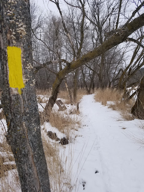
Across the river I was in higher ground, and the trees were thicker and more mixed hardwood than cedar. The whole trail was well maintained and had plenty of blazes, so I didn't have to think very hard as I walked. I came upon the stone memorial from the backside identifying this as the Weber Memorial Natural Area just before reaching the road.


I got to the car and drove out to pick Theresa up. She had just finished a minute or two earlier and was walking down the road.
We had about two tenths of a mile to finish, between the end of Mill Road and the post office. We did one more crisscross to complete the day.
I saw this sign that was worth a mention. I felt very elcome.

I finished at 4:47 pm, and Theresa picked me up a minute later.

Running Total: 890.3 miles of trail covered, 145.7 miles 'extra' hiking/biking. End of Day 132.
No comments:
Post a Comment