Friday, January 21, 2022

Day 129: Devil's Lake Segment (Part 3), Connecting Route, Sauk County

Day 129: Friday, January 21st, 2022

Total Miles covered for the day: 4.9

Location 1: The northern leg of the Devil's Lake Segment, between the northern (western?) trailhead and the parking area on Park Road just where the staircase heads up the west bluff
3.2 miles of trail covered plus 1.2 miles extra hiking

Map 61 has been one of those we have stared at many times. 

'When are we going to hike Devil's Lake?' has always been an issue. There are several problems with Devil's Lake. The hills. The humans. The bugs. The rattlesnakes. The hills. The rattlesnakes. 

There have been many times we have scheduled a trip there to 'Just do it', only to have that trip redirected, or canceled. And then last year, we managed to get one of those 'Just do it' trips accomplished. On a dreamy weekend in November, with unseasonably warm weather, we came down and hiked the Sauk Point segment, and then the infamous East Bluff, with its imposing rock wall staircase. But then came the snow and ice, and that added one problem too many. 

We wanted to hike it in the cold season. We needed to hike it in the cold season, for all the reasons above. Cold weather makes it easier for us to do the hills. It keeps (some of) the humans away. There are no bugs. The rattlesnakes are dormant. (Oh yes, dear child, there are rattlesnakes in the Baraboo bluffs.) But there are precious few days when it's cold in Devil's lake and there is no ice. 

And then came the Microspikes. 

It seems every post I make about hiking in wintertime makes mention of how indispensable these are as an addition to our winter hiking equipment list. With them, we can walk on ice as safely as on the warm, soft ground, and even more so, since its impossible to slip while we're wearing them. Last weekend we used them to walk up and over the ice-covered rocks and stone staircases at Gibraltar Rock in complete safety, comfort and ease, and suddenly the ice was no longer a factor. Suddenly, the heart of winter was the perfect time to hike at Devil's Lake. This was our weekend for finally getting map 61 behind us. 

We drove down last night to stay at a delightful motel in Baraboo called the Willowood Inn. The rooms are small, but the family that owns it tries hard to decorate it nicely and keep it clean. Our room had a nautical theme, centered around lighthouses, and it was a pleasant stay all around, given that we were in the off-season. The rates were decent, too, which was good because in the end I needed to do some of my own shoveling, but that's another story. 

When we woke up, it was cold out. Five below zero. That's minus 20 degrees Centigrade if you're metrically inclined. Cold weather is one thing, but that's getting really cold. Fortunately, we also invested in a few of those hand and foot warmers. Also, it was a bright, sunny day, and that would make it feel warmer. Psychologically, anyway. 

The Willowood Inn is only a short distance from the Ice Age Trail. Like, literally 1.5 miles from the place in the park where you pay for your park stickers. So it was a pretty short drive getting our vehicles in position for the first leg. Being that it was a new year, both of us needed park stickers on our vehicles, so we both had to drive down to the park office. 

This took us a little out of position, because Park Road is one-way. We were in the middle of our intended hiking zone, so we ended up dropping one vehicle off at the parking area right near the headquarters and then driving the full loop and starting our first leg at the parking area on Park Road where the trail starts up the west bluff. 


It was still cold. The temperature had clawed its way up to 5 degrees above zero by that point, but a brisk wind that cut through at least five of my seven layers of clothing. It was 11:19 am. We touched the sign, and walked, downhill, the three tenths of a mile to our waiting car. This seems like a ridiculous distance to hike, but the inconvenient one-way road made this actually a logical approach. Also, the bathrooms are open at the headquarters, and you know how it is when you're walking in wintertime - it doesn't take long on that first hike before a restroom is a welcome sight. 

After walking down to the parking lot, I hoofed it back up the road to the waiting car. As it turns out, the walk up the road was four tenths of a mile. I should have just gone back up the trail - it would have been faster. 

Our second leg was a lot longer. Because the road up to the campgrounds was gated and unplowed, we had no choice but to hike a longer section than we had originally planned, doubling over some ground that we biked last year. We eventually would have come back to walk it anyway, in order to get the thousand-miler patch, but we hadn't planned on doing it today. 

So we left one vehicle in place, and drove up to the spot where the trail crosses County Road DL, basically at the top of the hill. This made for a 2.6 mile walk back to the van. Parking was not good at this intersection in wintertime, and we managed to get our vehicle only about a foot off the edge of the road. 


The trail was trampled, which was great. We touched the sign at 12:08 pm, and we were on our way. 


There is a bench at the top of the first small incline, but it is listing severely backwards and could use replanting. This was the first of perhaps 10 benches we passed on this leg, which is also great. I have always said the trail could use a few more benches. 


It was a magnificent, bright, sunny day for hiking. 


I was appreciative of all the hard work someone had put in keeping the brush at bay. Two or three years of no maintenance, and this would turn into a no-man's land. 


About halfway along we hit the T intersection where a little more grooming had taken place. To the south the trail led off to the big parking area on DL, where the vault toilets remain open. We stuck to the trail and kept going. 

Absolutely everywhere was the evidence of a healthy population of squirrels and rabbits. Made me wonder where all the foxes, coyotes and hawks were. In addition, I saw plenty of tracks for deer, and even some for turkeys. They were a source of entertainment as we trundled along. 


By the time we got into the area north of the Ice Age Campground, we saw signs telling us we were walking on the Johnson Moraine. I'm not sure who this fellow 'Johnson' was. It made me think I'd like to have a land feature named after me someday. It wouldn't have to be a whole moraine. It could just be a pile of boulders. They could put up a sign. Brock's Rocks. 

On second thought, scratch that idea. I changed my mind. 

Blazes were plentiful until we reached the camp road, then it was hit or miss, with a lot more misses than hits. If I hadn't been sure of the way, we could easily have gone wrong. There was one long walk down the hill on a road with no blazes in either direction for four tenths of a mile, and they were a little spotty for the quarter mile before that stretch and the next two tenths of a mile afterwards. In fact, I highly recommend zooming in to that section on the Hiker Resource map and bringing a screenshot with you as you hike, or you're likely to make wrong turns. 

After going under DL through the tunnel bridge, and heading down the road, the trail takes a severe turn to the left, going back up the hill in a way not accurately reflected on the Resource Map. 

Hiking under County Road DL

We passed what looked like a chapel in the hills, but may have just been a place to give presentations. We could hear the train whistle screaming below, and a hawk screaming above as we walked. 


One more left turn down the road, and we had the parking area in sight. Once past the turnoff where Park Road exits the park, we had connected the two halves of the bifurcation and brought the trail back down to a single line. 


The bathrooms at the headquarters are heated, and open through the winter. That is useful knowledge for those hiking in the cold weather. Also, interestingly enough, the last little bit of trail through the woods at the top of the hill was tagged as biking OK, so keep your eyes open for Mountain Bikes while you're there. 

Our next leg was to cover the rest of the segment to the east until we reached the Sauk Point Segment. We left our car parked at the DL crossing and parked our launch vehicle at the parking area on State Road 113. After touching the sign to reconnect to the St Croix River, we headed once more into the woods hiking west. 

2:52, and the sun already looked this low in the sky. 


After a brief walk on what is exclusively IAT, we connected with the Uplands Trail, where we were once again surprised to see that mountain biking was allowed. The Upland trail, headed southwest, is a pretty decent shortcut to the top of the East Bluff. Going the other way, it heads modestly downhill and through a gentle woodland. We were almost completely out of the wind, which was really nice. 

A sign told (warned?) us that we were entering a piece of trail with four bridges. I don't know what made this sign-worthy. It certainly is nothing new for Ice Age Trail hikers. Maybe it's there for the bicycles. And, true to life, we did in fact encounter four bridges as we made our way along. 


There were also one or two benches along the way that we took advantage of. At the last bench, which was a mere tenth of a mile from the car, Theresa noticed that I was edgy, and anxious to get finished. She saw me looking at something off in the woods. 

"What is that?" she asked. 

"Looks like a wasp's nest."

"Why don't you go take a better look at it?"

I wasn't fooled. I knew she wanted to give me something to do so she could sit for a few more minutes and rest. I didn't mind. I wanted to take a closer look anyway. 


They are amazing creatures, the wasps. In fact, the various members of the bee, wasp, yellowjacket and hornet family are quite amazing to me. Most are communal, and even specialized, where an entire colony works together with the common goal of survival. They communicate with each other, and build elaborate structures, sometimes below ground and sometimes above. 

This ruined nest, as it turned out, was almost certainly the work of the bald-faced hornet, a black-and-white hornet that's a little on the large side. Like most Hymenoptera the bald-faced hornet is beneficial, feeding on other pest insects like flies and mosquitoes, but they can become quite aggressive if they feel like you're intruding their space. 

If you see a large, gray-white-brown nest, about the size of a football or basketball, with a single large opening at the bottom, you're looking at the home of a hive of bald-faced hornets. Best advice - look from a distance. As people, we like the bald-faced hornet. We just like it from a long way off. 

This nest looked like it had been destroyed by someone with a stick. It made no difference. The only members of the colony that survive the winter are the pregnant females. They overwinter in stumps, or other protected spots, leaving nests abandoned. All the rest of the colony will die, including the old queens. In the spring, the pregnant females emerge and build new nests, laying a single egg in each chamber. In this way, wasps have been surviving harsh winters for millions of years. 

At this point we had walked 4.0 miles of trail, with an extra 0.4 miles of hiking to get back to the car at the beginning. But we had already counted 0.8 of those miles earlier when we were biking through, so bottom line, we could only count this as 3.2 miles of new trail covered, with 1.2 miles of 'Extra', of which .8 miles was now extra biking. It's all very confusing, even to me. 

When we got back to the car it was about 3:45. Time for one more short hike.
 

Location 2: The southern tail of the Devil's Lake Segment between the South Lake Road parking area and the southern (eastern?) trailhead
1.2 miles of trail covered

The second location we picked was the extreme opposite end of the Devil's Lake Segment, between the trailhead and where we left off with the East Bluff on South Lake Road. It was a 1.2 mile hike through the marsh. By 4:20, we were in position. 

The walking was easy across restored prairie. We had the trail to ourselves, though it was apparent that many people had been there before us. Even though the sun wouldn't officially 'set' for another forty-five minutes or so, it was already behind the bluffs, so we were walking in deep shadow with the wind in our faces. The temperature had started falling again.  


One highlight was a really excellent interpretive sign that gave an great description of the terminal moraine, clearly visible to the west. The sign described how the moraine got there, forming Devil's Lake. Pictures showed that the place we were standing was the last outlying tongue of the glacier, and the moraine to the west was the dropping-off point for all the boulders, dirt and debris at the leading edge. The moraine from this angle looks almost artificial, so straight and level as it spans between the two older, larger, and more jagged bluffs. 


We had been so worried about getting caught out in the dark that we both were hiking quickly, without breaks. We were shocked at our own speed when we reached the other end at 4:55 pm. We had hiked the 1.2 miles in a little over 35 minutes, a pace in excess of two miles an hour. Laugh if you want; for a Snail, that's really moving. 

The sun was long out of sight, but there was still enough light left in the sky to see with. It was now 10 degrees, and according to our phones we had reached a high of 14 degrees at some point today. 


It was a terrific way to end the day. Tomorrow we had a lot of ground to cover. We headed into town and found Candy's Cafe open. We had a belly-busting fish fry that was as good as I had anywhere, ever. 

It should have ended there. It didn't.

Location 3: The connecting route south of the Merrimac Segment between the water's edge and the railroad tracks
0.5 miles of trail covered

So now we were all the way down at the Ferry and we had 1.5 miles of connecting route between us and the south end of the Merrimac Segment. The temperature had dropped down to about 5 degrees, but it seemed like a reasonable distance. We had certainly covered more in the past. 

We dropped a car at the Ferry and drove our launch vehicle just north of the railroad bridge to get started. It was 7 pm. 


It was full-on dark out, but there was a little ambient light from the nearby street lamps. We had head lamps on, but only used them as needed. 

The walk was, at best, bitter cold. Dinner had made us more susceptible to the wind, not less, and by the time we reached the ferry were were done, done, done. And yes, we did walk all the way down to the water's edge before turning back and walking up the road to the waiting car. The extra 200 feet felt like a burden.

The day ended at 7:25 pm, temperature 4 degrees. The rest of the connecting route would have to wait for another day. 


Running Total: 880.7 miles of trail covered, 145.7 miles 'extra' hiking/biking. End of Day 129.
 

Monday, January 17, 2022

Day 128: Connecting Route (x2), Columbia County

Day 128: Monday, January 17th, 2022

Total Miles covered for the day: 4.6

Location 1: The connecting route between the Gibraltar Rock Segment on the north and the Fern Glen Segment on the south 
2.2 miles of trail covered

Today was Monday, but it was a holiday Monday from work, so we got the bonus day added to our hiking window. 

We woke up a lot earlier this morning at the Airbnb because we didn't stay up last night until 2 am putting a jigsaw puzzle together. We always bring a percolator coffee pot with us hiking, because it's an easy way to make hot water for dehydrated foods, or coffee for the morning. This morning we had both, using the hot water to make hot cereal out of Theresa's special homemade granola with some powdered milk.  

After that, we broke 'camp' and headed back up to Columbia county to march off a few miles of roadway. The goal was to get from the end of the Gibraltar Rock Segment all the way down to the City of Lodi Segment. This was only 4.6 miles of roadway, so it was very doable.

The first leg was the Connecting Route from Fern Glen to Gibraltar Rock. We left the target vehicle at the Gibraltar end, and once again had a tough time making it up the ice-covered driveway to the parking area. Then we drove down to the start of the Fern Glen Segment, where there was another large, easy parking area to use that had been plowed. 

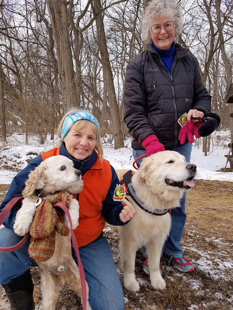
We hiked the Fern Glen segment back in September last year, and it was a charming little segment, even though there was quite a bit of poison ivy around. Before we started hiking, two dog walkers arrived, and we had a long chat with them Naturally, we made Deb Woodworth and Linda Jacobson new honorary Snails. 


It was 11:32 am, and it was the kind of a day that you could tell really wanted to become bright and sunny, but wasn't quite there yet. The temperature was 25 degrees, but you can tell from the pictures that there was some cold wind to deal with. Even so, we were eager to get started.  


The Connecting Route here runs along County Road J, It's a surprisingly busy road, even on a Monday late morning. There was a bunch of activity going on with earth moving equipment, and people working on telephone poles, but we never figured out what they were up to. 


Coming from this direction, it was interesting to be able to see Gibraltar Rock from a distance, and slowly hike up to it. This was the view I had been hoping for yesterday but never got. From over a mile away the rock face was impressive. 

We actually spent quite a while standing and staring at the cliff. As we stood there, we could see someone else at the top of the cliff, looking down. We wondered if they could see us, too. 

I'm sad to say I lost quite a few photos from that day. I don't know what my phone does to all the pictures I take. I know my memory of that view of the bluff will fade with time, too, so the best I can do is say that I found it incredible that we had hiked up there just the day before, and that I know I may never go again. It was worth the journey.

As we were leaving J and turning onto V, we saw a merlin hanging around in a farm yard. I think. It's a common bird to see in Wisconsin, but you have to know what you're looking for, because they seldom sit vey long and let you see them up close. They are a small hawk-shaped bird, and they have a blue-gray coat with a striped tail and a striped white underbelly. Usually when I see them I identify them mostly by what they are not. Too small for a red-tail hawk, too large for a kestrel, and shaped like a raptor. Conclusion: Merlin. To be honest, it could have been a sharp-shinned hawk. I didn't get that good a look at it. 

From there, it was just a hop, skip and a jump to the waiting van, hanging around in that icy parking lot. I managed to walk up the hill and get out of the driveway without falling down or sliding into the street. The night before, Theresa wasn't that lucky. She didn't fall, but when she went down that hill in the car, she slid headlong right out onto the road. Good thing there wasn't another car coming. 

We ended this leg at 12:52 pm, and the sun had broken free from the clouds. It was turning into a glorious day for hiking. 


Location 2: The connecting route between the Fern Glen segment on the north and the City of Lodi Segment on the south 
2.4 miles of trail covered

Because we had already hiked the Fern Glen Segment, we picked up on the other side at the end of Bilkey Road. We actually did this as a crisscross hike, because we were concerned there wouldn't be any reasonable parking near Fern Glen. There certainly wasn't much parking in the fall, and with al the snow we felt certain we would have a problem. 

But we were surprised when we got there. Not only was there enough room for one vehicle, it would have been possible to park two cars there. Unfortunately, we had already dropped one car off down the road a piece, and we didn't know there was available parking until Theresa was dropping me off for my part of the walk. 


As I started the hike, I was initially concerned about the wind and the cold. You can see from my picture I was well-layered. But as I started walking down Bilkey Road, alongside the enormous cottonwood trees, and in the company of a red-tailed hawk, I could tell that the sunshine and diminished wind had combined to make it a much more comfortable walk. 

First, the mask came off. Then the neck gator. Then the coat got unzipped, and the next layer opened up a bit. Eventually, I would end up taking off the gloves, because my hands were sweating. I had definitely overdressed. 

Around the corner, I spotted Theresa off in the distance along County Road J. She's that tiny, little black spot on the right side of the road. 


Really! It's her! I swear it is! Same photo as above, zoomed in a little bit. 


By the time we crossed paths, she had taken her outer jacket off. 

I got to the car and then drove back to pick her up at the Fern Glen end where she had dropped me off about 40 minutes earlier.


Hey, good lookin'! Going my way?

We had only about a mile left to go, from the City of Lodi Segment to the car at the north end of Development Drive. 

We snapped this pic at the end, which was where the Connecting Route intersects with the City of Lodi Segment. 


We took this photo at 2:36 pm, and it was the last one I took today. We actually walked from here to the van and finished up about a half hour later. It's amazing what flat roads and a little cold weather can do for your hiking speed. 

This marked a minor achievement for us, having completed map 62. This also meant we had finished all of Columbia County, so that was another one we could check off the to-do list. 

We definitely could have done more, but we decided to call it a day. We wanted to get back home as close to dark as we could manage. So - we picked up soup at Culvers and ate our sandwiches, driving home and getting there by a little past 6 o'clock. 

I wish I could say the story ended there. Unfortunately, when I unpacked the cars and dumped all the gear into the living room, I couldn't find my computer. My work computer. The computer I needed to use the next morning at 7:00 am. 

I called the Airbnb, the only place where it could have been, and got no answer. I got a text back from the hosts a little later, saying that they were not home, but would be getting home a little past eight, and they could look for it then. 

There was no way I could wait until 8:00 to have them tell me what I already knew. I had left my computer bag an hour and fifty-two minutes south in DeForest. Resigned to the long, lonely drive, I was relieved when Theresa told me she would come with me. 

She took the first leg, the drive down. I did my best to 'rest' as we drove, but with little success. Just before we arrived, I texted again because I hadn't heard from them. I got a text back, saying that they had looked, and the bag wasn't there. 

Wasn't. There. 

We were 15 minutes away. 

"Drive there anyway", I told Theresa. "It has to be there." 

Of course, this is when your mind starts racing, and you start thinking about all the conceivable places it could be if it really wasn't there. Inside the suitcase? Under a car seat?

Long story short, when I arrived it took me less than two minutes to locate the black bag with the computer in it, underneath a pillow on a futon in the corner.

The drive home was uneventful, and even though I was the one behind the wheel, it was the first time I felt relaxed in over three hours. We were home by 11 pm. 

From now on, the computer bag is the first thing I look for when packing the car up after a hiking trip.


Running Total: 875.8 miles of trail covered, 144.5 miles 'extra' hiking/biking. End of Day 128.
 

Sunday, January 16, 2022

Day 127: Gibraltar Rock Segment (Part 2), Columbia County

Day 127: Sunday, January 16th, 2022

Total Miles covered for the day: 3.5

Location 1: The Gibraltar Rock Segment, between the crossing on State Road 113 and the Slack Road parking area
1.7 miles of trail covered

Theresa and I stayed up way too late last night doing a jigsaw puzzle. Too late, as in, 2 AM too late. Not sure what we were thinking. That translated into a very late start for us today. For a miracle, Theresa didn't have a headache.

As I mentioned in yesterday's post, our main reason for coming down here this weekend was to hike the section of trail through the Steenbock Preserve before they cut down a whole bunch more of the beautiful red cedar trees. 


I have a degree in Forestry. I understand the concept of 'conservation' and why it's different than 'preservation'. And I know why it's necessary to cull some trees in favor of others. But the decision on what to cut must always be made with the health of the forest in mind. 

I understand the role that Tree Stand Improvement plays in the health and well-being of the forests. I have practiced that art in several small stands of woodland. I can say with some authority that cutting down large, healthy trees that are providing critical wildlife habitat for the exclusive purpose of making it possible to see the hills beyond where you are standing has nothing whatsoever to do with conservation or preservation. 

These trees, identified as the 'Cedar Curtain', have been marked for death. The worst part of this whole offensive activity is that there is no effort given to using the trees in any way, not even for lumber. They will be killed and burned for the sole purpose of providing a better view of the faraway hillside, despite the fact that they are thriving here because it is the exact spot that nature has given them to exist. 

Why do these trees grow here when they don't grow elsewhere? Is it the soil? The rocks? The amount of rainfall? The elevation?  What makes this a place where they grow, and all the other trees do not? And what makes these trees more worthy of being cut down and burned than the uncountable millions of other trees we walk past on the Ice Age Trail? We stand back and marvel at the 300-year-old oak trees, and sigh with contentment as we pass through white cedar and hemlock groves, thinking how beautiful those places are. Are we so hateful of the prickly branches of these red cedars that we forget the role they play in providing food and habitat for squirrels, birds, porcupines and the like? I am saddened by their impending doom. Those trees don't know that they have struggled through their last winter, and are seeing their last days of sunshine. I'm saddened by thinking we have brought the woodsman's axe to this beautiful place for no better reason than arrogance and avarice. 

Time to hike.

After leaving a vehicle near the Hwy 113 intersection we drove back up to the Slack Road parking area and started our hike on the Steenbock Preserve hump of the Gibraltar Rock Segment at about 12:15 pm. 


We started out by traipsing west and working our way downhill into a long ravine, eventually crossing a creek.  We also crossed paths with a new Snail by the name of Heidi Freymiller and her dog Petey. 


But then, what goes down must inevitably go up, or such is the rule of the Ice Age Trail. After crossing the small, unnamed and frozen intermittent creek we started a long uphill climb that took us from 930 feet in elevation to 1080. I can tell, from my own perspective, that a 150 foot climb doesn't seem as difficult as it once did. Based only on the fact that we didn't stop along the way, I think they are getting a little easier for Theresa, as well. Under cold-weather conditions, anyway. There were a couple nice switchbacks to help with the climb, and it was nice to see how well they were done. 


Once again I have to say how incredibly important it was that we were wearing our Microspikes. Without them, we wouldn't be able to make it up and down the ice-covered hills, let alone safely. But wearing these babies make me feel like a cat on Velcro. I couldn't slip if I wanted to. 


After crossing the first hilltop, and on the way to the second one, we walked through a stand of mature white pines, though not of the ancient monolith variety. There is a nice bench up there, and a small lean-to structure to play in. These are teepee creations using the sticks and debris that can be found in almost any public park. They are the archeological remnants of the playful, be it children or adults, as they serve no purpose other than to spark the imagination of those who would climb inside their hastily-made boundaries. 

Some, like this one, have been fortified and rebuilt over time, strengthening the illusion of walls and enhancing the allure of the entrance. "Come play inside", it says to the children who pass by. Evidence in the snow shows that many such children have passed here recently, and their patient parents sit on the convenient nearby bench while the children burn off their relentless energy. 

They are worthless, or course, from a survival perspective, except maybe as a source of raw material for building a functional lean-to shelter. And though I have not yet succumbed  to the invitation, I think, as I write this, that the next chance I get, I will crawl inside one of these structures and let my own mind wander. Or maybe I'll take some time and build something more elaborate. Goodness knows there is plenty of raw material laying around on the trail. 


It is at the top of this second hill, the one where there is an IAT Logbook and another fantastic bench to rest upon, that the sacrilege of cutting and burning is taking place. I can appreciate the view they are creating. As one gazes across the open field created in part by tree removal, one can see a magnificent vista of the Baraboo Bluffs across Lake Wisconsin. But this view is coming at the sacrifice of trees that are truly just a part of the landscape I was there to appreciate. 

Need a better view? Build a tower. 

I spent quite a while wandering around among the red cedars and enjoying their company. Interestingly enough, they aren't a cedar tree at all. They are in fact a juniper tree, juniperus virginiana, which explains the prickly nature of their branches and greenery. The mature trees all grow with a tortured and shriveled look to their trunks, like desiccated fibrous muscles without a surrounding sheath of skin. Popping out of the folds come the branches, often dead at human height, sticking out like porcupine quills, creating a barrier to large animals and a haven for smaller ones. 


The winter color of the foliage is unique, with the green flavored by a reddish-purplish hue. Once you know what you're looking for, you can spot a red cedar from a quarter mile away.

Image downloaded from the Internet

Their thick foliage plays host to many species of animals and birds, and the abundant berries are happily devoured by many others. Quails, bobwhites, ruffed grouse, pheasants, and turkeys are often found roosting in their branches. Certain species of butterflies are particularly attracted to them. The silvery bark peels off easily (if you can get to it) making it an ideal source of nesting material for birds and squirrels. In the fall you can find Robins, Juncos, Cedar Waxwings, Mockingbirds, and over 50 other species of songbirds munching on the berries right along with rabbits, foxes, raccoons, skunks, opossums, coyotes, deer and others. The berries, by the way, grow only on the female trees. The Eastern Red Cedar is one of many species of tree that is 'gendered', or dioecious. Only the females produce fruit. 

Internet Image


The greatest mystery, perhaps, is how they came to be called a 'cedar' at all. They look nothing at all like our soft, friendly white cedar, or arborvitae tree, know by the Latin name of thuja occidentalis. (I could spend more time discussing how weird it is that thuja occidentalis came to be called the 'Eastern White Cedar', but that's going too far afield.) 

There are negatives, of course. One is that the red cedar is simply too good at propagating itself. I could dedicate a similar post to the benefits and drawbacks of blackberry and raspberry thickets, and anyone who has ever tried to eradicate a patch of berry bushes is aware that they are a persistent species. Eastern Red Cedar is similarly difficult to get rid of if it is growing somewhere you don't want it to be. It is considered an 'invasive species' in many areas, because it is so good at taking over abandoned fields. 

It is this fact that brought me peace as I wandered through the open field. I saw, among the burned stumps and branches, hundreds - nay thousands - of small red cedar trees popping up through the grasses. When the IAT grows weary of cutting them down, year after year, and burning their branches, I know the cedar curtain will return to this hillside. They, alone among all tree species, are the trees that are meant to grow in this spot. 

Satisfied with our red cedar experience, we proceeded down the trail to work on our other objective, completing the Ice Age Trail (someday). 

The trail was unsurprisingly a little busy today, and there were a number of small groups making their way along in twos and fours. Several passed by as we dallied at the hilltop, and we crossed paths with one or two more as we walked down from the top of the hill. 

I took a side-trip over to see the distributed camping area, and it seemed nice enough. It was a little too sloped for my taste. Nothing flat on which to set up a tent. There is a water jug sitting there for some reason I can't think of, since it is not close to any source of water, and really - would you drink water from a jug that had been sitting in the woods for some unknown period of time? 


Catching up to Theresa, I found her sitting on a bench, situated on a little knoll in the shelter of a large Eastern Red Cedar tree. 


And there we sat and waited for a group of hikers to catch up to us. This is unusual, as we normally don't have to wait for anyone to 'catch up to us', but this group in particular was doing more exploring than hiking, with grandpa showing the grandkids all the interesting tracks in the snow, so they were slower than most. 

When the kids caught up to us, we showed them our 'Snail tracks', and awarded them with SnOTT patches. 


By now a light snow was falling, gently blown by the breeze that caught the tops of the hills but failed to penetrate the valleys. We took a final, long walk downhill to the waiting car, with the river in view much of the way. 

This leg of our journey ended at about 2:45 pm. It was a gray, chilly day (21 degrees) but the woods felt welcoming and friendly. 


Location 2: The Gibraltar Rock Segment, between the Gibraltar Road parking area and the south/west Trailhead on CTH V. 
1.8 miles of trail covered

Getting from leg one to leg two involved picking up the launch vehicle, finding a public restroom (which wasn't as easy as you might think, as there is NOTHING close-by), and repositioning both vehicles. Bottom line, we weren't ready for walking again until 3:51 pm. 

We decided the best approach would be to hike south to north, or maybe west to north, from the end of the segment to the Gibraltar Road parking area. The parking lot on the south/west end was very icy, and I had to take two runs to get up the driveway. 

As we got ourselves ready to go, two other hikers arrived and were about to start walking when they noticed our ice cleats. We advised them that they were useful, so they doubled back to put some on while we got started. 


The walk uphill was pretty mild at first, though steady. The hard-packed trail was mostly just that, but in a few places it was icy. Just as we were passing a few boulders in a grove of trees, we were passed by the other couple as they made their way up the hill. It wasn't a surprise. We aren't called "The Snails" for nuthin'. 


The trail here was was well-used - even trampled. I was hoping to get a view of the famous 'Gibraltar Rock' from the bottom as we went up, but it wasn't to be. That view would have to wait until the next day when we would walk the connecting route.

Just before we headed into the woods and started walking closer to the bluff we sat down for a think. I had never been to Gibraltar Rock before. Theresa had been here many times, though never from this side. 


As we started walking up the hill, through a jumble of talus boulders littering the landscape on the western edge of the bluff, she told me stories of some of the many trips she had taken here. As we walked and climbed, and I listened to stories of the past, the boulders, trees and cliffs fell away behind us and we barely noticed that the way was steep and icy. Well - I barely noticed, and Theresa didn't say anything, so... I'm sticking to the fantasy. 


We walked around the north end of the first peak and eventually reached the top. Given our choice, we picked the yellow trail towards the cliff (of course). 


We never did cross paths with that other couple again. While we took the yellow trail, they came back on the white loop. Which meant we had the cliff to ourselves, which is probably unusual. 

I can see why people like coming here. Even on a gray, snowy late afternoon, with light fading fast and color fading into black and white, the bluffs have a magical quality to them. There was only a hint of wind as I stared over the edge of the cliffs, off into the distance that we would be hiking tomorrow. 


But it was more than just the future I was looking at. It was also the past. Here, at the top of this cliff is a tree that is probably the most photographed tree on the whole Ice Age Trail. It is, unsurprisingly, a Red Cedar, distinctive in the loop of limb that forms a nearly perfect circle at its base. The tree has stood here, in this place, greeting visitors for as long as there have been visitors. Theresa tells me that she remembers seeing this same tree, fifty years ago, looking almost exactly the same. 


You may question how a tree can be so unchanging over so long a period of time, but that's because you're thinking about time on the scale of humans. I remember reading a while back about a researcher who was taking samples of trees in different places, trying to find the oldest trees in the state. It turns out they are located at Ship Rock, another glacial feature not far off the Ice Age Trail, and they are the gnarly and knotty old conifers hanging off the edge of the rock faces. They look like they are barely alive, precariously scratching out a meager existence. They have been doing so for over 1300 years. This tree, the famous peephole tree on the edge of the cliff at Gibraltar Rock, could easily be over 1000 years old. 

There is a bronze plaque on a rock talking about the history of the land. It used to be possible for people to drive all the way up to the top, many years ago. Theresa told me she and her family would drive up here and picnic, the kids running around and mom and dad trying to keep them from falling off the edge. 

I believe the road is still there, based on the cleft in the tree canopy that is visible from a satellite view, but the road is now gated. We saw no sign of the parking area that used to be at the top. 


This is a view taken along the edge of the cliff. The trees are sticking out from the tops of the cliff close-by, while far behind them the rock face falls away 30 and 50 and 75 feet straight down. This was as close as I wanted to get to the edge. Ice cleats or no, one slip on those ice-covered rocks would make for an unplanned detour, or an abrupt end to the adventure altogether. 


I would have stayed longer, but we were severely pushing our luck on daylight. As twilight started passing into darkness, we made our way down the stone steps that would have been treacherous and nearly impassable without our special footgear. 


Once past these stone steps, the rest of the trip was easy. The ice cleats made the footing safer, but the fading light caused us to lose depth perception and detail. Roots, stones, and even variations in the height of the snow became places we could trip over. 
 
My headlamp guided us home. We had only the one light between us, but it was enough to keep us from breaking our necks as we made our way to the car. 


We crossed the now-gated road just before reaching the parking lot and ending the day at 5:36 pm. Alive and well, we had just done the unthinkable. We hiked the Gibraltar Rock Segment in wintertime, over the ice, in the dark. 

Theresa says this wasn't her idea.

Running Total: 871.2 miles of trail covered, 144.5 miles 'extra' hiking/biking. End of Day 127.
 

Saturday, January 15, 2022

Day 126: Gibraltar Rock Segment (Part 1), Columbia County, Connecting Route, Dane County

Day 126: Saturday, January 15th, 2022

Total Miles covered for the day: 4.5

Location 1: The Gibraltar Rock Segment, between the Colsac III Ferry and the crossing on State Road 113
0.5 miles of trail covered

We don't always get an early start on our hiking. This weekend we really had only one goal - get to the Steenbock Preserve on the Gibraltar Rock Segment and see the beautiful Red Cedars before the Mobile Skills Crew comes through to cut them down in the name of scenic beautification. I'll save the discussion on that for tomorrow's post.

For once in our adventure, we weren't in a hurry. That meant that even though it was Saturday, we weren't up at the crack of dawn, hurrying to get to the trail. I don't know what time we left the house, but we didn't get down to Merrimac until late afternoon. For today, all we were planning to do was walk off the easy bits along and on the road. The real hiking would be tomorrow. 

With our cars in position by 4:13 pm, temperature a nice, windy 16 degrees, we parked at the large parking area for the Colsac III Ferry, known by all and sundry as the Merrimac Ferry, and started our day.

Both Theresa and I have ridden the ferry many times. This, however, was our first opportunity to walk up to it and touch it as it lay docked for the winter. This was important to me because - I have no idea why. It was like 'touching the sign', I guess. If I'm going to claim that I covered every last inch of this trail, well, those inches included walking down and touching the ferry. 


The wind coming off Lake Wisconsin was brisk, but not ferocious. I noticed as I walked the official trail along the lake that ours were the first and only sets of footprints, but as we got up to the point where the trail leaves the parking area it was surprisingly well-traveled. Including by the wildlife. 


Highway 113 gets a lot of traffic. I was happy to see that there is in fact a trail that goes through the woods alongside the highway, making it easy for hikers to pass safely. Given the temperature and time of day, I wasn't really expecting to encounter other hikers, but in this short stretch we actually crossed paths with a group of five hearty hikers who were finishing up an out-and-back up into the Steenbock Preserve. 


In short order we reached the waiting van, and we repositioned for the next hike. 

Location 2: The Gibraltar Rock Segment, between the Slack Road parking area and the Gibraltar Road parking area.
0.8 miles of trail covered

In the middle of the Gibraltar Rock Segment is short bit of road hiking that gets you from the Steenbock Preserve hump to the Gibraltar Rock hump. This goes decidedly downhill in a north to south direction, and we saw no reason not to take advantage of that. So we dropped one car down at the Gibraltar Road parking area and then drove up the hill to the Slack Road parking area, which was fairly icy, but not so bad we were going to get stuck. Probably. 

After touching the trailhead sign, we turned around and hiked the road. 


Daylight was dwindling fast as we descended Slack Road. The wind had died down a lot, which was good, and we were able to enjoy more wildlife than we typically see on the trail, including a group of young deer ga-looping and cavorting across the field. 

As we were topping the small hill and making our way down to the car, an owl started hooting off in the distance somewhere. It was quite peaceful. 

We ended this leg about 5 pm, and it was still 15 degrees out. Time to get checked in for the night.

We drove to the Airbnb and checked in. It wasn't too bad, a basement room in someone's house. I wasn't all that great, either, so It's not going to make anyone's list of Hidden Gemspots. After having a little dinner, we decided we could still get out and do a little night hiking. 

Location 3: The Connecting Route between the Springfield Hill Segment on the south to the intersection of CTH V and Buethin Road on the north. 
3.2 miles of trail covered

Headwear is more challenging for people with long hair. Theresa was wearing pigtails, but the hat she needed to wear was designed for a ponytail. Rather than re-braid, we found that we could just shove the pigtails through the hat hole, because they were long enough. 

This will not end up being a new fashion trend. 


We had no intention of hiking actual 'trail' this late at night so we looked for some quiet connecting route to cover, and we found it between the Springfield Hill Segment and the Lodi Marsh Segment. 

We dropped a car at the Springfield Hill parking area, then drove down the road a ways to find a place to park so we didn't have to walk it all at once. As it turns out, this was not an easy task. All of the land here is private, and with the snowbanks on the road, there wasn't anywhere to pull over. We ended up pulling into an unused drive that headed off into the woods, just far enough to get off the road. No one else had been driving there, and we were only going to be there for a half-hour or so. 

Not good enough. We ended up explaining ourselves to the landowner, who had traveled down here in the dark and the cold to find out what we were up to. He was nice enough when we explained what we were doing, but I'm not at all sure he would treat all trespassers the same way. 

With some haste we walked the road so we could get our other car and reposition for another leg. What I do remember about that walk was how magical the snow was. There was a light dusting of new snow, and a near-full moon to light up the night. We walked with our headlamps off, and the moonlight sparkled and glistened off of every tree branch while the fields lit up with the joy of a trillion tiny little diamond points. 

Our second leg was another mile down the road. I literally pulled off into the snow in a spot where I figured I wouldn't get stuck, and was fortunate enough to be right. There was no wind, thank goodness, but this was where the cold started to seep in. It was only 10 degrees out, and I was dressed for 15 to 20. Theresa was doing OK, because she was dressed well, but I could have used another layer. 

We had the road to ourselves. Not one vehicle passed us as we walked our second, and then our third leg down the road. This last mile was along Buethin Road, headed north to County Road V. My knee started to hurt for no reason I can think of, but Theresa was feeling great. She finally got a pair of boots that fit her the way she needed, and her whole body was layered and warm. 

I suppose we could have kept going, but enough was enough. We ended the night at 9:45 pm, with the temperature down to 5 degrees. 

I actually enjoyed it a lot. A moonlight stroll on a deserted road is always special. 


Running Total: 867.7 miles of trail covered, 144.5 miles 'extra' hiking/biking. End of Day 126.