Sunday, August 8, 2021

Day 91: Connecting Route (x2), Adams and Waushara Counties

Day 91: Sunday, August 8th, 2021

Total Miles covered for the day: 12.4 plus 1.4 miles extra biking 

Location 1: The Western Bifurcation Connecting Route between the intersection of Cypress Avenue and 7th Drive in the west and the Adams/Waushara County Line on Czech Ave in the east.  
8.1 miles of trail covered

We woke up this morning in our own beds, having escaped last night's torrential rainfall by driving north an hour away from the heart of the storm. Our tent was still in Oxford, along with a small amount of gear, but we weren't going to be camping in it any more during this vacation. In fact, we had no idea what condition we would find it in when we got there, assuming it didn't blow away.  

Today was day nine of our nine-day Ice Age Adventure, and we had just struggled through two ridiculous days of rain-dodging, trying to cover a few measly miles on our bicycles. We had no solid plans other than to take a look at the weather and drive down to pick up whatever was left of our tent and equipment. 

And yet - the weather forecast for today showed a long-ish gap before yet more rain and thunderstorms would be moving through the state. So after unloading most of the gear from the car, including sleeping bags, clothing, and a surprising amount of gear that we had with us and not in the tent, we filled both cars' gas tanks and headed back south, hoping against hope that we could actually finish the western bifurcation today. 

Despite the extra time it would take us to do it, the first thing we did was drive down to Oxford and pack up the campsite. We were very relieved when we drove up and everything was exactly as we had left it. No damage, nothing missing. Not even any tree limbs down that we noticed. Everything was soaking wet, of course, but with two empty vehicles we had no problem just piling everything in a heap and tossing it in wet. I figured we could dry it out later. 

After that, we drove back up to Cypress Ave, a few miles west of Roche-a-Cri State Park, approaching it from the east. We got as far as the place where Cumberland Lane turns back into Cypress Avenue (why did this piece of road need a different name?) and a little bit further when our path was blocked by a fallen tree. It didn't fall right on top of where we were parked the night before, trying to wait out the rain, but it was darn close. 

And, the part of the tree that actually blocked the road was small enough for me to pull out my saw and start cutting. Theresa, though, didn't want to wait, and I couldn't blame her. While I sawed the road open, she took off on her bike to cover the distance between where we were blocked and where we were trying to get to. That distance turned out to be 1.4 miles. 

I'm not positive why I chose to follow her on bicycle at that point, because I could have driven down the road and met her at the other end, but I also hopped on my bike when I was done cutting up the tree and rode fast to catch up with her. Along the way we saw another large, dead branch that had come down on the road. That was when I looked up and realized this entire road was covered in overhanging dead oak branches just waiting to fall during storms. We were fortunate to have gotten out of there unscathed last night. 

I met Theresa coming back the other way, because she had already reached the end and turned back. I finished the loop and caught up to her before we reached the vehicles, and from there we started leapfrogging our way east. 

One thing was for sure. We were both kind of worn out from all the driving and the stress of trying to cover as much ground as possible, as fast as we could. I remember that for the last leg of the trip, we ended up riding in opposite directions. She, riding east, came down 1st Drive and finished up on CC. I started at CC and rode back up to Cypress to get the waiting car. I was just barely able to pull past her with the car, park, and get our to welcome her with open arms, using a gesture that had become familiar during the week. 

I didn't take a photo, so here is a repeat of one of yesterday's shots. It pretty much sums up the whole week. 


So this was the end of the western bifurcation. We completed maps 53f-W and 54f-W, we finished Adams County and over the last few days Juneau County as well. 

8.1 miles was all we had left. It took us about an hour. If we had been given but one real hour of riding time yesterday without perpetual lightning, we would have finished. 

I don't know why, but I didn't feel like celebrating. I felt more like we were in an episode of The Amazing Race, and we got to the finish line a day behind our competitors and Phil Keoghan was standing there to clap his hands and give us our participation trophy. 

Nevertheless, we achieved more this week than we thought we would, having covered 6.4 miles of trail and 86.1 miles of biking, under a constant barrage of heat, humidity and thunderstorms. I lost count of how many maps we had finished. It was time for a celebration. There was another restaurant we spotted in Friendship, and we decided to go back and give it a try. In hindsight, I wish we hadn't. it was dirty and noisy, and the food wasn't very good. It shall remain nameless here. 

But - sitting there consuming bad pie and worse coffee, we had an opportunity to look at more radar forecasts, and more maps. After all - we were here to fill in maps, right? It was still reasonably early in the day, and there was plenty of connecting route to cover between us and home. 

Location 2: The Connecting Route between the north end of the Deerfield Segment on map 50f and the intersection of 15th Road and County Road A on map 49f. 
4.3 miles of trail covered

North of the Deerfield Segment and south of the Emmons Creek Segment there is a 14.6 mile connecting route that we had set our eyes on a couple days ago, thinking that if we finished the Western Bifurcation, we would go there next. So, despite the forecast of oncoming rain, we decided to go there on the way home and see if we could knock off a few miles. 

I said 'we', but in my heart I know it was more 'I' than 'she'. I remember discussing it, and I remember there being agreement. But there is little doubt in my mind that the suggestion was mine, and Theresa, good egg that she is, went along with it. 

I'm not sure what I was looking for. A real achievement, perhaps? Complete just one more map? Something 'extra' to toss onto the trip, like a third cherry on a banana split?

I don't know. whatever it was, we didn't find it. 

Here we were on a busy highway again, with impending rain, doing a bike-and-follow and trying to get just a few more miles in. Theresa went first, but as she went up the road I realized I needed to step into the woods for a minute. Since she was walking up that first hill this wasn't really an issue. But then as I left to go catch up to her, I had forgotten some other thing that was back in the other car, so I turned back around to go get whatever it was. As a result, I was a good five minutes behind her. 

You wouldn't think that would be terrible, but while I was busy doing whatever I was doing, she was out on this busy highway alone, and when she had crossed Hwy 73 and was headed towards 14th Ave, a woman intentionally drove her truck within inches of Theresa while she rode on the side of the highway, sneered at her as she drove past, then gunned the engine and belched diesel smoke at her as she drove by. It was deliberate and dangerous intimidation, just short of an attack, and I have no doubt that if Theresa had startled and veered a few inches to the left, this would have been just one more hit-and-run on the open highway. 

My white-haired wife, riding her bike down the road on a Sunday afternoon, had been targeted and nearly struck by some person we had never met. Experiences like this are why we use a trailing safety vehicle on some roads. As Paul Harvey was fond of saying, it is not one world we live in. 

So I picked her up on the road, down by Lake Wautoma and drove her up to the corner to take a break. She did end up riding back down the hill to connect the dots, but then it was definitely my turn.

I started the same place, back at the north end of the Deerfield Segment, and I rode hell-bent for leather to make it as far as she did before the rain started, and to get off this piece of highway with as little interference as possible. I stopped at the the intersection of 15th Road, and we could hear distant thunder, but it was still a few miles away. I knew I could go just a little further, and I ended up riding all the way to County A, another 1.6 miles. 

When we got back to the 15th and O, the lightning was much closer. Too close for Theresa to ride safely on the last 1.6 miles I just did. But by this time she had caught the same insanity I was displaying earlier, and she decided to risk just one more ride. 

There were no close lightning strikes. She did not get caught up in hail and wind. And she did manage to finish that last 1.6 miles of roadway to County Road A, but it was a very poor decision. In fact, the idea of trying to beat yet another rainstorm to get in a couple more miles of biking was a poor decision all around. We should have just beat feet for home after our terrible pie and coffee and called it a successful vacation. 

Instead, we were still all the way down by Plainfield, WI, and well over an hour from home, and if yesterday's thunderstorm felt like Norse mythology come to life, today's storm looked like a typhoon over the Maelstrom. It was a scene where Scylla and Charybdis could have loomed up from rocky outcroppings on the sides of the road to swallow passing vehicles if they got too close. 

Seriously, though, the ride home was absolutely hellacious. Interstate travelers in Wisconsin are a hearty lot, conquering the highway on their all-season, water-shedding radial tires, and almost nothing will prevent them from traveling at 75-80 miles an hour like it was a God-given right. Not this day. 

We were traveling, along with every other car on the road, at a top speed of 25 miles an hour, and nearly every vehicle was driving with their emergency flashers going just to be seen. For nearly two hours we drove through over five inches of rain, barely able to see through the blackness. We were always able to see the side of the road, as demarked by the painted white line. We were always able to see the vehicles ahead of us and behind us. Beyond that, sight sometimes failed us. 

We finally broke through the rain about 15 miles from home, and were shocked by the fact that it was still daytime. We actually got to see the sunset as we drove the final few miles. 

When we got home, we came to find out that we had traveled north in the middle of the black eyeball of a monster storm that just happened to be sliding north on the highway at the same speed we were going. We got the absolute worst of it for more than two straight hours. 

But on the plus side, we did get in another 4.3 miles of biking. 


Running Total: 681 miles of trail covered; 70.5 miles 'extra' hiking/biking. End of Day 91.

Saturday, August 7, 2021

Day 90: Connecting Route, Adams County

Day 90: Saturday, August 7th, 2021

Total Miles covered for the day: 10.3 

Location: The Western Bifurcation Connecting Route from the railroad tracks southwest of Adams-Friendship to the intersection of Cypress Avenue and 7th Drive
10.3 miles of trail covered, plus 1.1 miles extra biking

When you go to sleep before the sun goes down, you will almost certainly wake up before the sun rises, even up here near the 44th parallel in summertime. And we did wake up before the sun was properly out of bed, somewhere around 5:00 am. It started to get pretty light out by 6:00, so it was definitely time to crawl out of our sleeping bags and get moving. 

Dawn was met by a low mat of fog hanging just a few feet off the ground, and it made for some pretty awesome viewing across the meadow, looking at the namesake for Roche-a-Cri State Park. And while I didn't get an awe-inspiring photo of the bluff (first photo), I took a few shots of the meadow that I was pleased with. 

"Screaming Rock" (Roche-a-Cri)

Sunrise, Roche-a-Cri State Park 

Sunrise, Roche-a-Cri State Park 

Sunrise, Roche-a-Cri State Park 

Theresa was also up and moving early, too. With only 18.4 miles to cover, and a start at dawn, we were very hopeful of actually finishing the Western Bifurcation today. 

There are those who would suggest that the low haze we saw was actually smoke from the massive wildfires blazing out of control out in Oregon and up in Canada. While we certainly did experience plenty of smoke haze, this stuff felt a lot more like plain-old fog, especially since all the grass was dripping wet with dew. 

At any rate, we were completely done with our preparations and had driven to the railroad tracks before 7:00 am. Except for the times we camped out in the Chequamegon Forest to hike in Taylor County, this was easily our earliest start ever. I had visions of finishing by noon.

The railroad tracks, unexpectedly, did not have a train sitting on them. At some point the evening before, or possibly in the middle of the night, that train that sat on the tracks blocking the road for the entire afternoon yesterday and early evening was moved to another location. We literally scampered across the tracks to the other side and made sure we physically connected with the spot we left off yesterday, but we weren't going to risk going over there with a car. 

Back safely on the north side, we left one vehicle behind and drove back up to Roche-a-Cri so we could actually start covering ground. First, though, was an important side-trip. We went to the park office again to ask if it would be possible to plug in Theresa's battery pack. They did, and we dropped off a number of books for their Little Free Library, which was looking quite sparse. Then we went back to the parking lot and got biking.

I'm happy we had driven the route a few times, because it made the ride much easier. It didn't seem like all that far when we looked at it on the maps, but in the end it was about 4.6 miles, and by the time we drove down, dropped off a car, drove back, ran our errands, biked down to the railroad tracks, loaded our bikes, and drove back up to Roche-a-Cri, nearly two hours had elapsed. 

And here, ahead of schedule, came the rain. 

It wasn't a hard rain. It wasn't really much of a rain at all. But it did rain hard for a short time. We found ourselves huddled in our car in a church parking lot on 11th Avenue trying to get phone reception long enough to view the weather forecast. It wasn't good.

After about 45 minutes, things started to lighten up a little. The lightning that made a brief appearance was gone, and even though it was still raining lightly, we decided we'd take a chance and ride the one mile to the car. We made it, too. And then it started up with the lightning and thunder again. {sigh}

So while we waited out the rain, we went a little further, all the way to 9th Ave, hoping to cover two miles during the next break in the rain. And we waited. And we waited some more. Every time we thought the lightning had been gone enough to allow us to ride down the road in the rain, we'd no more than get out of the car and we'd hear some more thunder. 

Eventually we ate lunch, right there in the car. We had gotten up before dawn, and had managed only 5.6 miles of biking by noon. 


Then - an almost-but-not-quite break in the weather enabled us to go for another ride. Two miles later and we were resetting for the next piece of roadway, and the lightning came back. Again. So we drove down the road, thinking we'd just keep heading down Czech Ave, got exactly six more tenths of a mile and saw that the road turned to sand. Really. Loose. Sand.

I got out of the car long enough to walk down this road a little. It's the last 2.4 miles of Czech Ave, or the first 2.4 miles if you're coming the other way. It's terrible. I refused to drive on it. I wouldn't want to walk on it, and I certainly wouldn't have been able to ride a bike on it. Time for Plan B.

Looking ahead to map 53f-W, we could see that the route went south onto County J. We decided we would go there now, cutting south on 8th Drive, and ride J the rest of the way. But since our time was so slim, I dropped Theresa off at 9th Ave so she could start biking while I drove down, parked the car and rode back. 

I think we actually made it that whole 1.1 miles without any lightning, but it was definitely still raining. Unfortunately, when we took a better look at WI-J, we determined that going that way, in the rain, was out. It was just too dangerous. No shoulder, and the white line was mere inches from the edge. 

So now it was time for Plan C, and some creative thinking and route planning. We spent the next lightning-filled hour driving all over the area, looking for the best possible route. The problem was, if it wasn't County J, it was going to be out of the way, and it would involve gravel or sand. Take your pick. 

In the end, we decided that our route would be best if we went one mile north to Cypress Avenue, then went east all the way to 1st Drive then south to CC, thus avoiding County Road J entirely. But we had to sit out the lightning. 

So we drove up to the intersection at 8th and Cypress, parked a vehicle, and drove down Cypess a while to set up and wait for the next break. And we waited. And we waited. 

Until we finally just couldn't wait any more. 

"I have an idea", I said. "Let's go back to Roche-a-Cri and pick up your battery pack. We'll be able to get back here just about the time it's supposed to stop raining."

Which we did, except that we took both cars, because there was no way we were leaving one behind. We had learned by now that being flexible was the only way to go. 

Once back at the State Park, we decided we'd drive around a bit and evaluate the campsites. Really nice. If you're looking for a place to camp with an actual tent, I highly recommend this park. There is almost no such thing as a bad campsite. 

There was still a glimmer of hope that the rain would be ending somewhere around 6:00 pm. So we drove back out to 8th and Cypress, but this time we left a car back at 9th and Czech, because we needed to connect the dots somewhere. When the rain let up a little, and when the thunder sounded like it was a long ways off (it never really stopped), we decided to chance a run down the hill to bring the line up to Cypress Ave. We were successful in not getting killed, and we then drove back up to 7th Drive, about a half-mile further. This time we were able to immediately cover the half-mile, and we loaded up and drove back to our spot on the gravel on Cypress Ave. 

And we waited. 6:00 came and went. Then 6:30. 

"When is the next break?" Theresa asked. 

"According to the radar forecast, this is all supposed to clear up completely by 7:00, or maybe 7:15 at the latest,", I replied. "That will give us a good hour or so of rain-free biking to end the day. We can get a lot done in an hour." 

So we waited. And we waited. Every once in a while we would think there was no more lightning, then another roar of thunder would prove us wrong. 

6:55 pm. Still raining.

"How does the radar look?"

"Still showing we should get a break, about 7:15," I said. 

7:10 pm. Still raining. Harder. 

"How long are we going to wait?"

If it's not obvious by now, I was the idiot who wanted to keep going at all costs, right down to the last minute of daylight. We were a half-mile from being off the edge of map 54f-W, and I wanted to get that done. Theresa, on the other hand, had been up since before dawn, had more than once been riding down the road on a bicycle with lightning strikes all too close, and was now more than ready to call it quits for the day. 

"Let's give it another 15 minutes."

So we waited. And the promised break in the weather not only didn't manifest itself, but the Mighty Thor himself started casting angry bolts out of the heavens, and he teamed up with NjÇ«rd, the God of Wind and Sea, to lash out at the puny mortals who had been foolish enough to ignore their warnings for the last nine straight hours. 

We did NOT get in any more biking. After a day that literally started at dawn, and during which we took every conceivable opportunity to make progress, we had managed to claw out only 10 miles of biking. On a good day, that usually only takes us about an hour and 15 minutes. 

Theresa drove me back to the waiting van, and I had to dash to my car in a downpour, and by the time we made it one mile to the north, on Hwy 21, the rain was so heavy we couldn't see more than a quarter mile down the road. Vengeance was unleashed upon the earth. Windshield wipers could do little more than splash puddles of water across the glass. We drove right past Ship Rock, and couldn't see it. 

For a short while we pulled over and talked on cell phones. We had completed so many miles over the last few days that we were now well north of Oxford and our campsite. But home was to the north. The campsite was forecast to be in the bullseye of another several rounds of thunderstorms, and the last thing we wanted was to have both vehicles damaged by hail, or destroyed by falling trees. We chose to drive home to the relative comfort and safety of our own beds. We left the tent to its own devices and headed north through the rain, which didn't let up until we were five miles form home. 

It was one of the worst storms I have ever driven through. It would be bested by an even worse punishment the very next day. 

Running Total: 668.6 miles of trail covered; 69.1 miles 'extra' hiking/biking. End of Day 90.

Friday, August 6, 2021

Day 89: Connecting Route, Juneau and Adams Counties

Day 89: Friday, August 6th, 2021

Total Miles covered for the day: 18.3 

Location: The Western Bifurcation connecting route between County Hwy HH on map 57f-W and the railroad tracks just southwest of Adams, WI on map 55f-W.  
18.3 miles of trail covered.

This was day seven of our nine-day adventure, and the weather mostly held out for us. In the end we were stopped both by rain and by a train, but I'll get to that later. 

This morning we woke up at camp, more-or-less dry and none the worse for wear after last night's rain. A quick breakfast of coffee, eggs and oatmeal (yes, we ate up more of that pasty glop oatmeal we prepared for the trip) and we were on our way.

Picking up where we left off yesterday, we were in high spirits. We were getting an early start, the temperature was reasonably cool, and it wasn't supposed to rain until much later in the day. After a roughly forty-five minute drive from camp, which thankfully avoided having to drive through Wisconsin Dells again, we were back parked at the intersection of County HH and 55th Street in Juneau County, headed north.

We did bring both cars, but the plan was to drop one off in White Creek and use the bike-and-follow method until we got to that point. Today was going to be another day riding along steeply hilly, dangerous roads, with almost nothing in the way of a shoulder, let alone a biking lane. Theresa took the first stint, as usual. 


On the map above, our starting point was on the right side, working our way left. The first leg on HH all the way to Hwy 82 was basically a downhill ride, though of course not as easy as that sloping line would indicate. With me trailing behind, emergency flashers going, middle of the morning on a Friday, we had no less than a dozen cars pass us during that first 2.3 miles. 

At the corner of HH and 82, Theresa was now faced with a crossing of the Wisconsin River, from Juneau County into Adams County, but at least here there was somewhere for her to ride her bike while scores of cars flew by. I opted for not trying to follow behind and block traffic. Instead I waited just off the road and counted while ten cars passed until I jumped back into traffic and drove across the bridge. She was just about done and turning onto County Rd Z when I caught up to her. 

The ride along County Rd Z was level and open, even a bit downhill overall despite going upriver, and traveled past several farms. Nice enough as it goes, but with zero space to ride a bike it was necessary to ride in the lane of traffic, where cars are used to passing along at 60 miles an hour or more on those narrow lanes. Many a cyclist has died in similar circumstances, so we felt our method of blocking the lane was the best way to go. It was only a little more than two miles, after all, and we felt like people could use a little slowing down. 

After finally making our way up Fawn Ave and into the tiny town of White Creek we felt a little safer on the roads. Here, Theresa took a break and I took my turn. 

After repeating the exercise with me on the bike and Theresa behind the wheel we were back in the mode of being able to ride together again, which I find far more enjoyable. We drove up the road a ways to the parking area on 14th Ct. at the Quincy Bluff state natural area. 

Have you ever noticed how the most inhospitable and uninhabitable places in the state always seem to turn into 'State Natural Areas'? And, not coincidentally, how often the Ice Age Trail leads you into and through these Natural Areas? It would not surprise me at all if at some point in the future someone will proudly cut the ribbon on a brand new section of trail called the Quincy Bluff Segment, starting with a loop up to duck creek, winding along through the White Creek Wetlands, up and over Quincy Bluff, and then back to 14th Drive or 14th Court. It's a beautiful enough area, to be sure, and there is no doubt that Quincy Bluff and Rattlesnake Mound, as well as some of the other amazing geological features through here were formed 10,000 years ago during the Ice Age. 

I did stop along the way to take a couple of photos of this feature, which was NOT Quincy Bluff, but which was a cool feature nevertheless. 


Honestly, the photos cannot do justice to the gigantic rock features along this road. What looks like a charming pile of rocks in the photos is an imposing and startling monolith of stone, rising up out of the ground like a petrified ship wasting away on an ocean of sand. They are worthy of gaping at, and possibly even hiking up to and around. Not so for us today - we were putting on miles. 

As our day continued, we moved up to the next parking area on 14th Road, which brought us biking past Rattlesnake Mound, another gigantic feature on the landscape that no doubt has a reason for the name given to it in the mid 1860's. There is no reason to believe that you wouldn't still find a timber rattler or two warming themselves on the rocks on sunny summer days. 

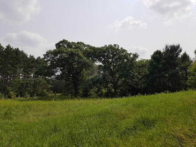
Across the road from Rattlesnake mound (I think that's where it was) we passed a wooded area that was so unusual I stopped to take a picture of that, too. It was completely natural, I could tell, but it was also unlike any woodland I had ever seen before. There was a carpet of long grass, from which sprung a mature canopy of deciduous trees - and there was nothing in-between but the occasional fallen limb. 

For acres and acres, there was a mature forest area with literally no understory. It looked like someone had spent years of their life manicuring the woods. 


Another 3.5 miles behind us, we moved up the road four more miles to the train tracks just southwest of Adams on 14th Drive. Actually, we stopped about 3 tenths of a mile short of the train tracks, because when we got there we were impeded by a train that lay across the tracks and seemed in no hurry to move. So we turned around, found a place to park, and rode south to our car. This was a boring, workmanlike stretch with nothing to call a 'feature', so I'll just move on.

The next thing to do, of course, was to ride past the train tracks and get into Adams. But when we drove the car up to the train tracks, the train was still there. This time I drove all the way up to the train, and discovered that indeed, there was a place to pull over right next to the tracks, so we parked the van there and walked the three tenths of a mile to Theresa's car. Still - the train hadn't moved. It had been there at least forty-five minutes that we knew of, and probably much longer. We could see the end of the train, just eight or ten rail cars down the tracks, but there was no way around it by car. So we gave up on that and drove around it and up into Adams. It was 2:30 pm, and we could tell from the looming skies that out luck with the weather today was about to run out. We decided to treat ourselves to some lunch in town. 

We drove both vehicles around the offending train, about a seven-mile detour, and up into Adams-Friendship. The gray skies were turning black. Rain was imminent. We drove all the way to the north end of Friendship to park our cars on WI-13, and were running for the front door of the Friendship Café when the skies opened up and started to pour. 

This was a genuine gully-washer. A worm-drowner. A hold-onto-your-children storm, complete with crashing bolts of lightning and thunder. And through it all, our waitress politely served us our coffee and lunch specials, with complimentary soup-of-the day. It was delightful.  

The storm, powerful in its first 20 minutes, didn't have much staying power. By the time we were done with desert, the lightning had mostly passed and it was down to a steady rain. We decided to spend our time driving the route we would later cover on bicycle to see if we wanted to do it together, or if we needed to do it one at a time for safety. We drove back down to the train tracks to see if the train had moved. Nope. It was there for the long-haul. just ten cars from being out of the way, blocking one of the major roads into town. 'Don't mind me - I'm just gonna sit here for a while', it seemed to say. 

We were so close to getting off map 55f-W, we really wanted to get that last couple of miles done, but the rain wouldn't let up, and there was still occasional lightning, so we just kept driving. We discovered that the trail does indeed go off-road briefly in town, running along a path in Friendship Park before veering west and going around Friendship Mound and up to Roche-a-Cri State Park. 

From here we started hatching a plan. What if, instead of camping in Oxford that night, we van-camped down here at Roche-a-Cri? We stopped at the ranger station and asked about parking, and the ranger there told us that as long as we had a State Sticker on the car, we were welcome to park in the lot on Czech Ave, even overnight. 

The rain had gotten steadily worse again, and we checked the forecast. Rain, followed by heavy rain, followed by thunderstorms, then a little more rain. Any hope we had of doing two and a half more miles to complete one more map was erased. We were probably done for the day. 

So we left one vehicle behind and drove the van back to camp in Oxford to get supplies. We were perfectly set up for van camping, having planned for that contingency, and made our way back to the State Park well before dinnertime. Of course, we weren't very hungry after our very full lunch, so dinner wasn't a factor. 

We decided to try driving down to the train tracks. the rain was petty light at the time, and we were entertaining the idea of doing just a little more biking, or even walking, in the rain. At first we thought there had been a change. And, indeed it did look a little different. There was a different set of cars across the tracks, or so we thought at first. Then, on closer inspection, we could see that there was now not one, but TWO trains parked across the roadway. More than four hours after we had first encountered the blockage, that same train was on the far side of a second train that came to hang around like buffalo on the roads in Yellowstone Park. Unperturbed, and unmoving. And there was a car parked down by the train with a photographer hanging around that we didn't like the looks of, so we abandoned the idea of getting anything else done for the day.

We went back to the 'Winter Parking Area' for Roche-a-Cri (Screaming Rock) and settled in for the night. There was a vault toilet there, which was highly convenient, but no running water, and no picnic tables. We did snack a little on trail food, then prepared ourselves for bed. We were asleep before dark. 


Running Total: 658.3 miles of trail covered; 68 miles 'extra' hiking/biking. End of Day 89.

Thursday, August 5, 2021

Day 88: Connecting Route, Juneau and Sauk Counties

Day 88: Thursday, August 5th, 2021

Total Miles covered for the day: 13.0 

Location: The Connecting Route between County HH to the north (map  57f-W) and Lage Road to the south (map 58f-W), bypassing Wisconsin Dells itself.  
13.0 miles of trail covered.

This was day six of a nine-day adventure. Days ago we set our sights on biking the entirety of the Western Bifurcation. As I mentioned in posts past, we were working our way north from Devils Lake. Today was the first day where we started battling rain, and it would be a recurring theme throughout the rest of our vacation. 

Last night we slept at home rather than at base camp, which meant we were over an hour and a half away from our starting point. Plus, we left a car at the Mecan River Segment the night before, thinking we would finish off the last piece on the north end before starting our biking. But then we reevaluated our priorities, and determined that if anything was to be left undone, it would be a much further drive to get us down to Wisconsin Dells, and we could do the Mecan River Segment as a day hike if we needed to. So - 

The first thing we did was drive down to pick up Theresa's car. Then we motored both vehicles toward Lage Road west of Wisconsin Dells. On the way, though, we stopped by our base camp in Oxford to see how our campsite fared through last night's severe thunder storms. No problems. No branches on the tarp, and only a tiny amount of water inside the flaps. Excellent. Onto the trail.

Our route today included getting past the off-putting obstruction known as Wisconsin's wettest tourist trap. 'Welcome to Wisconsin Dells' reads many a sign, but since our objective was to get past or around it, seeing that the suggested route passes directly down Hwy 12/16 in a plummeting loop around Trappers Turn Golf Course, we weren't feeling very welcomed. 

Walking in the suggested direction into the Dells has very few benefits. On the plus side it leads the hiker past Rocky Arbor State Park, and into the Dells where shopping, or perhaps the all-important rest stop can be had. We, on the other hand, were on bicycles, making the ride along these roads beyond hazardous, akin to foolhardy. We needed an alternative, and it was here that we were happy to remember that the Connecting Routes represent merely a suggested path, and were not mandated if we wanted to reach the hallowed status of Thousand-milers. But then, we were doing this on bicycles, so any consideration of 'rules' was utterly moot. 

Which leads to our route. We had no intention of riding bikes or walking all the way down the hill into Wisconsin Dells, just to claw our way back up the hill to meet up with the place we left off at the Juneau-Sauk County Line. Yet we needed to get under I-90, so our options were limited. 

We chose instead to use Hwy 12/16 to get beneath the I-Road, which limited our use of that road to just a quarter mile, rather than the 1.5 miles suggested by the 'official' route. Then, a short run along Plaza Road, Curry Road, and Old Hwy 12, all of which was done in the total absence of any other vehicles, led us down to Lage Road where we left off two days before. This got us back on the dotted lines. 

I should mention that despite the hours of driving and erranding, we got a fairly reasonable  start. I didn't record the exact time, but it was about 1:00, and surely could have been worse. 

Once again, we decided to use the bike-and-follow method, enabling one of us at a time to  travel down the road while the other provided safety and support. Theresa started first, and with me running interference, made her way under the I-Road and onto safer ground on 60th street. 

The route we took would have looked like this, starting at the county line on the right, traveling down to Wisconsin Dells and back up and over the next few hills. 


Instead, we took the shortcut and it smoothed out the route to look more like this:

Significantly shorter, less hilly, and far less dangerous. 

I know we traded off riding and driving, and believe me, the logistics of getting around all that traffic safely took a lot out of us mentally. And we were starting to get tired. All that probably led to the problem we faced when I was biking the I-90 piece and Theresa was following. I started riding at the south end, on Lage Road, and was working my way north. I told her to meet me on the other side of the I-Road, on the far end of the short piece on Hwy 12. This was mostly because it wouldn't have been possible for her to drive slowly behind me through here. 

I will only state for the permanent record that she made a wrong turn and ended up waiting for me in the wrong location. After waiting what seemed like a very long time, I finally saw her down the road coming from a very unexpected direction. She found me. No lives lost. On we went. 

I took no photos as we went today. The ride was pleasant enough, and the hills didn't feel quite as severe as they look in the elevation maps. The highest point of the ride was when we rode past the world famous Stand Rock on County N. I'd like to say that we stopped and took pictures. Truth be told, I didn't  even know it was there. Was it possible to see it from the road? I have no idea. I'll have to drive back that way some day. 

Though we were untroubled with sight-seeing, we were dealing with some pretty stout winds, and the overcast skies promised rain sooner rather than later. As first one of us and then the other made our way to the corner of County HH, riding along the increasingly rural roads culminating in a ride past the Lemonweir River backwaters on 55th Street, we could tell that our day was finished. The first few fat drops of rain were falling as we were loading Theresa's bike onto the rack, and the skies opened up on our way to camp. 

Thankfully we got a break during the time when we were making dinner, but we fell asleep that night to the sound of pitter-patter raindrops on the tarp. 

Running Total: 640 miles of trail covered; 68 miles 'extra' hiking/biking. End of Day 88.

Wednesday, August 4, 2021

Day 87: Connecting Route (x2), Mecan River Segment (Part 3), Waushara County

Day 87: Wednesday, August 4th, 2021

Total Miles covered for the day: 7.8 

Location 1: The northernmost 3.8 miles of the Western Bifurcation Connecting Route between the Adams/Waushara County Line and the parking area on Czech Road just east of County Road CH.  
3.8 miles of trail covered.

Today we woke up in our tent a little drier than the day before. The fog was gone from the morning before, as was last night's rain, but that didn't mean everything was magically dry this morning. In fact, despite the rain it was already in the mid sixties and perversely humid. Today was going to be another day in the mid to high 80s, with humidity that simply refused to go away. Another breakfast of hot coffee and cold boiled eggs and we were on our way. Maybe the time was 10:00, or maybe it was a bit later. We were trying hard not to be in such a hurry on this trip. It was certainly making it all more enjoyable. 

Our plan for the week had been to hike and bike our way through Wednesday, then go home for a real shower, a clothes washer, our ever-so-comfortable bed, and some snuggle time with our two cats, Skittles and Zuzu. So instead of heading south today to pick up from where we left off yesterday, we went north, planning to pick off the Mecan River Segment. But even as we sat and looked at our maps, it seemed there was always just one more thing to get done before we got to the part we really wanted to do. 

As we stared at maps, we realized that if we were to cover just a few miles of the north end of the Western Bifurcation, we could officially complete the rest of map 53f-E (which we had already thought of as 'complete' prior to deciding we would do the Western Bifurcation). We would also make our way onto map 53f-W, and chip off that nagging little bit of dashed line on the lower left corner of map 52f. It wasn't too far, we reasoned, and it would accomplish a lot as far as maps go. 

So we ended up parking a car at the parking area on Czech Ave near the intersection of CC and CH. By the way, don't try to use "Czech Ave" as a way to find anything in Waushara County. There are so many Czechs out there it looks like someone's toddler went nuts with a rubber stamp when the roads were being named. 

The first two tenths of a mile we had already covered when we did the eastern bifurcation back in 2013, but back then the suggested route went south on CTH CH. That means to truly connect the dots we had to go an extra mile to 4th Avenue before the real western bifurcation started. 

Our target vehicle had been dropped off down the road a bit, and we actually had some trouble finding a safe place to park. We ended up going all the way to the Adams County line at 1st Ave, but that was a fine place to end the first leg of the trip.

The biking was an easy up and down, and the 3.8 miles fell away quickly. I hardly remember it at all, except for seeing a farm vehicle out harvesting something or the other, making Wisconsin what it is. 

So now we needed to decide what we wanted to do with the rest of our day. The plan was to go hike the Mecan River Segment. But it was very hot. And it was very humid. And hiking didn't sound like as much fun as it did three hours and 20 degrees ago. Plus, there was this ice cream shop...

As we rode, we saw signs for the Clauson Barn Theater. They had ice cream. They had shows on Wednesday afternoons, and - Hey! - It was Wednesday! 

We thought long and hard about ditching all hiking for the rest of the afternoon and hanging around in air-conditioned comfort, listening to the sounds of Johnny Cash played by the Clauson Family and enjoying a leisurely family-style dinner. But in the end, Covid-19 was the straw that broke the camel's back, and we went hiking instead. We didn't even get any ice cream. 

Location 2: The Connecting Route between the Mecan River Segment to the north and the Wedde Creek Segment to the south. 
2.3 miles of trail covered


It was sometime just before noon, but before we could get to the hiking on the Mecan River, we needed to cover the bit of Connecting Route between the Mecan River and Wedde Creek. As I noted in a previous post, the parking at the north end of the Wedde Creek Segment is not for the faint of heart. Many people would consider that roadside 'not park-able', but having done so once, I figured we could do it again. 

In hindsight, our logistics weren't all that brilliant. Theresa took her car to the Mecan River Segment parking area and started riding back to Wedde Creek. I drove my car back to Wedde Creek where I parked my van on the side of the road with the hope that I could get it back out again later, and rode north to the where Theresa had parked her car. After finishing my ride, I would load up my bike and go back to pick Theresa at Wedde Creek.

Which is basically what we did. And while there was one major flaw in our plan - it made no sense to end on the Wedde Creek end - there was also a major benefit. The benefit was that Theresa was alone and traveling at her own pace when she passed by the sign advertising the anchor store of the Town of Richmond Business Center - the R & R Candy Shoppe. 

The R & R Candy Shoppe is where we got our treats for the day (cookies) and also samples of several other delicious goods, all made fresh and preservative-free by the Mennonite family that runs the Shoppe and other families in the Mennonite community. The cookies were good, but the granola was great. We ended up going back several times over the next several weeks, and every trip was well worth it.  

Location 3: The portion of the Mecan River Segment between Chicago Road to the north and County Rd GG to the south
1.7 miles of trail covered

So having finished closing up the small gap along the roadway, we were finally able to get off the bikes and get on our feet. We had previously hiked two bits of the Mecan River Segment and thoroughly enjoyed both, although one was peppered with occasional poison ivy. We dropped one car off at the parking area on County Road GG, then drove up to the other parking area on 6th Lane, just south of Chicago Road. 


We were a little puzzled as we drove 6th Lane, because there are one or two yellow blazes you can see from the road as you drive by, so we didn't know what to expect as far as the trail itself. That quickly resolved itself when we started walking, though, because shortly after passing the trailhead sign, the trail ran right up to and alongside the roadway for several hundred yards. You can see the road from the trail, but you can't see the trail from the road. 

And, back on my feet, I found myself taking photos again of all the magnificent mushrooms.


I'm not sure what the first two are. Actually, there are a lot of mushrooms I'm not sure about, but there are a few I know. And some I think I know. Like the ones below. I think these are red chanterelles. But if they are, they are really small, and I didn't bother to photograph the bottoms, so don't take my word for it.


The mushroom below I absolutely DO recognize. It's the Death Cap mushroom, or Amanita phalloides. You won't die from touching it because the poison doesn't go through the skin, but you have to wash your hands thoroughly if you touch one. My advice - don't touch one. 

Death Cap Mushroom

On the other hand, the one below is the two-colored Bolete, or Baorangia bicolor. It is very edible, though the specimen below is far too large and over-mature to be delicious. They are much better when small, when the red cap is a distinct and bright red color, rather than the blotchy mess in the second picture. 

And of course, I must caution anyone reading this that this is NOT a mushroom identification guide. I take no responsibility for anyone using my photos to identify a mushroom. There are poisonous lookalikes for the Two-Colored Bolete, so please educate yourself well on the process of identifying and safely testing wild mushrooms. 


This is another mushroom I love, below, although once again it is absurdly over-mature. Had I found this one three or four weeks earlier I would have figured out how to take it home with me. It's called "Chicken of the Woods", or "Sulphur Shelf", and it's typically a very bright yellow and orange color. It cuts like steak, doesn't reduce in size when you cook it, and is unmistakable for anything else. You can grill it, or cook it on a stick over your campfire. But one it reaches August, it's too late. You want to get this one early or it gets woody. The specimen below is about 17 inches across, and that's fairly small. 

Very Over-Mature Chicken-of-the-Woods Mushroom

We also enjoyed some late-season blackberries as we walked. 


So enough already with the mushrooms. How was the trail? Despite all the recent rainfall, it was fantastic, tick-free, and along this segment, nearly poison-ivy free. 

As with the lower sections of the Mecan River Segment, this one passes over sandy terrain, within a loose canopy of mostly oak forest leaning towards oak savannah most of the way. There are parts of the trail that are park-like, passing gracefully beneath trees with limbs that cross the air above you with an almost child-like whimsy.


And there are places that fairly beg for someone to lay down and take a nap, if not set up camp for the night. 


The flowers are plentiful and blooming gloriously.


Though not every tree that grows here is your friend, as this black locust picture demonstrates. 

Black Locust Tree

Black Locust Tree


Sadly, the one place I really WANTED to be able to see a long distance was the part of the trail closest to the Springs themselves, but it wasn't possible. The Mecan Springs are the source of all that beautiful, clean water downstream, and when we were in a position to actually see it, the canopy and the understory were too thick to be able to view anything but the most fleeting glimpses of the springs to the north, more than 100 feet in elevation downhill from where we were hiking. 

At one point the trail takes a severe dip to the south, then back to the north, almost touching Cottonville Court. The reason for this is obvious if you look either at an elevation map or simply peer ten feet to the north, where you see the land plunging into a deep ravine. Even the enthusiastic IAT Trail-builders were wise enough to go around that hole in the earth. 

After another similar but less obvious loop north, south, north and south again, we came out into more grassy, open trail. 


Yellow Bluestem?


Bee Balm

The final leg of the trail took us within sight of our car, waiting across the road, then inexplicably further east where we came out on GG, crossed it, then had to re-walk the short spur trail to get back to the car. Why? I have no idea. Certainly could have just walked right on up to the road about 50 feet away and straight to the car, which would have eliminated the need for a spur trail entirely. I'm guessing that the trail went through long before the parking area was realized. We wouldn't have been the first people to take the shortcut, based on the tracks, but we resisted the urge. We needed to tough the sign, after all. 

So did we pack up our poles and go hike the last piece of the Mecan River to the north? We did not. It was 3:17 pm, it was insanely hot and humid, and we had over an hour of driving to do before having to do several loads of laundry and make dinner. Besides that, we knew there was going to be severe weather later that night, and we wanted to be home before it hit.

That worked today. We would not be so lucky later in the week.


Running Total: 627 miles of trail covered; 68 miles 'extra' hiking/biking. End of Day 87.