Friday, February 25, 2022

Day 141Milwaukee River Segment, Fond du Lac County, Southern Kewaskum Segment, Washington County

Day 141: Friday, February 25th, 2022

Total Miles covered for the day: 5.4

Location 1The Milwaukee River Segment (Fond du Lac County)
4.3 miles of trail covered

We're back. 

Ice. Snow. Hills. Cold wind. Perfect. Let's go hiking! 

Winter is really losing hold of the Wisconsin woods fast this year. Most years we can count on winter being around through March, even into April. Not this year. 

No - perversely, this year, when we need winter to last and hold the ice on the trails it is failing us, with intermittent warm spells to go with the bitter cold. Every opportunity we can find to go hiking while it is still frozen is an advantage to us, because the Kettle Moraine area has steep hills with badly eroded, treacherous tread, full of loose stones and rocks. Ice holds those rocks to the ground, and provides a coating layer that protects us from many of those projecting people-trippers. With our ice cleats, ice is not an issue.

So when we saw the forecast for more cold weather, we knew we had to come racing right back down to the hills of Kettle Moraine, to pick up from the south end of the Parnell Segment where we left off last weekend. 

We came down last night, Thursday, to stay at the AmericInn in West Bend. The AmericInn is literally a tenth of a mile off the trail, and affords pretty good road access to the trail both north and south. Theresa got down here a little earlier than I did, and managed to cover a couple miles of the West Bend Segment, but I promised her I wouldn't do any more of that half-hiked stuff, so I figured I would count those miles when I hiked them, too. The plan was to get to them this weekend sometime. 
 
We woke up to a few inches of fresh, fluffy white snow. Sunrise - 6:46 am.


We have never been famous for early starts. There are just too many things to do before we are ready to hike. Today was no different, especially since AmericInn has a fairly nice breakfast layout. It's a little heavy on the carbs, but at least they have good coffee. 

Today's target was to finish the Fond Du Lac half of the Milwaukee River Segment, a relatively short 4.3 mile goal. After that, we would see where we were and make decisions from there. 

The wind was blowing north to south today, so we leapfrogged the segment from south to north, allowing us to hike north to south with the wind at our backs. 

For our first leg we determined it would be possible to drop a car on Kettle Moraine Drive, so long as I did a little shoveling to make it possible. After seeing the weather forecast, I made sure I packed the shovel with us this weekend. It came in useful all day long. 

Then we drove up to County Road DD and had to shovel a place to park there, too. Parking secured, we positioned our cars and started hiking south from DD. 

We started walking at 11:00. It was 21 degrees, and there was a light wind, with mostly  cloudy skies. The forecast called for pleasant temperatures today, so we were dressed with fewer layers than usual. For me, that meant five. For Theresa - three. 


Like so many of the hikes through the Kettle Moraine area, the leg started with an uphill climb. I think this is basically always the case, because it's an extremely hilly region, and when the roads were put through they looked for gaps in the hills to lay them down. This means when you're on the roads, it's uphill in every direction. Frankly, that's how it feels sometimes when you're hiking out here, too. 

In this case we lucked out. The uphill part was fairly short, and this was followed by a long downhill stretch. We were hiking through roughly four inches of fresh powder, and we were the first to come through, It was a powdery snow, so it wasn't too terrible, but breaking trail is breaking trail. It creates a drag and slows you down. 

Just what we needed. 

On the plus side, we were walking towards the sun, so the snow was sparkling like a million diamonds. 


We were making good headway, and really enjoying the fresh air. Then we heard some other hikers ahead of us. We thought it might be Ice Age Trail hikers, but it turned out to be dog walkers on the New Fane trail system. New Fane is the closest town to where we were hiking, and they have an impressive trail system that follows a different course through the kettles and eskers. One of their dogs saw me; none of the people did. 

Then we ran into two people coming down the IAT in the other direction. Those two turned out to be Thousand-miler Jac Geidel and her hiking companion CM Norman. The dog, as usual for their species, chose not to be photographed. 


We had a good, long talk with Jac and CM. We talked about winter hiking, and summer hiking, and favorite segments, and what we love and what we don't love about the trail. Those two had already hiked four miles that morning, and were doing an out-and-back. We could have chatted much longer, they were such nice people, but we eventually needed to say goodbye and keep walking. 

A short while later we reached the end of the segment. It was 11:42, and we were 0.9 miles into our hike. The sign said, "Come hike again".  You never know - it could happen someday. 


The other side of the sign told us that we were 184.4 miles from the Eastern Terminus, and that we were entering the realm of the Lakeshore Chapter. Based on what we've seen so far, they do a nice job of keeping the trails cleared of windfalls. 


Driving to our next stop we passed this venerable old stone church that was built in 1871. It was the Deutsch Evangelical Lutheran St. Johannes Kirche, U.A.C. The 'UAC' part stands for Unaltered Augsberg Confession, and meant that this church would hold fast to tradition and not succumb to the influences of Americanism and the "New Measures". 

Wisconsin would not be what it is today without the influence of the German immigrants. Their hard work and dedication to this territory brought us the beautiful farm landscapes that still dominate these rolling hills, and left behind some magnificent buildings as well. This church is still in operation today. 

I have no idea if the New Measures have crept into their sermons. 


Hiking south from County Road S, where we parked the launch vehicle for the next leg (yes, I had to dig out a parking spot) we decided that sunglasses would have been good equipment to have. Bright sunshine and brand new snow made for some squinty southward views. 


South of County S there is a spot where the trail splits. One leg goes to the east, and another to the south. There are no blazes anywhere, in either direction. We didn't want to leave tracks going the wrong direction, since we were the ones blazing trail, so we made our best guess based on where we thought we were on the map. We went south, which turned out to be the right direction, but we had to go nearly a 
tenth of a mile uphill to find the next blaze. 


It was a lovely wooded walk, surrounded by crystal gems glinting out of the snow.


As we hiked, I made up a new verse to my Lovely Day hiking song:

It's a lovely day in New Fane; The weather sure is nice
There's half a foot of brand new snow to cover up the ice
There's at least six hours of daylight before the skies turn dark
I brought along a shovel so I'd have a place to park

I met some lovely people out walking with their dog
I even took their picture and I'll put it on my blog
It's winter in Wisconsin but that won't stop The Snails
It's a lovely day in New Fane on the trail


It was another steady climb until we got up on top of the hills and eskers again, and then we got to spend quite a while on top of the ridge. They are consistent through these hills, at least. For the most part, the course of the trail takes you to the top of the hills and keeps you there. 


There is a spot about 90 percent of the way through this leg where there is a bench to sit on and enjoy a fabulous view. This was one of those 'stop and smell the roses' moments, and we spent quite a while on this bench, snacking and basking in the bright sunshine. 


To preserve the beauty of the view we didn't walk out to the end, but we did leave behind some graffiti in the snow.


It makes me wonder if anyone else passed by and saw that, and knew that they had just missed the chance to get SnOTT patches. 

And if evidence was needed to show how much terrible hiking we're avoiding by doing this in the wintertime, here is a pile of potato rocks that had been removed in one small area. All of their friends that line the trail were hidden under the snow and ice. 


Just before the end of this leg there was a tree laying across the trail with many branches blocking the way. I spent a few minutes cutting limbs while Theresa made her way to the car. 

Another 1.9 miles covered; 1.5 to go.

The next leg was the final one for the Milwaukee River Segment (Fond Du Lac County). We parked once again at the State Park parking area just off of GGG. We met a woman there named Bonnie Conway who took a patch but declined to be photographed. She said she and her late husband used to walk all the time, and today she was just out here spending time in the woods and thinking about him. 

We also met a couple on snowshoes, who had walked nearly the entire trail we were about to cover, in both directions. Suddenly, we weren't breaking trail anymore. 

It was now 2:35, and the skies had turned mostly sunny. The temperature was a nice, warm 30 degrees. 


One thing we noticed as we walked was that there were very, very few animal tracks. With the fresh snow, we should have been seeing many more. We did hear the hammering of a pileated woodpecker, though. At least the woods weren't totally empty.


This last leg had us walking quite a while on the flat before heading up a large hill. At the top of this hill was a shelter, and I went over to check it out. 


This was a gorgeous structure, like all the others along this stretch, and I took this photo about three seconds before someone walked into the frame, laden with overnight camping supplies. He and his buddy, whom we met a little later on down the trail, were out here to spend the night. He said they do it every year. 


So after topping out over that last hill, which was almost gratuitously crested by the trail, we spent the next couple tenths of a mile making our way down to the car on County S. We got there at 4:01 pm. It was warm enough that Theresa had been hiking without hat or gloves for quite a while. 


So at 4:00, we could have decided to call it a day, but we were out here to make progress and make as much use of the winter conditions as we could while they lasted. Unfortunately (an odd word choice, but it fits) we made arrangements during the day to hike tomorrow with at least one other person, and maybe three. That hike would start at the north end of the Washington County half of the Milwaukee River Segment. 

If I had my choice about what to do next, that is exactly where I would have driven. 

"What about the last part of the next segment, west of where the bridge is out on County H?"
"No good - too far. That's two miles, and we don't know if we can break it in half."

With sunlight fading fast, we made for the Southern Kewaskum Segment, a 1.1 mile hop that sits just north of the West Bend Segment. 

Location 2The Southern Kewaskum Segment
1.1 miles of trail covered

We dropped the van off on County Road D, where a number of other vehicles were pulled off the side of the road. Then we drove up to the parking lot on Wildwood Road only to discover no one had been in there yet. Four inches of snow on top of ice. It was downhill coming off the road into the parking area. We weren't going to risk it, and the shovel was in the van. 

RATS!!

With sunset fast approaching, we decided we would just do it as a crisscross hike. I started walking east and Theresa drove back down to D and started walking north. For her, the 'trail' walks along Friendly Drive for about three tenths of a mile before cutting west under the power lines. 

For my part, the trail was pretty much a straight line run under the power lines. I had started at 4:58 pm. and it was getting colder by the minute. 


I'm not sure what the history of this Segment is, but it must be interesting.


At the top of the hill there is a small section of trail that bounces into the woods for a couple hundred feet, then comes back out again. It's a funny little triangular jog that doesn't add much to the segment, but I guess it's better than walking the whole way on either the road or the right-of-way.  Actually, there is also a white-blaze loop trail through this small area, but we didn't have any time at all to enjoy it. 

Further east, I found a bridge built to get past a chronically wet area. 


I had been following boot tracks, dog tracks, snowshoe tracks and many other tracks, but for some peculiar reason, no one had crossed this bridge since the snow fell last night. 


There are information signs to tell people about the trail, and some of the important pioneers who helped make it happen. I took a snapshot of the Ray Zillmer sign, but missed the one talking about how the trail eventually got named as a National Scenic Trail, signed into existence by Jimmy Carter. 


When I crossed paths with Theresa she was moving fast. Dusk was here, and night was coming. This was my last view of her as she topped the hill, moving away. 


When I reached the road a short time later, I found an informational sign. 

It's a good thing there is a sign here, telling people where to go. Because from this point until you are well onto the West Bend Segment, there are nowhere near enough blazes. That little circle on this sign in the lower right hand corner, three tenths of a mile north of the actual location, is the only thing that identifies the Trail Head for the West Bend Segment. 

The detailed distances on the sign are generous to a fault. The whole segment is only 1.1 miles total, and barely that. 


When I got to the car, I came back to find Theresa just coming down the last bit of hillside. I had time to kick a little snow off the parking lot and pull the car off the road a little bit. Don't ask me why, but I forgot to bring the shovel with me again. 

It was 5:36 pm, temperature back down to about 18 degrees. We completed two whole Segments today. That was worth a little celebration. 


Running Total: 942.5 miles of trail covered, 147.5 miles 'extra' hiking/biking. End of Day 140.


Sunday, February 20, 2022

Day 140Parnell Segment (Part 4), Sheboygan and Fond du Lac Counties

Day 140: Sunday, February 20th, 2022

Total Miles covered for the day: 3.3

LocationThe Parnell Segment, between the road crossing on County Road SS and the road crossing on County Road F
3.3 miles of trail covered

For three days, we have worked on the Parnell Segment. On all three days we stopped before the end of day, for one reason or another. The first time we stopped because the roads were too icy to get to our next intended parking area and nearly ditched the van trying. The second time we stopped because the hills were taking too much of a toll. The third day we stopped because there wasn't quite enough time in the day to hike the last 3.3 mile stretch. 

To be fully honest with ourselves - we've been avoiding this 3.3 mile stretch because it's been bitter cold and windy, and we didn't feel like walking that far all at once. 

So now, this one section, which could have been broken in half if not for the ice-covered roads, is all we had left. And I'm not talking about 'icy' roads. I'm talking about roads that are covered, top to bottom and end to end, with a one inch layer of ice. Glassy and slick on the top with a dynamic friction coefficient of about 0.05. In other words - don't go there. 

So we had no choice but to do the whole hike in one leg. This might have been better if we had tackled it earlier, when the ground was good and frozen, but the temperatures today were going to get unseasonably warm, and we were facing mush and even a little mud for our walk. 

We weren't looking forward to it. 

So on our way through the town of Dundee we stopped at the 3 Sweets Bakery and Café to get some motivation. I stopped because I knew Theresa wanted to stop there. She had told me as much the day before. Theresa stopped because she was going to stop whether I did or not. 

It's an interesting little shop, and it does a whale of a business on Sunday mornings. When I arrived the 'Closed' sign was still hanging in the window. That didn't stop the locals, who knew full well the place was open, and they were packing the tables when we walked in. 

We browsed. They had some sweets, which Theresa bought, some handmade soaps and lotions, which she didn't buy, and a variety of bric a brac to go along with the regular breakfast menu. We didn't stay for breakfast, and it wasn't even really about the sweets. It was about wanting to stop and smell all the wonderful small town bakery goodness that fills places like this. It was a nice place, with nice people. Next time we go through we're going to sit a spell. 

Another feature in Dundee which I would have liked to admire more closely was the old mill, built over the East Branch Milwaukee River south of Long Lake in 1856. The water wheel was frozen in place, but the mill was a fascinating spectacle. 

With nothing left but the hiking, we dropped a car at the north end of our intended hike on County Road F, where there was just enough melting that we could safely park right next to the trail this time, rather then driving a tenth of a mile down the road. Then we drove to the SS Parking area and headed for the trail. 

We started hiking at 11:05 am, and the temperature was already up to 39 degrees. By the time we finished hiking at 2:20 pm the temperature would hit 51. 

This was the last hike on the Parnell Segment for us. Our goal may not seem ambitious to others, but covering 13.9 miles of hills in the snow, wind and ice, all in one long weekend, was good enough for us. 

The skies were blue and sunny, and there were steady 20 mph winds from the SSW. 


The hike starts out in Sheboygan county, but quickly crosses over into Fond Du Lac County. The boundaries aren't marked. 
 

At the very beginning there were a couple of steep hills to climb, but then there was a long section where we walked almost on the level as we made our way around Crooked Lake. There was certainly opportunity to the west to have taken us up and onto some large and imposing hills, but I'm really glad they didn't. We were really more in the mood to just mosey along and climb as few hills as possible.

We were overtaken on the north end of Crooked Lake by a solo hiker and his dog, a curly-haired black lab mix that he referred to as a 'Chessador'. Obviously, that's a cross between a Chesapeake Bay and a Labrador. It was a pretty enough animal, but I don't know about all these fancy new crossbreed 'breeds'. Labradoodles, Schnoodles, Buggs (Boston Terrier/Pug) and others are cute in their own way, but let's just admit that a lot of these so-called new breeds of dogs started out as - ahem - an open gate in the yard?

Anyway, the fellow was nice enough, and the dog was very friendly. I find that almost all dogs are friendly if you give them a chance. Off he went at his pace, and we at ours. 

This was right before a little hill we had to climb, and at the top we stopped to sit on a log. We weren't so much tired as hot and overdressed. 

I made a tiny, little snowman. 😀


Immediately on the other side of that hill we crossed Division Road, There is enough room there for one vehicle, if you can get there. As we crossed, sure enough, one vehicle came driving by from the east. There was a bit of fresh snow, and the temperature was above freezing. Maybe there was enough traction on that ice runway for him to get safely through. We never found out. 


Crossing Division Road got us back into Sheboygan County again. Right away, the path got hillier, and the trail conditions worsened. The worst part about it was the route, because the trail went straight up one hill and straight down the other side, without utilizing switchbacks. This is terrible in most places, but on this glacial till it's just plain old mismanagement. The erosion was evident even under the ice, and as the streams were running down the trail from the rapidly melting snow, it was getting nothing but worse. Even some of the potato rocks were coming loose, making for the kind of hiking we were trying to avoid.


The vast majority of birds' nests are good for only a single season and are not reused. Even knowing this, I still felt the urge to pick this old nest up off the ground and find the crook of the tree it came from so I could put it back. It looked lonely there. 


One of the lakes visible from the trail.


One of the hills visible from the trail. 


By this point many of the ice patches had turned to slush, and the mud was starting to form on the edges. As we walked we discovered a limitation of the ice cleats. We could walk with confidence over solid, slick ice, but turn that ice into sticky snow and mush, and it starts forming ice balls on the soles of your boots. 


We finally crossed paths with several groups of hikers as we made our way north of the three Kellings Lakes. The first two were women, who were real trail runners. Literally, they were running along, holding an animated conversation as they ran. They weren't even winded. 

I was never in that kind of shape. 

Then we crossed paths with an older couple who were the first people we've met on the trail who could give us a run for the title of Snail. 

Then we met a man and his son out exercising a 9-year-old pointer, who was all business and had no interesting in talking to us. The dog, that is. He was busy working. The dad and son chatted a while. 

All of this happened in a stretch of about two tenths of a mile just before hitting the intersection with the blue spur trail. (0.7 miles). 


We had the last six tenths of a mile to ourselves. I'm glad, really. We needed some time alone. Or I did, at least. 

For a while, I just hung out far behind Theresa and watched her walking down the trail in front of me. As we neared the end of the Parnell Segment I started thinking about the end of the trail. It wouldn't be all that far ahead of us. By the time we finished today we had only about 275 miles left to go. 

Even the longest journey can feel shorter when you start getting close to the end. Today, with nice, warm temperatures and the happiness of achieving our goals, Theresa was in a pretty good mood, and her pace was showing it. 

Life is that same, long journey. We have a ways to go yet, but we're getting to the point when the end of our trail isn't 'out there' somewhere. It's getting closer, and it's getting real. Someday, and it will come sooner than either one of us wants, we won't be able to go hiking together on thousand-mile odysseys. And then someday, one of us will be hiking alone. 

I don't typically borrow the future, but today I was thinking what it would be like if I'm the one left walking through life alone. It made me a little melancholy, and I thought to myself as I watched Theresa walking confidently ahead of me that this day, this image, this person, is the one I want to remember if that terrible day ever comes. 


Running Total: 937.1 miles of trail covered, 147.5 miles 'extra' hiking/biking. End of Day 140.

Saturday, February 19, 2022

Day 139Parnell Segment (Part 3), Sheboygan County, 

Kewaskum Segment, Washington County

Day 139: Saturday, February 19th, 2022

Total Miles covered for the day: 4.8

Location 1The Parnell Segment, between the road crossing on County Road V and the road crossing on Kettle Moraine Scenic Drive
1.3 miles of trail covered

Today was supposed to be a group hike for the 'Get Off The Couch' hiking group, known affectionately as GOTC. Unfortunately, due to the brief but ferocious winter storm that was unleashed on the region last night, that hike was canceled. This actually worked in our favor, because we fell 1.3 miles short of our loosely-defined goals yesterday, and had a small section to hike north of where the group would have been hiking. 

Of course, we didn't know this until after we had gotten up and started getting ready, so we were uncharacteristically early in being ready for the road. 

We were able to double-check our parking places and get our vehicles in position by 10:00, and we were actually at the start of the trail by 10:13 am. 


The sun was shining, but that did little to offset the brutal cold and west winds. It was only six degrees, and the winds were blasting from the west between 10 and 15 miles an hour. This by itself wouldn't have been too bad, except we weren't hiking in the woods, we were hiking on top of the famous Parnell Esker. 


It was interesting, standing on top of this esker and looking down to the west to see a huge lake that showed up neither on the trail maps nor on Google. I could find no name for this wetland region that was a quarter mile wide and a half-mile long. 


As I was walking, I came to the conclusion that if 100 different people had been given the task of choosing a hiking path through this area, all 100 of them would have independently selected the exact same path. There is one, and only one way to get through here, and it is atop the Parnell Esker. Rising steeply from the surrounding wetland, the esker stands roughly 50 feet above everything else around it. 

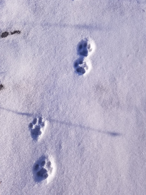
We were the first people to lay tracks since last night's snowfall, but we weren't the first ones there. As we walked, we saw the tracks of what appeared to be a coyote, who led the way in front of us for nearly a mile.


We also saw tracks from rabbits, squirrels, and mice. Which is probably why we saw the coyote tracks. 

Theresa, who is normally very warm as we hike, was bundled snug and deep as we walked on top of the hill, exposed to that bitter cold west wind.


Eventually the trail did drop off the north end of the Esker, across a small wet area that had a boardwalk, and up the other side onto another hill. Between the logging and the storm damage, the skyline looked a little ragged. 


We crossed a snowmobile trail roughly one hill from the end, and found our way to the road. The car was waiting at the pull-out a tenth of a mile to the east, and we got there at 11:30 am. The temperature had climbed to 10 degrees. 

Location 2The Parnell Segment, between the road crossing on County Road F and the Butler Lake parking area 
1.4 miles of trail covered

The next leg required that we reposition the target vehicle again at the Butler Lake parking area and drive to the road crossing on County Road F. We found that about a tenth of a mile west of the crossing, there was ample room to pull a car or three off the road, and we parked our launch vehicle behind a truck, whose occupants were also out enjoying the trail. We could tell because of the footprints. 

We were underway by noon. It was still only 10 degrees out, and the wind wasn't getting any softer. At some point in the past, someone had placed two gallon jugs of water at the intersection. They remain there, a frozen testament to a gesture I wouldn't ever take advantage of, or preparations from a previous hike that were left behind as trail litter. 


This leg was very much like the previous one, except it wasn't as steep, or at least, not at first. There was an initial hill to climb.


As with other areas in the Kettle Moraine region, we found good general signage. I'm no longer surprised to see absolutely no blazes on the trees. Literally every blaze was on a 4x4 post that had to be dug into the ground through all those stones and rubble. 


There is a Cold Cache here on this segment, describing some of the land features as crevice hills. 

There was quite a bit of logging in this area, but it didn't have as much of a visual impact as some of what we hiked through earlier. The early going was mostly level. This wouldn't last for the entire hike. Toward the north end, we started running into real hills, climbing up, down, and up again to stay on top of the eskers. 


We were not the first humans on this section of trail. We started out following the out-and-back tracks from the aforementioned truck owner. Just about the time that those stopped, we encountered another set of tracks coming in and back from the other side, but those were from a different hiker. Then we encountered a third set, also coming in from the north end, and also showing evidence of just a short walk. None of them appeared to be dedicated Ice Age Trailers, but then, how would we know?


On top of the very last hill, still part of the Parnell Esker, we got a great view of Butler Lake and got to enjoy one of the rare benches. It was cold and windy, and we were only 500 feet from the van. We didn't stay long. 


Back at the car by 1:20 pm. I don't know what the temperature was. I'll just say cold. That will cover it for the whole weekend. 

Over the course of three weather-restricted days we had managed to cover 10.6 miles of the Parnell Segment. This left us with only 3.3 miles remaining, which if you look at the map only tallies to 3.2 miles. Either way, it was too far for our current energy level. We needed to get out of these hills. 

South of the Milwaukee River Segments, on the way to West Bend, there was the Kewaskum Segment, a mere 2.1 miles. Theresa and I decided we could probably handle that much, so we picked up the other car and headed south. 

Location 3The Kewaskum Segment
2.1 miles of trail covered

Did I say we were trying to get out of the hills? This certainly wasn't the way to do it. In fact, from the driving we've been doing and the hills we've been seeing, I don't think there is anywhere you can go out here to get away from the hills. Even the roads are hills. 

We scoped out the segment and as we approached the central parking area we found... a ski hill. The Sunburst Ski Area was bustling with cars and people, all wanting a piece of this sunny Saturday afternoon. 

Our initial impression was that it would not be possible to park at the east end of the segment, where it goes under the highway and runs directly into the southern twin of the Milwaukee River Segments. It turns out we were wrong - a car could have been parked there at the beginning, but we didn't realize it until we had already gotten underway with a crisscross hike. 

Theresa dropped me off on County Road H, one tenth of a mile north of the trail. I got to the trail by walking down a nice, gravel bike path. This led to the tunnel that goes underneath the highway and up the other side into a marsh. The water table through here is high enough that there is a sign warning hikers not to cross through if it's flooded. 

The goal was to clip off 0.6 miles and leave ourselves with a hike between parking lots. I started at 2:40.  


On the other side, I found myself walking through a level, grassy marsh area. There were plenty of boardwalks through this section. I can only assume it gets wet in the spring. 


And this is where I crossed paths with Theresa in the middle.


When I got to the car at the ski hill, I was getting odd stares from the other people in the lot. Everyone else had ski poles. I had a stick. The distance along the road, between the ski hill parking area and the east-bound trail, is barely two tenths of a mile, though the sign says 0.3. I didn't care. Shorter was better. 

I drove back to pick Theresa up at the end by the bike trail. 

"You could have parked right there at the end and picked me up," she told me.

"Really?" 

"Yes - there was a place you could have pulled in straight off the highway."

She was right, and I had walked right by it without even looking up. Next time we come back to do the Milwaukee Segment, I'll remember that little trick. 

Next, we drove up to the top of the hill and the south/west end of the Kewaskum Segment. It was 3:31 pm. We didn't choose this direction on purpose, but we sure did luck out with the hiking. The trail started out there at 1120 feet in elevation. It went up another 20 feet over the course of the hike, but then plunged down to just under 1000 feet in elevation. Going the other way, that 120 foot climb might have been a bridge too far for Theresa. 


This time, along with the fox and coyote tracks, we also saw a kitty-cat. 


We got a phenomenal view of the surrounding area and the distant drumlins at the first bench we encountered. 


The way remained fairly gentle, some downhill followed by some uphill, for quite a while. I stopped to check out the DCA, and it was adequate. Nothing to write home about - not even a view. And - there was a no-fire restriction. 


We came out into the open, walking through a farm field of some kind. We strolled along the top of this hill for nearly three tenths of a mile before finally coming in sight of the ski hill. There was a second bench along the way, but we didn't stay long because it was still windy and cold. 


When we reached the ski hill, the whole trail changed character. It got quite a bit steeper, but we were (luckily) going downhill so it wasn't slowing us down. 

Unfortunately, the closer we got to the ski hill itself, the worse the trail got. At one point we were suddenly faced with an eight foot section that dropped at a 45 degree angle. It was the first time I started sliding despite the ice cleats. Fortunately it was short, but then there was another obstacle. There was an orange fence that had been strung across the trail blocking the way. It was partly laying on the ground and didn't belong there, so we stepped over it and clawed the rest of the way back down to the bridge and the parking lot. 

This last tenth of a mile ruined what was otherwise a very enjoyable hike. We finished at 4:45 pm. The temperature got up to 14 at some point today, but it never felt that warm. There would be no restaurant tonight. We learned that lesson yesterday. 

Running Total: 933.8 miles of trail covered, 147.3 miles 'extra' hiking/biking. End of Day 139.