Day 139: Parnell Segment (Part 3), Sheboygan County,
Kewaskum Segment, Washington County
Day 139: Saturday, February 19th, 2022
Total Miles covered for the day: 4.8
Location 1: The Parnell Segment, between the road crossing on County Road V and the road crossing on Kettle Moraine Scenic Drive
1.3 miles of trail covered
Today was supposed to be a group hike for the 'Get Off The Couch' hiking group, known affectionately as GOTC. Unfortunately, due to the brief but ferocious winter storm that was unleashed on the region last night, that hike was canceled. This actually worked in our favor, because we fell 1.3 miles short of our loosely-defined goals yesterday, and had a small section to hike north of where the group would have been hiking.
Of course, we didn't know this until after we had gotten up and started getting ready, so we were uncharacteristically early in being ready for the road.
We were able to double-check our parking places and get our vehicles in position by 10:00, and we were actually at the start of the trail by 10:13 am.


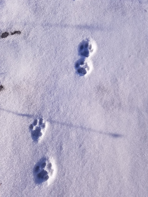
We were the first people to lay tracks since last night's snowfall, but we weren't the first ones there. As we walked, we saw the tracks of what appeared to be a coyote, who led the way in front of us for nearly a mile.


We also saw tracks from rabbits, squirrels, and mice. Which is probably why we saw the coyote tracks.
Theresa, who is normally very warm as we hike, was bundled snug and deep as we walked on top of the hill, exposed to that bitter cold west wind.


We crossed a snowmobile trail roughly one hill from the end, and found our way to the road. The car was waiting at the pull-out a tenth of a mile to the east, and we got there at 11:30 am. The temperature had climbed to 10 degrees.
Location 2: The Parnell Segment, between the road crossing on County Road F and the Butler Lake parking area
1.4 miles of trail covered
The next leg required that we reposition the target vehicle again at the Butler Lake parking area and drive to the road crossing on County Road F. We found that about a tenth of a mile west of the crossing, there was ample room to pull a car or three off the road, and we parked our launch vehicle behind a truck, whose occupants were also out enjoying the trail. We could tell because of the footprints.
We were underway by noon. It was still only 10 degrees out, and the wind wasn't getting any softer. At some point in the past, someone had placed two gallon jugs of water at the intersection. They remain there, a frozen testament to a gesture I wouldn't ever take advantage of, or preparations from a previous hike that were left behind as trail litter.


There is a Cold Cache here on this segment, describing some of the land features as crevice hills.


Back at the car by 1:20 pm. I don't know what the temperature was. I'll just say cold. That will cover it for the whole weekend.
Over the course of three weather-restricted days we had managed to cover 10.6 miles of the Parnell Segment. This left us with only 3.3 miles remaining, which if you look at the map only tallies to 3.2 miles. Either way, it was too far for our current energy level. We needed to get out of these hills.
South of the Milwaukee River Segments, on the way to West Bend, there was the Kewaskum Segment, a mere 2.1 miles. Theresa and I decided we could probably handle that much, so we picked up the other car and headed south.
Location 3: The Kewaskum Segment
2.1 miles of trail covered
Did I say we were trying to get out of the hills? This certainly wasn't the way to do it. In fact, from the driving we've been doing and the hills we've been seeing, I don't think there is anywhere you can go out here to get away from the hills. Even the roads are hills.
We scoped out the segment and as we approached the central parking area we found... a ski hill. The Sunburst Ski Area was bustling with cars and people, all wanting a piece of this sunny Saturday afternoon.
Our initial impression was that it would not be possible to park at the east end of the segment, where it goes under the highway and runs directly into the southern twin of the Milwaukee River Segments. It turns out we were wrong - a car could have been parked there at the beginning, but we didn't realize it until we had already gotten underway with a crisscross hike.
Theresa dropped me off on County Road H, one tenth of a mile north of the trail. I got to the trail by walking down a nice, gravel bike path. This led to the tunnel that goes underneath the highway and up the other side into a marsh. The water table through here is high enough that there is a sign warning hikers not to cross through if it's flooded.
The goal was to clip off 0.6 miles and leave ourselves with a hike between parking lots. I started at 2:40.


I drove back to pick Theresa up at the end by the bike trail.
"You could have parked right there at the end and picked me up," she told me.
"Really?"
"Yes - there was a place you could have pulled in straight off the highway."
She was right, and I had walked right by it without even looking up. Next time we come back to do the Milwaukee Segment, I'll remember that little trick.
Next, we drove up to the top of the hill and the south/west end of the Kewaskum Segment. It was 3:31 pm. We didn't choose this direction on purpose, but we sure did luck out with the hiking. The trail started out there at 1120 feet in elevation. It went up another 20 feet over the course of the hike, but then plunged down to just under 1000 feet in elevation. Going the other way, that 120 foot climb might have been a bridge too far for Theresa.


Unfortunately, the closer we got to the ski hill itself, the worse the trail got. At one point we were suddenly faced with an eight foot section that dropped at a 45 degree angle. It was the first time I started sliding despite the ice cleats. Fortunately it was short, but then there was another obstacle. There was an orange fence that had been strung across the trail blocking the way. It was partly laying on the ground and didn't belong there, so we stepped over it and clawed the rest of the way back down to the bridge and the parking lot.
This last tenth of a mile ruined what was otherwise a very enjoyable hike. We finished at 4:45 pm. The temperature got up to 14 at some point today, but it never felt that warm. There would be no restaurant tonight. We learned that lesson yesterday.
Running Total: 933.8 miles of trail covered, 147.3 miles 'extra' hiking/biking. End of Day 139.
No comments:
Post a Comment