Day 113: Point Beach Segment (Part 5), Manitowoc County
Day 113: Saturday, October 23rd, 2021
Total Miles covered for the day: 10.0
Location 1: The Point Beach Segment
10.0 miles of trail other-half-covered, plus 5.4 miles extra hiking
Saturday October 23rd. For the 69th time in the last 217 days we woke up with the intention of going hiking. That's not quite one out of three, but it's darn close. So far this year, one or the other of us has covered 461 miles of trail and connecting route, and it's only the madness of the October Mammoth Hike Challenge that has made it so that Theresa and I have been hiking in different places at different times, leading to half-covered this, and half-covered that. Mostly we have both hiked the same bits of trail, but there were still two places where catch-up was needed. Today was a day to clean up most of that mess.
Of the two days this weekend, today was the one forecast to have pleasant weather along the coast of Lake Michigan, so that's where we were headed. My plan was to hike the ten miles of the Point Beach Segment, which Theresa had already hiked, while Theresa did as she pleased. Her participation was uncertain, because she got her COVID-19 booster shot on Friday afternoon, and we didn't know how she would be feeling today. I would be walking at a brisk pace for a long distance on ground she had already covered, so for certain we wouldn't be walking together. There was no need.
When we got up there was light frost on the roofs in Wausau. Theresa was feeling good enough that she felt like she could ride with me and give me shuttle service. At least that meant I wouldn't be riding my bicycle ten miles to get back to the car. The drive out to the lake was pleasant, and the weather looked perfect.
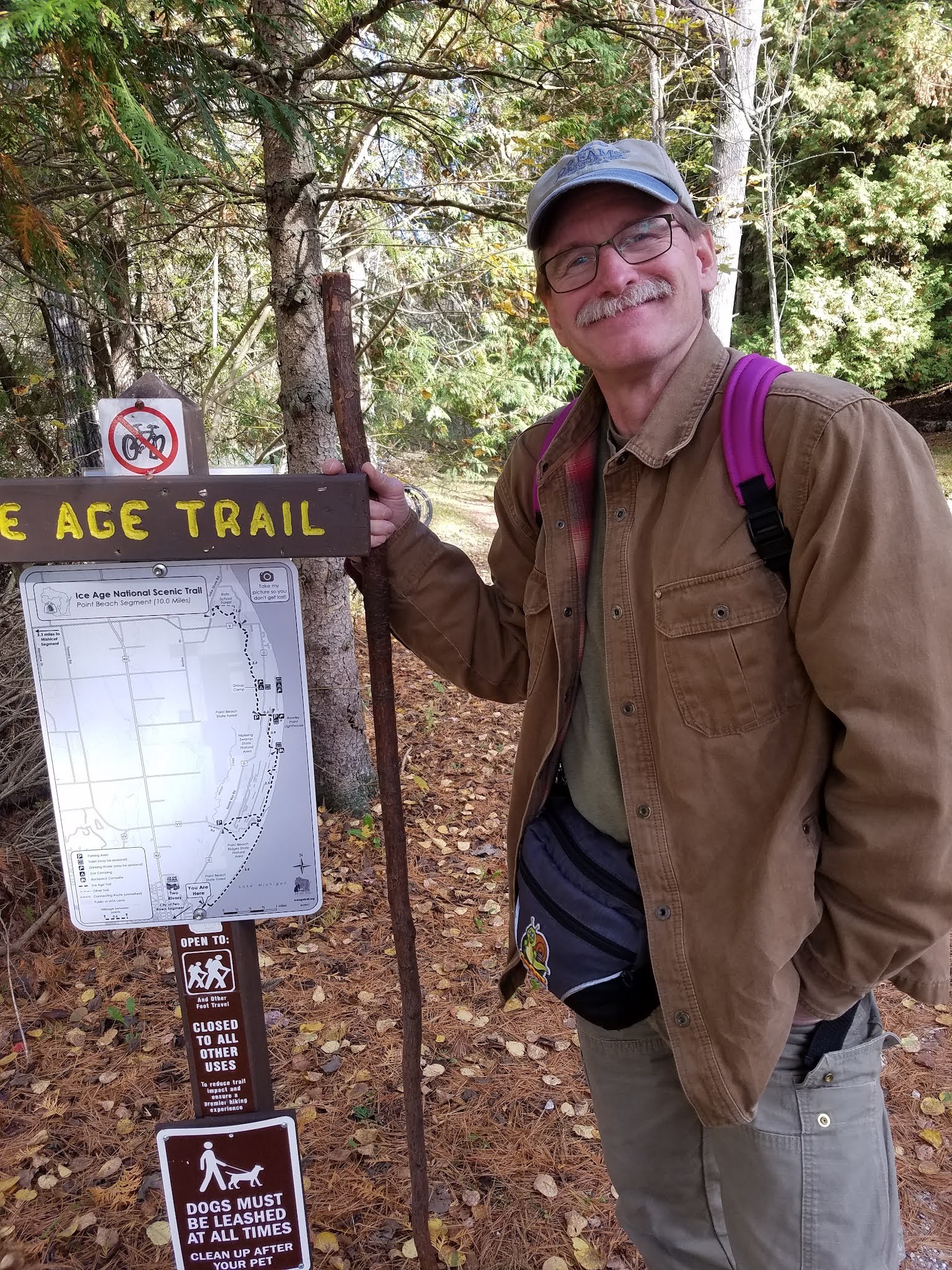
Theresa dropped me off at the south trailhead at 12:30 pm. The temperature was a chilly 49 degrees with a light northeast breeze coming in off the lake. There are times when 49 degrees feels balmy. And there are times when 49 degrees slips down the back of your neck and slips icy fingers into your body like a spinal tap. I overdressed for the weather just to make sure today wasn't one of the latter. Layers, as they say, are the solution. My own secret weapon is a neck gaiter. If you've never worn one in the cold, I recommend it highly. I didn't need it today, but a neck gaiter will add ten degrees to the comfort level of whatever garments you're wearing. I had it with me just in case.
I was warned that this might be one of my favorite hikes, and I wasn't disappointed. The trail starts with about a quarter mile of sandy path leading through a cedar grove that spills out onto the shore of Lake Michigan.


2.1 miles, the sign says, and for the next couple miles I enjoyed a unique, memorable and treasured hike along the beach, which I had all to myself but for the driftwood, gull feathers and the zebra mussels.
It was 50 degrees, with light wind, forming 12" waves that lapped the shore with a persistent hissing roar. Who wouldn't want to be here at this exact moment?


I mentioned the zebra mussels. To be honest, I don't know the difference between zebra mussels and quagga mussels, but both are invasive and both are a problem for the lake. I have a better understanding now of why there is a big concern. I found one site discussing declining populations of zebra mussels over the last 15 years, but only because quagga mussels are taking over. Population densities being described were a staggering 5,200 mussels per square meter of lake bed. Each mussel filters up to a liter of water per day, removing virtually all organic materials from the food chain. This increases water clarity, which causes other problems, as the sunlight penetrates further down, increasing the growth of other types of plants like bottom-dwelling algae.

Both zebra and quagga mussels also perform the function of cleaning up all the toxic contaminants we humans dump into our waterways. They have high fat content in their bodies, making for perfect storage vessels for PCBs and other chemicals, thus allowing these poisons to travel up the food chain through ducks, drums (a.k.a. sheepshead), carp and lake sturgeon. Zebra and quagga mussels get a lot of bad press for making fish inedible but as far as I'm concerned, they are just the messenger. They aren't to blame for the PCBs being in the water they have to live in - they are just less susceptible to dying from it. If we want to blame someone for inedible fish in the lake, we need to look no further than all the selfies on our cell phones.
The shells of these creatures are ubiquitous on the sand. They are underfoot with every step, either in the full half-shell wrapped around bits of seaweed as in the photo above, or as tiny bits that make up the sand itself, crushed by the relentlessly pounding surf.

There were occasional other objects on the beach that seemed out of place. Black rocks and stones, some of them fairly large. I finally bent over to pick one up and it was impossibly light. It had the look of obsidian but the weight of pumice. After showing it to Theresa later we determined it to be black anthracite, the name given to raw, unprocessed coal. We figured it must have been spillage off a ship carrying the substance, since the floor of Lake Michigan is made of dolomite, and anything so soft as anthracite would have been long-ago eroded away and would not be washing up on shore as big, blank hunks.

As my two miles of beach were nearing an end, I finally saw another person ahead, walking a small dog. It marked the location where the trail comes down to the beach, and was in fact the first place in two miles that I had seen a yellow blaze. This isn't surprising, because no blaze could possibly survive the storms if it was down on the beach itself, and anything placed up higher on the dune would just be confusing. So in fact, it would be easy to miss the turn if you were looking down and not up, though you wouldn't get far. The creek just north of the turn would force you to come back.

I thoroughly enjoyed my time on the beach. Though the trail would come close to the beach later on, it would never get back to the point of walking next to the waves.

Walking inland, I had to march up and down over repeated swales and ridges, the evidence of long-ago changes in water level. The path was gorgeous, passing through cedar and hemlock groves, and all along the way staying near the edge of Molash Creek, which turns into a broad, slow-moving backwater as it nears the shore.


As I got closer to the Viceroy Road parking area, I started encountering more people. There was a dog walker or two, and a couple getting photographs taken with a new baby. Then I briefly joined the bike path, a wide gravel road, that led west to the roadway. When the parking area came in sight I could see the blue blaze leading west, but I turned north again and crossed the bridge.

I started seeing a lot more people, including a few that were real Ice Age Trail hikers, but none of them recognized me or was looking for a snail patch, so no patches were given out.

The bike path, a broad gravel expanse as shown above, goes due east about a third of the way back to the lakeshore before turning north again. The IAT continues east from that point, getting close to but never reaching the shore. Just before turning north again, there is a spot with a bench overlooking Molash Creek and if you look across the creek you can just see the yellow blazes on the other side.

Continuing north, the trail passes land-side of some group camp cabins, that were filled to capacity with a boisterous crowd loving the odd combination of isolation and togetherness. I'm quite sure no one spotted me as I slipped past quietly just a few dozen feet away.
Shortly after crossing the road that goes to the group camp (don't park here!) I got a text from Theresa with the cryptic words, "Loma Family". The reception out there was poor, so I didn't get a chance to find out what she meant until I unexpectedly crossed paths with her a short while later. The 'Loma' family (it was actually the Luoma family, as we later learned) was a family out for a walk that day. When Theresa stopped to talk to them, they recognized her from her Facebook posts (actually - they recognized the patch) and Theresa gave them all patches. The photo is a classic.

When I crossed paths with Theresa a few minutes later, I learned that she had decided to park up near the Rawley Point Lighthouse and take a stroll down the trail for fun. I thought I would be meeting her up by the lighthouse parking area, but she said she really enjoyed this segment and didn't want to be cooped up in a car waiting for me.
Here are some photos of her adventure:
 |
| Starting her hike |
 |
| Showing off her new shoes |
Theresa and I shared plans for the rest of the hike. It was a little after 2:00 and I still had a ways to go. Even so, I had been moving fast, so there was plenty of time to finish.
Within a few hundred feet, though, I encountered an oak tree down across the trail. If you've ever hiked with me you know that i have trouble just walking past such an obstruction without pulling out my folding saw and doing something about it. Even though this tree was over a foot in diameter, I couldn't just leave it be.
There was no way I was going to clear all of it. But I figured if I could just clear away a few of the many limbs I could at least make the way passable. I got started with a limb here, and a branch there. The more I cleared away, the more I thought, 'if I just get a couple more branches out of here it would really be nice.' So I stayed and kept clearing, probably much longer than I had intended. I know from the timestamp on a couple of photos that I wasn't there a half hour, but it was probably pretty close. When I was finished and looked back at my work I was highly satisfied with the result, and off I went.


So now I was headed inland again for the last time as the trail left the shoreline and wallowed into the dunes. I know the Dunes Segment is further south from here, but this whole hike thus far could have satisfied a claim to that title as well. There were lots of trails through here, and thankfully the IAT was well-blazed as it passed over the ridges and threaded through the swales. Along the way I met yet more dog walkers, and as I neared an Earth Cache in the middle of all that I met one of the biggest German Shepherds I have ever encountered. He was a big, goofy lug who lumbered up to say hello, and I'll bet he cleared 130 pounds. He could have stood on all fours and sniffed my armpits if he had wanted to, though that wasn't his first choice. I dutifully patted his huge shoulders (without bending over) and he and his humans wandered past without incident.
There were other geocachers there at the Earth Cache. I was better at judging distances and they were better at judging land formations. Both were needed to claim the find, and I was glad that I was walking a little faster than they were. One of their group showed a deep curiosity for the flora, fauna and land formations, and I realized that I had learned enough about each that I could have been delayed for an extended time with their questions. I managed to answer only the first question as I breezed past.
"It's a club moss of some kind. I think it's a... Northern something-or-the-other Club Moss. Those little yellow things are the flowers."
Most of the time I would have enjoyed lingering and sharing what I know, or what I think I know, but I knew the oak tree had set me behind schedule a bit. I kept moving.
Eventually the trail dumped out on Service Road, where I took a left turn and headed for the big parking lot. Here I crossed paths with a person whose car license plate read, "IATCC". I had to stop her and let hew know that I knew what that stood for, and I was also out walking the IAT and hunting 'Cold Caches'. After she left I just about kicked myself, because I was carrying with me, in my fanny pack, a button bearing a picture of Monty the Mammoth and the letters IATCC on it, and I didn't give it to her. Talk about a missed opportunity.

When I got to the car, I reloaded my beverages and ate a snack, thinking Theresa might be showing up at any time, but I didn't see her, so I kept hiking.
From here, the trail had a completely different feel. There were more deciduous trees, and it had more of that 'single-track' feel to it. I knew that there were a couple of geocaches in this section and I did stop to get them even though they were a bit off-trail. This delayed me even more, and I reached County Road V a good forty-five minutes later than Theresa expected me, mostly due to the delay caused by cutting the oak tree.

I had only the last mile or so to go before finishing the segment, but here is when I learned that Theresa wasn't feeling well. It was now about 24 hours after getting her booster shot, and the side effects were kicking in. I found out that after I passed her on the trail, she started feeling ill, and had stopped to take an extended break. She ended up walking a total of 5.4 miles round trip, and she said it was really a tough walk getting all the way back to the car, because the sick feeling had come over her suddenly and hit like a ton of bricks.
Even so, as she reasoned, she would be feeling awful whether I walked that last mile or not, so rather than stopping I pushed on for one last one mile through the swamp.

South of V the woods had a thick understory, the product of a carefully managed clearcutting that removed all but a few mature white pine trees. Clearcutting is not always the evil practice it is made out to be. There are legitimate ways to use it as a means to propagate habitat for specific species, and responsible use can be enormously beneficial. Unfortunately, there is little to no regulation covering the practice, and too often it leaves behind an unusable wasteland covered in small branches that are both a physical barrier to foot traffic and a fire hazard.

North of V, as I got into Rahr School Forest there was no understory at all. This section had been managed using a different practice, where all the best and most mature trees were left behind and everything else was removed beneath it. The result, ten years later, is more park-like, with lots of mature overstory but very little growing beneath it. The land is more usable from a human perspective, but less usable for a number of other animal species. This is not a forest that will be filled with deer and grouse, or for many other forest floor bird species like the oven bird. On the other hand, there will be more owls and woodpeckers in an area like this. In the end, there is no single best 'forest management practice'. There has to be a variety of landscapes and habitats to maintain the diversity of life forms that are independently adapted to each.
An unexpected and unwelcome discovery north of County V was that trail markings suddenly vanished. It was now possible to lose one's way. I knew that the trail would eventually cut to the west, so I kept going generally north, and I was rewarded with an occasional yellow blaze, but the trail was indistinct as it wound through this multi-purpose landscape, and only my confidence that a major turn would be made obvious through signage kept me walking with purpose.
I reached the beginning of the boardwalk at 4:30 pm, and it was every bit as amazing a structure as Theresa had described from her earlier hike.

This was truly a walk through the swamp, giving a view of the area that would have been impossible to reach without the boardwalk. Swamps are inaccessible even in the heart of winter, because there are places where the water never freezes no matter how cold it gets. People who are unwilling to wallow in muck up to their armpits don't usually get to see this fascinating landscape. I wonder if the kids who come here on field trips ever truly appreciate what they are seeing, or how rare it is to get such a view. I doubt it.
The boardwalk is three tenths of a mile long, though it feels longer. Winding gracefully to the left and to the right, with an occasional platform or viewing spot, the boardwalk turns what would have been a multi-hour test of endurance into a casual 15-minute stroll. I can only imagine the hundreds or even thousands of volunteer hours that went into building this thing, and the conditions in which it was done. Summer or winter, either approach would have limitations and challenges. My thanks go out to whatever team of people conceived of, funded, and eventually built and now maintained this walkway, so that I could be here to appreciate it.
Once the trail left the boardwalk, I needed only go around a small pond where I unexpectedly passed one last hiker going the other way. By 4:48 pm I reached the northwestern trailhead of the segment, and it was time to go home. I don't know the temperature of the air, but I could tell that Theresa was running a slight fever. I was a little worried for the next day, because we planned to drive back to Langlade County to finish the Kettlebowl Segment, and that would depend entirely on how Theresa was feeling. She slept in the car seat next to me for nearly the entire ride home.

Brock's Progress on the Mammoth Hike Challenge: 57.8 miles
Theresa's Progress on the Mammoth Hike Challenge: 54.7 miles
Running Total: 793.4 miles of trail covered, 0.8 miles of trail half-covered; 132.0 miles 'extra' hiking/biking. End of Day 113.
No comments:
Post a Comment