Day 108: Monticello Segment, Albany Segment, Green County
Day 108: Sunday, October 10th, 2021
Total Miles covered for the day: 16.3
Location 1: The Monticello Segment, from the south trailhead to a point 0.8 miles north of County C, then skipping 2.6 miles, then another half mile north of Exeter Crossing Road
1.2 miles of trail covered plus 13.1 miles extra hiking/biking
Sunday, October 10th. 3:00 am.
I awoke in my sleeping bag, inside my van, in a parking area somewhere in Green County. The Mammoth Hike Challenge lay more in front of me than behind. The plan was to hike later that day on an official SnOTT Walk, along the Albany Segment with an unknown number of Snails, but that was HOURS away. There was no reason I wouldn't be able to hike off the entire Monticello Segment while the rest of the world slept, so I got out of the car as quickly and quietly as possible and headed for the trail.
It's never possible for me to get up without waking Theresa, so the key is to get in and out of the van as few times as possible while getting ready. I'm making progress on that, but I still have a ways to go.
By the time I got to the south trailhead parking area and had both me and my bicycle ready to go, it was 3:50 am. Here is the selfie I took at that time.

And here is what it looked like as I looked down the trail.

As I crossed roads in town, I checked to make sure I could see the Ice Age Trail logo on the other side before I continued. The last thing I wanted to do was get lost out there in the dark.
A short distance down the trail (eight tenths of a mile, as it turns out), I encountered a trestle bridge which looked interesting in the dark. I attempted to take a photo, but the tiny amount of light I could generate on my phone was insufficient to get anything that didn't look like a Halloween photo. You can't even tell that there's a bridge there to walk under.

There were few stars out, and no moon. Often times I would get within five feet of a trail sign before I would see it loom up out of the dark. Near town, there were occasional lights near buildings - some actually way too bright in the otherwise absolute darkness - but as I walked the main goal was to keep from walking off the edge of the gravel.
Within a mile or so after leaving town my eyes finally adjusted to the light, or else I was starting to see the first hint of false dawn. Certainly it seemed slightly less black in the east, but that may have been just hopefulness.
I walked past trees. I walked past rock formations. I walked over bridges.
I heard crickets. I heard an owl. I heard the scrunch-scrunch-scrunch sound of my own feet as they pushed relentlessly down the trail. I didn't see any blazes as I walked, but they I couldn't see anything at all beyond a ten foot perimeter, barely enough to stay aligned with the trail, so I hardly thought about it. Although it did seem like I was walking farther than expected before encountering the next road.
Finally I saw ahead what looked like a road, and out of the gloom a sign emerged. Exeter Crossing Road, it said. I pulled out a light and checked the map. Yup, Exeter Crossing Road. In a little bit I should hit the spot where it said I needed to take a bypass to avoid the tunnel, which was closed for safety reasons.
Onward I walked, across more bridges. Dawn was somewhere in the not-too-distant future. The sky was getting lighter way out in the east, or at least it looked like it might be getting lighter. I passed what looked to be a snowmobile trail crossing the IAT. Was that the bypass? It couldn't be. It would have had better signage. On I went.
Too far. No way, I thought, could the bypass be ahead. I must have passed it somehow in the gloom and eventually I would come to the tunnel and it would be closed, then I'd have to backtrack and figure out what to do from there.
Except that what I saw ahead in the darkness wasn't a tunnel, it was lights. And not the lights of a farm - it was the lights of a town. My phone rang.
5:32 AM. "Where are you?"
"Good question. I'm on the Monticello Segment, walking north."
"What road?"
" I passed Exeter Crossing Road a while ago, but it's been too far. I should have come to the tunnel by now."
"How far?"
"A good mile ago, anyway. I should have crossed Tunnel Road along here somewhere, but I haven't seen it."
"A good mile ago, anyway. I should have crossed Tunnel Road along here somewhere, but I haven't seen it."
{talk, talk talk}
"Wait a minute - there's a road coming up. Hang on..."
{thirty seconds passes}
"It's Valley View Road."
{pause}
"Valley View Road? Where ARE you? Wait - did you say Valley View Road?"
"Yes."
"You just walked all the way to New Glarus. You're on the wrong bike path."
{talk, talk, talk, looking at maps, grumble, grumble, grumble}
"There are two bike paths. You're on the wrong path. How do you get on the wrong bike path?"
"I have no idea."
"Do you need me to come pick you up?"
"No," I said. "I got this."
So now I took a good, long look at the map in my hand. I was also in possession of a set of coordinates, that, if I had bothered to use any one of them over the last 4.7 miles, would have helped me to realize I was in the wrong place. Using them now, it was easy to determine what I needed to do to correct course, and so I got on my bicycle and started biking back the way I came. There was just barely enough light to be able to ride without falling down, so that's what I did. As I rode, I kept wondering what went wrong.
Clearly I had made an error somewhere. This troubled me, because I couldn't imagine how things had gone so wrong. I remember checking the post in Monticello, and I never left the bike path, or came to any kind of intersection. How on earth did this happen? That mystery would have to be solved later.
Riding my bike back to Exeter Crossing Road, I could see that I needed to go east. I rode that way (it was still dark enough that it would have been dangerous if there had been any cars) and I came to an intersection but still hadn't found the trail. Checking the maps one more time and I realized I needed to go north to find the trail, so after biking 2.9 miles I finally got back onto the IAT. Dawn was starting to become something I would actually see soon, and it was easy to see yellow blazes across the road in the dim light of a nearby farmhouse. I turned and looked south, and there was a nice, pretty bike path - the one I should have been walking on - leading back to where I started. Pondering that any more was pointless. I had trail to cover.
After three tenths of a mile I reached Tunnel Road, and they were serious about the closure. Gates, fencing - they really didn't want people going that way. So I took the advice of the signage and started walking Tunnel Road to get around the closure. This bypass extends the distance of the Segment from 3.5 miles to 3.9 miles, and I had gone about two tenths of a mile along that route when out of the corner of my eye I saw a flash of light behind me and to the west, where the skies were still black.
Lightning. RATS!
I had gone as far as I was going to go. Without hesitation I wheeled around and got on my bike and started hot footing it back for the car.
When I reached the Exeter Crossing Road intersection I immediately went back down the road and back to the bike path I knew. I had biked on trails in the dark before, and if there is a tree down, it's not always possible to see it before it's way, way too late to stop.
Back down the wrong path, back across all the bridges I admired. It was now light enough to know I should have seen blazes, and didn't.
Back under the railroad bridge, getting closer to town. Then I crossed County Road C and looked over my shoulder, seeing something that made me come to a dead sliding stop.
What the...? There, on the post, was an Ice Age Trail Marker. How? Why? I had to know. The lightning was still pretty far away, and I had yet to hear thunder. I wheeled around one more time and rode north. And there, less than two tenths of a mile after crossing County Road C and heading north out of town, there was a little arrow pointing east, that led to a 150' footpath that crossed over from the Sugar River State Recreational Trail I was on, to the Badger State Trail that runs nearly parallel through town.
I missed the path. I missed the sign. I missed everything in the dark as I walked, believing that as long as I stuck to the bike trail and looked for signage at intersections, I couldn't go wrong.
I have since come to question why the IAT chose to take this route to get over to the other trail when it would have been so much easier to do it two tenths of a mile earlier while still in town, but I guess that decision was theirs to make.
As I made my way the last 0.7 miles back to the car, I could see Theresa just pulling in to the parking area, and we arrived at almost the same time, somewhere shortly after 6:00 am.
So after walking a total of 5.9 miles and biking an additional 9.0 miles, I could only tick 1.2 miles off of the 'official IAT' and the rest - 13.7 miles - was 'extra' hiking and biking. I should have stayed in bed.
The thunderstorm was fast approaching, and Theresa was very glad to see that I was back safe to the car. We decided to go to town and have some breakfast while we waiting out the storm.
The only place we found to eat in town didn't open until 7:00 am, so we had to wait around a bit. While we waited we ran through town one more time to see if there were any alternatives. We got back to the restaurant at 7:05, and there were already at least a half dozen locals filling booths and seats at the counter.
I believe both Theresa and I had the steak and eggs, and passable coffee. The thunderstorm finally roared into town from the west and we sat out a downpour as we waited for the start of the SnOTT Walk.
Location 2: The Albany Segment
9.4 miles of trail covered
Theresa's plan was to meet with a group of hikers for an official SnOTT Walk starting at 9:30 am at the west trailhead of the Albany Segment, walking east 4.0 miles to Schneeberger Road. After some deliberation, we decided that I should continue to do everything I could to make sure I reached the full 41 miles by the end of October, so instead of hiking with them, I went to the Schneeberger Road intersection and left a target vehicle for Theresa, and I walked in the opposite direction.
At 8:45 am, the rain had stopped and I was back hiking. This time it was daylight, and I made good and certain that I was never out of sight of those trail blazes.

Once again, Theresa was meeting up with two groups of people. One group would walk with her and stop at Schneeberger, and one group would continue on and try to finish the whole segment. I was also hopeful of completing the entire segment, so I was really hoofing it down the trail.
At one point, I thought to myself, "Oh no - I forgot Theresa's hiking sticks in the car!", so I hopped on my bike quick and started pedaling back to the car. I went about a half mile, and then remembered, "Oh yeah - she won't want the sticks - she's pushing her bicycle too!"
It was almost like I was short on sleep or something.
Back on the bike I rode back to where I had turned around and started run-walking again.
In the meantime, Theresa's group was fully loaded and ready to go by 9:29 am. This was their group photo just prior to starting down the trail.
 |
| Theresa Whitehouse, Delores Olver, Greg Schrader, Moe Hincapie, Jan Peterson Hincapie |
I thought it would be possible that I could reach the end before the group started, but they left right on time so I didn't make it. I crossed paths with them along the way and got introduced to everyone in the group except Moe.
Moe and Jan had made an error with keys, and Moe had borrowed Theresa's bike to go back and get the right keys out of the other car. As a result, he wasn't in the group when I met them. I used this to his disadvantage, because after I left the group and started hiking west again, I saw him coming down the trail on Theresa's bike long enough in advance for me to play an unfair trick on him.
When he was close enough to hear me, I shouted out, "Nice bike, Mr. Hincapie!!"
The look on his face was priceless, as he went from awareness to apologetic to surprised and then bewildered in the matter of half a second. As he rode by, left utterly speechless at the mystery of some stranger who knew him by name, I had a chuckle knowing he would have no way at all to figure out what happened before he rejoined his hiking group.
I got to the end of the line at 9:45 am, and the next step was for me to go reposition the car so that I could hike the rest of the Albany Segment while Theresa hiked with her group and finished her event.

The best part of Theresa's Story came as she was hiking with her group. As she was walking, a thru-hiker came from the opposite direction. "Are you the Snails?" she asked.
Her name was Brianna Grace, and it turns out she had started that morning in Janesville and had hoped to catch the group as they were walking the Albany Segment. Her entire motivation was that she wanted to meet Theresa and get a SnOTT Patch. As a bonus she had previously met Delores, so it was a nice little party there on the trail.

"How far do I have to walk with you?" she asked. Boy, do we know that feeling well. Just don't make me turn around and go back.
"Not far", Theresa said. "We'll turn around and walk the other way with you."
Which they did, if only for a very short distance. Then they parted ways, each to their own adventure.
So Theresa and Delores continued east (the rest of the group had long ago departed so as to hike the whole segment) until they reached Schneeberger Road. They each had vehicles waiting, so Delores left and Theresa was sitting in her car, taking a break and planning her next move.
Suddenly a man comes tearing down the trail on a bicycle. "Are you the Snails? Where's the rest of the group?" he asked. "I'm the snail", Theresa confirmed. Everyone else has left.
His story was that he had been hiking the segment, hoping to catch up to the snails for his patch, though he knew he was late. When he passed Brianna, she told him the snails were up the trail a bit, but that they may have reached the end of their hike by now.
So he abandoned his walking and took off on the bike in hopes that he might still catch up to Theresa and get his patch. The joy on his face tells exactly how happy he was that he was successful.
 |
| John Unertl getting his SnOTT patch |
On the other end of the world, I was hiking along, pushing my bicycle, picking up geocaches and not going as fast as I had been earlier in the day. For one thing, I had another 5.4 miles to go, and I was starting to get tired.
On the way I encountered things as exciting as this fellow doing trail maintenance...
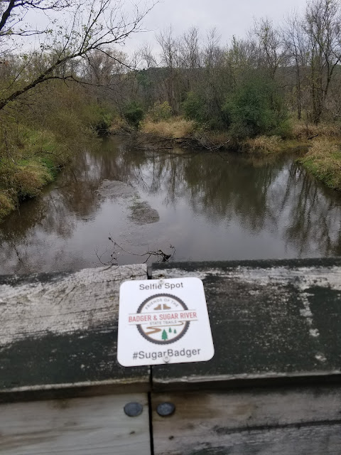
 ... and this 'selfie spot'....
... and this lovely late bloomer.


 |
| Prairie Spiderwort |
But nothing genuinely exciting happened to me as I walked. No one stopped me to ask if I was a snail, and I didn't get to give away any patches. I was just past Tin Can Road when I ran into Theresa again walking the opposite direction.
The plan was that Theresa would continue walking from Schneeberger Road, heading east, and I would finish the segment if I could. When I was done, I would find out where she was and go get her. She had the safety net of her bicycle, so I wasn't in too much of a hurry and continued picking up geocaches as I went. The trouble is, when I do that I effectively reduce my speed to just below the snail threshold, and Theresa actually covers ground faster than I do. As a result, when we once again heard the crash of thunder, I found myself a good mile or so from the car, where instead I could have easily been done by that time.
The phone rang. Theresa had made it as far as Ware Road. Due to the lightning she was going to bike the rest of the way to the car. I basically ran all the way to Schneeberger Road, barely beating the rain, threw the bike on the rack and drove to Albany in a sweat. I believe the time was about 2:00 pm.
The rain, as fickle as a cat while you're holding a door open, came and went once again, and by the time we were done eating lunch it had diminished to a light mist.
This left us with just enough time to go back to the Monticello Segment and make up for my earlier mistake, as well as give Theresa the opportunity to cover the miles.
Location 3: The Monticello Segment: All of the segment for Theresa, and the parts that were left for Brock from this morning.
6.5 miles of trail covered by Theresa, 5.3 miles by Brock, plus 2.0 miles extra hiking/biking
Both of us had done enough walking for the day. It was time to do some bike riding and just get the segment marked off as 'Done'. Someday, if we ever want to get the Thousand Miler patch, we'll both return and hike the segment, but for now we just want a line across the map.
We decided to start easy. There was a very light mist in the air, but not enough to be a real problem. We dropped a car at the south trailhead and drove north to the Tunnel Road intersection where we started biking south. We actually ran into Brianna Grace one more time up here as she continued walking merrily under her umbrella.
We biked the trail I had missed walking on that morning, and took the correct path, crossing over that silly 150 feet of footpath so that we ended up finishing on the other trail once we got into town. Then we reworked our way north to tackle the rest.
We had absolutely no intention of going through the tunnel, but we both thought it would be nice to see the rest of the trail, so we went around the gate (there was a well-trodden path where others had done the same) and biked our way leisurely to the mouth of the tunnel, where another gate stood open. Obviously, people aren't too concerned about the tunnel collapsing, but as I said, going through wasn't really an option.
Instead, we biked back to the car again, and drove around to the north side to repeat the exercise on the other part of the closed piece of trail. This meant we covered 1.5 out of the whole 1.7 miles, and did it twice, once going each way. I look forward to coming back some day and doing the last little bit if they ever open up the tunnel.
For the last leg, the 1.1 miles north of Tunnel Road, we drove to the far end and walked back to the car. It was an exhausting day, and we were both wiped out. It would be a long, tired drive home, but we had covered an astonishing amount of trail today, and put a real dent in our 41 mile target for the month.
On the way home we went through Lodi to snap a few photos and fill up on gas. Trail community visited.

One more story to remember. When Theresa was walking eastward on the Albany Segment, she happened across a Buddhist Monk. She could tell he was Buddhist because she asked and that's what he told her, plus he was clothed head toe to in a monk's robe. He said he wanted to tell her about Buddhist Dharma. "What does that mean?" She asked. He told her that it was a very long story, but if we could take him to our home where he could bathe and wash his clothes, he could tell her the story. When she said she lived three hours away in Wausau, he said, "I could go to Wausau."
Theresa then asked if he was vaccinated, and he got angry at her, saying that he didn't need vaccination, his prayers keep him healthy. "Well," Theresa said, "that may work for you, but it doesn't work for me."
At that point the fellow stormed off furiously, and shouted back at her, "It would work for you too you just don't know it!"
We have seen many odd things along the Ice Age Trail. This was the first time we've encountered an irate Buddhist.
Brock's Progress on the Mammoth Hike Challenge: 30.8 miles
Theresa's Progress on the Mammoth Hike Challenge: 39.2 miles
Running Total: 766.4 miles of trail covered, 10.8 miles of trail half-covered; 125.2 miles 'extra' hiking/biking. End of Day 108.
No comments:
Post a Comment