Day 147: Scuppernong Segment, Merton Segment (Part 4), Waukesha County
Day 147: Saturday, March 19th, 2022
Total Miles covered for the day: 6.5 plus 0.5 miles extra hiking
Location 1: The Scuppernong Segment
5.6 miles of trail covered plus 0.4 miles extra hiking
Scuppernong. "The Scupp". The land of hills and trees. The land of... grapes?
I'm often curious about how a Segment gets it's name. Or a city park. Or even a hill. When I see a name like "Scuppernong" I say to myself, 'This is an opportunity to learn something'.
The Guidebook was no help on this one. Onto Google Maps. There is no City or Town of Scuppernong. There is the Scuppernong River, and the Scuppernong Springs Nature Trail and the Scuppernong State Prairie Natural Area. There is a Scuppernong Drive in Dousman, WI.
There is the Scuppernong StoneWorks business where presumably, one can hire stone work done, or at least get stone. One can live in Scuppernong Heights. None of this was getting me any closer to what the name actually meant.
A quick search of surnames came up empty, which wasn't entirely surprising. I mean, who wants to introduce themselves as 'Alicia Scuppernong?'.
So a more traditional Google search was needed.
Wikipedia to the rescue. https://en.wikipedia.org/wiki/Scuppernong
The scuppernong is a large variety of muscadine (Vitis rotundifolia),[1] a species of grape native to the Southern United States. It is usually a greenish or bronze color and is similar in appearance and texture to a white grape, but rounder and larger and first known as the 'big white grape'.[2] The grape is commonly known as the "scuplin" in some areas of the Deep South. It is also known as the "scufalum", "scupanon", "scupadine", "scuppernine", "scupnun", or "scufadine" in some parts of the South. The scuppernong is the state fruit of North Carolina.[3]
State fruit of North Carolina? How had I never heard of this thing before now? Even so, what does it mean? Where did the name come from?
In literature:
Scuppernongs are mentioned in chapters 4 and 22 of To Kill a Mockingbird.
Really? To Kill a Mockingbird? Huh.
Another Scuppernong River in North Carolina. A Scuppernong Lake... AHA! There it is:
It was first cultivated during the 17th century, particularly in Tyrell County, North Carolina. Isaac Alexander found it while hunting along the banks of a stream feeding into Scuppernong Lake in 1755; it is mentioned in the North Carolina official state toast.[5] The name itself traces back to the Algonquian word ascopo meaning "sweet bay tree".
So now I know. There is such a thing as a 'State Toast'. I also know that the word 'Scuppernong' is derived from the Algonquin language.'Ascopo' is "sweet bay tree", and according to another source, 'askuponong' means "the place of the sweet bay tree". So 'Scuppernong' isn't really a grape, but rather a word describing the place where the bay tree grows. Apparently, the Algonquin people valued the region for the bay leaves, not the grapes. It surprises me not one tiny bit to discover that the word has been used incorrectly since 1755.
Oh yes - hiking. Sometimes I forget why I'm blogging.
Today was another official "Snail Hike", put on as an organized event. Theresa does all the planning. I just hike.
Yesterday we played a new game called 'Catch the Snail', and it worked so well we did it again. The hike didn't officially start until 10:00, but I dropped her off early at the starting point for our first leg of the trip, which was at the intersection with County Road ZZ. The time was 9:47 am, it was 35 degrees, and the skies were gray with forecasted rain looming.

Welcome new Snails: Rich Hilliger, Doug Richter, Lucia Liudmila and Evgenya Liudmila (Shelobolina).

By 10:16 am, we were ready to go. It was 35 degrees. That didn't seem to phase anyone there. We left the lot (there are two large parking areas here on ZZ and we chose the big one to the north) and walked the 0.2 mile down the road to the trail, choosing that over the blue spur. I only did that because that was where Theresa started, and I didn't know exactly where the blue spur would take me.
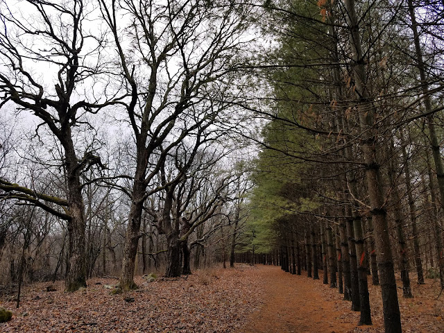
We started out walking through a dense wood with lots of evergreen trees and lots of undergrowth. The way was uphill at first, though not steep. With no snow on the ground, we were making good headway.

It wasn't exactly a gorgeous day for a hike, but there were still plenty of other people around. We saw lots of cars in both lots we had used so far, and it wasn't long before we were passed by a couple of joggers.
Bing! My phone went off. Message from Theresa. It was a photo of the two joggers.
Apparently, Theresa engaged them in conversation. "Heck yes, we want SnOTT patches!"
Introducing Michael T Riordan and Gabby (very fast snails).

On we went, and we eventually caught the snail at 10:34 am. Everyone was excited to get their patches.


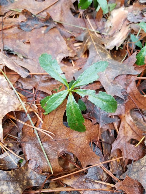
There were a great many lichens, mushrooms and other fungi. Lucia loved them all.

This is one of the photos Doug shared after the hike. Better camera - better photo, but more than that, better photographer. I have a lot of photos of Theresa walking down the trail ahead of me, but this is one of my favorites. Maybe it's the ponytail.

A shot of Lucia exploring Wisconsin.


As is typical, we keep the Chat Group updated as to our progress and direction of travel. That way anyone who couldn't make it to the start of the hike knows where they can go to find us by hiking in the opposite direction. That's what this trio did, and we briefly chatted with them before giving them SnOTT patches and sending them on their way.
Carrie Preston, who hikes with her very own Monty the Mammoth, had met us in Cross Plains and so already had her patch, but we added to new Snails to the list, Kris Krummel and Liz Krummel.

Just before we reached the Hwy 67 crossing, we ran into this young man, who may have been the most elated recipient ever of our silly patch.
Meet Loren Phillips. If ever a casual passerby could become an instant friend, this was one of those times. I sincerely hope we encounter Loren again on the trail.


Ordinarily I will take the time to do side-hikes to go check out DCAs and Camping structures. This part of the trail passes by Kettle Moraine Southern Unit Shelter #1, and I even started the side hike with Rich and Doug, but it was farther off-trail than I wanted to go.
Rich and Doug persevered, however, and went up to check out the Shelter. Doug sent this photo, and while I didn't personally get a look at the inside, I can say that this (along with literally all the shelters we have encountered in the kettles) seemed like an awesome spot to spend the night. It even has a picnic table.
This one also has the benefit of being a long way off the main trail, meaning that there would be a reasonable expectation of privacy. Nice.

We reached the Eagle Trailhead at 12:02 pm. Rich and Doug caught up to us at the end, and they took off for the day. Meanwhile, we went north to hike the second half of the Segment and Lucia and Evgenya came with us.

All of us needed a rest stop. What to do? There were options, of course, but we chose to drive up to the Village of Dousman to the Sunny Side Up Restaurant for a little break from the trail. We spent a nice, relaxing lunch with our new Russian friends, and ended up eating way too much food for a hiking day.
Eventually we rolled ourselves out the restaurant and made our way to the north trailhead. There is a little but of off-road parking there, but it might be iffy in the wintertime. We started hiking the north half at of "The Scupp" at 1:49 pm. It was all the way up to 37 degrees, but the rain that had been holding off for so long finally started falling. It was a light, spitting rain, though, so it didn't really cause an issue.


I checked back on the elevation maps and apparently we picked up about 100 feet in elevation as we walked through the woods and made our way to the Group Camp. It didn't feel all that steep, and I don't really remember the climb at all. I think it's because we were enjoying the company.
The private road leading into the group camp area was gated off, though we couldn't see it from here. We had originally thought of this as a possible parking area to meet people, but found that it was still shut down for the winter. In addition to the vault toilets being shut down, the water was still turned off. There should really be different symbols on the map to indicate facilities that are seasonal and may be unavailable during the 'off-season'.
And then we hit the part of the Segment that gives the Scuppernong its reputation for being hilly. The All-Trails website has lots of comments like, "The most challenging of Waukesha County's IAT segments", "rocky, rolling terrain with plenty of nature to push you on" and "Not an easy or moderate trail".
The northern Scuppernong is like a fine symphony. Smooth and easy going at the start, soaring and exciting in the middle, then smooth at the end. The middle part features hills and dips, first with 20 and 30 foot shifts, then a sixty-foot drop followed immediately by a sixty-foot climb. Then we began a long, slow descent down 100 feet of elevation, ending at the bottom of what is basically a teardrop-shaped hole in the ground. We had just spend the better part of three tenths of a mile walking downhill, with hills both left and right, to find ourselves at the bottom of a well. Where was the water? I didn't even see a streambed, or any indication that water typically flows through or collects in this area. I can't explain this, and even now, reexamining the maps and topography of the area I have no idea why there is not evidence of water. There's got to be a drain somewhere, so I'm guessing we were sitting on top of some very porous and eroded limestone.
In fact, there were several such holes. We no sooner climbed the step muddy path to get out of one hole than we were plunging right down into the next one, as if the whole intent of the thing was to make us say, 'Oh look - what an interesting series of holes in the ground. I wonder where the water is?'
Seriously though, I am not completely at odds with the course of the tread through here. It absolutely would have been possible to avoid a lot of the elevation changes that we encountered on the trail, but this was an opportunity to see some of these kettles from the bottom. Most of the time through both the northern and southern units of Kettle Moraine, the trail sticks to the tops of the eskers and avoids the depths of the very features that give the region it's name. But here, on the Scuppernong, one can get an up-close and personal view of the kettles without the risk of seasonal flooding.
I am guessing, and it is an educated guess, that all the water in this region makes its way underground until finally breaking free at Scuppernong Springs. After all - the water that flows through the Scuppernong River has to come from somewhere.


Location 2: The portion of the Merton Segment along the Bugline Trail between County Road VV and Dorn Road
0.9 miles of trail covered plus 0.1 miles extra hiking
One may ask how it's possible to stretch the Merton Segment out into four trips. Let's just say it's because there are so many tough miles surrounding it that it always felt like a place to go to get just a little extra hiking in. Two such trips were night hikes, with headlamps. One trip, yesterday, came at the end of a long day and we were racing to get done before darkness fell. Today, the last day, was the only one where we still had plenty of light left when we finished.
So here we were today with only nine tenths of a mile left before finally finishing Merton for good. It wouldn't complete map 83, or the county, and we wouldn't reach the 1000-mile mark, but it sure felt good to finally put it behind us. It had reached the point of being a standing joke whenever we finished our planned hike for the day and had time and energy left for just a little more.
"Where should we go now?"
"Well - we could head back to the Merton Segment."
So we left a car at the top of the hill on Dorn, then drove around the corner to park at the transfer station situated where the trail crosses VV.

It was now all the way up to 40 degrees. Reasonably warm considering what conditions we have been walking in over the last few months. The skies were gray and there was a light, damp breeze in the air. Our legs were tired, and the trail was causing a feeling like we had been watching someone else's unruly children for a little too long.
It was 5:50 pm.
We walked east, truly expecting to be walking on the Bugline bike trail, but no - the Ice Age Trail Alliance decided to go off to the north a few feet and establish their own trail in the ditch that runs beside the bike trail. I'm not sure why they did that. North of VV, and for nearly three quarters of a mile the IANST walks atop of the bike path, but most of the 0.9 miles east or south of VV is just slightly off of that easy, gravel walkway.
After finishing Scuppernong it was a little disheartening to see a nice gravel path a few feet away and yet feel compelled to walk in the ditch instead. Not that it was a terrible trail. It was actually quite decent as far as trails go. Despite running so close to the bike path it actually had a somewhat woodsy feel to it, and it keeps hikers away from the snowmobiles.


Nailed it.

Running Total: 983.4 miles of trail covered, 149.3 miles 'extra' hiking/biking. End of Day 147.
No comments:
Post a Comment