Day 148: Monches Segment, Waukesha County
Connecting Route (x2), Washington County
Day 148: Sunday, March 20th, 2022
Total Miles covered for the day: 10.7
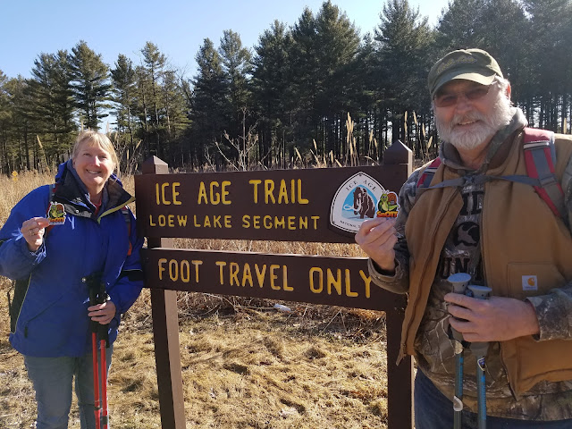
Location 1: The Monches Segment
3.1 miles of trail covered plus 0.1 miles extra hiking
So it was with somewhat raised expectations that we approached our day. While this didn't quite make our top ten list of favorites, I can see what it was that people liked about it. Hills, trees, water (there has to be water for anyone to call a segment a 'favorite'), nice tread, not too terribly steep, good blazes, good parking on both ends - all of these added up to a pleasant segment. The fact that today was the first official day of Spring and actually felt a little like Spring might be on its way made it all the more enjoyable.
Once again, we played our game of Catch the Snail. Theresa drove her car up to the huge parking lot situated just north of the Waukesha/Washington county line on County Road K and started her hike a few minutes early while I hung out at the official meeting place, the reasonably large parking area just west of the point where the Monches Segment meets the Merton Segment.
By 9:30 am the crowds were gathered at the south trailhead parking area and I was surprised to see how many people were there. Apparently, the hint of Spring in the air on a sunny Sunday was enough to bring out the hiker in people.
I took a photo while we were at the south parking area.
I'm not sure why I passed out he Snail patches at the beginning today. I got carried away.

Then we drove up to the starting point of the hike, the same parking area Theresa had gone to earlier. It was a little unusual for me to catch a ride with someone else at the start of the hike. When we pulled into the lot, I met two additional hikers who wee just catching up with us, Greg Moreau and Lucy Bunker. They were a really nice couple and I enjoyed chatting with them for whatever time we had together.


Despite her pace, or lack of it, she still manages to cover 6 to 10 miles a day, and sometimes more. What she lacks in speed she makes up for in determination. In my opinion she has earned every one of those breaks she takes, and more.


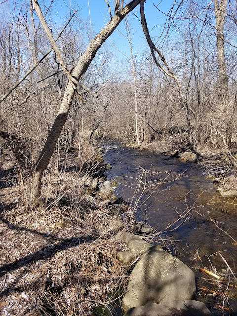
I don't know why people like taking pictures of water so much, or why so many people think pictures with water in them are beautiful pictures. Perhaps it's that lizard-brained connection we have with water, connecting at the deepest level with what we innately understand is the very source of life.
Give me a bench by a creek and a warm Spring day, and I will stop time itself just to watch the water ripple across a set of stones, or swirl next to a branch. Water is magical.


More Snails!

Meet Mike Bonness, Jason Affeldt, Cindy Bonness, Larissa Affeldt, Theresa, and of course, Sable (the dog).


This was an absolutely awesome example of the type of rock that forms in hummocky terrain. You can tell this wasn't part of the outwash, because the particles aren't sorted into size strata. Instead, this was the supraglacial meltout debris from the top of the glacier that fell in place and spent 10,000 years hardening into rock.

I don't know who fished this out from where, but I'm glad they left it there on the side of the trail for people to discover.


We have seen many such people who were not truly avid hikers of the IAT suddenly appear on the Thousand Miler Wannabes or the IAT Facebook pages as new members. You never know where the next group of people will come from who truly love the trail and help to keep it alive. Maybe the little one in the backpack will lead a Chapter someday.
It could happen.
Location 2: The Connecting Route between the Cedar Lakes Segment and the West Bend Segment
5.4 miles of trail covered
So now we sat in the car with the afternoon in front of us. It was a driving home day, but it was also pretty early. A few miles to the north, on either end of the West Bend Segment, was two relatively short connecting routes that were the only unhiked miles between the Eagle Segment and the City of Glenbeulah. Put differently, it meant 7.6 miles separating maps 80 through 89.
7.6 miles was a lot to ask after hiking more than three miles on trail, but the rest was all on roads. Could we do it? We weren't sure. The only way to know was to start walking and see how far we could get.
We dropped a car at the north trailhead parking area of the Cedar Lakes Segment and made our way around the corner to Sleeping Dragon Road.


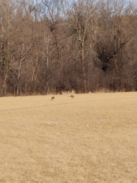
Just around the corner to the south, we came up to these guys, who would have dearly loved them.

When we got to the car, we started looking for another place to take the next leapfrog hop. This was not as easy as you might imagine, because we wanted to go at least as far as County Road NN, and once we started looking for a reasonable place to pull over, we found that there was literally nothing north of Scenic Drive at all until we reached the parking lot for the West Bend Segment. That was too far for one leg, so we went back down to NN and parked along the road in the best spot we could find.

The miles didn't exactly go by quickly, but they did go by. We jumped in the car at Sleeping Dragon and had to drive all the way up to the West Bend parking area and just take the long walk all the way back to NN for our final leg.
Is it a scenic walk? Well - maybe. There are some pretty impressive hills, and we walked past some nice homes. On the south end there was a nice view of the Lake. Was it a safe walk? No, no it wasn't. There was basically no shoulder. Cars would come whipping around corners and have to come to a sudden stop because we were there on the road with nowhere to go and a car in the opposite lane kept people from swerving to avoid us. It was not fun at all, and we were more than a little relieved to make it all the way down to NN and the lake's edge, where the road was a little more open and easier to walk.

Yes, it's a fake frog.
This connecting route was 5.4 miles long. We made exceptionally good time. It was only 4:00, and both of us were still standing. With only 2.2 miles left on the other CR, we knew we could finish it, but that would make driving home a risky exercise. Despite the risk, we pushed on.
Location 3: The Connecting Route between the Kewaskum Segment and the Southern Kewaskum Segment
2.2 miles of trail covered
It was now up to 54 degrees. According to Theresa, that's t-shirt weather.


And then we were done. by 5:43 pm we reached the Southern Kewaskum trailhead sign and put this "high-mileage" first day of spring in the books.

Running Total: 994.1 miles of trail covered, 149.4 miles 'extra' hiking/biking. End of Day 148.
No comments:
Post a Comment