Day 68: Northern Blue Hills Segment (Part 3), Rusk County
Connecting Route, Washburn and Barron Counties
Day 68: Saturday May 29th, 2021
Total Miles covered for the day: 7.0, plus 0.5 miles extra hiking
Location 1: The southern half of the Northern Blue Hills Segment, from Stout Road to the north to County Rd F to the south.
4.6 miles of trail covered, plus 0.4 miles extra hiking.
4.6 miles of trail covered, plus 0.4 miles extra hiking.
This was our second attempt to hike this section of trail. Yesterday we were planning on hiking this piece but wound up in the wrong spot for our drop vehicle so we adapted our plan and hiked the Southern Blue Hills instead.
Today, though, I took a little more care in giving instruction to our GPS and ended up on County Rd F as we should have, so as to drop our car off at the intended end of the hike. There is literally NO parking at the trailhead, so instead we went about a tenth of a mile west and parked at what looked like a reasonable pull-off on the south side of the road. Then we drove back up to Stout Rd to the 0.3 mile spur trail we hiked two days earlier.
One thing I didn't mention is that just as you're making the final turn to the large, gravel parking area you can see the remnants of a 1941 Ford Super Deluxe, color rust, dumped in the weeds and shot full of holes. There isn't much that remains intact on this once proud vehicle, having seen the ravages of time and neglect. It's actually a pretty good metaphor for the Northern Blue Hills segment.
Today was a LOT different than it was two days ago, where we were dealing with cold, pouring rain. Today it was 58 degrees already, although that was at least in part because we were getting a much later start. After the punishing conditions we faced over the last two days were were less than eager to get started today. Nevertheless, we were geared up and ready for our hike at 11:30 am, very much looking forward to saying 'done' to the Blue Hills.
The spur trail was a lot different today, too. The torrent of water was gone for the most part, leaving behind a seriously eroded mess. Walking was easier because it was fairly sandy and it drained well, but someone will need to put serious effort into reclaiming this road for drivability if they ever intend to use it again.

The first part of the trail was a long, uphill stint that peaked out about a half-mile later at 1662 feet of elevation. It was the highest point on the Northern Blue Hills segment, and the Southern Blue Hills boasts one only slightly higher. The trail here was wide and grassy, with very easy walking and almost no mud.

About a mile into the trek, as we neared the pond called 'Lake in the Hills' by the locals, we ran across this fine fellow.
 |
| Good camouflage |
The lake itself has very black water, though that doesn't show up well in photos.


After that, we had to pick our way across the mucky trail right next to the lake, or bushwhack a little bit uphill. This was poor route planning and could use a permanent move about 10 feet uphill.
On the south side of the pond the trail rose rapidly, straight uphill, creating a very unfortunate washout that was 100% the fault of the IAT. This absolutely needs a re-route with a switchback, or a slightly different approach to the whole thing.
Once we climbed up out of that gorge, however, we found ourselves walking along a gorgeous part of the trail that was mostly level, grassy, and with good footing, before we stepped onto an ATV trail that we followed for a while.


It's a little hard to see from the photo below, but this is a fairly steep hill, and directly across the creek was the continuation of the trail on the other side.

This was NOT the river crossing we had been hoping for. Now I am fairly adept at rock-hopping across streams, and Theresa had made an artform out of ignoring them and marching straight through, but I wasn't all that impressed given that there was no indication on the map that there was a ford involved. Plus, as we started up the other side we could see where the four-wheelers had absolutely torn the uphill track to shreds, gouging deep ruts as they clawed their way uphill through the mud. We got another 100 yards or so, avoiding what was suddenly very wet, puddled, muddy trail until Theresa and I realized just about the same time that we were no longer seeing yellow blazes.
I went a little further down the trail, and came to the conclusion that something was definitely wrong. I needed to backtrack and figure out what we missed. And - after I re-crossed the creek to the northwest I very quickly spotted the blaze that was on a tree, 90 degrees to the left. We were so focused on getting across the stream that we missed not only the turn arrow, but also the yellow blaze.
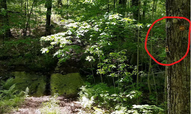 |
| The arrows we missed |
 |
| The Yellow Blaze we missed |
In our defense, though, we are definitely NOT the first hikers to miss that turn. I know it in my bones. Let me warn you, if you are hiking north to south through this section, that you must TURN LEFT when you get to the river. If your river crossing doesn't look like the picture below, you're in the wrong place.

So I had to assist Theresa back across the river at the shallowest point we could find so that she could get back to the trail, because it wasn't possible for her to bushwhack her way along the other side until we reached the bridge.
Once we reached the correct creek crossing, however, we found ourselves at the one and only place in the Northern Blue Hills that I would consider a gem. For about a quarter of a mile we hiked along this creek, crossing over I don't remember how many times on little bridges. For a quarter of a mile, I was really enjoying the Northern Blue Hills.
Sadly, the last of these bridges had taken a little damage by a falling tree. It's still sound and can be crossed, but one end lists a little and could be hazardous when wet.

When we left the creek, though, it was back to the Northern Blue Hills in one of its grumpy moods, with a lot of up-and-down hiking on a single track, being grabbed at from both sides by long grasses and a few early raspberry stems. It was a little more muddy, too, and it ended up with a long, downhill stretch before we had to cross another creek.
The hills continued, not terribly steep but by this point very noticeable because we were getting fatigued and Theresa's knees were saying, 'Enough, already!' Really - it's not the walking that's a problem, it's the uneven ground and the accursed mud puddles that force you to walk awkwardly on whatever uneven surface you can find. That, combined with steep downhill pitches, had been taking their toll, and not just on her. My knees were starting to hurt too, and my ankle, and my feet, and various other parts of my anatomy because really, this was day three in a row of miserable hiking through the mud.
If there was any consolation, it was a bright, sunny day, and the birds were singing up a storm. Another quarter mile or so and we were hitting even more hills, coming out onto a hilltop for a while, and thankfully staying there until we approached the final drop-off.
There is a spot on the trail, a little more than a quarter-mile from the southern trailhead, where there is a major switchback that crawls up (or down) an escarpment that defines the northern edge of the Devil's Creek waterway. It is steep enough that a number of stair treads have been installed, not all of them successfully, and significant care needs to be given to prevent slipping on the gravel and falling. Picking our way down that hill Theresa must have tweaked her knees at least five times, until it got to the point where every step was painful.
At the bottom of this hill, we were treated to two creek crossings on wooden bridges, and I must say that the fast-moving Devil's Creek was quite pretty. But we were starting to feel the end of the hike, and didn't linger long.

As we made the long, slow, uphill climb from Devil's Creek, which featured a few more log stairs, we encountered our first hiker of the entire Blue Hills adventure, going the opposite direction. He was moving fast, and said he was hoping to cover the rest of the Blue Hills and part of Hemlock Creek before the weekend was up.
"How did you like the Southern Blue Hills?" we asked him.
"Not too bad", he said.
We didn't bother to warn him about any of the hazards ahead. We figured he would do just fine.


Even though we were less than a tenth of a mile from the end, when we spotted a log Theresa needed to sit down and take some stress off of her knees. If it hadn't been for the wood ticks waiting on the log for anyone silly enough to sit there we may have stayed longer, but as it was we got up fairly quickly and dragged ourselves to the finish line.

We breached the roadway at 5:25 pm, temperature 67 degrees. From here we faced the 0.1 mile walk to the car to the west. Believe it or not, we didn't quit there for the day.
Location 2 :Connecting Route between the east end of the Tuscobia segment to the north and the north end of the Hemlock Creek segment to the south, in Birchwood Wisconsin, Washburn and Barron Counties
2.4 miles of trail covered plus 0.1 extra hiking.
Despite the long, hard three-day march we had just finished, there was some daylight left and we didn't want to waste the opportunity to knock off some roadway connecting route. The 2.4 mile walk along Loch Lomond Rd and Tagalong Avenue up by the Tuscobia Segment in Birchwood was just the ticket.
We parked our car down near the end of the Hemlock Creek segment where we had once before, a couple hundred feet from the trailhead. Then we drove up about halfway to the park near Sucker creek and walked back down along the gravel and paved route to the car. We wanted to do this shorter piece to evaluate Theresa's knees. As it turned out, the flat, easy walking was actually helping her knees feel better, so we went ahead and drove up to Featherstone Road on the north end to walk back south and finish the roadway.
This hike was started at 6:30 pm, ended at 7:59 pm, and the temperature was 63 degrees on both ends. As we got to the car I decided to take one more photo of one of the very busy buzzy bumble bees on the honeysuckles in the park.

Running Total: 471.2 miles of trail covered; 40.1 miles ‘extra’ hiking/biking. End of Day 68.
.
.
.
.
No comments:
Post a Comment