Day 177: St Croix Falls Segment, Polk County
Day 177: Sunday, May 22nd, 2022
Total Miles hiked for the day: 1.7; Net Miles 1.6
Location 1: The St. Croix River Segment, between the western terminus and the first available parking lot.
0.13 Miles of trail covered (again)
Before I get around to talking about our short jaunt to the revisit the western terminus, I'll tell you about our early morning. We slept last night in the van again, in Luck, Wisconsin, in the parking lot of the Café Wren. It got down to about 40 degrees last night, which is positively balmy considering the layers of padding and bedding we have with us.
Once again we woke early and made our appreciation known by heading up to Café Wren for breakfast and coffee. Today we sat in the art gallery side of the building, appreciating the art and in general getting ready for our hiking day. A man was there, performing a volunteer function for the community, and he couldn't help but notice we were talking about the trail. We ended up striking up a conversation.
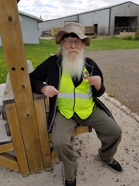
Meet Jeff Peterson, trail hero. He does the trail maintenance for the Straight River Segment. He is a member of the Indianhead Chapter and spends many hours quietly helping to keep the ticks at bay by regularly cutting the grass along the trail. His wife helps with branch removal.
Now, he is a member of the Snails.
I really like running into people who help to maintain the trail, so I can tell them how much I appreciate their efforts.
Thanks to the fact that I made such huge mileage yesterday, our goals for the day were actually fairly limited, and it gave us time to do the one thing I really, really wanted to do if I could: Revisit the Western Terminus.
So after breakfast Theresa and I made our way into Interstate State Park and drove directly to the parking lot at the intersection of Interstate Park Road and Park Road, which sits on top of the Ice Age Trail. It was so easy - we knew right where to go, and could drive there with no difficulty at all. Nine years ago, when we came here in 2013, that was not the case. We had no idea what we were doing, or how to find the trail. We spent an entire day wandering around Interstate State Park, and after literally hours of walking in temperatures in the high 90's we finally made it to the parking lot. That was an awful day, which I refer to as Day 0 of our IATA adventure because it took us the entire day just to find the trail. You can read more about that at the very start of our blog.
Today, though, we were trail-savvy, seasoned hikers and we wasted no time at all in stepping onto the trail and heading towards the terminus.
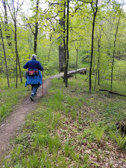
My biggest reason for coming back was because the last time we were here we didn't get any photos. I had no idea at the time that having a digital record of our standing at this spot would be so important. So though we have been here before, we started down the sometimes steep and fairly rocky trail that led across bridges,
past scenic overlooks of the Dalles,
past interpretive signs,
and the occasional plaque,
on the well-beaten path
that got ever closer to the river, and eventually led us to
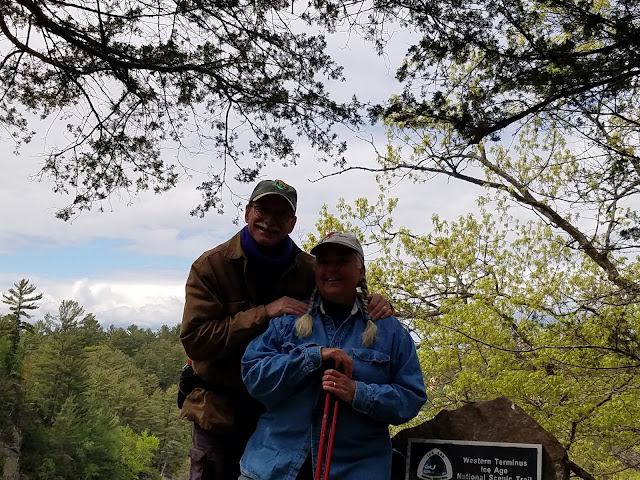
The rock of rocks, where our adventure had begun.
There is a camera/phone stand there that allowed us to take a picture of ourselves, but the lighting was absolutely terrible. I tried zooming in a little, and that seemed even worse.
OK, try another one.
How about a smoocher?
Still not a great photo. Maybe zoom out again?
This is ridiculous. Here - gimme that thing...
Perfect.
If you were to ask me which end of the trail I would have someone start with if they were doing a through hike, I would have them start here. If you asked me which end they should finish on, I would also say here, at the Western Terminus. It's fabulous. It's gorgeous. It's everything you could want the Ice Age Trail to be.
With one final shot of the river and a moment to take it all in, we headed back up the trail.
Location 2: The St. Croix River Segment, through Ray Zillmer Park
1.7 Miles of trail covered
When we came through here in 2013, the section of trail that now travels through Ray Zillmer Park did not exist. Instead, there was a connecting route that went up Mindy Creek Lane, then along Oregon Street and Sunrise Road. Now, instead of a 0.65 mile walk down the road, hikers are treated to a 1.7 mile walk past some of the most interesting and unique topography on the whole trail, featuring exposed bedrock and basalt knobs and outcroppings.
We hiked it from west to east, which meant for us it started out in a parking lot on Day Road, where a kiosk gives a lovely bit of history on Ray Zillmer, who was quite literally the founder of the IATA, and without whose efforts the trail would not exist.
Even the forest through here seemed new.
I think we were fortunate in our choice of direction. It afforded us this view of the now-famous Zillmer Park gateway tree.
The trail absolutely could have gone around this tree, rather than under it. I'm so glad they didn't do that.
Unfortunately, this was not the only tree to avoid. About halfway into the journey we encountered this tree. What you're seeing below is not what we saw when we got there. In fact, there was so much tree in the way the trail was essentially unpassable.
While Theresa sat and took a short break, I went after it with my folding saw, and in a matter of fifteen minutes or so I had hacked away enough branches that it was now possible to walk through.
At least some of the feeling of newness came from the fact that the trees were just leafing out in bright yellow-green foliage after their long, long winter's nap.
The temperature had by now climbed up into the mid-fifties, so it was a spectacular day to be wandering through the woods, and we were surprised we hadn't encountered more people.
We went on for a while by ourselves, Theresa in the lead and me trailing behind, chattering about who knows what, as we always do. Then I told Theresa to freeze!
Off in the distance, quite unalarmed by our presence, was an albino deer. There was a lot of foliage between us, and it made photography quite challenging. I did manage one image that clearly showed the deer, but after a while I just gave up on that and the two of us stood and watched this beautiful animal that had made itself known to us.
This was not our first albino deer on the trail, but there is something incredibly special about any time we encounter one in the woods. I count this encounter among the most precious of all my memories on the trail.
Eventually the doe wandered out of sight and we headed back down the trail, with blue skies above and spring surrounding us on every step.
And when we got to the sign on Sunrise Road we had now officially completed the St Croix River Segment, having replaced the connecting route with the new bit of trail.
So then we drove back to the parking lot on Day Street, and I said, "We have to walk down and touch the sign."
There are those moments when you say to yourself, 'Does it really matter?' And the answer you give yourself is, 'No', but you do it anyway. On the other hand, maybe it's what you do when no one is looking that matters most. In any case, Theresa and I walked from the parking lot down the driveway and across the street until we could get ourselves in front of the trailhead sign headed off toward, and along, the St Croix River.
We touched that sign at 1:47 pm, and now we could say it was well and truly done. I'm glad we did. There is nowhere else to get a picture of a sign labeling the old Mindy Creek Segment.
On each segment we revisit, I go back and check to see how many miles I counted before, count the mileage for what was actually hiked, then adjust the numbers for whatever is longer or shorter. This one was weird, and I can't explain the differences. Though we hiked a 1.7 mile section to replace a 0.7 mile roadway, the final tally was actually a full 1.6 miles further than before. Somehow or other I had cheated us out of mileage that we should have been carrying with us all along.
I guess this is why everyone has a slightly different tally for themselves when they add up all the miles. The trail is ever changing, and unless you walk it all from end-to-end in one go, it likely has shifted a little by the time you get to the end.
This was the end of my hiking day, but not Theresa's. I had to drive back so that I could work in the morning, but Theresa was planning to stay out here an extra day or so to cover all that mileage on the Gandy and the Connecting Route that I blew through yesterday.
So that was how I found myself parked back up on the Gandy Dancer, taking one last photograph of Theresa headed down the trail, just before turning my car east and heading home.
You go, Snail!!
The tally:- Completed map 1
- 1.7 new miles covered
- Converted 0.7 miles from biked to hiked
- Added 1 mile to 'extra hiking and biking'
- 280.3 miles to go
Running Total: 1177.8 miles of trail covered (856.7 hiked), 184.5 miles 'extra' hiking/biking. End of Day 177.
BONUS PHOTOS - these are the photos Theresa took while she was hiking the Gandy Dancer on the 23rd.


No comments:
Post a Comment