Day 134: Connecting Route, Arbor Ridge Segment, Storrs Lake Segment, Milton Segment (Part 1), Rock County
Day 134: Friday, February 4th, 2022
Total Miles covered for the day: 6.4
Location 1: The first 1.4 miles of Connecting Route west of the Arbor Ridge Segment ending at the intersection of County Road A and Burdick Road.
1.4 miles of trail covered
The first creeping rays of sunshine broke through past the blinds and the curtains in out little Airbnb room this morning, and the thermometer read 5 degrees below zero. I say that as though I stood there holding a little droplet of mercury encased in a pipette of glass, its upper edge receding, its life force protectively caving in on itself like my enthusiasm for hiking today.
There was no actual 'thermometer' of course. All I had to do was wake my phone up, give a casual swipe to the right, and I could see, instantly, what the current time and temperature were at the approximate place I was standing. This small device in my hand, somehow wirelessly, magically connected to 'the internet', continuously sending and receiving octets of ones and zeroes, was able to track my current location on the planet and determine what the correct time and temperature were.
Children who grow up in today's world will accept the internet as a given, never really understanding how unthinkable all this was as little as twenty years ago. I suppose, somewhere, there is a thermometer out in the frigid dawn light, measuring the current temperature. It wouldn't use mercury, but rather some form of metal alloy, capable of precisely reading temperature by the expansion or contraction of something-or-other, and that information is somehow translated to a recording device, which is then in turn stored on the memory circuits of a computer and replicated instantly to 'cloud' servers, which distribute the information on demand via api calls, sending the stream of ones and zeroes through a dizzying array of servers, routers, modems, nodes, transmitters, receivers, and sometimes actual satellites, all so that I can wake up and glance at my phone to see how cold it is, rather than take a few steps and stick my nose out the door. In the same way I grew up accepting radio and TV, taking it for granted that all that amazing stuff could just 'appear' on demand, beamed to us through the air from some distant tower.
Teachers will try to explain it. I think we all understand the basic principles of how it works. But if the apocalypse happens and I am somehow left standing to rebuild society, I don't think I could rebuild a toaster, let alone an iPhone. Ask me about fire-building. I think I could manage that one.
Which is a roundabout way of saying we were in no hurry to get going this morning. The forecast promised that we would reach 20 degrees or more by the afternoon, so we took our time getting ready. By 8 o'clock it was three above. By 9 o'clock it was eight degrees. We were out the door by 10:00, and stopped at a store or two to do a little shopping. By 10:54 we were at the starting line, and it was 13 degrees out. It would have to do.
Since we were crisscrossing our hikes using only one vehicle, Theresa had to drop me off on one end and park at the other end, walking in the opposite direction, and I would eventually reach the car and drive back to pick her up from where I started. She dropped me off at the intersection of County Road A and Burdick Road, where there was a convenient turn-off onto a farmer's field. She pulled off back towards Arbor Ridge with the car and I started walking in that direction along the very busy County Road A.

There isn't a lot to say about this walk, except that it was cold and flat, and the road was very, very busy. (Did I say that already?) With zero inches to spare on the gravel side of the white line, I found myself often walking on a steeply pitched gravel shoulder, trying to keep from tumbling into the ditch as cars went whizzing by. I walked only one mile along that road, and in that half-hour I probably had to dodge fifty cars. This, on a cold workday before noon. I can't imagine what it would be like on a nice summer Saturday.
I crossed paths with Theresa just as she was turning the corner onto A, from the parking lot about four tenths of a mile to the north. Not much information to share, we both just kept walking.
I reached the car in short order, walking along this road that wasn't really a road into the Robert O'Cook Memorial Arboretum. I posted a note to the world at large (through the ever astonishing internet) that The Snails were back on the move, and where people might be able to find us. Then I drove back to pick Theresa up at the starting point. She ended at 11:40 pm, and it was 18 degrees.
The purpose of this first, short walk in the cold was allow nature to take its course, and it worked perfectly. Both of us needed to make a comfort stop, so we headed a couple of miles back into town to take care of that and grab a snack for the afternoon. By the time we got back to Arbor Ridge, ready to start our next leg, it was 12:21 pm, and the temperature was all the way up to 19 degrees.
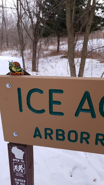
Location 2: The Arbor Ridge Segment
2.1 miles of trail covered, plus 0.8 miles extra hiking
To set up our next crisscross hike, Theresa dropped me off at the parking area situated between the Arbor Ridge Segment and the Devil's Staircase Segment.
The parking lot was very icy, and it ran downhill toward 'no way out' in case of a problem. Down at the bottom of the slope there was a large, full-sized kiosk with great information.
We snapped this photo at 12:41 to mark the 'Start time' for this segment. It was chilly, but not too bad.


With me walking west from the kiosk, Theresa was going to drive to the other end and start working her way east.
The first thing I had to do was cross Highway 14, more or less a city street at this point, but it is still labeled 'Danger Curve' on the IAT map. It's well-labeled, because the cars that come whipping through here are moving at a pretty good clip, and the roadway is wide.
A key feature of this corner, and a good indication of what might come, is the 'Great Wall' of Northridge Drive, a rock retaining wall built to hold back the hillside from creeping onto the road. Thankfully, the way is not too steep at first, and while the road continues up and into the hills as it bends south, the Ice Age Trail takes an uncharacteristically leisurely right turn to meander first on the level, and then downhill to follow a small waterway called Marsh Creek.

What snow there was existed as hard-packed trail, The ice cleats were helpful though not strictly necessary. I said hello to a few magnificent red oaks as I made my way along the trail.


Arbor Ridge basically means trees and hills. Looking to the south, while I was casually strolling along past the creek, I could see lots of Ridge and plenty of Arbor. Eventually, I knew, I would have to hike up one of those large hills while Theresa took the downhill route.
I spotted this platform built out there in the middle of nowhere. I'm not completely sure what its purpose was, except that it offered a nice place to hang out and watch the marsh, as long as you bring your own chairs.

After the platform came the river view.

Just slightly off-trail is a picnic area by the creek. There must be a shelter somewhere, though never spotted it.

And at the creek itself there was a lovely bridge, which the IAT never crosses.

They are often disguised to look like other things. The round tube under this rock, covered by camouflaged tape looks exactly like a drain pipe.


I was getting to the point on the trail that I was genuinely surprised I hadn't crossed paths with Theresa. Having finished the section by the river, I was making my way up the 170 foot climb (elevation, not distance) that would take me almost to the beginning of the Segment and was quite a ways up when I finally crossed paths with Theresa.
"Where were you?"
"I took a phone call from Nicole at just the wrong moment and missed a turn while I was fumbling with my phone."
"How far did you go?" I asked.
"About four tenths of a mile. I kept wondering why I wasn't seeing blazes, and then the terrain didn't match what you described for me, so I turned around."
Two things.
One, there are a lot of crisscrossing trails out at the Robert O'Cook Memorial Arboretum. They are everywhere, with signs in blue or red pointing this way or that. There are plenty of yellow blazes, too, so if you're going the right way you'll keep seeing them as you go.
Second, no matter how many blazes there are it's possible to get lost. Especially if you're distracted by your cell phone.
Conclusion: Don't walk and talk at the same time. Hang up and hike.

So while I was making tracks, she was baking backtracks, and had put in an extra eight tenths of a mile before getting back on the trail. This took some of the wind out of her sails.
The solution I use on hikes like this is to get to the end, drive back to where she's headed, and walk back up the trail until I meet her so we can walk the last little bit together. Most of the time I only get a tenth of a mile or so in before I see her coming the other way. This time it ended up being closer to four tenths.
But back to the hike.
There are a few interpretive signs along the way for those interested in learning more about the many trees in the arboretum. They are sometimes placed near small clusters of benches, where I can imagine groups of Boys Scouts and Girl Scouts avidly listening to someone instruct them on the information they need for a merit badge.
Truth be told, I had forgotten about the Norway Maple, and needed a little refresher to be able to distinguish it from the more familiar Sugar Maple. I like these signs.

Near the top of the hill there is an old log cabin, circa 1940s. The cabin is not in its original location, but was moved here, log by log, and rebuilt in the year 2000.
It's a cool old building, but if you really think about it you wouldn't have to be told it had been moved. It sits here, on top of the hill, more than 180 vertical feet from water, accessible only by walking a very long distance downhill. No 1840's settler in his right mind would build such a structure in this spot. They would never survive.
.

I got the story in reverse, but it's still charming.


I reached the end of the trail at 1:37 pm, and drove back to the other end to pick up my lovely and lonely wife. Heading back up the trail I met her just at the bottom of the only downhill run in this direction, and together we made our way back to the end and the waiting van.

We finished up at 2:28 pm, which left us just enough time to go and hike the Storrs Lake Segment, the real goal for the day.
Location 3: The Storrs Lake Segment
1.8 miles of trail covered
A while back, we talked to experienced hikers who told us there was segments we should really try to hike as soon as possible. Tisch Mills was one, and Storrs Lake was the other.
The enemy was water.
2021 had been a very dry year, and we were urged to tackle these two segments as soon as possible.
Then, a little while later someone posted a note on Facebook listing the parts of the trail that are best hiked in wintertime. Again, water and mud were the primary things to avoid, and again, Tisch Mills and Storrs Lake were on the list.
We decided to take this advice, and we hiked Tisch Mills last weekend. Today, we were going to hike Storrs Lake and get that off the list as well.
It's a short segment, only 1.8 miles, and it wanders through a marshy area north of Storrs Lake through a wetland affectionately known as Bowers Lake. Don't let the name fool you. There is no Bowers 'Lake'. It's all marsh grass and wet feet.
Which is what makes wintertime the absolute best time to go there. Much of the trail wanders through some heavy woods, but the rest sits not much farther above the waterline than a loon's nest. More on that later.
Theresa dropped me off at the south end of the segment at 3:03 pm. The weather had warmed up enough that we didn't need face masks and neck gaiters. It was shaping up to be a great day.

My immediate impression was that the woods around Storrs Lake were a mess. I couldn't tell if I was looking at storm damage, terrible logging, or some combination of both. There were limbs and whole trees sprawling all over the place. There were even some semi-confusing signs to follow, such as the one below.


I got to the road at the north end of the segment, and was just a tiny bit flustered because I couldn't see where the parking area was. My phone was dead, so I couldn't bring up the sat map, so I just kept hiking down the trail, hoping it was the right way to go.
I was rewarded within a few hundred feet, and as it turns out the segment doesn't end at the road, it ends at the parking lot. I got there about 3:55, which meant I was able to get back around to the other side and catch up to Theresa again just in time so that she and I could spend some relaxing time on the Lover's Bench.
I'm not sure what time we got back to the car. For once, it just didn't matter.
Location 4: The easternmost 1.1 miles of the Milton Segment, from the Storrs Lake trailhead to the intersection of Storrs Lake Road and North Janesville Street.
1.1 miles of trail covered
I suppose we should have just stopped hiking after completing Storrs Lake. The day would have been fulfilling, having completed two segments and a little extra roadway besides. But as there was some daylight remaining, and the next thing we had in front of us was the Milton Segment, we made the decision to do just a little bit more, working our way back towards Janesville.
I say 'we', but it was really me. And it wasn't even a good idea. The wind had picked up and it had started to snow. We drove into town, looking for a reasonable place to start, or stop. We found it at North Goodrich Park, and Theresa dropped me off there to start walking while she drove back to the parking lot at Storrs Lake.
I didn't waste time on the walk. Even though this was technically a 'segment', it was really just a walk down the road. And it was an icy road, at that. We actually took the cleats off during this hike, but there were stretches where I thought that might have been a bad idea.
The highlight of the trip was walking under the highway. That's not saying much.
By the time I got to Storrs Lake and touched the sign, then got back in the van to drive back and rescue Theresa, the weather had turned positively foul.

Someday I will learn to stop on a high note. Today wasn't that day.
Running Total: 907.2 miles of trail covered, 146.5 miles 'extra' hiking/biking. End of Day 134.
No comments:
Post a Comment