Day 135: Eagle Segment, Waukesha County, Janesville Segment (Part 5), Rock County
Day 135: Saturday, February 5th, 2022
Total Miles covered for the day: 7.8
Location 1: The Eagle Segment
5.6 miles of trail covered
Once again, we woke to below zero temperatures, leaning toward 0 by 8:00. I had to work for a few minutes at 9:00, so it was easy to pretend we were delaying our departure because of other obligations. Don't think those single digits weren't a factor. They were.
Last night, the conversation went something like...
Her: "Where should we hike tomorrow?"
Him: "I think we should hike the Eagle Segment."
Her: "If we stayed close to Janesville we wouldn't waste all that time driving. How far is it?"
Him: (Checks computer) "About 45 minutes."
Her: "Each way?"
Him: "Yup."
Her: "So that's like an hour and a half where we would be driving and could be walking."
Him: "Good point. The only reason I say Eagle is because it's on the 'Do this in winter' list."
Her: "We can always come back down another time and stay closer to Eagle. It's not like we don't have plenty to do around here."
Him: "OK, then. Tomorrow we'll go back up and start in Milton from where we left off and see how far back we can get to to Janesville."
This morning, the conversation went something like this...
Him: "Well, where are we headed?"
Her: "I thought you wanted to do Eagle."
Him: "I thought it was too far to drive."
Her: "I changed my mind. Eagle is only 5.6 miles long. If we leave now we can finish before dark."
Him: (Pauses...)
Him: "All right, then. Eagle it is."
This is our life while hiking. Every day starts with a plan, that is perpetually restructured, adjusted, altered, or sometimes outright abandoned. It all depends, as they say, on the weather. And how well we slept. And which body parts ache from the previous day's hike.
It could just have well gone the other way, with me complaining about the long drive and Theresa wanting a specific segment finished for one reason or another. Bottom line - hiking is hard for us. But we do what we can, where we can, when we can. And we know that if we're persistent about it, the miles remaining will keep ticking downward.
So we headed up towards Eagle Wisconsin, to hike the beautiful marshy lowland known as the Eagle Segment. We had one car, so we were hiking alone, crisscrossing our way across the landscape.
We were working the segment from south to north, and the first thing we did was clip off the 0.3 mile driveway that ran from the parking lot to the end of the segment on Hwy 59. It was ice-covered, and didn't amount to much worth noting. Except that once again I had to question the decision to end the segment at the road, rather than at the parking lot. For us segment hikers this can be annoying, figuring out how to make it to the end of the segment not once, but twice, when there's nowhere to park at the end.
10:33 am, temperature cold.

I started south at 11:15 am.

We encountered a family of Snails on this leg, and I caught up to Theresa just as she was giving out patches. Welcome to the Snails, Kaio family!

This was actually fairly close to a a creek crossing, which stayed stubbornly open in the cold weather.


The next leg was up to Wilton Road, a mere eight tenths of a mile. Theresa dropped me off at the north end and drove back to park at the snowed-in area on County N. There really wasn't anywhere we could have parked at the Wilton Road end, so this one-car method was working out pretty well, and we were making remarkable time.

There isn't a whole lot to say about the hike thus far. The day was cold and windy, but we were hiking an area that was almost tarmac-flat, and we hadn't seen much in the way of people or animals. I did notice a couple of hawks in the sky. They were taking advantage of the unusually strong, steady winds to 'hover' in place, soaring along at the same speed as the wind, but not moving an inch in relationship to the ground. How cool would that be, to be able to just float in place like that, with hardly any effort beyond steering?
Once again, I had barely made it back to the prescribed meeting spot on Wilton road before I saw Theresa trucking up the trail.
The next leg was from Wilton Road to the parking area on Hwy 67. This time, it made more sense for me to hike south to north to accommodate the parking.
I started off on Wilton Road by 1:17 pm.


For my part, I knew Brady's Rocks were there because there is a geocache there that I wanted to pick up. Now that I think about it, I haven't logged it yet, so I have to make sure I do that someday.
Brady's rocks are worth a visit. It involves taking a 0.1 mile side-hike on a white-blazed loop trail, and there is delightful signage making the spot even more interesting.


All the wind that had been flowing freely out on the marsh and savannah came roaring up this hill, directly in my face, and I had to fight my way to the van through bitter cold blasts of air. Theresa had warned me, and she chuckled as I described it to her later.
"Told you it was windy up there."
While I was out bouncing around Brady's Rocks, Theresa encountered a truly nice couple out on the trail who were doing an out-and-back hike. They told her they came here to hike it in winter because it's such an awful place to hike in the summertime, with the water and the bugs.
This is Kevin and Allison.

"Are you here to meet Theresa?" they asked.
"Yes I am", I responded. "Did you get your patches?"
They said yes, and they told me they were really glad to see me there. We've been in the same shoes as they were. We see a lone hiker out on the trail regardless of age or even gender, and give thought to their safety and well-being. Add to that Theresa's age and slow progress, and it's easy to see how people could feel concern. That's how I feel when she's hiking alone, and I'm always just a little relieved to see her making her way along that last piece of trail.
They said yes, and they told me they were really glad to see me there. We've been in the same shoes as they were. We see a lone hiker out on the trail regardless of age or even gender, and give thought to their safety and well-being. Add to that Theresa's age and slow progress, and it's easy to see how people could feel concern. That's how I feel when she's hiking alone, and I'm always just a little relieved to see her making her way along that last piece of trail.
At 2:56 pm, she texted me the photos she took of them. I replied back and said, "They said hi."
When Theresa was strapped in, she asked "How far do we have left?"
"Only 1.1 miles," I said, "plus the tenth of a mile down to the car at the end."
She was feeling weary, and so was I. Cold weather will do that to you.
She dropped me off at the north trailhead at 3:24 pm. The trail was well-trampled up here, as it had been all day.

As the sun started hiding behind the branches the temperature started dropping. We had been as high as 24 degrees, but now it was only 20.


The story it told was sad in one respect and really awesome in another. Jim Welch was trying to hike the whole trail, it seems, and life got in the way. He made 850 miles.
You'll notice I didn't say 'only' 850 miles. That's because 850 miles is an achievement all on its own. No matter that the trail goes on for 300, or 2000, or 10,000 more miles - Jim achieved 850 miles on his journey, and that's worth celebrating. I'm glad someone loved Jim enough to brag about his accomplishments, while providing this place to sit down and ponder our own life's journeys.

Then she went her way, and I went mine.

Down the trail, past another bench, up to the top of the hill and along the spur trail to the van, the wind still brutal in my face.


One of our early goals for the weekend was to finish the Arbor Ridge Segment (done), walk off the west side of map 74 (done), finish the Janesville Segment (not done), and walk off the north side of map 74 (also not done).
There was no particular need to do any more hiking today, but those last two goals were nagging at us. Time to be impractical again.
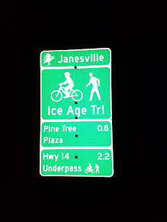
Location 2: The easternmost 2 miles of the Janesville Segment, from the intersection of N Wright Road and Humes Road to the east trailhead at the end of Rotamer Court.
2.0 miles of trail covered
This is one of those hikes where it seems like it might be a good idea before we start, and by the time we actually get there we know it will be bad, and it ends up being worse than we thought.
Winter in Wisconsin is measured in degrees. Often single digits. Often negative single digits. Toss in some wind, and cold becomes bitter. Take away the sun, and bitter can become deadly.
We take it in stride. We put on our badges of courage and truck out into the world on a daily basis, shrugging off the suggestion that it's too cold outside. But even the most hearty of Wisconsinites will recognize that being outdoors in the cold all day and not taking in anything warm to eat or drink can have an effect. Cold like that gets into the bones. It dulls the brain. It saps your strength and sours your enthusiasm.
It was a frozen excursion into a bleak Wisconsin winter night.
We did this in three legs. Keep in mind the overall objective was to finish the Janesville Segment, and we had only two miles remaining. It wasn't on roads, exactly, but it wasn't in the hills, either. Theresa dropped me off at the corner of Humes Road and N Wright Road, and then drove over to the parking lot behind the shopping center over near Briarcrest Park.
I walked on the trail first along the road, then along the back side of the shopping center. There was no joy, and nothing interesting to observe. Just the ice and snow. Actually, the trail had been cleared mostly of snow, so there was a lot of concrete and asphalt. I found myself stepping from ice chunk to snowy grass hump while I tried to preserve the sharpness of my ice cleats.
I crossed paths with Theresa. She was as unenthusiastic as I was. It was still windy, and she was getting the brunt of the now southerly wind. As soon as I finished I rescued her from the end of the trail and we took on one more leg.
This time she dropped me off at the trail intersection with East Rotamer Road, and I hiked south while she went back, parked in exactly the same spot and hiked north. This time I got the wind in my face while she had it at her back. More ice, more wind. Ambient city light meant we didn't need our head lamps.
There was one more leg to go. She dropped me at the end of the segment, across the footbridge on Rotamer Court. There is no trailhead sign.
This last walk was a test of will. Everywhere else, the wind was a terrible icy reminder of how unpleasant a Wisconsin night can be in the wintertime. On the pedestrian footbridge over the highway it was like forcing all that air into a wind tunnel and putting a path through it. I had to lean into the freezing gale to keep from getting blown off balance while the side of my face felt the onset of frostbite setting in. Ten minutes in that space would have caused permanent tissue damage. Fortunately I was able to cross it in three.
Across the bridge and out of the wind, I stopped to take off my ice cleats. I didn't need them, and I was just dulling the tips. That made it possible for me to walk faster, and I reached the car just a few seconds after Theresa had it parked. She didn't want to hike the last leg. She didn't see the point.
"You've got to hike it", I said. "You want to hike it."
"No I don't! Why do I want to hike it? What - is there something special I'm supposed to see?"
"No. It's probably the worst hike you'll ever take. It's bitterly cold and miserable, and you'll freeze your face off when you get on the bridge."
- Silence -
"Tell me again why I want to hike this."
"Because you want to finish the Segment. You won't be happy with yourself if you don't finish it."
There was more discussion. The truth is, she really wanted to hike it, just not under those conditions. Finally, knowing just how short the trip would be, she finally relented and strode off into the night. I raced the car around to the other end, and actually crossed the bridge again to meet her on the other side, so that I could help her take her cleats off. I knew she wouldn't need them for the last tenth of a mile.
When we reached the end of the route, she asked where the sign was.
"It's a little weird", I said. "This is all we've got."

Location 3: The southernmost two tenths of a mile of the Janesville to Milton Segment, from the end of Rotamer Court to the intersection of West Rotamer Road and Ohara Drive.
0.2 miles of trail covered
Unfortunately, finishing the Janesville Segment wouldn't quite get us off the map.
I was surprised, but I wasn't surprised, when Theresa asked me how far we had to walk to get off the map. I was ready with an answer.
"A quarter mile."
"Show me."
And I did. It was actually just shy of a quarter mile, at 0.24. We decided to just do it while we were complete icicles and have it over and done with. We didn't want this to get in the way of whatever we were planning on doing tomorrow.
Once final crisscross, and not even any more pictures. We ended the line a bare fraction of a tenth of a mile off the edge of map 74 at roughly 9:30 pm.
Success, but at a price. This last effort wore us both out, and Theresa had to sit under a heating blanket for two hours to feel normal again. And tomorrow we were headed back out into the cold to do it again.
Running Total: 915.0 miles of trail covered, 146.5 miles 'extra' hiking/biking. End of Day 135.
No comments:
Post a Comment