Day 138: Parnell Segment (Part 2), Sheboygan County
Day 138: Friday, February 18th, 2022
Total Miles covered for the day: 5.1
Location 1: The Parnell Segment, between the north trailhead and the road crossing on Scenic Drive
4.4 miles of trail covered
We spent last night at the AmericInn in West Bend, which was a tenth of a mile from the trail in West Bend, but a 45 minute drive from the north end of the Parnell Segment. Our entire focus this weekend was to hike Parnell, a total of 13.9 miles, and we had four days to do it in. Yesterday, though, was a driving day, and due to our late start and hazardous driving conditions we only managed to snip off a little less than three miles.
The wind had totally changed directions, and would be blowing south to north, so we changed tactics and went to the north end first. We were working our way south by walking south to north in bite-sized chunks.
To get underway, we left a vehicle at the ice-covered parking area on Hwy 67 at the north trailhead, then drove to the crossing with County Road U to see how close to the trail we could park. At worst it would be a half-mile away, but it turns out there was just barely enough room on the shoulder to leave a car at the trail crossing.

It was a bright, sunny morning. I noticed that every time I looked up at the groaning branches, wondering if one of those trees would come down on our heads.

Or maybe not.
In the book Woodcraft by George W. Sears, he says, “We do not go to the green woods and crystal waters to rough it, we go to smooth it. We get it rough enough at home.”
Well said, George. Staying in one of these shelters would definitely be 'smoothing it'.
The trail goes back downhill pretty rapidly from the shelter in either direction. Headed north, I found the trail to be quite steep and icy, but with the ice cleats we were having no problems.
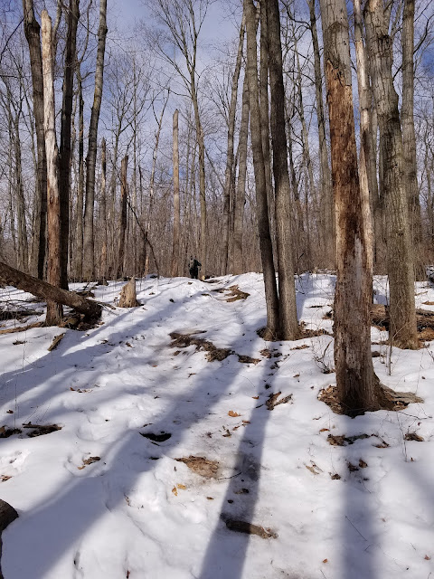
The trail had a tendency to stay on the ridgebacks of eskers wherever it could, but there was ample opportunity to claw our way up the side of one hill and back down the other, or dip into a kettle or two.


A little after 12:30 we found a nice log to sit on for a break and a snack. Shortly afterwards we crossed paths with a lone hiker, the only other person we would see on the trail today.

Then the trail takes another turn north. This was the one place where I saw a tree that was actually laying in the way of the trail. For the most part, anything across the trail had been diligently removed by chainsaw, and some of that was quite recent. I stayed with my saw long enough to clear most of it out of the way while Theresa walked ahead.
By the time I caught up to her she was walking through a lovely stand of balsam fir trees, some of which were very large and very old indeed. It was relatively level hiking, and was absolutely the most inviting part of the Parnell Segment we've seen so far.


We had a tiny bit of a challenge getting out of the parking lot, but were soon on our way to starting the next leg.
We drove down to Scenic Drive, wondering if we would be able to park anywhere close to the trail crossing. As it turned out, a tenth of a mile to the east there is a decent turn-out, so we parked there and headed north.
The wind was still blowing steadily, 15-30 miles per hour. It was 2:08 when we started, and down in this area there had been significant thinning, a logging practice that removes many of the mature trees but leaves a sprinkling of stems to provide optimal cover for developing seedlings. The result was that we lost all of our windbreak protection, and the gusts of wind were blasting us from behind as we walked up and down the snow-covered trail.
Not a lot of actual ice through this area. Mostly it was just just crusty snow. But this 1.8 mile section had an entirely different feel to it. With so many of the trees gone, it was possible to see long distances through the trees and get a feel for the awesome bigness of the area.
Between the howling wind and the massive rolling hills and moraines, I got a mental impression of a small boat being tossed about on massive waves in the open ocean, except that these hills weren't moving.


And of course, there are always mushrooms, even in this weather. Here is a cluster of small puffball mushrooms, still holding large number of spores.


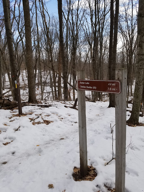
Location 2: The Parnell Segment, between the Butler Lake parking area and the road crossing on County Road V
0.7 miles of trail covered
The next leg to the south below where we had just hiked would have been 1.3 miles, down to County Road V, where there was adequate parking available. Theresa was feeling too tired to make the journey, and the cold wind was taking a lot out of both of us.
But we didn't want to totally waste the rest of the day. I managed to talk her into hiking the relatively flat 0.7 mile section that runs between the Butler Lake parking area and the County V crossing. Though there was adequate parking on both ends, we decided to do this as a crisscross hike. Theresa started at the parking lot and I drove the car up to V to walk back.
I said it was relatively flat. That would be relative to what we had been hiking in. In actuality, the trail goes immediately up and over the end of the Parnell Esker, which rises a good 25 feet or so from the parking area, up a set of about 30 log steps.
The wind kept blowing, and on the County V side I started with a short walk down off the hillside, and then through the marsh.


Theresa pulled into the parking lot at 4:26 pm, just as I was gathering information for a couple of Earth Caches.
On the way back to the hotel, which was mostly in daylight, we decided to stop at a restaurant in Kewaskum for fish fry. The only thing memorable about the restaurant was how long it took for us to get the food. An hour and a half later, we were on the road again, sorry for having wasted the time.
Running Total: 929.0 miles of trail covered, 146.7 miles 'extra' hiking/biking. End of Day 138.
No comments:
Post a Comment