Day 154: Blue Spring Lake Segment (Part 2), Jefferson County
Connecting Route, Walworth County
Day 154: Sunday, April 3rd, 2022
Total Miles covered for the day: 11.7
Location 1: The Blue Spring Lake Segment, between the north Trailhead and the Bald Bluff Parking Area
6.8 miles of trail covered
I don't know how to keep up with the weather. Thursday it was cold and snowy. Friday was still chilly, but bright and sunny. Temperatures got up into the low 40s. We were wading through water and it wasn't the end of the world. Yesterday was low thirties with snow and sleet. Today - OK, not quite warm and sunny yet, but even in the morning it was reasonably pleasant.
Last night was spent in the Hincapie Cabin again, on Whitewater Lake, and this meant we could get here early for the SnOTT Hike. We met this time at the Bald Bluff parking area on Highway H, and by 9:30 am the place was jumping. 27 people and two dogs. It wasn't even the full count of everyone who showed up.
We had just recently received 200 more SnOTT patches, and as we assessed our crowds from yesterday and today, and started thinking about all the SnOTT Hikes we had scheduled in the near future we thought, 'My goodness - we're going to have to order more again!'


Our first leg started at the large parking area on Little Prairie Road known as Horseriders' Camp. This put 4.0 miles in front of us to get back to the cars; 3.9 of trail, and an additional 0.1 mile blue spur trail.
There was actually quite a large group of people who came with us for the first leg. For various reasons, Theresa and I were ready to go at different times, so she decided to start walking with about 15 people in tow, and I waited around at the car to hook up with a straggler or two and planned to catch up later.
All was going fairly well until I started walking to the trail (it's in the back of the parking lot) and heard voices. In the wrong direction. What flashed through my head was that they had a nearly ten minute head start on me, so I tried using the bear whistle to get their attention. Useless. I could hear voices, but they couldn't hear me whistle. Now I seriously wonder why I carry the thing.
So instead, I took off trotting down the trail. I got about a quarter of a mile down and caught up to Theresa, bringing up the rear.
"You're going the wrong way!" I told her. "Where are the rest?"
"They're further ahead," she told me, so I took off running down the trail.
I caught up with some stragglers, and one of the younger ones took off at a dead sprint to get to the leaders and get them turned around.
It wasn't really that big a deal, because everyone got turned around within no more than four tenths of a mile but Theresa felt bad, thinking she was somehow responsible for the error.
Much later in the day, well after we were done hiking, Theresa looked at me and said, "Why didn't you just call me on the phone?" My reaction was

OK, well - NEXT time, I'll call.
Back to the hike. Once we were all pointed in the right direction, life was much better. By 10:09 we were tracking through the light snow and we were on our way.


I had no fear that I would catch up eventually. The trail south of Horseriders' Camp goes straight up a 110 foot hill, only to plunge right back down 50 feet again on the other side. When we reached Little Prairie Road I still couldn't see Theresa ahead, and I wanted to catch up to her in time to put the cleats on so she would be safe on these hills. So I told my hiking companion that I was going to trot on ahead to catch up with the group.
On the other side of Little Prairie Road I had to climb right straight back up another fifty foot rise to get on the spine of a short, steep ridge. I caught up with Theresa at the top of hill, and pretty soon we were safely on our way again.
I'm not positive what this little ridge was, but it seemed like part of an esker or a mid-lateral ridge that ran right through the Whitewater Lake Segment, the Blackhawk Segment, the Blue Spring Lake Segment and the Stoney Ridge Segment. It wasn't perfect in its continuity, but it was remarkable in structure every time we got up on top and looked down on both sides.

The group had begun to string out a bit, with the faster hikers in the lead. Many of this group we would not see again, but they started leaving little 'friends' behind to make sure we felt included.

The snowmen became a theme that day, and we ended up leaving several small ones behind ourselves.
It was warm enough that some of the sunnier slopes were melting pretty quickly.


Honestly, no one looks happier in these photos than Theresa. I have mentioned in previous posts that she loves winter hiking, even here in the Kettle Moraine region. More than that, she loves handing out Snail patches. It really goes a long way towards making a long hike seem shorter.


What a disappointment. Maybe if I look from the other side...


The terrain continued to bounce up and down, as could only be expected for the Kettle Moraine area, but the temperatures were cool, we were taking it slow, and Theresa didn't stop once to complain about the elevation changes.


I had other photos of her, but for some reason they didn't survive the trip.


As is typical for our hikes, when we make the leap to the second half two things become 'normal'. First, people seldom travel with us for the next leg, and second, we usually take a bit of a break. Both were true today. Actually, we spent a while in the parking lot trying to make contact with another hiker who we heard had been having some sort of medical issue. Long story short, the person we were so worried about was as stubborn and slow as we are, and was not in distress. She was just taking her time, and told other people to go on ahead - she'd be 'fine'.
I totally get why people were worried about her. It's one thing to leave Theresa and I behind with a wave and a smile, knowing that at least there are two of us. It's another thing altogether to leave behind a single hiker (of any age) that is perceived to be under duress. I may have shared their concerns if we had been hiking with her. But we weren't, and we had no real way to get in contact with her, so we just kept the chat lines open with the group to have someone report back to us if they got news that she had reached her vehicle safely. She did. End of story. (UPDATE: We found out weeks later that she was actually hiking with another person - a regular hiking companion - so there was nothing to have ever been concerned about.)
But that gave us a great excuse for delaying the start of our second leg, and gave us the break we needed to keep going. After seven miles on these hills yesterday and already four today, a little break was a welcome relief. Nevertheless, by 3:23 we had driven to the parking area on County Road Z at the north/east end of the segment and found ourselves standing in front of a yellow-blazed oak tree with big smiles on our faces.


I recall hiking the area close to Carlin Trail, and I remember the IAT looping around up towards the road, then back into the woods, then up to the road again a few times. I don't recall if that made sense to me at the time or not, but I do seem to remember that there was a volunteer trail on one of the loops making it possible to access the IAT there. I did not evaluate if there was parking available.
We spent the next mile or two just quietly plodding along, making the best of our time and being grateful that the worst of the hills were over. The final climb up to Horseriders' Camp seemed somewhat familiar to me, though I can't say for certain that I really recognized the place where we had turned around earlier in the day. But I definitely recognized the last few pine trees and the touchpoint sign telling us that we had conquered the Blue Spring Lake Segment. The time was 5:37 pm.

You would think that we might just decide to call it a day there, but you have to remember that we were in a faraway land using a cabin, and that while I would be forced to remain tethered to my computer tomorrow and work, Theresa would be free to go out hiking. So after we finished Blue Spring Lake we made a B-Line to the connecting routes west of our present location, so that I could hike off as much roadway as possible, leaving Theresa to finish it off tomorrow. Spoiler: She did that, of course, so I'm just going to record it here as though we both did it.
Here's how it works. Theresa drops me off in one location, and I hike, as fast as I can. She drives the car to a spot a mile or so down the road, parks the car and starts walking back towards me. We cross paths in the middle, and when I get to the car I drive back to pick her up. She notes where she left off, and then comes back the next day to finish the gaps. This is a variation of our typical crisscross hiking, where I would wait for her to finish the leg before we move on. This method is the 'Get Brock done as fast as possible method', because Brock can only hike on weekends or conceivably after work.
Of course this means that Theresa occasionally has to double-hike some parts of the road, but she has more time, and I find that she covers quite a bit while I'm walking so the gaps aren't too large. Given the late start, we targeted the gap between Clover Valley and Whitewater Lake.
Location 2: The Connecting Route between the Clover Valley Segment and the Whitewater Lake Segment
4.9 miles of trail covered
It was 6:36 pm. Immediately I started walking west along Clover Valley Road, looking for the turn south onto Island Drive. I spotted this cool old oak tree out in the field. I'm really glad farmers leave these old giants out there sometimes. They really do a lot to add beauty to the farmscape.

And then I finally spotted Island Drive. I have to be honest with you. I have seen plenty of surprises while out hiking actual segments, where something is marked as a 'Road', only to discover it's little more than a Billy-goat trail. (e.g. Burma Road, Kettlebowl Segment.)

But to get to this bit of gravel and mud that was clearly marked as a 'road' on the maps while I was out hiking Connecting Routes, was a bit of a surprise, even for the Ice Age Trail.
It's not a road. It's the part of the field that wasn't plowed with a little gravel tossed on it. Would I drive a car on it? Maybe in the heat of summer, but anyone taking a vehicle on this 'road' during springtime better have a towing service on hand that owes them a favor.

I didn't waste time tonight. I kept going at the fastest pace I could muster, because in the back of my mind I wanted to cover the whole 4.9 miles tonight before dark, and to achieve that I would have to achieve land speed records for this old snail.

After the bend to the west, I eventually did hit pavement again.


So then we drove back to the same drop-off spot and I started off in the other direction. I snapped this photo of a farm that caught my eye somewhat down the road, and you can start to see how dark the sky was becoming.

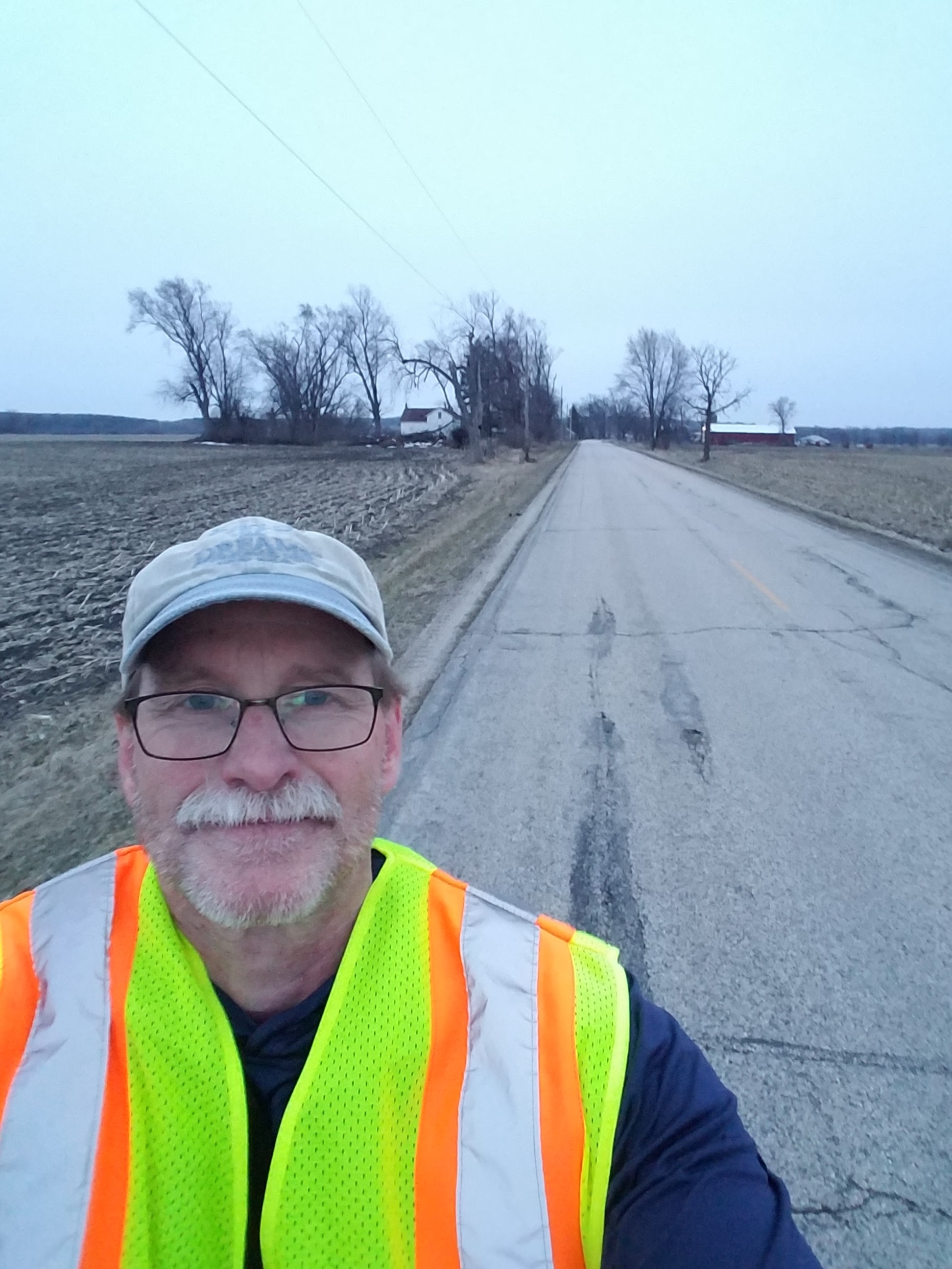
I did snap a photo, but I can tell you I was starting to stretch the limits of my phone to auto-correct for low light conditions.


Running Total: 1035.2 miles of trail covered, 151.2 miles 'extra' hiking/biking. End of Day 154.
No comments:
Post a Comment