Day 160: Forestville Segment (Part 2), Kewaunee County; Sturgeon Bay Segment (Part 1), Door County
Day 160: Thursday, April 14th, 2022
Total Miles covered for the day: 5.3
They say the worst day fishing is better than the best day at work, and I suppose the same can be true of hiking the Ice Age Trail, but today was one of those days that test the theory.
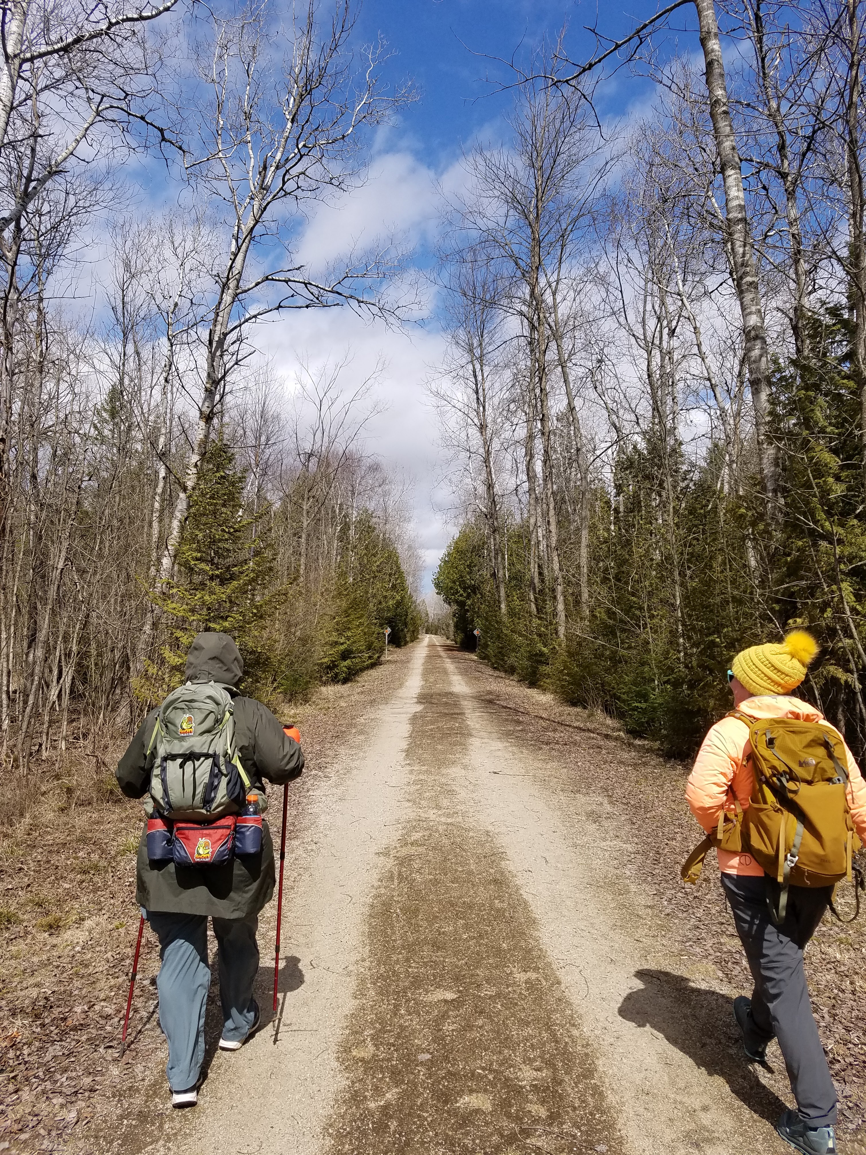
I mean - we've been out in colder weather, and we've been out in wetter weather, and - well - we've been out in pretty much all weather. But when we got to the parking lot at the southern end of the Forestville Segment it was no surprise at all to find only one hiker who wanted to walk with us.
By 11:00 it was clear this was all we were going to get, so we welcomed Emile Rabbitt to the Snails.


The original plan had been to drive to Blahnik Park from here and hike back south to the cars, but the temperature was hovering in the low 20s and we were dealing with steady 15-25 mile per hour winds, so we reversed course, dropped our cars at the north end, then came back to the beginning so we could walk with the wind. Even though the wind direction was from the south, it wasn't warm, and it didn't feel good.
By 11:15 we were back in place and ready to walk the short 2.2 mile stretch to Blahnik park.


Emile's occupation is EMT, so it made for interesting conversation as we walked. She knew a great deal about the ailments were were both feeling, and we ended up talking a lot about those, especially Theresa's nerve-damaged foot, which remains a persistent issue.


After Emily had said her good-byes (she was only planning the short hike from the beginning, because she needed to go to work), I walked to the edge of the parking lot and was rewarded with a 20 dollar bill sticking up out of the snow. I decided to pocket that as part of my usual good fortune and we drove back to pick up our second vehicle.
This completed Map 102 for us (yay!) and even more exciting, we finished all of Kewaunee County (double yay!). More than that, it left us with a large part of the day completely free.
Rather than heading back south of Mishicot again, we chose to go north and snip off part of the Sturgeon Bay Segment. We took both cars north and would have parked at the large parking lot at the south end of the segment, but when we got there it was barricaded and closed. So instead we went to the place where the trail crossed South Neenah Ave. and parked at the side of the road after dropping a car off some distance north.
I didn't get any pictures from the beginning of the hike, but I wish I had. It was clear that the IAT crossed the road on the bike trail. There were blazes on both sides leading on down the path. So we started walking northeast from the crossing, following the very obvious bike path.
I am getting a little sick and tired of being on bike paths and missing turns.
About 250 feet from the road there is a short path that leads north to the parking lot. As we walked by we turned our heads and looked down that path and could see where the parking lot was, with its bathrooms (still closed for the season) and spacious parking. Then we turned our focus back to the trail and kept walking. We didn't realize that we had made a wrong turn until we got to Leeward Street, a full half-mile down the bike path. We missed our turn.
When we zoomed way in on the maps, we realized we should have turned left into the parking lot, but had somehow missed the signage. We went back much later in the day, and I'll share here for future hikers that the arrow telling you to turn left at that point is on the opposite side of the trail from the parking lot. That means if you walk through and your head turns left to look down that trail towards the parking lot, you won't see a sign telling you to turn that way. Even worse, there is no yellow blaze visible from the bike trail on the way to the parking lot.
The next time we go out there we're bringing yellow paint with us.
This also meant that we ended up hiking about eight tenths of a mile farther than we should have, having walked the long way around the parking lot. In addition, and this is important only to numberphiles like myself, we ended up NOT walking past the little-celebrated easternmost point on the trail, which occurs in that parking lot. Well - we didn't walk past it until much later in the day. More on that later.
Back on Neenah Street we were walking north and the wind had shifted around completely, where it was now blowing directly in our faces from straight off of Sturgeon Bay. The charming 15-20 mph winds were now more like 25-30, and it had started to rain.
This is another reason I got very few photos of that leg.
The IAT darts east off of Neenah Ave shortly after getting into what I would describe as an industrial park. It followed a bike path through a parking lot and behind the buildings, then along a field, around some trees, and past more buildings before coming out to Yew Street.


"Can we be done now?"
I remember someone saying that. I think it was me.
We didn't put on very many miles today, but it felt like twice the distance we hiked yesterday. We drove one of our vehicles down to the meeting place for tomorrow's Snail Hike, the north end of the Forestville Segment, and headed back to the condo, where we spent a solo night just relaxing and getting a good night's sleep.
Running Total: 1079.3 miles of trail covered, 155.8 miles 'extra' hiking/biking. End of Day 160.
No comments:
Post a Comment