Day 158: Connecting Route (x3), Kewaunee County
Day 158: Tuesday, April 12th, 2022
Total Miles covered for the day: 10.3
Today was another planned Snail hike and like the day before, we were meeting at the giant grandfather clock in Kewaunee. Since this was only a Connecting Route hike, we weren't expecting a large turnout. This turned out to be true, but still we got three great women to show up.
We gathered again in front of the grandfather clock for the group photo at a little past 10:00, and then started ferrying people around for the actual hiking.
One of the gals wanted to hike a much longer distance than the short leg we started with, so we took her north and dropped her off at the end of the Forestville Segment so she could walk the whole 13.7 miles. We, on the other hand, opted for the much shorter 3.6 mile hike from the parking lot on Lakeshore Drive near first avenue back down to the clock. We managed to get everything and everyone in place and ready to hike by 10:23 am.
The other two women ended up hiking with us. One of them was Deb Jones, and she was busy taking notes and photos for the next Companion Guide, due to come out in the next year or so. It was interesting hearing more about what goes into the creation of all the content you see in the guide.
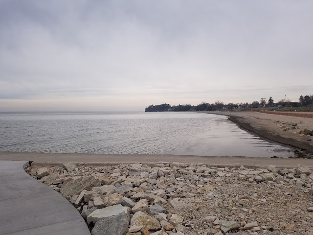
It was a chilly day, but not too terribly windy, and it turned into a sunny and pleasant walk along the lake. We had raingear with us, but it never came into play. Below is a photo with Theresa in trademark short sleeves while everyone else wears coats.
It would be easy to miss the turn onto Hathaway Drive that is necessary to get across the river. Fortunately we had driven it often enough that we knew to walk that way, and we made it back to the grandfather clock shortly after noon.
We didn't celebrate it at the time, because we didn't realize it, but we had just finished Map 101.
We said goodbye to our fellow hiker, Deb, who remained with us the whole time. The other woman tried to walk slowly with us, but just couldn't master the pace, and so ended up leaving us behind.
Theresa and I ended up having a little lunch, then driving back up to pick up our launch vehicle. Along the way we were keeping an eye out for Rick Dorian, a Thru hiker that was walking in the same general area, but we didn't see him. In fact, we kept driving the entire route, all the way back up to the Forestville Segment and didn't spot him. We were disappointed, because we take special joy in "bagging" thru hikers with our Snail patches.
Rather than taking both cars north to hike the remaining 3.9 miles of the Connecting Route, we went in one car, and needed to crisscross hike our way through Algoma. This turned out to be not as simple as a walk down main street, no matter what it looks like on the map.
We started at 1:28 pm, and the temperature had dropped enough that I had my purple neck gaiter back on, and even Theresa was in a long-sleeved garment.
The start of the hike, from the north end headed south, is simple enough. Follow the tire tracks.
One thing we were concerned about was lightning, so we kept our stints short and our eyes on the sky. We literally leap-frogged our way south a half-mile at a time if we could, but no more than a mile.
We found a spot to park on Valley Road, about two tenths of a mile south of Luxemburg Road. We had almost reached our waiting car when we started seeing lightning, and our day was finished. We had managed to chop 2.8 miles off of this 20+ mile connecting route, and that was just going to have to be good enough. Tomorrow, if the weather holds, we'll come straight back up here and keep working our way south.
It was a wild ride south, bucking around in the car as the wind howled by, but for the most part the rain stayed in our rear-view mirrors. It was black behind us, but we somehow managed to avoid the worst of the storm.
When we got back to the condo Jan Hincapie, Delores Olver and Sheila Meehan Gailloreto, were there waiting for us, happily chatting away with wine glasses in hand, and there was a fabulous chicken casserole dinner on the stove just waiting for us to gobble down.
We sat down immediately to eat, which wasn't rude because the 'girls' had already eaten, and Jan was busy texting back and forth with Rick Dorian.
"Where was he today?" we asked.
"He did the Forestville to Kewaunee Connecting Route."
"He.. What?!? How did we miss him? Did he finish by noon or something?"
I'll make a long story short. It turns out when we were driving down the road looking for him, he was taking his only break of the day, having gotten off the road and closer to the water to enjoy his lunch. At present, Jan said, he was holed up in the hotel in Kewaunee riding out the weather.
Theresa and I looked at each other. "You want to go?" I don't remember if it was me asking or Theresa we were of one mind on the subject.
"Duty Calls!!"
Theresa and I jumped back in the van and drove the half-hour back up to Kewaunee to meet up with Rick and give him his Snail patch.


No comments:
Post a Comment