Day 155: Kewaunee River Segment (Part 2), Kewaunee County
Connecting Route, Kewaunee County
Day 155: Saturday, April 9th, 2022
Total Miles covered for the day: 10.7
Location 1: The Kewaunee River Segment, between Clyde Hill Road and the Bruemmer County Park parking area on County Road F
4.2 miles of trail covered
Wow. It's been six whole days since our last hike, and with the schedule we've been running lately, that's actually a long time. However, this was also the first day in what is planned as a nine-day hiking vacation. We'll see how well that goes as the week goes on. But first -
Last night we drove out to the thriving small community of Tisch Mills (that's a bit tongue-in-cheek) to spend the night at the Historic Forst Inn. The new proprietors have spent time, love and money restoring Ye Olde Hotel and have brought it up to snuff enough to let out a couple of rooms.
Our experience was... interesting. Let me start by saying the room was very attractive and the bed comfortable. I can also say that the building has a marvelous authentic antique charm, and comes with all the aches, pains and inconveniences one can expect of a building that has been used for years as a hotel, bar, living space, dance hall and theater, with a shockingly low budget and appetite for maintenance. As I said, the new owner - who is more art and theater director than he is a carpenter - has been restoring the property a little at a time, finding ways to start bringing in income. He rents two rooms for the airbnb part of the year, and he also runs the theater, with a series of performances that take place in the old dance hall.
Had we known about the stage production that was taking place last night we might have driven down special to try and make it, but we arrived when it was halfway through, and parking was at a premium. Also - the sound from the stage carried up to our room. This might not have been an issue for most plays but the play they were performing last night had something to do with monsters, or dragons, or dragon-monsters. I don't remember. But there were screams. Lots of them. And MAN could those stage actors project! Their voices carried through with amazing clarity.
"Not to worry", said our host. "The play should be over soon. They're on the third Act."
Great, as far as it went, but he forgot to mention that after the performance people tend to drift into the bar for a little post-production night cap. And it was opening night, so there was a lot of enthusiasm over a performance gone well. And the bar was literally beneath the floorboards in our bedroom, one flight down.
We tried to take the noise in stride. We both started getting ready for bed, and that's when I noticed that the water wasn't working in the bathroom. Then after a while it came back on, so we were able to finish our evening preparations and get to bed, if not to sleep. Eventually the noise died back down, and we were able to drift off in the very comfortable bed.
The next morning I awoke early, as I often do, and once again the water was off. I went downstairs to brush my teeth because there was still enough pressure in the pipes to achieve that goal. Then I searched for the proprietor, or a means of turning the water back on, with no success on either. But there was hot coffee available in thermoses from the night before, so I just settled in to enjoy the sunrise.
I failed to mention that the Forst Inn is quite literally on the trail. If you look across the street from the entrance you can see an Ice Age Trail sign indicating where people can park if they are walking the segment. It is located on County BB on the portion of the Tisch Mills Segment that walks through town.

Eventually we got the whole water thing straightened out, and we got ourselves showered and packed up to go. We had to leave because this was just an overnight stop to get us in the area. The real stay - for the next seven nights - would be in Manitowoc. More on that later.
Today was our 'off day', meaning we didn't have any planned events, with anyone joining us. That meant we could take a look at what was ahead and hike in places that would make the other events more enjoyable (= shorter). We did that planning while we ate breakfast in Kewaunee at the Anchor Down Family Restaurant. Not a five-star event, but worth stopping by for breakfast if you're in the mood.
We decided to hike part of the Kewanee River Segment to get started. Over the next couple of days we would be hosting events that hiked both the north and the south ends of the Kewaunee River Segment, so we decided to hike the middle portion today. We were in two cars, so we dropped off one car on Clyde Hill Road and then drove to County Road FF. This left us with about 2.8 miles of trail in front of us to get to the waiting car.
We actually didn't get started walking until 11 a.m. It was a cool, gray day, and it was only 37 degrees out, but the wind wasn't all that bad. We've certainly been out in worse weather.
Smile!


Yeah - should have stayed with the second photo. That one was better.
We heard some cranes belting out their unmistakable calls as we were getting ready to go. After the photo op, we started trekking north.

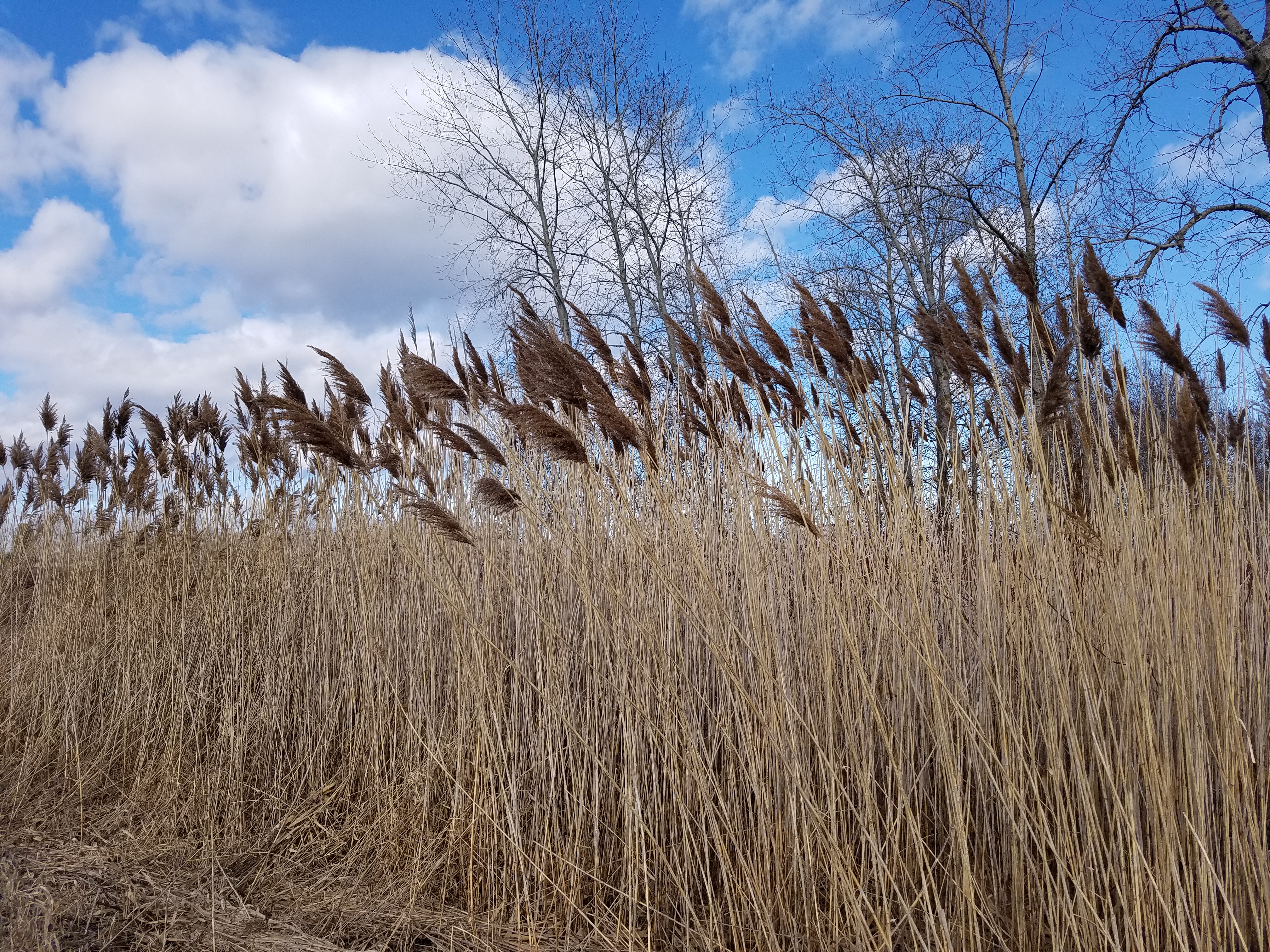
The Kewaunee River Segment is on a bike trail, which itself was a converted railroad bed. That means it's relatively straight, level, and follows the course of the river.
Why the river? Because water takes the path of least resistance, and if you stay with the edge of the river you don't have to work so hard keeping the minimal grades needed to run a railroad.
Below is a wildlife sighting. Can you see the rabbit?

One of the things I have been looking forward to as we hiked through the winter months was the coming of Spring, and all the birdsong that comes with it. Today, I was rewarded with that beautiful music. The birds all knew warmer weather was on the way, even if it was just barely above freezing. Everywhere was the sound of birdsong, and I was treated to the sight of a bird I don't see often in my part of the state. I had a Golden-Crowned Kinglet come and visit me for a little while, bouncing about in the thick brush. This one below isn't my photo, but it shows why they are such a fun little bird to see. The males have a brilliant yellow streak on top of their heads that hide an orange plume they can put up at will.

 |
| The kinglet wore it better |
The wind was a lot colder than I gave it credit for.

North of County Road FF the trail snuggies up close to the edge of the river for a while. The river is bloated right now from all the recent rains, and it was flowing swiftly as we wandered past.
The trail itself through this section is nice and dry, considering the rain. No puddles, and well groomed. There were not really enough blazes, though. This is a frequent complaint of mine on segments like this. Yes, it's straight and impossible to get off-track, but if you don't have blazes every once in a while, how do you know you're still on the trail?


Next, we drove down to Bruemmer County Park on County Road F.
Years ago, Theresa and I biked a portion of the Kewaunee Segment, back when it used to end in a different spot. That was our 'Part 1' post way back in September of 2016. We're going to be hiking that portion this week, but the spot where we ended our bike riding was at Bruemmer Park. We were probably even in the same parking spot. So touching that sign and moving on felt just about right.


Where the trail crosses County F we were wedged between the river just barely to our left and a high bluff to the right. We walked in the shadow of that bluff for the next three quarters of a mile or so, and the river fell out of sight for us on the left.
As we walked we came across this delightful couple. They weren't IAT enthusiasts so much as people who liked to go out on long hikes together. They were happy to become our first SnOTT Patch recipients of this trip.


We ended this portion of the hike at about 2:00. Our plan next was to head up to walk some connecting route that we don't have otherwise scheduled for the week.
The goal for the week, I should add, is to hike the Kewaunee River Segment (12.5 miles), the Kewaunee to Forestville Connecting Route (13.7 miles), the Forestville Segment (9.8 miles), and a good portion of the Sturgeon Bay Segment (14.0 miles) plus whatever additional connecting route we can toss in there. There is an additional 12.6 miles of connecting route south of the Kewaunee River Segment. That seemed like plenty to keep us busy.
As we were getting into the car I got this awesome photo. Sometimes she really was having fun out there.

Location 2: The Connecting Route between County Road K to the north and the Lakeshore Drive parking area to the south, Kewaunee County
6.5 miles of trail covered
The Connecting Route between the Kewaunee River Segment and the Forestville Segment is 13.7 miles, and we have planned SnOTT Hikes for both the north end and the south end. So in the same way and for the same reason, we decided to hike off a portion in the middle. We decided to take only one vehicle north and do this as a crisscross hike, so we drove up to County Road K, just south of Algoma, and Theresa dropped me off to start walking south.
The time was about 2:45 pm. The sun was a little more apparent, and the light breeze coming in off of the lake wasn't very cold. It was actually a near-perfect day for walking.

While I was walking, Theresa and her beautiful smile drove down to a spot just south of 9th Road and started walking north. We crossed paths in the middle, and when I got to the car I drove back up to pick her up at the beginning.
It's nowhere near as much fun as walking together, but it does keep us from having to drive two cars. While I'm alone, I find that I have more time to snap photos of things that catch my interest. Water always seems like an interesting subject, even if it's in a puddle.

Completely unrelated - the word 'homeowner' has the word 'meow' in the middle of it.
My cat told me that.


We ended our day at about 5:30 pm, and we headed south to check into our time-share condo for the week. More on that tomorrow.
Running Total: 1045.9 miles of trail covered, 151.2 miles 'extra' hiking/biking. End of Day 155.
No comments:
Post a Comment