Day 156: Kewaunee River Segment (Part 3), Kewaunee County
Forestville Segment (Part 1), Kewaunee and Door Counties
Day 156: Sunday, April 10th, 2022
Total Miles covered for the day: 8.0
Location 1: The western third of the Kewaunee River Segment, between Clyde Hill Road and the west trailhead on Sunset Road
4.5 miles of trail covered
It's Sunday, and yesterday was a really long hiking day with lots of miles covered, but today feels very much like the beginning of the week, rather than the end. Mostly because it is. This is the first day of eight consecutive days of SnOTT Hikes, during which time we hope to cover a large part of the nearly 100 miles we have left out here. With 10.7 miles completed yesterday, we're feeling optimistic.
Especially since we had such a great place to stay. The location wasn't absolutely perfect, being all the way down in Mishicot, but the accommodations were phenomenal. My older sibling, Beth, owns a timeshare condo that happens to be in Mishicot at the golf course. Seeing that she was unable to use the condo this year she offered it to us, and what we got was a two bedroom suite with a large kitchen and living room to boot. We would be meeting up with Jan Hincapie later today, and she and another hiker would be sharing the condo with us, taking up residence in the other bedroom.
Today the plan was to meet up with the other Snail Hikers at the north trailhead of the Kewaunee River Segment, located on Sunset Road, then shuttle people around as needed before dong our typical short hike. The groups broke up into the 4-milers (us), the 6-milers (those doing half the segment), and the 12-milers (those doing the whole segment).
Meeting time was 10:00 am, and it was 41 degrees and sunny. We were delighted to see eleven people waiting for us when we arrived. We handed out patches to those who needed them, and took the obligatory group photos.
As it turns out, Theresa and I were the only ones doing the four and a half mile short hike. This did not come as a surprise. Rather than breaking up the hike into shorter parts and leapfrogging our way, we decided to uncharacteristically head to the place we left off yesterday and do the whole 4.5 miles in one go. So we found ourselves at the Clyde Hill Road tunnel, once again ready to take on the Kewaunee River bike path.
We started hiking at 10:25, and the temperature was right at 41 degrees with the sun shining merrily. There was hardly a cloud in the sky today, and it really made for a tough decision on what clothing to wear.
In short order it became apparent that even the small number of layers I had chosen was too many, and I had to shuck a couple as I hiked.
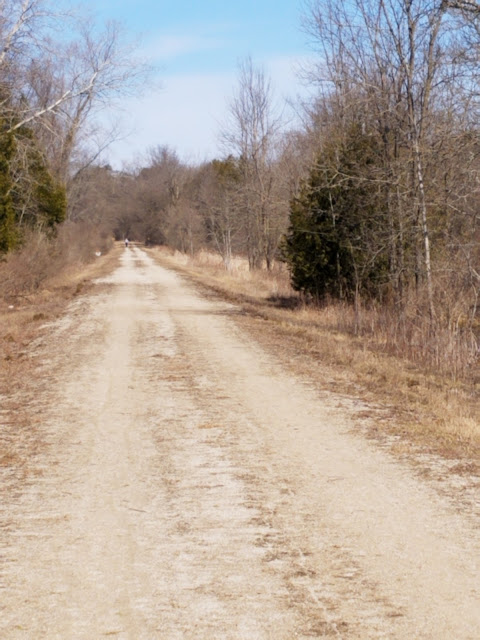
The foliage along the edge of the trail is consistent and not overly pretty. There's lots of honeysuckle, sumac, cherry, green ash, cedar, birch, and a whole bunch of scrubby little things I haven't identified yet. Standing water on both sides of the trail make for a lot of cattails and green slimy mucky stuff.
On the east side of the trail we saw raw cut rock whenever the railroad bed cut through the close hillside. Looking at those exposed rock layers you can see that what's there is flat pancake limestone rocks that look and act almost like shale. And, occasionally, these made for charming small waterfalls, the trickle of spring melt making its way to the Kewaunee River not far to our left.
As with the other pieces of this segment we've been on, there are essentially no yellow blazes. It's disappointing, because you have to know - KNOW - that you're in the right place. If you are walking through here hoping to see yellow blazes, you will be sadly disappointed.
At the tippy top of the trail, as it bends south and heads towards County Road C, there's a nice bench and an easy way to get down to the water's edge.
I took a picture in this spot, because it was literally the first blaze I remembered seeing so far today.
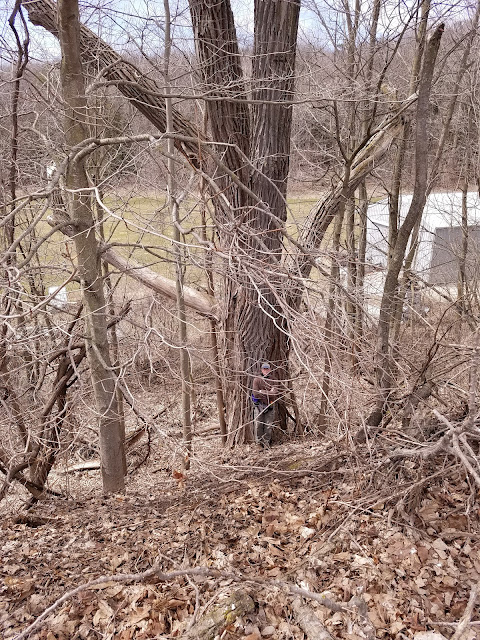
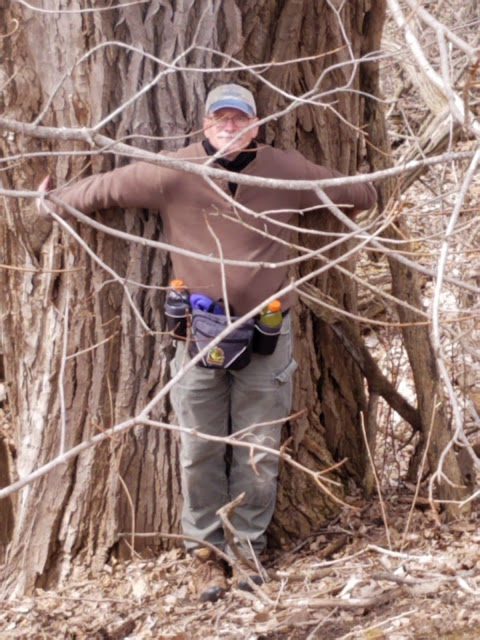
I took the opportunity to look up the state record for the largest known Aspen tree. If this is a quaking aspen rather than a cottonwood, it would be a state record. By a lot. I submitted the paperwork. Who knows? Maybe I found the biggest one in the state.
We eventually reached Sunset Road at 1:12 pm. Neither the six-milers nor the 12-milers had caught up to us today, a genuine surprise.
But, when we went to pick up the car at Clyde Hill Road we saw the 12-milers just north of where we started. We honked the horn and waved, and they waved back.
It was still early and we were feeling ambitious, so we took both cars and headed north to the Forestville Segment. Like yesterday, where we knocked off the middle third of the Kewaunee River Segment so as to make our other hikes easier, we wanted to hike off the middle third of the Forestville segment.
Location 2: The middle third of the Forestville Segment, between the Forestville Dam parking area and the Blahnik County Park parking area
3.5 miles of trail covered
It was a bit of a drive to get to the Forestville Segment, but not too far. We decided it would be best to hike north to south, so we dropped off a car at the Blahnik County Park parking area and made our way north to the Forestville Dam parking area. Both were large, with restroom accommodations to boot.
Before starting south I decided to walk over and admire the Forestville Dam, and I have to say it's quite a structure.
I find water mesmerizing, especially when its moving. Add to that the geometry and symmetry of the dam and the ingenious way it allows so much water to flow through such a small span, while still preventing large fish from being drawn through with the current made for a fascinating short study of the place.
The time was 2:30 pm, and the temperature had risen to 47 degrees, but the cloud cover was now almost complete and the sun only a distant memory. The chill wind caught us square in the face as we were hiking south.
I found the interpretive signs along the trail to be interesting and educational. This one, for example, talks about the continuous problems faced by the A&W Rail Line due to the harsh Wisconsin winters and the cranberry marsh we were walking through. Because of each, trains were frequently delayed or even derailed, and stranded passengers had to pass the time playing Sheepshead.
We were feeling pretty cold when we reached the bridge that crossed the Ahnapee River, but there were two people there fishing when we arrived. They had landed a fairly good sized brown trout, in the 10 to 12 pound category. I was not aware that you could fish and keep trout this early in the year, but apparently the regulations have changed since I last cared about such things. I looked it up and early trout season started on January 1 in selected waterways, and this must have been one of them. These weren't the only fishermen we spotted that day. Oh - it was the woman who caught the trout, not her boyfriend. They told us it was her first fish ever.
Nice.
The trail was level and flat as only an old railroad bed can be, but surprisingly we encountered very little standing water. Even so, there were places where the water ran over the top of the trail as it made its way to Lake Michigan, and there were a few scars left in the trail from the gouged waterway. It made no challenge hiking, but they could have been a little surprising on a bicycle.
As we made our way through the last of the swampy area we ended up chasing two geese down the trail for nearly two tenths of a mile. We walked - they walked. And they wouldn't step aside. Fully aware of how fierce an angry cob can become we chose not to try and chase them off. They just became rather funny-looking mascots who escorted us down the trail for a while.
Eventually they did peel off to the side to let us by. Judging from all the goose grease we found on this part of the trail I'd say they spend most of their time sitting up on that tiny hill that runs through their marsh.
Running Total: 1053.9 miles of trail covered, 151.2 miles 'extra' hiking/biking. End of Day 156.


No comments:
Post a Comment