Day 194: Portage Canal Segment, Columbia County, Connecting Route, Sauk and Columbia Counties
Day 194: Friday, June 17th, 2022
Total Miles hiked for the day: 13.8; Net Miles 0.4
Location 1: The southern one mile of the Portage Canal Segment, from Lock Street to the south trailhead.
1.0 Miles of trail covered
We came through this area on a Sunday back in 2013 during a 100-degree day in August, when we hiked the Marquette Trail Segment (no longer in existence), and then half of the Portage Canal Segment before biking the rest of the way south. That was our 11th day out on the trail and we were having a great time bouncing around all over the place. For some reason I only logged a total of 2.8 miles that day for the Portage Segment, half on foot and half on bike.
I came back here today to cover not only the half of the Portage Canal Segment again, but also the rest of the connecting route headed south, all the way to Hwy 33 where we left off last Sunday. The reason this is possible is that first, I took the day off from work, and second, Theresa came through here about two weeks ago and hiked a whole bunch of it on her own when she came home from the Madison area and had a day to kill.
So we got ourselves geared up and drove south this morning from Wausau and Theresa dropped me off at the intersection of Lock Street and Edgewater Street at 11:27 am. It was 77 degrees out.
It didn't get anywhere near 100 today, but it did reach the mid-80s. Fortunately there was a good wind blowing. That proved good and bad, keeping the feels-like temperature a bit lower, but also making it dastardly difficult to use an umbrella to keep the sun off my head.
Because Theresa had already hiked this section I was free to turn on the turbo and walk as fast as I wanted.
Even so, I found it surprising just how fast that first hike went.
I could see evidence of recent storm damage in town, but it wasn't anywhere near as bad as it had been further north. With the storms we've had the last couple of days, I honestly didn't know what we would find when we got down here. Turned out to just be a few limbs down and a bunch of leaf litter.
The walk through town was anything but boring, with gorgeous views of the Wisconsin River and several historic buildings.
The Portage Canal Segment is mostly well-marked going through town, but it is missing a critical arrow or two. Fortunately I knew the way, and quickly found this sign, which is not the end of the segment, but is the best place to self-identify where you've been. This sign is on the north side of the river, just across the bridge.
Next was the river crossing, which is accomplished by using Highway 33. This road, and this bridge, is very busy, but there is a nice, wide shoulder on both the bridge and the road, making the walking relatively safe and easy.
The Segment ends on the south side of the bridge, where there is a reasonably sized parking area. For some reason I failed to get a photo of myself there.
Location 2: The Connecting Route south of the Portage Canal Segment from the Portage Canal trailhead to the Historical Marker on Hwy 33.
12.2 Miles of trail covered
The Connecting Route that spans Sauk and Columbia Counties is a pretty long one, 21.5 miles, and the part I still needed to walk went from Hwy 33 to Hwy 33, but not by the most obvious path. Instead the route travels down Fairfield Street and then Levee Road, walking the length of Pine Island State Wildlife Area before cutting south just before the Aldo Leopold Legacy Center.
The Hwy 33 part is busy, but as before has a nice, wide shoulder. Blue skies were keeping me moving and happy.
Fairfield Street and Levee Road has very light traffic, which was nice. And it was surprisingly wet at first. It must have rained last night, but still - 12:00 on a hot day and it still hasn't dried off yet.
These guys were cute.
There's a lot of standing water next to the road even on the east side of the highway.
It makes me happy to be hiking in the heat of the day. That keeps the bugs at a minimum.
The winds were really gusty today, 5 mph or so constant, then buffeted again and again with 20-25 mph blasts. Yet somehow that doesn't impact these flowers. This is that happens to the Yellow Salsify when they go to seed.
The first mile marker you see when you're walking is number 2.0.
That's because it's not marking the length of the road, but rather the length of the Caledonia Levee, which actually starts about a mile and a half further east on Old River Road.

Considering the length of the levee system on both sides of the river here, you would think that there was a significant amount of planning and money that went into it. I suppose that's true, to a point, but the levee you're walking next to here has all the integrity of a sand castle. It was built mostly in the 1890's by local landowners using nothing but local materials - basically sand - and without any engineering design or adherence to any design standards. Picture a bunch of hard working landowners getting together and saying, 'We should put up a line of dirt along the river to keep the dang thing from flooding us out every year'.
I don't have as much confidence in the levee as I used to.
Levee Road doesn't officially start until after passing underneath I-39. Considering this is an interstate highway, and what a massive impact it would have if there was a problem with the bridge, I'm surprised at how low the clearance is here, and that it's not marked with a sign. From the bumps and scrapes it's obvious that not all trucks and tall vehicles make the passage unscathed.
Meanwhile, while I was walking west, Theresa had gone out and parked far out to the west and started walking towards me. It was one, giant crisscross hike along the length of Levee Road, and I had no idea where we would be when we crossed paths.
There are quite a few large parking areas along Levee Road, placed there for people to take advantage of the State Wildlife Area
It was a hot, sunny walk down the road. To a degree this was made more tolerable with the umbrella, but the unpredictable and sudden gusts of wind had a habit of trying to turn it inside out.
Along the length of Levee Road, there is a long earth and sand berm on the north side of the road, and a trenched waterway to the south.
The levee averages between 8 and 12 feet in height above the river, and effectively prevents actually viewing the river on the other side. There was one spot where the hill seemed a bit lower, so I stood on tiptoes and raised the camera up as high as I could to snap a photo. By doing that I was just able to see the Wisconsin River that was being held back, the water level actually higher than the road I was walking on.
Despite the shortcomings of how it was created, the levee has held up and been doing its job for over 130 years, with only one breach occurring in 1938. That doesn't mean there haven't been floods, but it means the levee hasn't washed away or failed since 1938.
The last time I was here in 2019 there was evidence of substantial flooding, where water had come over the top of the levee and was many feet deep over the road. Today it was just me and the pavement.
As I was walking I came to the conclusion that this was the longest 100-mile stretch on the whole IAT, as in one hundred miles. That wasn't a typo. It felt like 100 miles. There is just a sameness about the whole length of the road, with parking areas passing by like the seam on a treadmill.
It's the kind of walk that makes things like this interesting.
Even the birds were being quiet, this being the middle of the day. I saw a softshell turtle in the water as big as a garbage can lid but didn't get a picture. She just slipped quietly into the depths when I tried to get a closer look.
The sun was high, which allowed for very little shade on the road.
The area to the south is a large, dedicated sportsman's preserve, but I couldn't imagine being out in that no-man's land trying to hunt anything. It doesn't look very human-friendly.
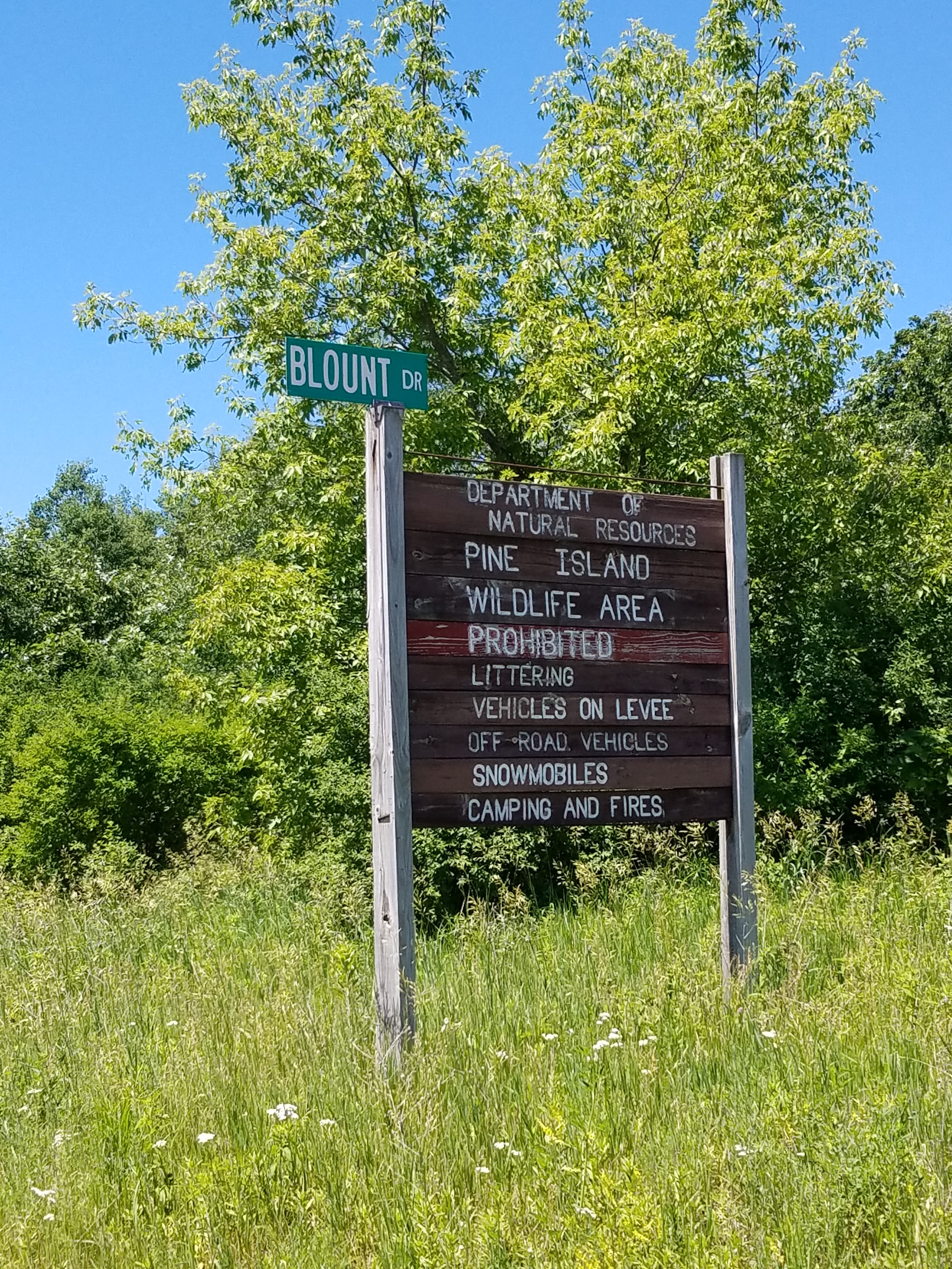
I got to Blount Road by 1:00, so I was making pretty good time. I had passed the point where Theresa needed to get to, so I figured I'd be seeing her soon. Blount road is the first real road that goes south off of Levee. I never drove down there to see where it goes, but after looking at a satellite photo it doesn't look like there's much out there to see.
And the road kept going...
This was an accidental picture, but it was a fine representation of what I had been staring at for six miles or so.
And then, happiness! I caught up to Theresa right around Statz Road. It was just south of Pine Island, the island for which the whole area is named. Not that we knew that. It wasn't like we could see the island from the road.
Right as I was crossing paths with Theresa a man came biking up who was out doing what we had been doing not so long ago. He was biking the connecting routes.
His name was Robert Tarrell. He has been quietly hiking the Ice Age Trail in his spare time, and tackling the roads on bicycle. He said it was his way of staying healthy.
As Robert headed off down the road, I parted ways with Theresa.
There is a public boat landing near here, so I walked the short distance to the launch and took a few photos of the Wisconsin River.
And then it was back to the treadmill.
And the miles just...
Flew by. Or not.
I walked off to the side in one of the parking areas to, uh, visit the trees. When I saw this one covered in vines it reminded me that the woods was full of poison ivy. Like these vines. It's the kin of ivy that climbs trees and chokes them out of the daylight, eventually killing even large, healthy trees.
I didn't go very far into the woods.
I almost missed this turtle as I walked down the road. Top notch camo, little lady! You make duck weed look hot!
Somewhere along the way I walked off the edge of Columbia County and into Sauk County. I don't recall seeing a sign, but I'm sure there must have been one.
At Schepp Road, the trail goes south. The Leopold Center is a short distance up the hill to the west, and that was where I headed, because that's where our car was parked. I got in and drove back to pick Theresa up, who coincidentally had just reached the end of her walk. Well - almost. I was a little late picking her up, but she didn't have to wait long.
We both needed a break. I had already walked nine miles in the direct summer sun and Theresa had walked nearly five. We decided we would drive back down and visit the Leopold Center, and take the opportunity to visit real bathrooms. To be honest, the Leopold Center was not all that exciting.
An hour later, I took this photo at the corner. We both had four miles left to go, and now we both needed to walk the whole thing, so the pace would be a bit slower.
I walked South while Theresa drove to the top of the hill and started walking north. The first thing I did was walk under the bridge for I-90/94. It's interesting - the I-Roads don't look as impressive when you're walking underneath them like that.
Apparently, these cliff swallows weren't all that intimidated, either. They made their mud houses right up under the bridge and raised their kids to the roar of traffic. You'd think they could find a better place to stay, but hey - the real estate is available, so... I guess they make do.
It was actually nice walking up a hill, after so many miles of walking on dead-flat roadway.
The view was pretty spectacular from the top of Schepp Road.
We made the turn onto County Road U, which was a lot easier to do in this direction. I remember coming the other way on bicycle and missing Schepp Road, accidentally biking all the way down the hill on Hein Road only to have to turn right back around and walk back up. That was not a happy moment.
We crisscrossed our way south, limping our way for the last 2.7 miles.
You can see the Hwy 33 traffic from a long, long ways away. Walking there might have been easier if not for the brutal sunshine, high temperatures and no trees. Not to mention the blisters, which I haven't. I just ignore them now. I wish they would ignore me.
Along side the road I spotted this charming plant. It looks innocent enough, but if you get the juice on your skin and stay out in the sunshine, you'll learn the hard way that weeds like this one, Wild Parsnip, can cause severe burns and permanent scarring. Really. If you see this thing, just stay away from it. And there's a LOT of it along the trail.
All good things must come to an end. By 5 pm we had reached the end of the line. I brought Theresa back to this spot so that we could take a photo of us finishing Sauk County.
But something was bothering me. Along the way while I was walking all those road miles it kept nagging at me that the hike through Portage didn't take long enough. I had checked back on my old Blog Post from August 8th, 2013, and realized that in fact, we had NOT finished all of the Portage Canal Segment.
Location 3: The Portage Canal Segment, from the end of East Mullett Street to Lock Street
0.6 Miles of trail covered
Theresa wasn't thrilled to learn that we still had a portion of the Portage Canal Segment to do, but she took it in stride. It wasn't easy to find our way back to where we had left off because the Portage Canal Segment is in a bit of disarray, with portions of the trail officially 'closed', being replaced with a temporary road walk. That was all because of some dredging that was going on or something, but there was nothing happening when we were there, so we walked the old route anyway. It was a bike path. Who cares? We even found one yellow blaze as we walked.
I say 'we', because we decided to walk this one together. It was only about a half-mile, and I wanted to walk together with Theresa. When all was said and done I walked the road back to the car and came back to get her.
When we came up to this spot we were a little puzzled and made a wrong turn. We didn't turn, actually, which was the problem. Walking along the sidewalk, this is what you see. And any normal person would keep going straight, along the sidewalk, which is what we did.
We could tell in a hurry, though, that something was wrong because we didn't see any more blazes. I backtracked to the last one I had seen and took a better look. I knew the path was supposed to go along the canal, and when I walked towards the water and looked back I could see another blaze on the post, at 90 degrees to the one you can see from the road, and this one had an arrow on it. I guess you're only supposed to hike this one south to north.
The bike path along the water's edge is full of good information.
And this is where we ended the day at a little past 6 pm. The street was right around the corner from here.
On the way back, we decided to stop at Craig's Popcorn and get some ice cream.
I was really hungry, so I got a double scoop in a dish.
Which was hands-down, absolutely, positively the smallest double-scoop serving I have ever had in the state of Wisconsin.
The tally:
- One new Snail
- Completed the Portage Canal Segment
- Completed maps 58 & 59
- Completed Sauk County
- Converted 13.4 miles of biking to the 'hiked' category
- Added 0.4 miles of trail miles (making up for past errors)
- Amazing - and I didn't realize it until I came back to tally all this stuff up - we crossed the 1000-mile mark for hiked miles. Now that I really think about it, Theresa got there before I did because she hiked a few miles miles down here two weeks ago, so she made it to 1000 miles earlier in the day than I did, or maybe even yesterday. I guess I really am slow.
- 127.1 miles to go
Running Total: 1213.7 miles of trail covered (1009.9 hiked), 303.3 miles 'extra' hiking/biking. End of Day 194.


No comments:
Post a Comment