Day 182: Monticello Segment, Green County
Day 182: Wednesday, June 1st, 2022
Total Miles hiked for the day: 4.6; Net Miles 0.0
Location 1: The Monticello Segment, between the south trailhead and the Tunnel Road bypass
3.5 Miles of trail covered
This being a worknight, one might ask how it was that I found myself hiking the Monticello Segment, situated a good 2.5 hours drive from home. The short answer is that I wanted to come down and finish up this Segment which I had so badly blundered last October, having not-quite hiked it in the middle of the night by missing a turn and walking almost all the way to New Glarus. You can read more about that misadventure on our Day 108 Blog.
Theresa has spent the last two days camping at the New Glarus Woods State Park and hiking during the day. I have been working and taking care of our cats, which just means I need to come down and do some fast walking to try and catch up. This type of thing happens a lot as we go, and I don't always mention it. Sometimes Theresa hikes roads before I can, and sometimes she sticks around and hikes it later. She has more freedom to hike during the week than I do, but it also means she sometimes has to walk in both directions or self-shuttle with a bicycle. I think when all is said and done she will have walked more miles than I have just because of the out-and-backs. It became impossible to track all the 'extra' miles, because sometimes it was her hiking them and sometimes it was me, so I only log them now when we're walking the same area on the same day.
Oddly, even though she was down here walking the Albany and Monticello Segments today, I didn't end up walking with her. Instead, we just made plans for her to drop me off so that I could hike what I needed to hike and meet up with her at the end. That was how I found myself dropped off back in the Town of Monticello at 5:30 pm standing alone and facing north, ready to hike the Monticello Segment for real.
I took the trail turn that I missed last time, and got myself over to the Badger State Trail, this time passing under the correct bridge.
[Note: the trail has been re-routed a bit since I wrote this. The turn to get from the Sugar River Trail to the Badger State Trail now takes place south of Monticello where the lines cross, not North of Monticello as it did when we came through.]
I had four and a half miles to cover, but I also had three hours before sunset. The temperature was a warm and sunny 71 degrees. I wasn't going to run out of daylight or get cold, so I took time to pick up the geocaches along the way.
I love the bridges on these bike trails.
At one point along the trail there is this nice little bench dedicated to the memory of Robert W. Lettman.
Sometimes while I walk these lonely stretches of once-was railroad through the marshes and empty fields I can picture what this must have been like 130 years ago when it was all so new. The world was a very different place in the late 1880s, when the locomotive steam engine was the height of travel technology. The people who worked these lines were on the cutting edge, and the future of the economy, indeed the country itself, relied on the smooth and continuous operation of the railroad. Little has changed in 130 years for some areas. This view below is exactly the same for me as it was for the men who first came this way.
This particular piece of railroad line was built by the Chicago, Madison and Northern Railroad company, which ceased to exist in 1903, though ownership changed hands and use of the line continued. The line opened in 1887 and ran for nearly 100 years, seeing its last freight car from the Wisconsin and Southern Railroad in the early 1980s. The conversion to a bike trail started in 2000 with the purchase of right-of-way rights by the DNR, and the trail officially opened on July 8, 2007, with a cost of well over 800 thousand dollars.
One of the biggest expenditures was made on restoration of the Stewart Tunnel, which began in 2005 with a budget of just over $300,000. Sadly, the tunnel has deteriorated and was closed in 2021 due to safety concerns. It has been gated off, but people still do travel to and through the tunnel, having found ways to get around the fences.
Not too far from Marshall Bluff Road there is a picnic table along the side of the trail. I'm not sure who maintains this, but it's a nice thing to have, especially if you know it's coming. It would be a great place to settle in and have a nice, comfortable lunch.
Location 2: The Monticello Segment, between the north trailhead and the Tunnel Road bypass
1.1 Miles of trail covered
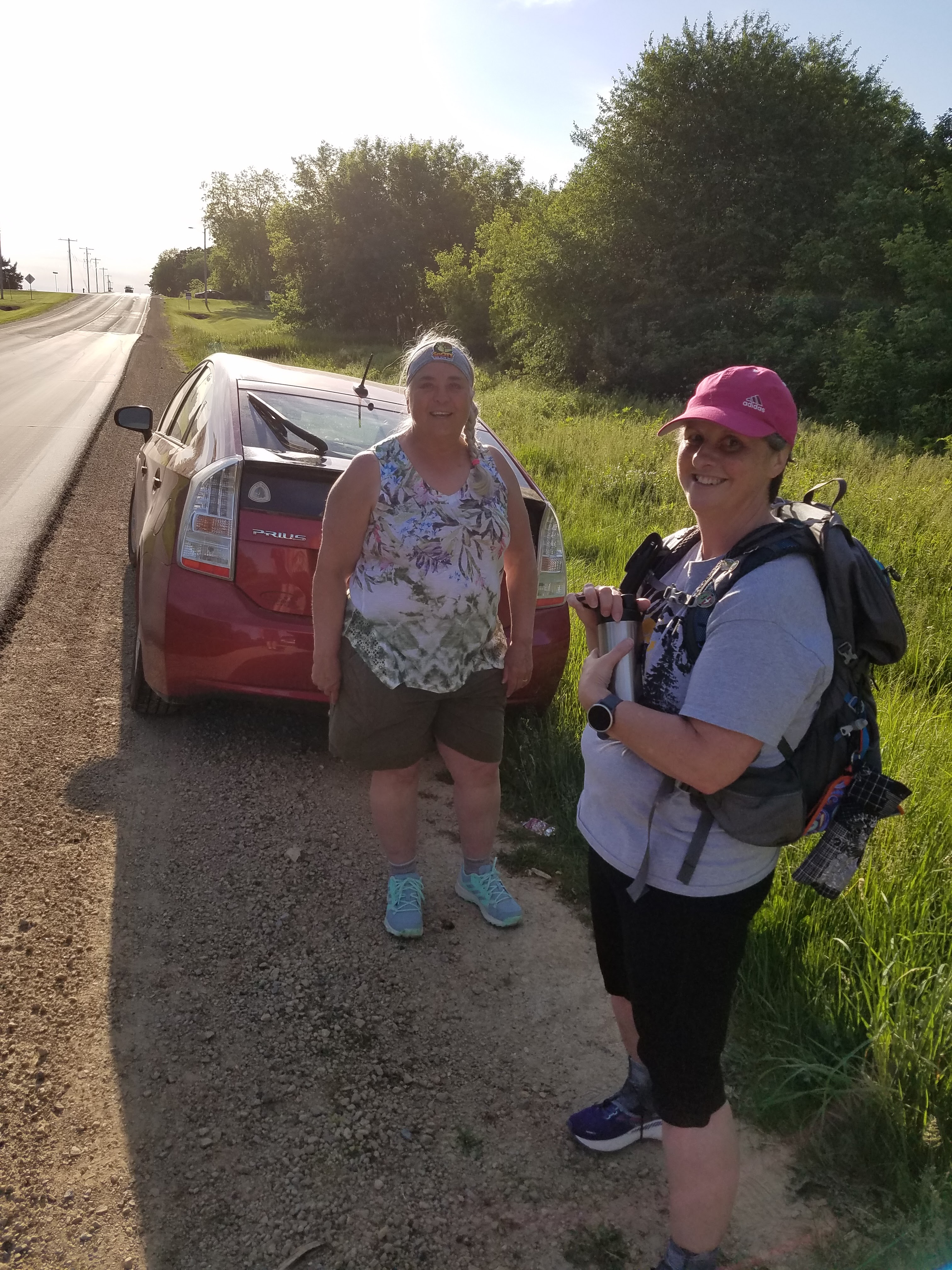
When I hit the spot where my car was waiting just north of Exeter Crossing Road, I drove north and managed to time it so that I met up with Theresa and her hiking companion. They had been leapfrogging all day, which meant Theresa didn't have to hike it twice.
We walked together over the last 1.1 miles of the Segment between Tunnel Road and County Road W, north of the closed tunnel section. This completed maps 68 and 69, and was the last little bit of hiking we had to do in Green County. Overall I'd rate this as a well-maintained and enjoyable segment, with nice scenery and plenty of blazes. I've heard that there are times when it gets flood damage in heavy rains, but apparently they come back and do regular upkeep. I saw no evidence of any former storm damage.
By the end of the day we had both managed to finish what we needed to do to cover the same bits of trail. By finishing this piece we were bringing the trail closer and closer to home. From here on out, the furthest south we have to go is map 61 near Devil's Lake.
The tally:
- One new Snail today
- Completed maps 68 and 69
- Completed the Monticello Segment
- Completed Green County
- Converted 4.6 miles of biking to the 'hiked' category
- Went over 900 miles of actual hiking
- 235.5 miles to go
Running Total: 1212.2 miles of trail covered (901.5 hiked), 196.3 miles 'extra' hiking/biking. End of Day 182.


No comments:
Post a Comment